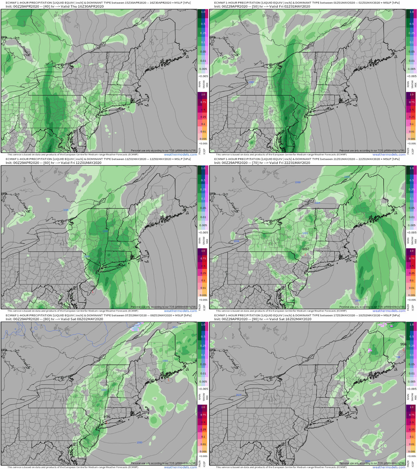
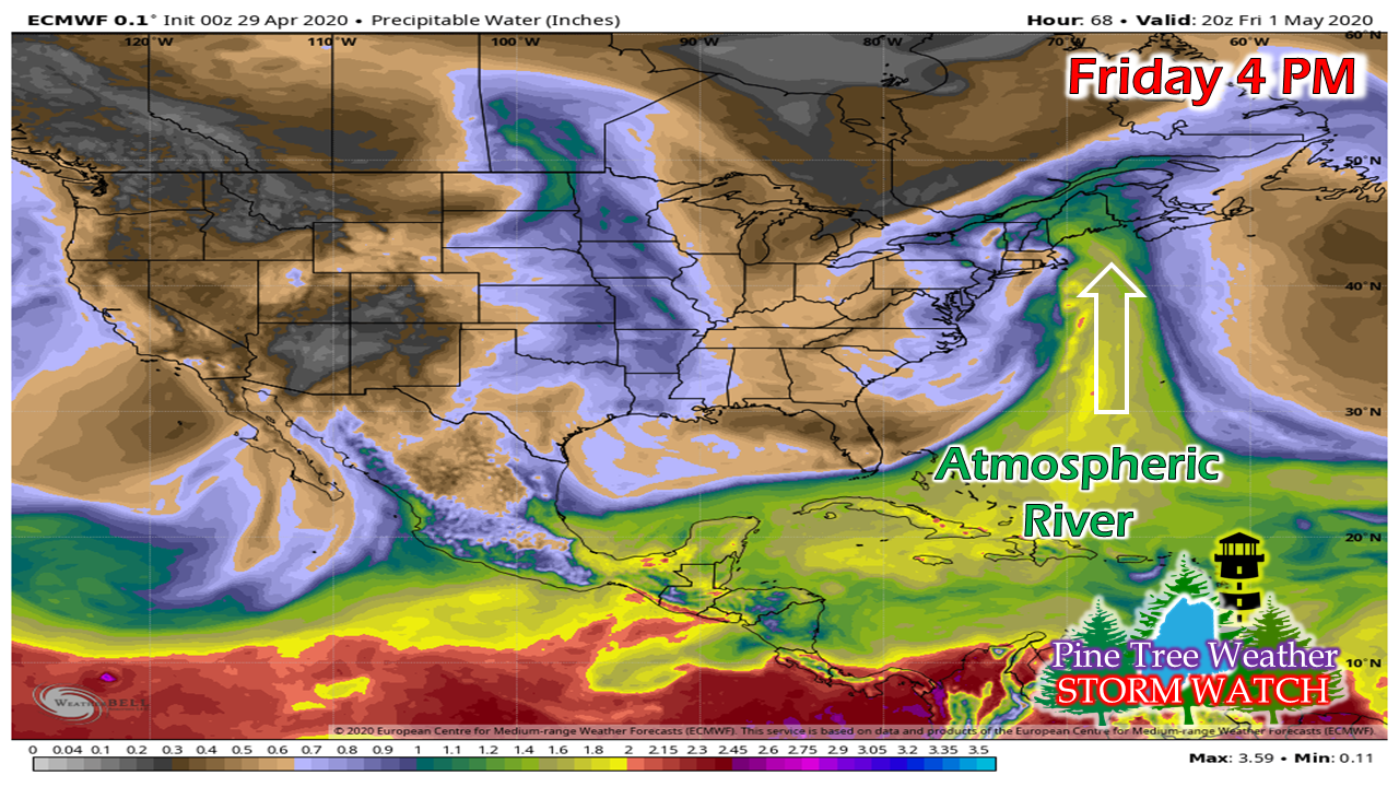
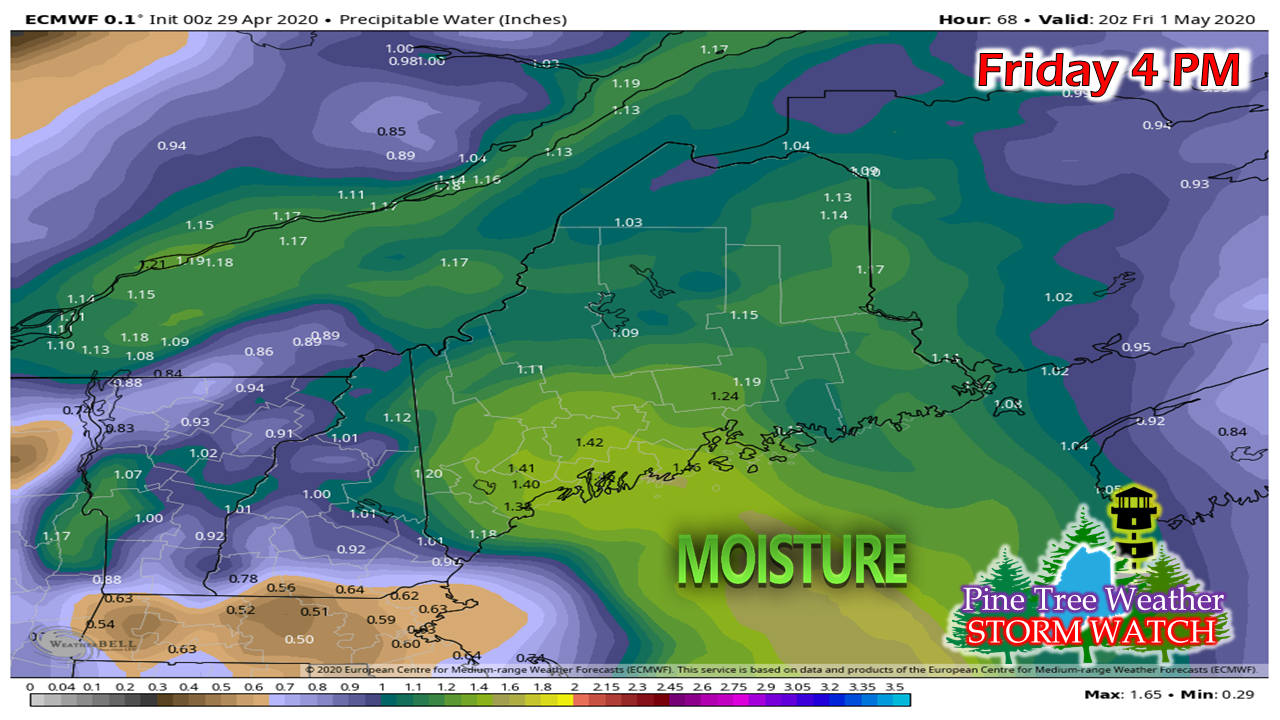
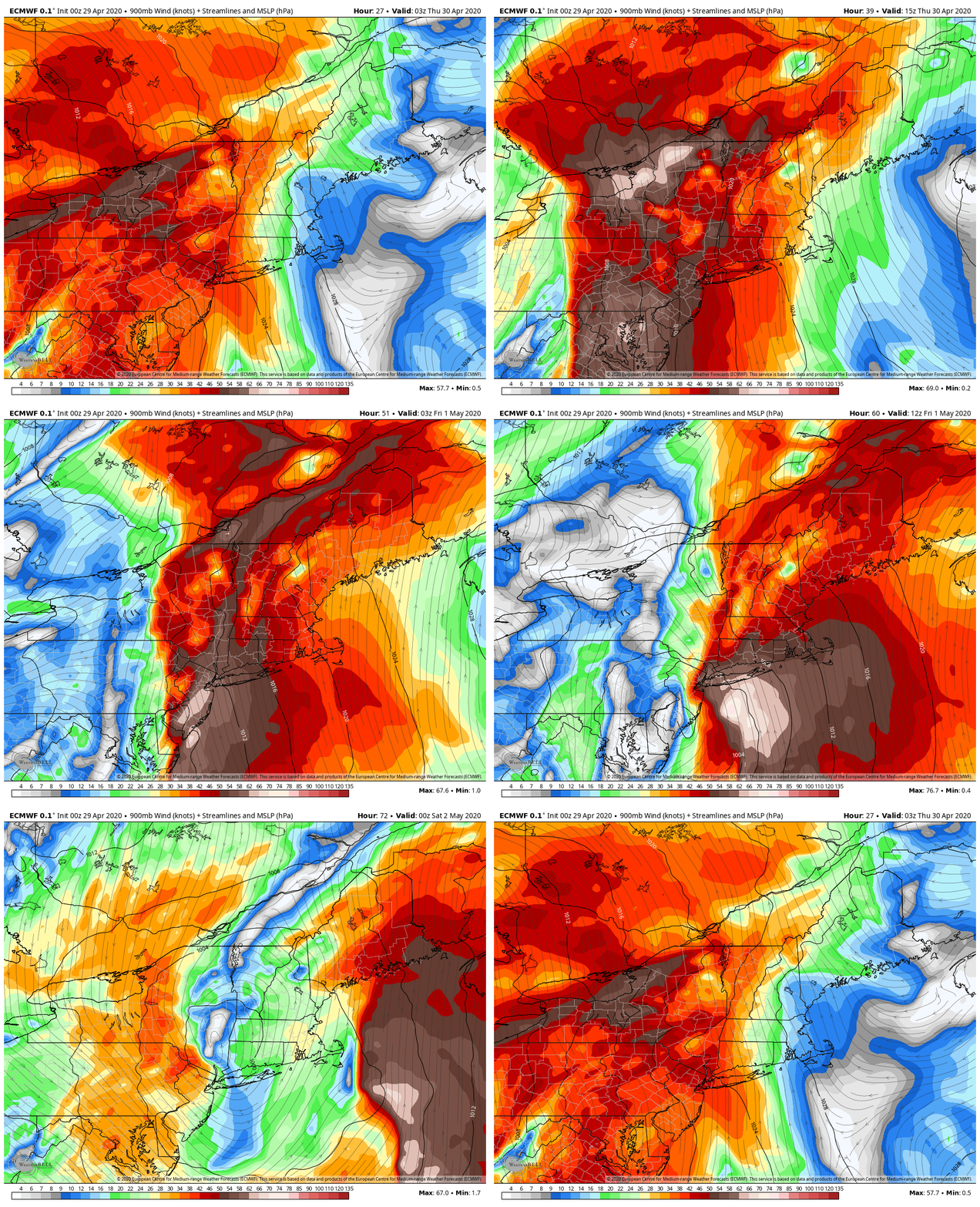
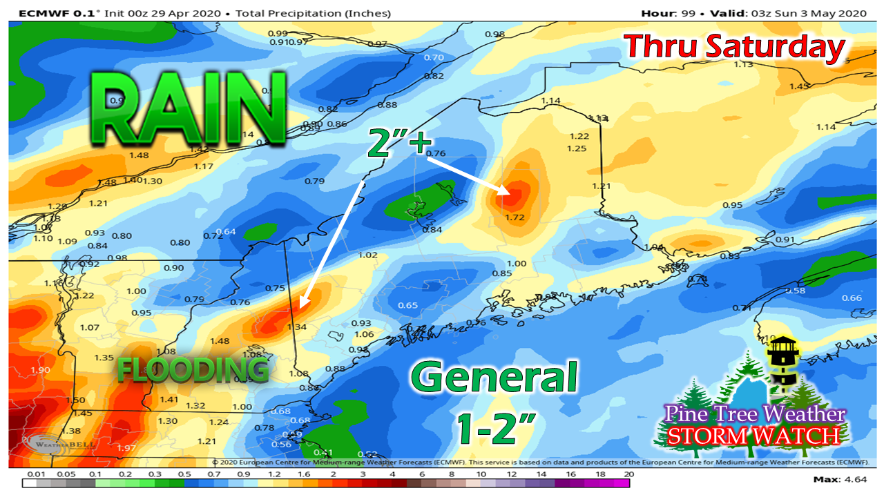
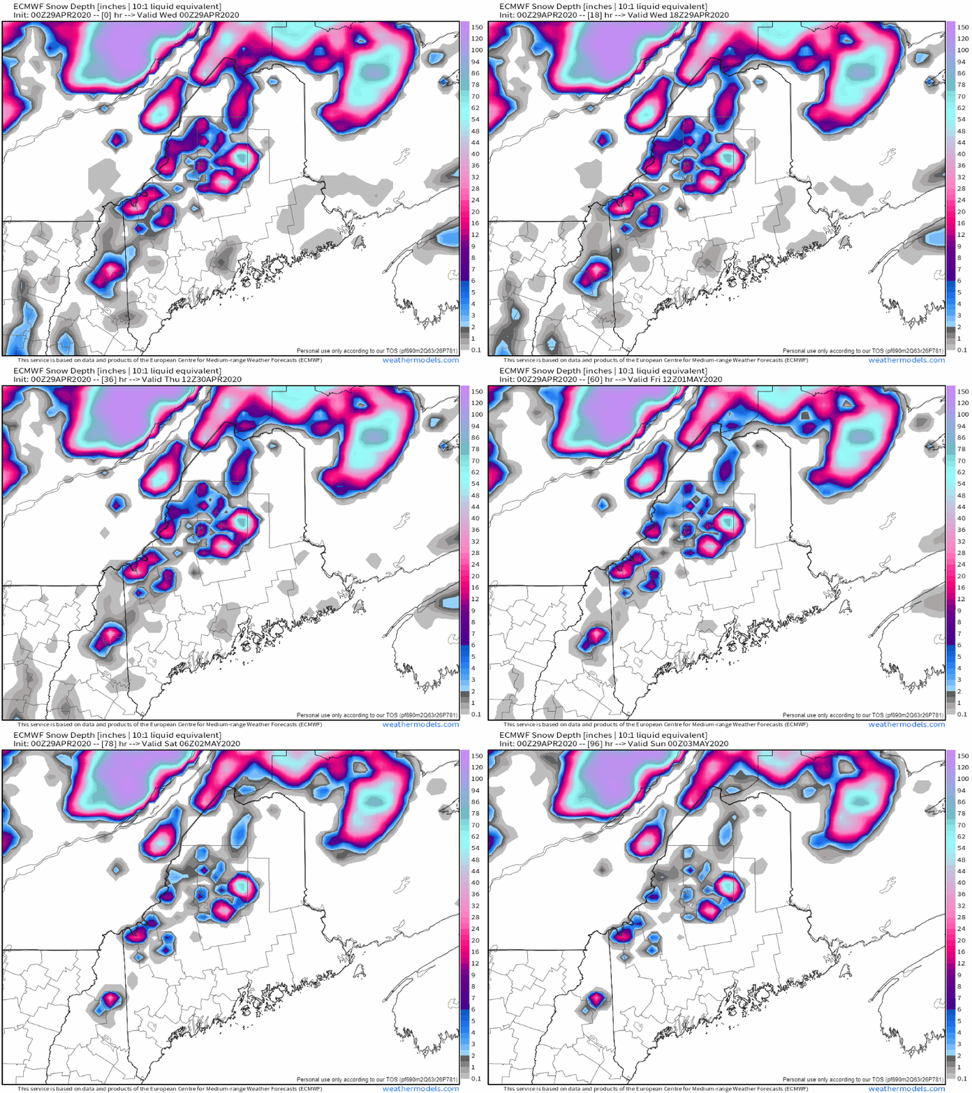
Some flood potential Friday into SaturdaySome isolated shower are possible Thursday, but the main event arrives Friday. It appears to start off in the morning over western and southern areas then move into northern and eastern areas Friday afternoon. As the storm moves to the northeast, showers dissipate in western and southern areas Saturday afternoon, and northern and eastern areas Saturday night. There is a rather large surge of moisture associated with this event. The weather term for the phenomena is called an "atmospheric river". Precipitable water values surge into the 1 - 1.5" range, which is 200% above normal for the region. This will have a tropical feel to it, but won't have the tropical warmth with it. Strong gusty low level winds are a concern with this event. Low level gusts in the 35-55 knot range along with heavy rain could carry the wind to the surface. This may cause some power outages in some areas on Friday. Flood potential in the mountains is a double sided sword. First, is the rainfall amounts itself. The higher peaks could easily see 2"+ of rain out this. The low level wind and moisture will push the heavy rain onto the higher hills. Second is the melting of the snow on the mountains causing runoff. I don't expect this will be a major concern, but for the headwaters of the Saco, Swift, and Kennebec, along with the brooks and streams that feed into them, some minor flooding is possible. After we get through this round, Sunday will be a decent day, then another round of rain and wind works in for Monday. Help the weather community and stay informed!
► ► For the latest official forecasts, bulletins and advisories, please check in with the National Weather Service in Gray for western and southern areas, or Caribou for northern and eastern parts of Maine.
Thanks as always for your support! - Mike |
Mike Haggett
|

