Not exactly a drought buster region wide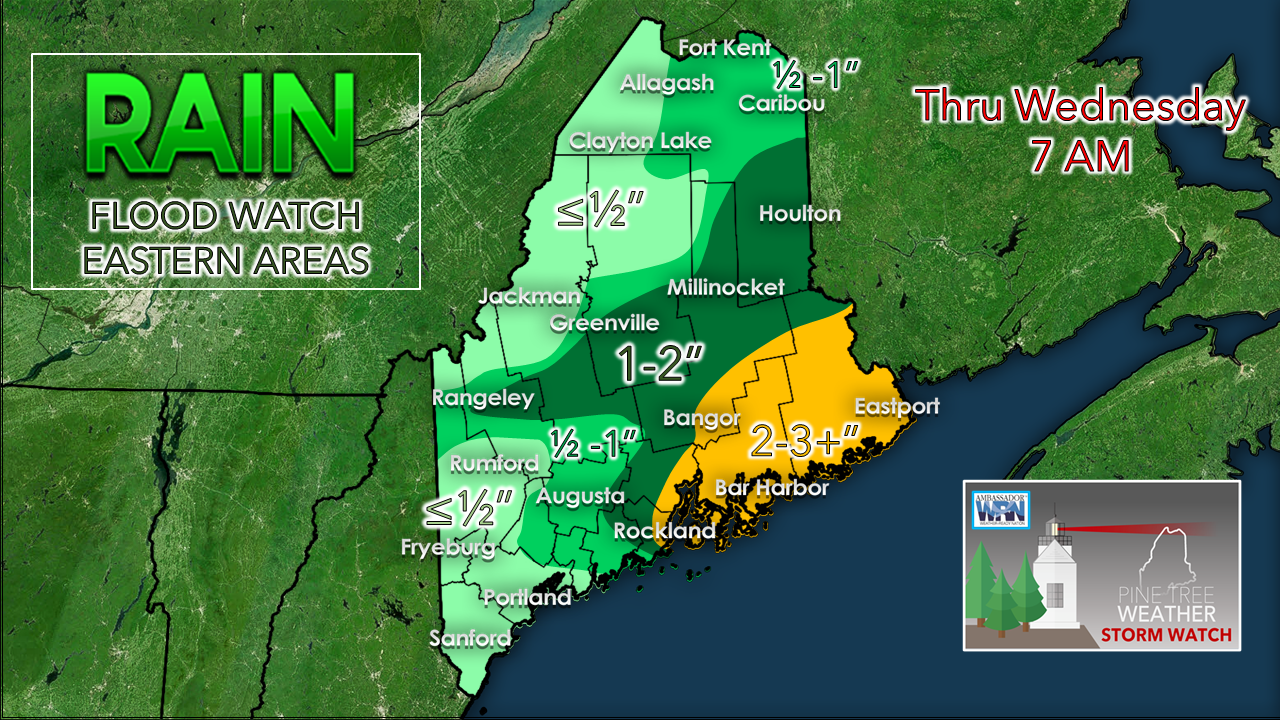 As mentioned in the Monday morning Facebook post, the western foothills to the MidCoast had the best chance for rain accumulation and that idea verified in earnest, with over 6" of rain recorded by weather spotters. This certainly helped ease the drought in those areas, but looking at the statewide view, other areas weren't as fortunate. From the NWS Gray forecast discussion from this morning: The question on everyone's mind is: does this mean the drought is over? While this week is providing much needed rainfall, as of yet it has not made up the deficit we have seen over the past few weeks. There is a significant improvement in portions of Maine, but southern NH still has a ways to go. Here are some numbers: ...PRECIPITATION FROM MAY 16 to JUNE 29... LOCATION PRECIP DEPARTURE % of NORMAL (CHANGE SINCE June 25) CONCORD 1.75 -3.80 31.5% (+30%) MANCHESTER 0.87 -5.14 14.4% (+1.1%) PORTLAND 3.10 -2.65 53.9% (+46.7%) NWS GRAY 4.60 -1.61 74.1% (+64.1%) AUGUSTA 1.80 -3.57 33.5% (+22.8%) The outlook remains generally dry. For those who benefited from the copious rainfall should stay mindful that it may be awhile before this happens again. Groundwater conservations efforts should continue until further notice. Thanks to meteorologist Margaret Curtis at NWS Gray for the information for this post. Spot showers & perhaps isolated storms for some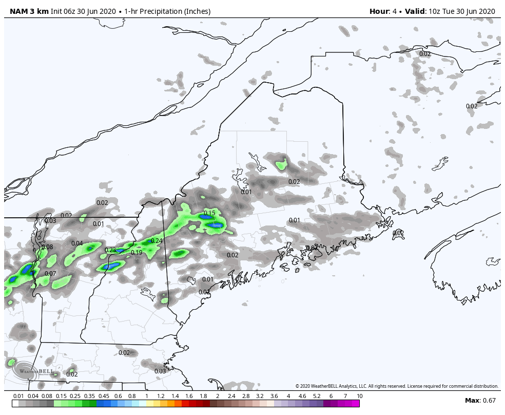 The upper level low responsible for this period of unsettled weather weakens, There is still enough energy and moisture around to trigger some scattered showers. A thunderstorm is possible in the mountains today. Areas that saw heavy rain Monday may see potential localized flash flooding from any downpours, but that chance is low. 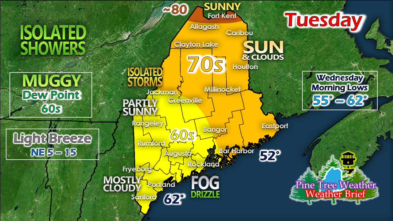 If you are looking for summer, the rooftop of the state is the place to be for the day. Cloud cover increases to the south of there. Coastal areas from Penobscot Bay west may see periods of drizzle and fog. If the sun pokes through over western areas, temperatures could spike into the 70s. If that happens, be aware of potential thunderstorm development. The upper low hangs around through Wednesday, with drier conditions returning Thursday. Isolated showers could occur in the afternoons over interior areas through the Fourth. Summer heat appears to return in earnest Sunday. Help forecast verification, and stay informed!
For more information, please follow Pine Tree Weather on Facebook and Twitter.
Thank you for supporting this community based weather information source that is funded by your financial contributions. Stay updated, stay on alert, and stay safe! - Mike |

Mike Haggett
|