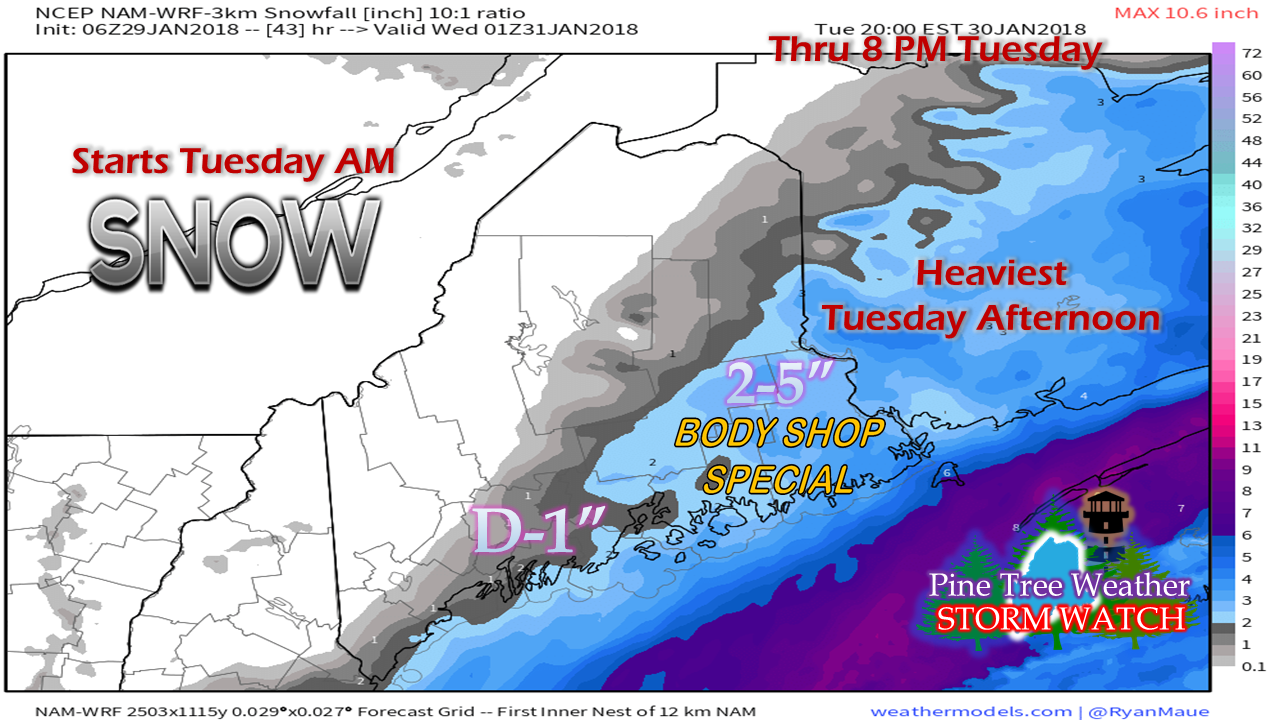
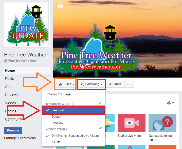
Still some wiggle room for accumulationsThe frontal boundary that passed through the region Saturday night into Sunday has stalled offshore. Low pressure is expected to form along it and travel northeastward. Snow flakes begin over southern areas around daybreak Tuesday and continue through the day. Eastern Maine should be on alert for a slick evening commute as the storm passes through Nova Scotia. Coastal Washington County appears to be the "jackpot" area with as much as 5" possible in the Machias / Eastport region. Snow is expected to end from southwest to northeast late afternoon into early evening. The position of the frontal boundary offshore holds the cards on how this will play out. This idea is presented to you to give you a rough idea on how this could end up. Any deviation to the west will easily put the southwest coast in the 1-3" range and could bump accumulations higher DownEast. The next chance for snow appears Wednesday night as cold front approaches from the northwest. Guidance is hinting that this front may also stall offshore and spin up low pressure along it which could keep the chance for snow in the forecast from Thursday until late Friday. Stay tuned for more on that. Moving UpdateThe process has begun for the relocation efforts for my family from Poland Spring to Kennebunk. We have an important week ahead as we prepare our current home for listing and have an inspection for our future dwelling scheduled midweek. This will impact my weather coverage for the coming weeks. I will do my best to give you rough ideas on what to expect as storms come along. I may not be able to respond to messages, comments, or tweets as efficiently as I normally do. I would appreciate your patience as we transition. Attention Facebook followersAs Facebook continues to fool around with its algorithms, it is important that you check your settings to receive timely updates from Pine Tree Weather. Make sure the page is both "Liked" and that you are "Following" with "See First" checked off in the drop down box. While I may not update as frequently due to the move, when I do update, chances are good that it will have come level of importance. This is the best way to make sure you don't miss out on anything.
Please stay tuned to the National Weather Service and local media for the latest forecast information. - Mike |
Mike Haggett
|


