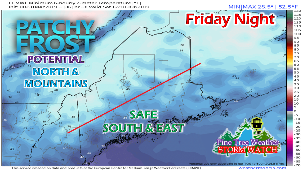
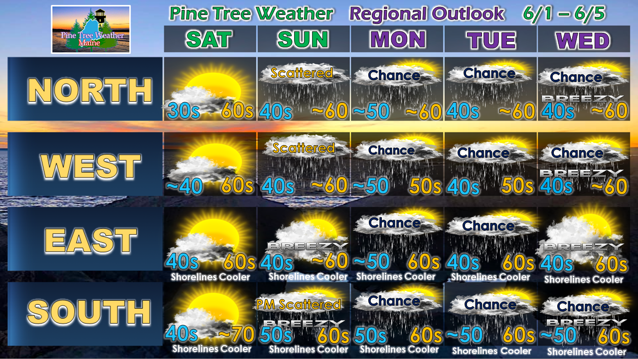
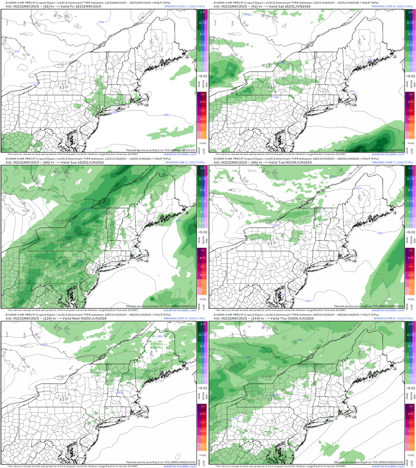
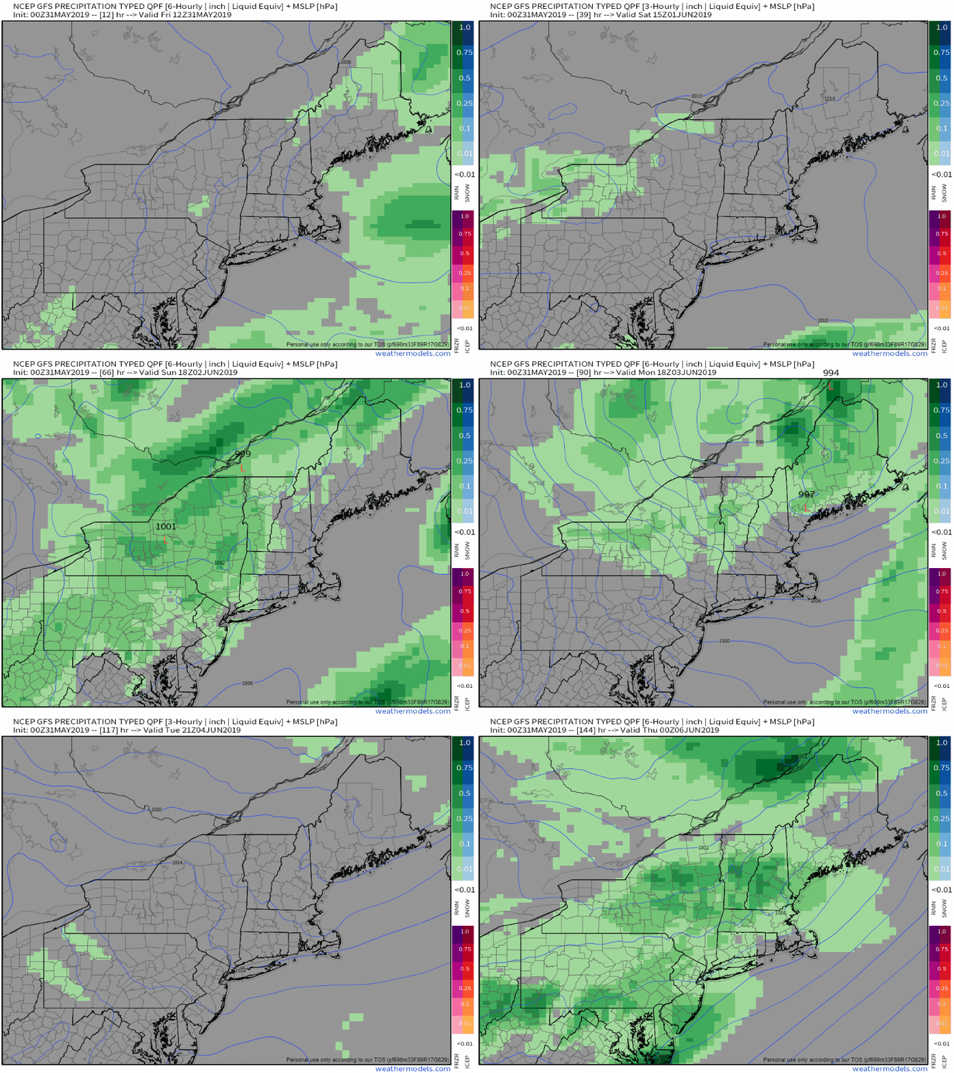
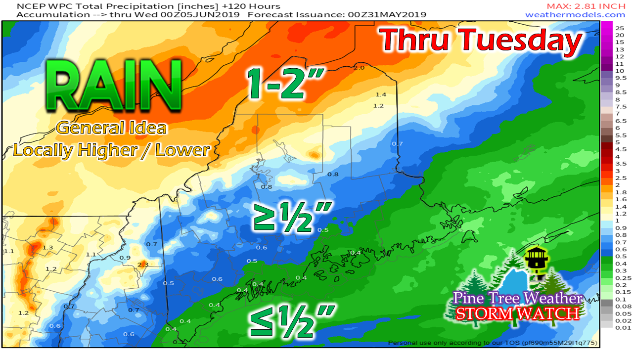
Friday OutlookAny remaining showers over northern and eastern areas end this morning, and areas of fog will clear out by around mid-morning. The week ends on a mainly sunny note, with highs around 60° for the mountains and north, 60s DownEast and for the shorelines, to around 70° for the southwest interior. With the clear skies from high pressure moving into the region, temperatures could fall into the 30s for northern and mountain areas, which poses a patchy frost threat. Temperatures over southern and eastern areas should stay above freezing and in the 40s. Regional outlook through midweek - explainedAt first glance, you will see where there are plenty of chances for some shower activity. As I explained in yesterday's update, an upper level low will park itself over eastern Canada. The results of that are repeated troughs swinging through the region. There are model discrepancies in how this will play out... One idea indicates a mainly dry Monday with showers possible on Tuesday. Another idea shows a showery Monday and a mainly dry Tuesday. The one idea that is consistent, is rain is likely Sunday night into Monday. After that depends on where the upper low parks itself and what results come from it. Northwestern Aroostook appears to be the jackpot region for rain Sunday night into Monday. Any reinforcing shots through midweek will add to the totals up there. Higher elevations in the western mountains into the central highlands can expect around an inch. Totals drop off after that toward the coast. For coastal areas, expect areas of fog Saturday night, and expect foggy starts into next week. Family time for me this weekendWith my wife headed out of town for the weekend, that means I have parental responsibilities through Sunday. I will try to post updates on Facebook or Twitter when time permits. I do not expect too much in the way of change in this pattern, and there is no threat for severe weather through the weekend.
► ► For the latest official forecasts, bulletins and advisories, please check in with the National Weather Service in Gray for western and southern areas, or Caribou for northern and eastern parts of Maine. Please consider supporting Pine Tree Weather ► ► Your financial donations are much appreciated to keep this site funded and for further development. I sincerely appreciate your support not only financially, but also in sharing my efforts with others. For more information from me, please check the Pine Tree Weather Facebook page as well as my Twitter feed. Always stay weather aware! - Mike |
Mike Haggett
|

