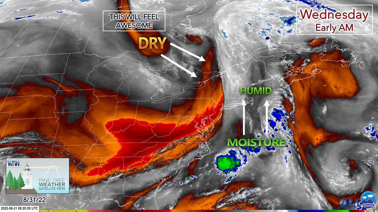
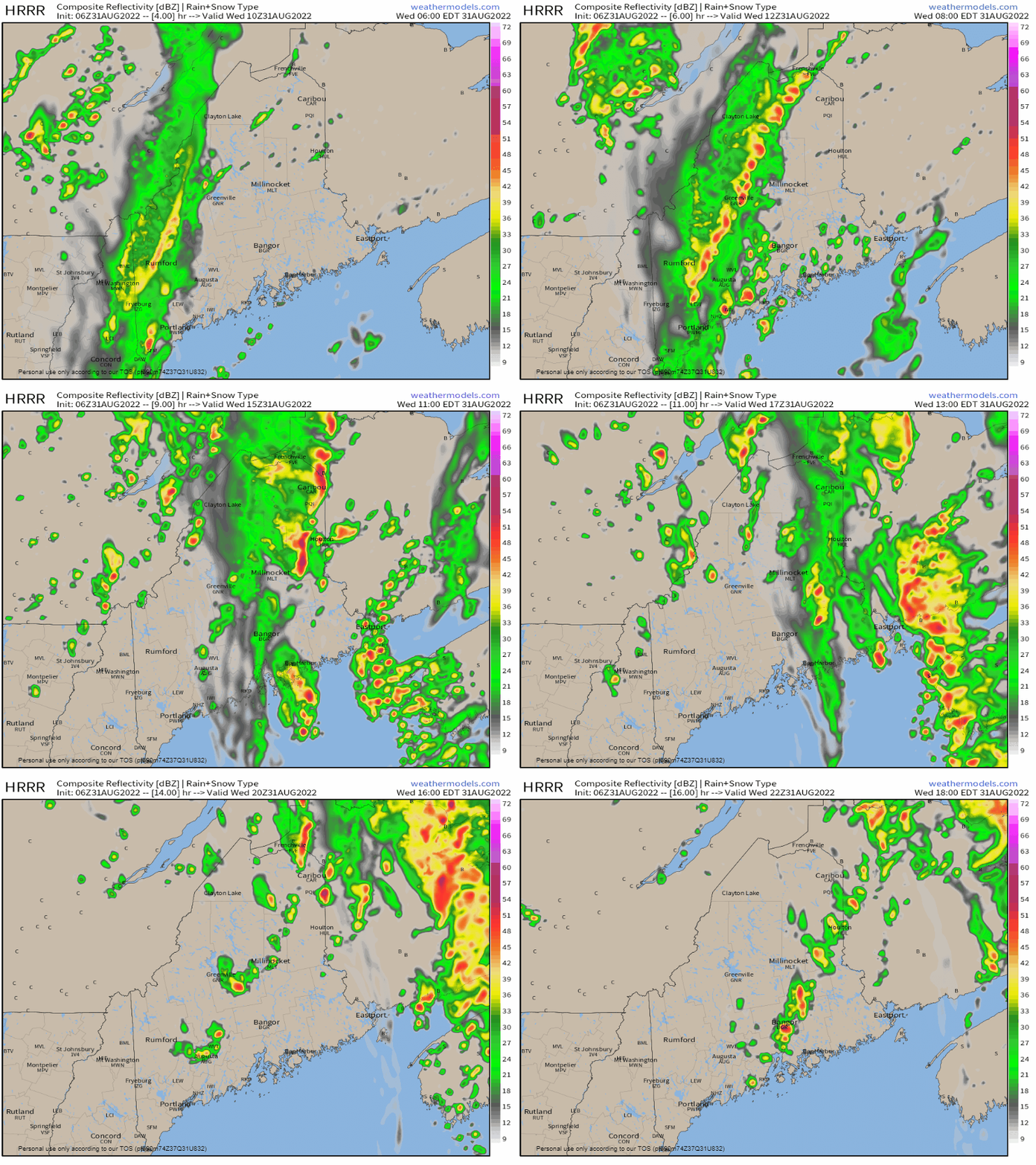
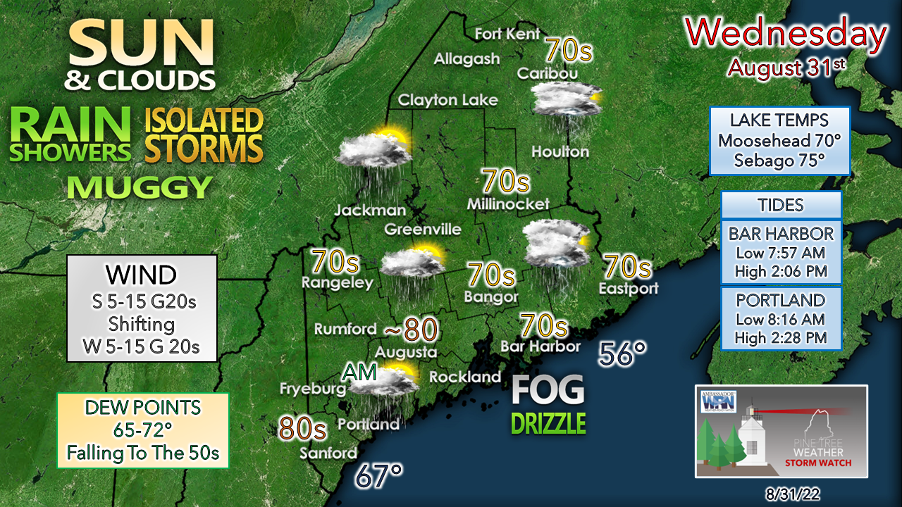
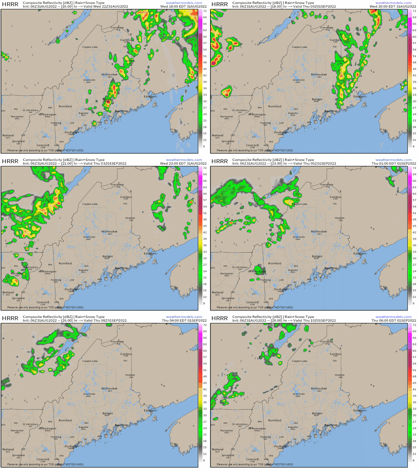
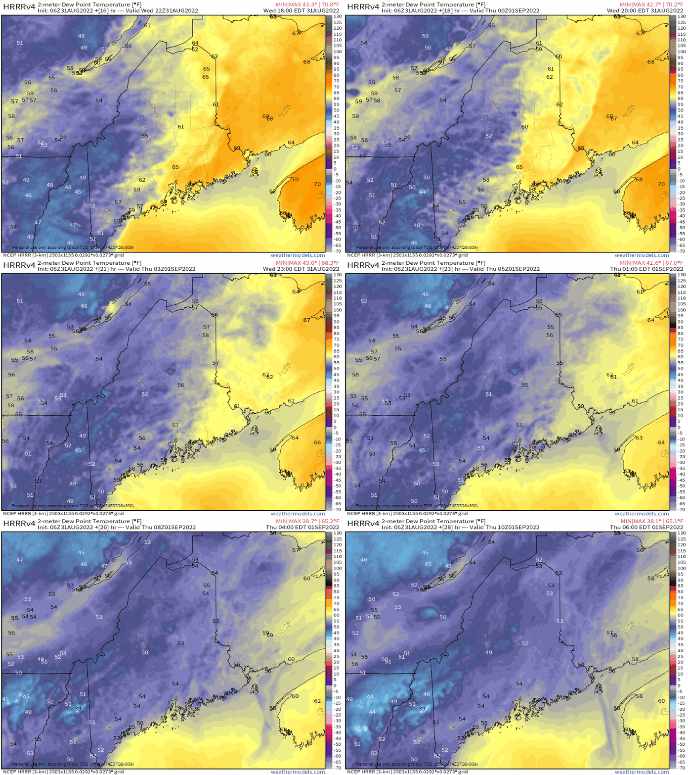
Relief from the humidity is comingA look at the mid-level water vapor image from 4:20 AM Wednesday morning shows the two main players in the weather of the day. Showers and storms for the day are being fueled by moisture from the south. A dry air kicker is quickly arriving from Ontario to move the moisture and humidity out of the region. Before that happens, one more day of mugginess with some rain and storms to contend with. Wednesday 6 AM to 6 PM - Forecast remains on track for rain to clear southern areas by late morning. Western areas see the steady rain end around the same time, but a pop-up shower or storm is possible in the afternoon. Northern and eastern areas have the best chance for thunderstorms through the day and pose the risk of isolated severe storms through late afternoon. Storms could contain damaging wind, hail, frequent lightning and heavy rain, which may cause localized flash flooding in areas where training occurs. Breezy conditions are expected across the region first from the south ahead of the front, then to the west behind the front. Southwestern areas have the best chance to see the warmest temperatures of the day as the westerly wind keeps the sea breeze away in the afternoon. DownEast area can expect areas of fog and drizzle at times through the day until the front passes through Wednesday evening. Showers and storms end overnight, |
Mike Haggett
|

