
Fiona a major CAT4 hurricane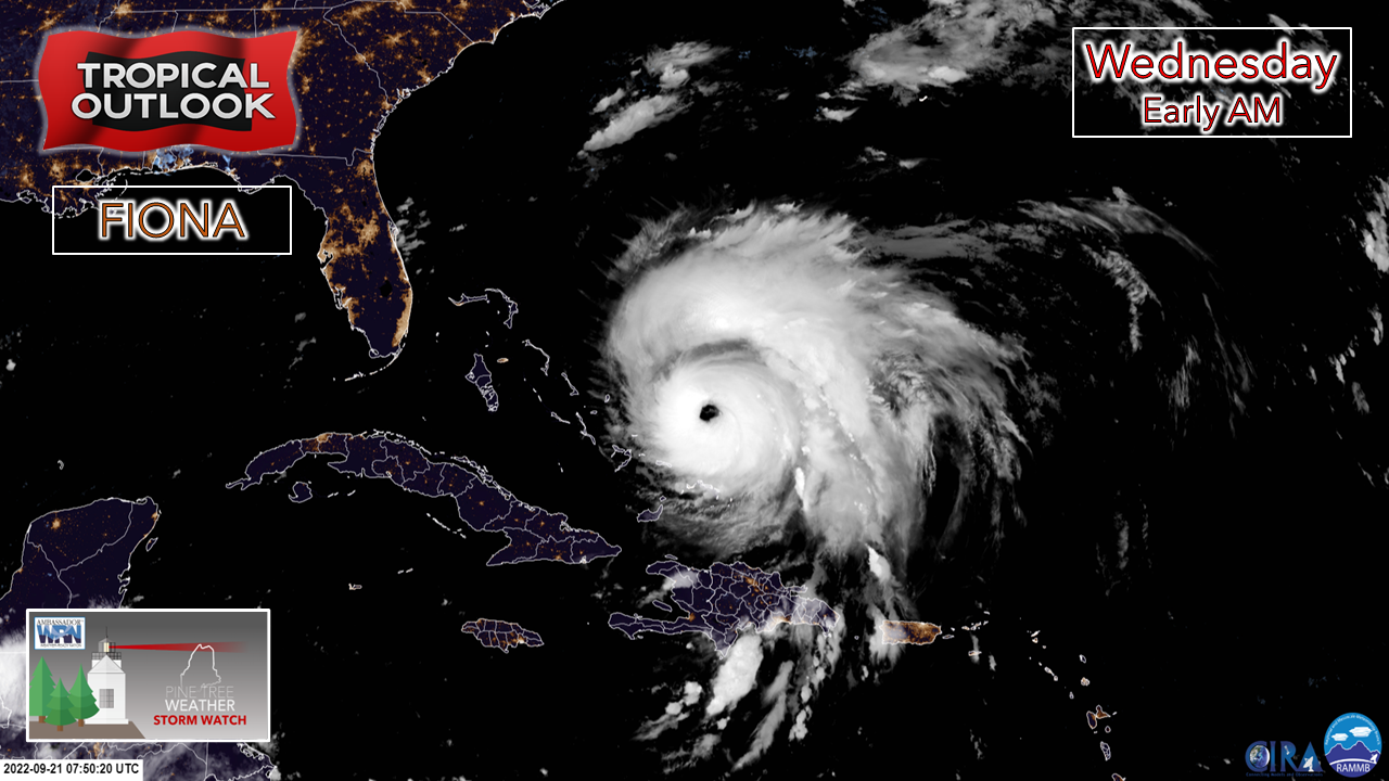 Watching these storms unfold is both astounding and terrifying. Seeing the reports from Puerto Rico of 30" of rainfall (12" in three hours) and recorded wind speeds over 100 mph is hard to fathom for our part of the planet. Viewing the model output and seeing what is still to come for our neighbors to the northeast is overly concerning as well. In the midst of it, to check satellite and see the image above, there is the beauty of it. The majestic eyewall purely defined and grandstanding. What shear that was holding it back is no longer. A mature, well-defined storm that is on track to head north, then northeast in the coming days. While the impacts for Maine will be minimal other than a stiff breeze and some surf, northeastern Nova Scotia, in the vicinity of Cape Breton, will deal with fury of what could be a high end CAT2 storm on Saturday, I suspect the Maine Turnpike will become busy with convoys of power restoration crews heading north to cross the border and get into position. Our Canadian friends will need all the support they can get in the coming days, if not weeks, to get back to some sort of normalcy after this one. Cold front passes through on Thursday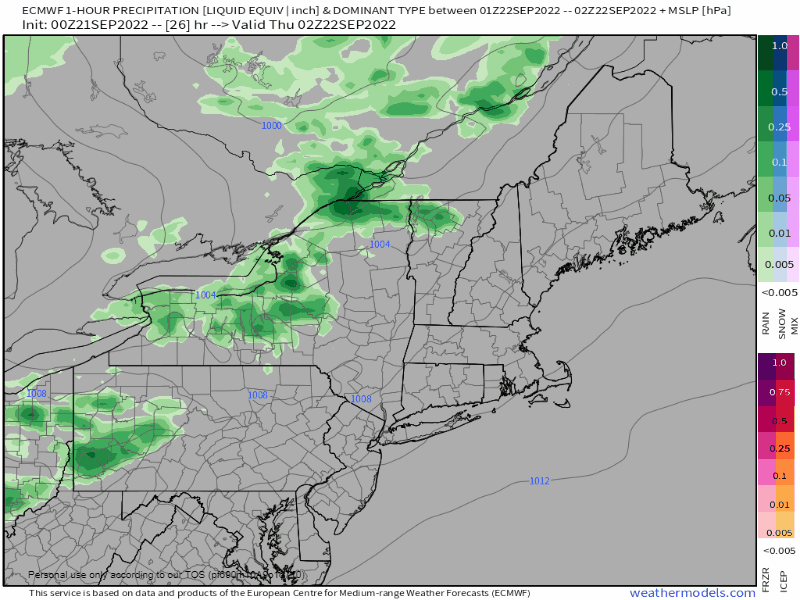 Wednesday 10 PM to Friday Midnight - A sharp cold front is on track to pass through the region with a decent moisture hose attached to it. Rain begins over the mountains and north by around midnight Thursday and covers the state in time for the morning commute. Showers end from northwest to southeast as the front passes through in the afternoon into mid-evening. 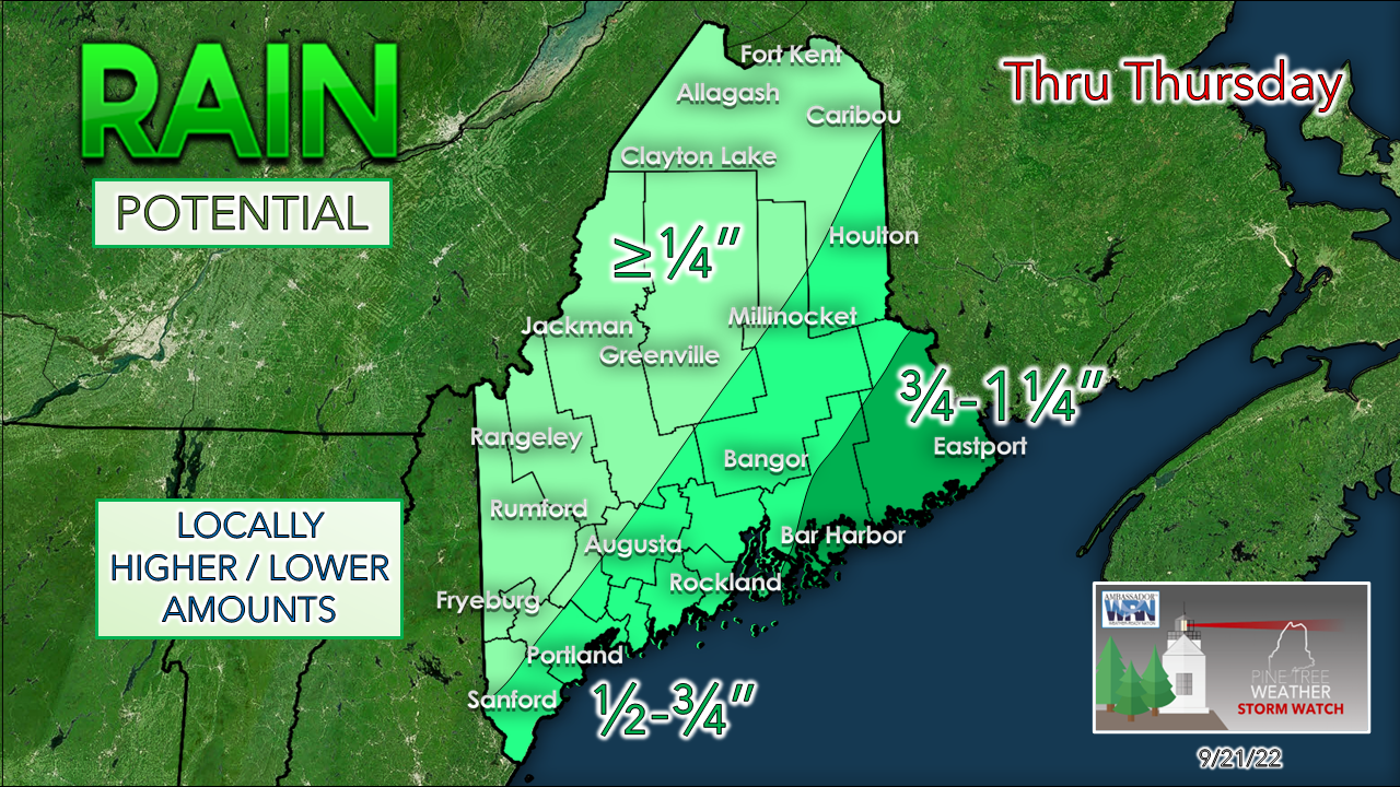 It is important to note that the Weather Prediction Center has a good portion of the coastal plain under marginal risk for localized flash flooding. At this point, the best guestimate for the high-end rain totals are over eastern areas. The mountains could see upwards of ½" pending on how much moisture can build ahead of the front and become enhanced by atmospheric lift. Expect the wind to pick up from the north as the front slides through. Between the passing front and Fiona, the breeze continues through Saturday. A few more quick thoughts on Fiona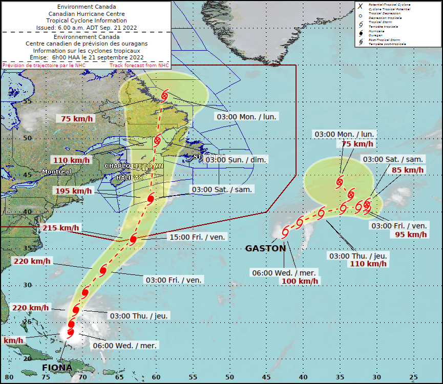 As far as Maine impact are concerned with Fiona. wind speeds may gust from the northwest in the 30-40 mph range DownEast upwards into The County as the storm passes east on Saturday. Long wave swells in the 5-10' range are possible in exposed areas with no islands around. There could be some minor beach erosion. For wave onlookers, please remember to watch from a safe distance. The ocean gradually settles on Saturday as Nova Scotia cuts off the wave train. For those following in the Maritimes, it is extremely important to follow guidance from your local forecasters in the local media, Environment Canada, US National Hurricane Center, and the Canadian Hurricane Center. I have a public Twitter list of people to follow for Canadian weather that can be viewed if you have an account or not. This storm is shaping up to be one for the history books that will be remembered and referred to for many years ahead. This will be my last update of the week on the website. My wife and I have a trip planned to celebrate our 24th wedding anniversary. and will be away until early next week. I will update on Facebook on Thursday and will tweet when I can. Thank you for supporting this community-based weather information source which operates by financial contributions from people like you. Stay updated, stay on alert, and stay safe! - Mike NOTE: The forecast information depicted on this platform is for general information purposes only for the public and is not designed or intended for commercial use. For those seeking pinpoint weather information for business operations, you should use a private sector source. For information about where to find commercial forecasters to assist your business, please message me and I will be happy to help you. |

Mike Haggett
|


