
A bit of a mixed bag for the weekend For those in the south and east, the weekend looks fair overall. Folks in the mountains and north may have to dodge some showers Sunday and Monday, but it certainly won't be a washout. Enjoy the break from the humidity... it will return for the second half of the weekend and into next week. Warm trend continues into September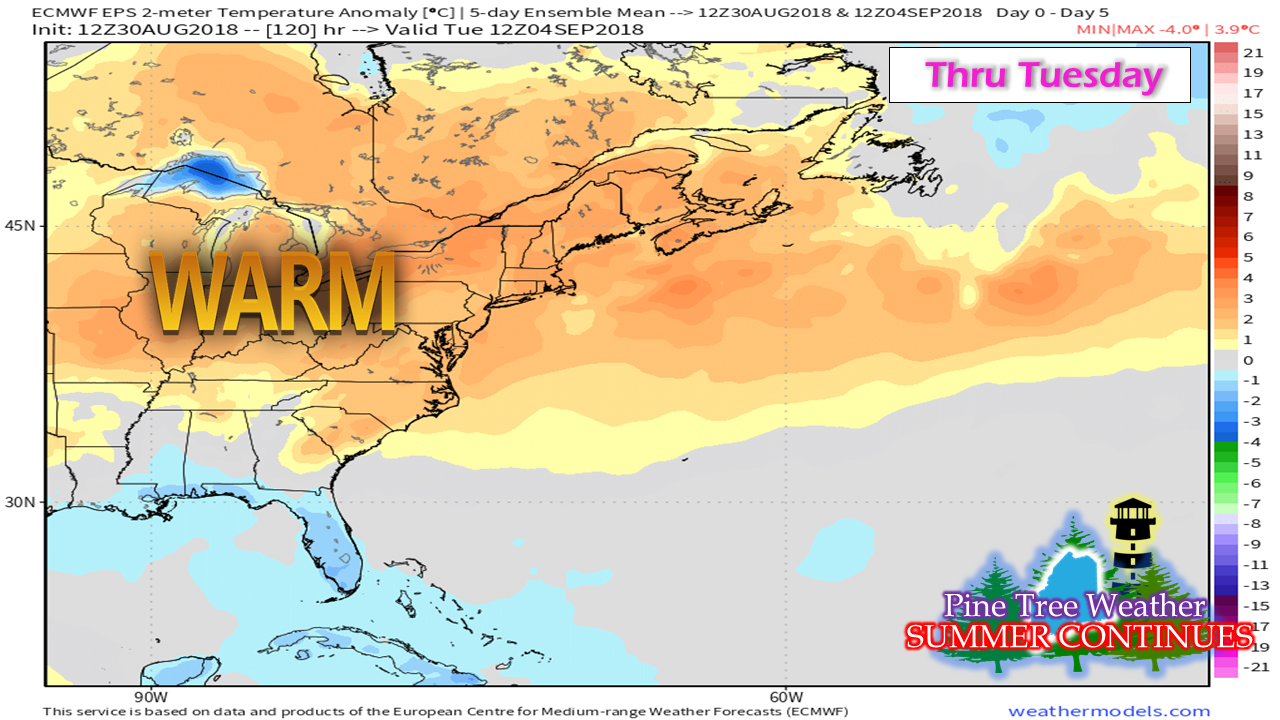 We'll be hearing about records broken for the meteorological summer season (June through August) in the coming days. It has been a very humid summer. For those longing for sweater weather, it will be awhile yet, outside of a few cooler mornings. September will continue on the warm side, and if the long term model ideas are right, it could be above average as we head into October. Drought concerns linger on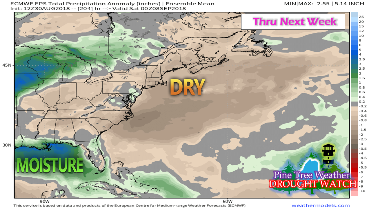 The moderate drought continues for much of the coast and it won't be going away anytime soon. With the pattern back into a west to east zonal flow, any rain gathered from showers or thunderstorms will be a bonus. Folks relying on groundwater resources should keep a close eye on it. While this idea shows that it will be dry into late next week, it could go on for much of the month. The tropics are heating up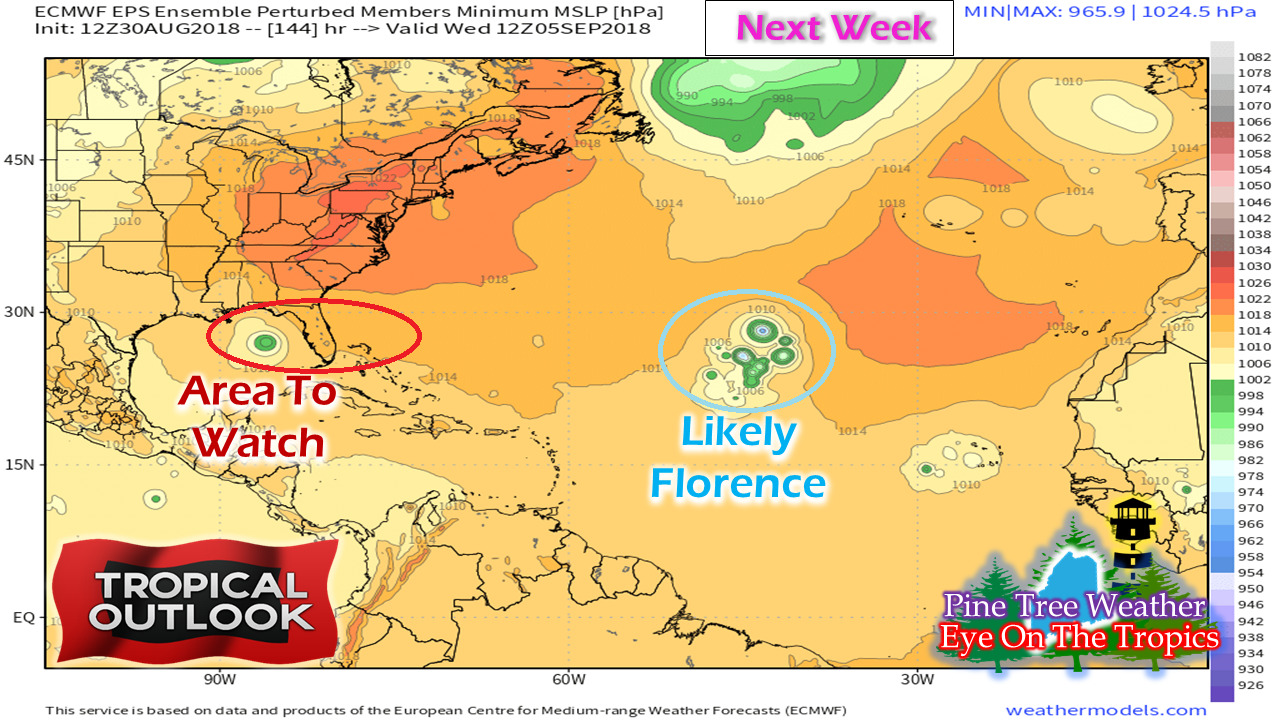 I mentioned this on the Facebook page earlier in the week about areas to watch and that idea hasn't changed a whole lot. A strong wave off the African coast near the Cape Verde islands is favorable to turn into Florence over the weekend. We'll have to keep tabs on Florence, but at this point it appears to be a fish storm with little impacts to the North American coastline. A disturbance near Hispaniola appears to head into the Gulf of Mexico early next week which is the main area to watch for the southeast. Another disturbance works off the African coast and that will have to be monitored as well. I am still thinking the main concern is the Gulf of Mexico and the southeast coast from Florida up to North Carolina for the next week or longer. Folks with interests in the southeast and the Gulf of Mexico should stay in touch with the National Hurricane Center for the latest on what is cooking there. Don't let the quiet season deceive you, activity is going to amp up. Make sure you are prepared in case the big one does come with tips from Hurricane Strong. Outlook through Tuesday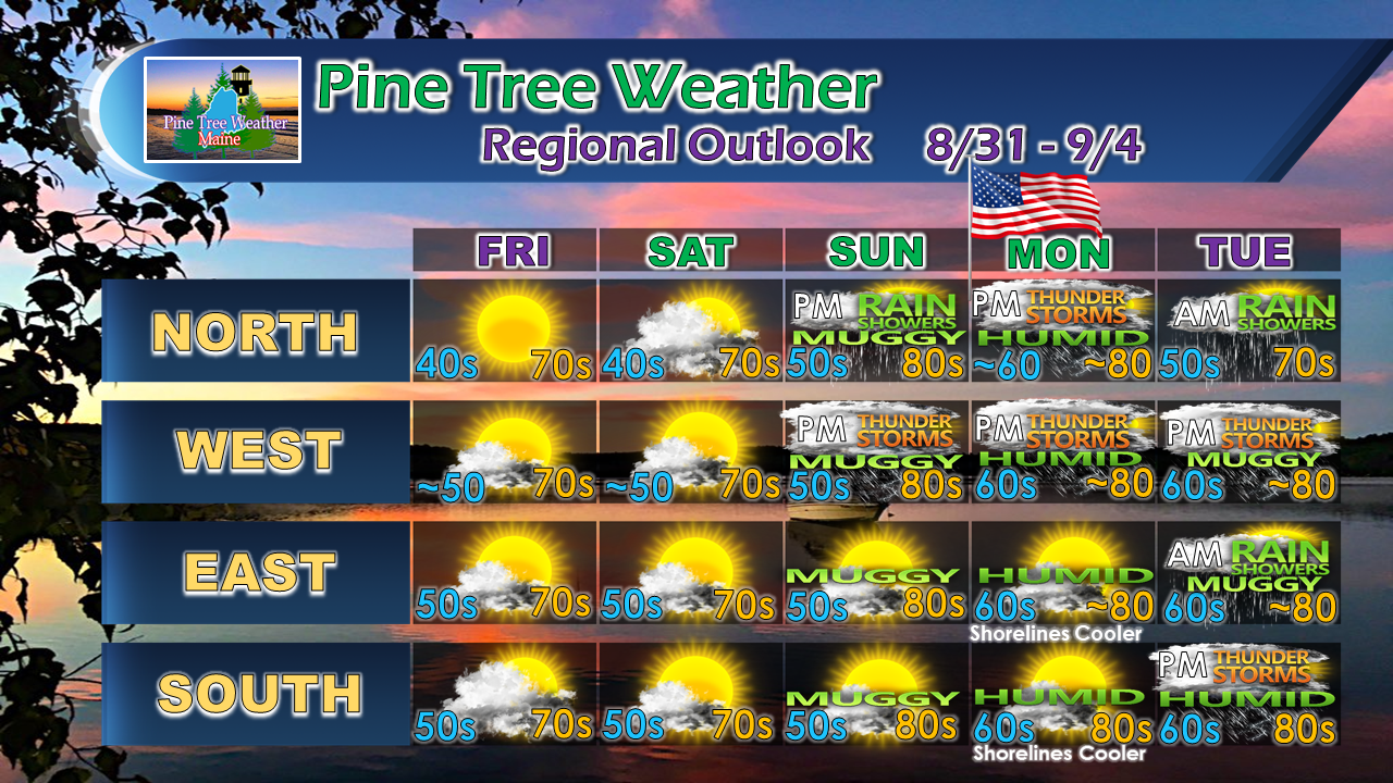 Friday and Saturday will have some cool starts, especially in the north where some upper 30s are possible around the Allagash and Estcourt region.
A warm front sweeps through Saturday night / early Sunday which may touch off a few widely scattered showers. The front appears to stall along the international border which may cause some scattered showers and thunderstorms for both Sunday and Labor Day. The humidity builds through the second half of the weekend, and temperatures rise along with it. It appears to be a beach day on Monday for the southwest coast as some areas may reach 90° over interior York County. A cold front approaches for Tuesday which may bring scattered showers and thunderstorms to start the short work week. I'll keep watch on what is going on, and may drop in a Facebook update over the weekend, or on the site here if necessary. You can always watch or follow me on Twitter for any snippets of information I pass along there. As always, stay in touch with the National Weather Service in Gray for western and southern areas or Caribou for eastern and northern regions for the latest bulletins, advisories and forecasts from those fine folks. Pine Tree Weather is still in pledge drive to keep the site going. For more information, check out the Donate page. Thanks to those who have made pledges and sent checks already. I am truly blessed by your support! Have a safe and enjoyable weekend! - Mike |

Mike Haggett
|


