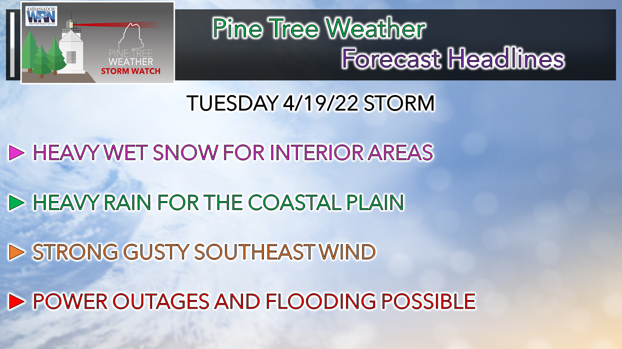
 With this being the 15th anniversary of the Patriots Day storm of 2007, strong events are certainly possible this time of year as cold and warm air battle it out for atmospheric control. While this event does not appear to be that severe, it will pack a punch with an assortment of precipitation types over the interior, along with wind and potential flooding issues. The blessing for the shorelines is that while tides are astrologically high, the main impact of the storm occurs in the lower of the two high tides around 2 PM. While a 2½' storm surge is expected, minor flooding, some splash-over and beach erosion are possible. It could have been far worse with the higher tide early Tuesday morning. Nonetheless, the storm is expected to bring impacts to the region and what type of impacts depends on where you are, and/or where you may be going. Another sou'easter to raise havoc on the region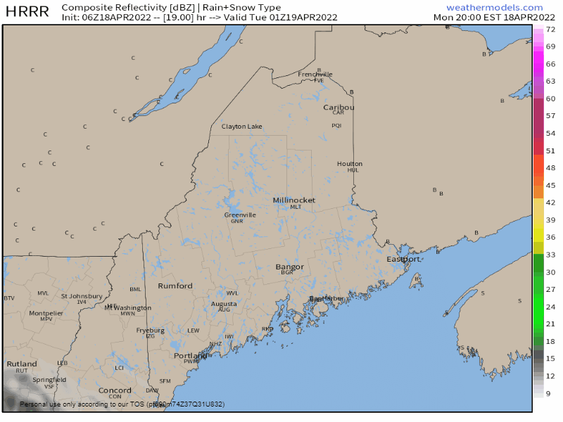 Monday 8 PM to Tuesday 8 PM - While the window is short, the strength of the storm is enough to pack a punch. The Tuesday morning commute brings slick roads from snow and sleet for the interior, heavy rain for the coast which could cause reduced visibility and hydroplaning. The western foothills on over into central areas are caught in the crosshairs of precipitation type. A word of caution here: don't depend on your home or car thermometer for an accurate read on travel impacts. Forcing aloft will drive cold air downward. This is a classic situation where the temperature could read 35-40° and the sky is dumping large fat flakes of snow that rapidly accumulate. Once warm air intrudes at the lower levels, a flip to sleet is possible. How far inland that occurs depends on how far the warm nose works inland. Steady precipitation ends over western and southern areas by around midday, northern and eastern areas by early evening. Expect an isolated snow / rain shower as the air column clears out into Tuesday night. 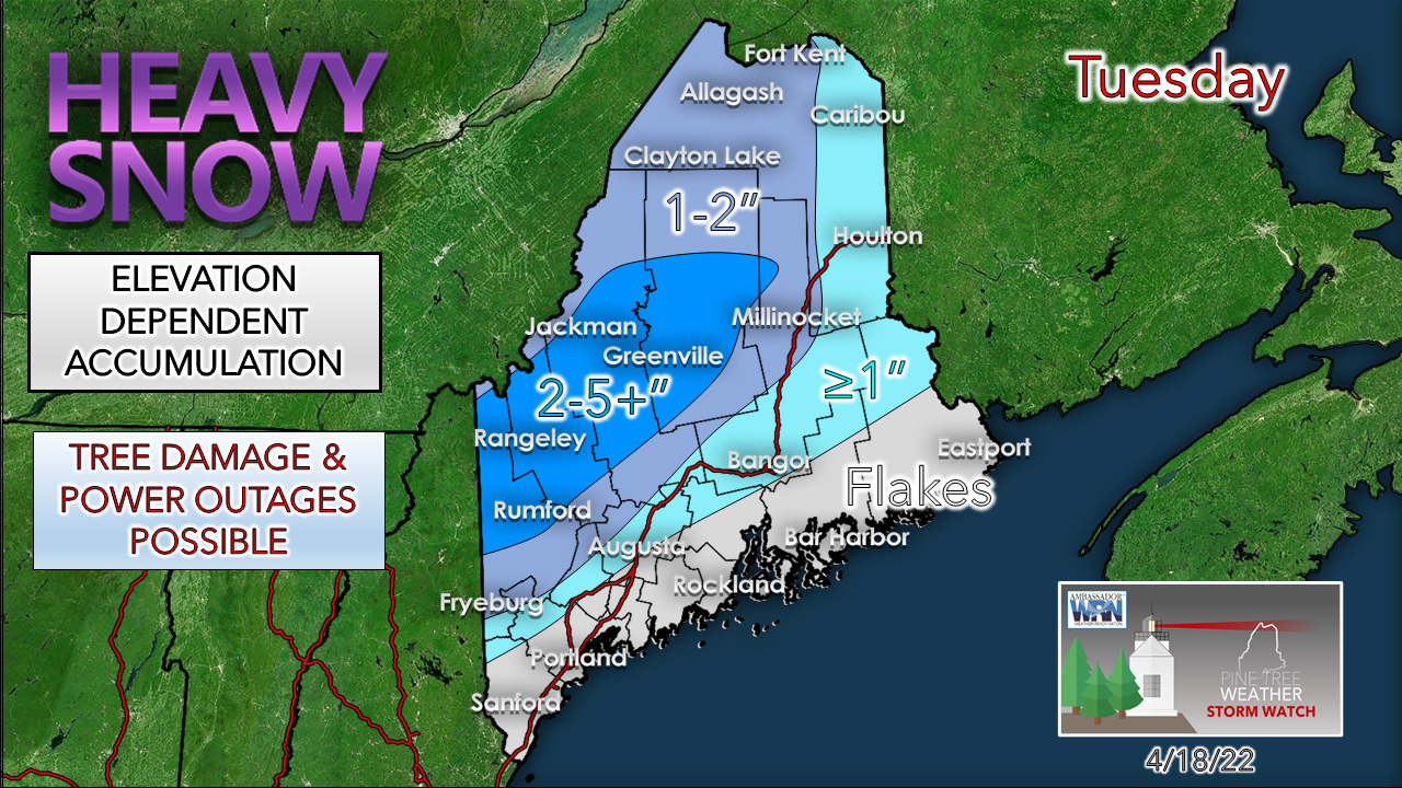 I've said it before, and I will say it again: spring snow events are a big challenge and bust potential on the high or low end is part of the drill. Given the dynamics, this one is no different. Higher elevations have the chance for more snow. The snow is going to stick to everything. Tree damage leading to power outages is not a matter of if, but how bad. Folks in the darker blue area should be concerned. Sleet is a snow accumulation buster, and that is a factor in this. The sooner the flip to sleet, the lesser of power outage impacts. Thundersnow? Maybe. 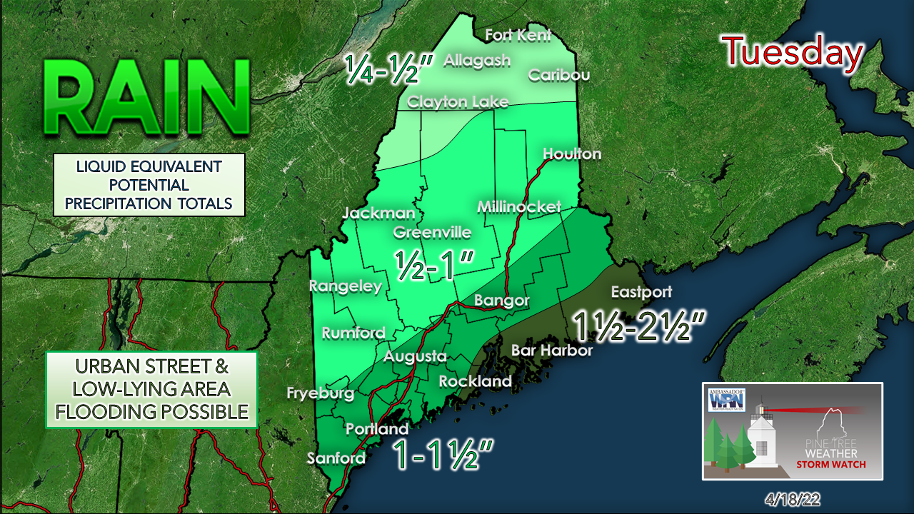 On the coastal plain end of it, heavy rain. This is a lot of rain in about a 12-14 hour window. Folks in the Penobscot Bay region eastward get the high end here. Localized areas could exceed 3" or more. Urban street flooding from clogged drains from blowing debris, rapid creek and stream rises could lead to localized washouts. A good old fashioned gully washer, with perhaps a thunderstorm thrown in for good measure. Folks up north dealing with ice jams need to stay updated on the latest on that. The snowpack is ripe for melting. Warm air advancing northward with the southeast wind could bring areas of fog over areas that have snow, and that could cause some rapid melting. 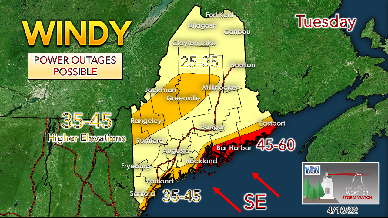 High wind watches are posted for the shoreline regions Penobscot Bay eastward. The National Weather Service offices in Gray and Caribou are working closely on this and may issue warnings at some point Monday. As the storm ends, the stronger wind begins to subside, but it appears to remain breezy into Wednesday. The mountains get in on the wind as well. Heavy, wet snow and wind is a bad combination. Folks with trash pickup on Tuesday should hold off moving their containers to the curbside until Tuesday morning. Please mPing your observations with the storm!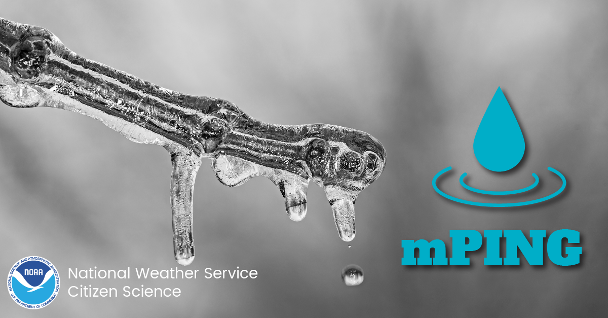 Check out mPING (Meteorological Phenomena Identification Near the Ground) project. Weird name, cool app! You can report the type of precipitation you see where you are. No need to measure! Use the free mobile app to send reports anonymously. Reports are automatically recorded into a database, which improves weather computer models. The information is even used by road maintenance operations and the aviation industry to diagnose areas of icing. FMI and for the app ► mping.nssl.noaa.gov Outlook through the remainder of the weekAfter the storm departs, a drier pattern is in the offing. A weak clipper passed through the region on Friday which may bring a few showers, but nothing widespread or torrential. Temperatures are expected to be on the cool side versus average through Saturday. 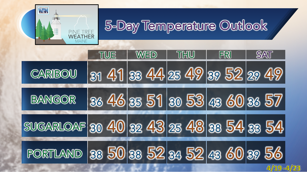 Be prepared to receive alerts and stay updated!
 For more information in between posts, please follow Pine Tree Weather on Facebook and Twitter. Thank you for supporting this community-based weather information source which operates by reader supported financial contributions. Thank you as always for your support! - Mike NOTE: The forecast information depicted on this platform is for general information purposes only for the public and is not designed or intended for commercial use. For those seeking pinpoint weather information for business operations, you should use a private sector source. For information about where to find commercial forecasters to assist your business, please message me and I will be happy to help you.
|

Mike Haggett
|