|
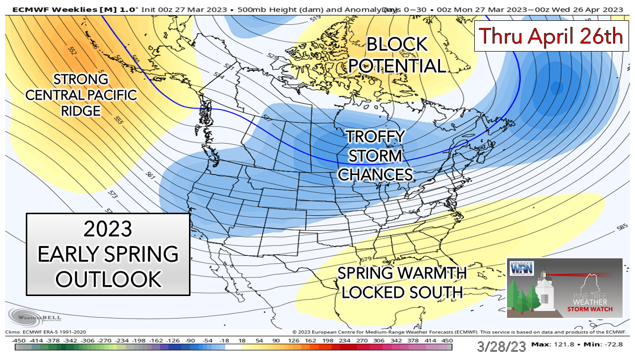
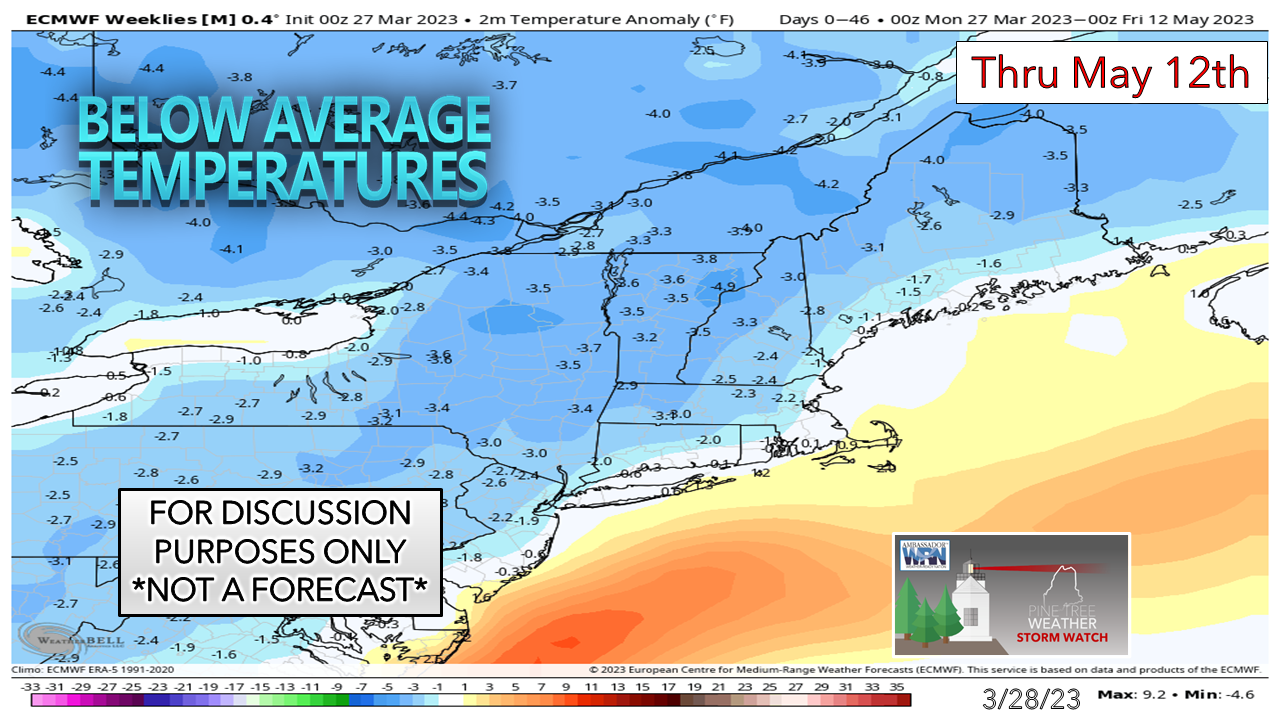
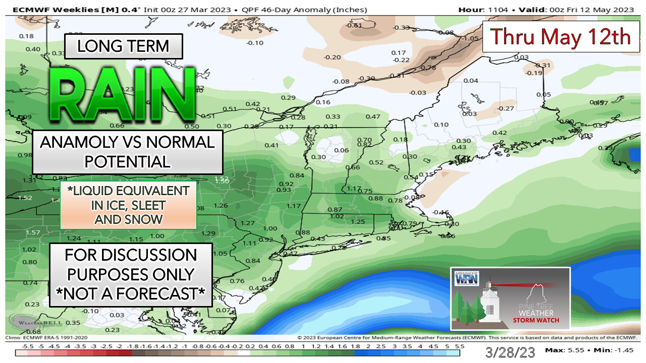
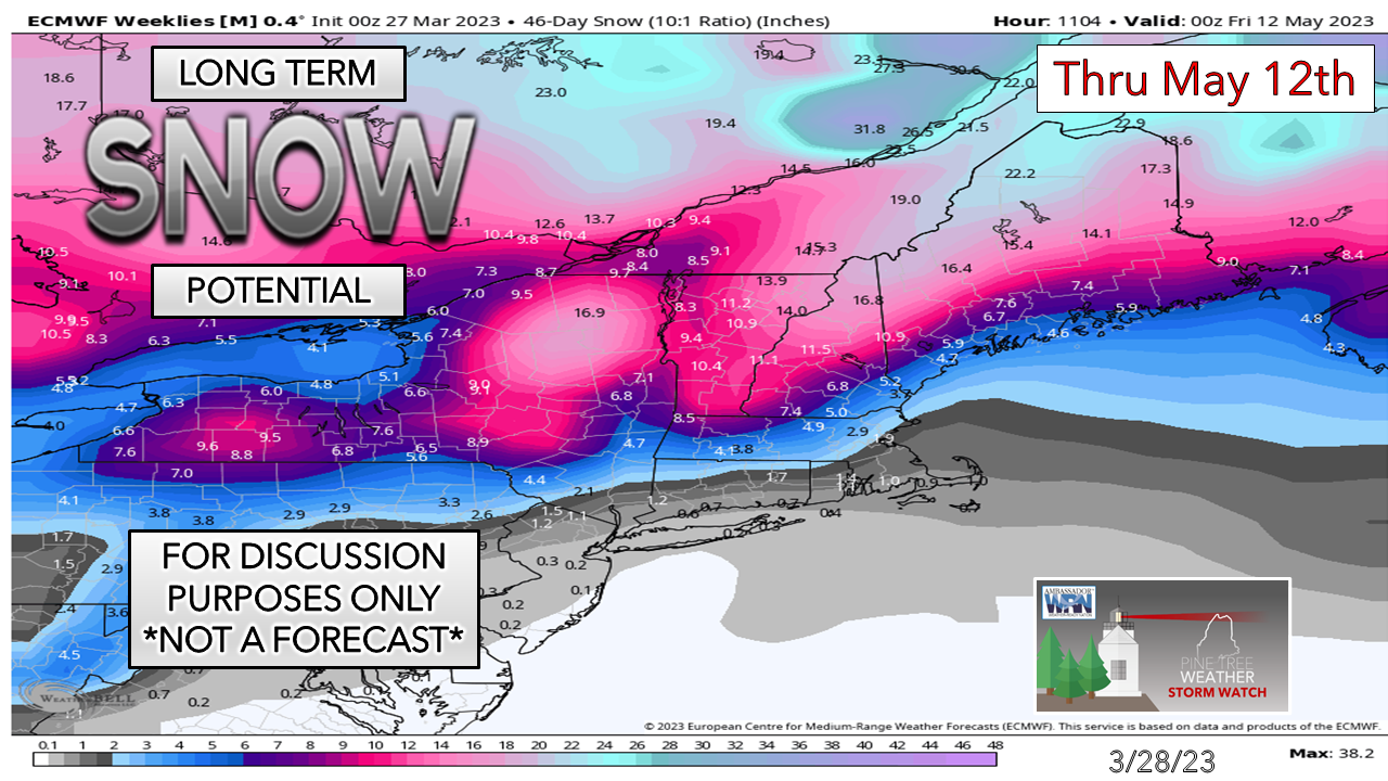
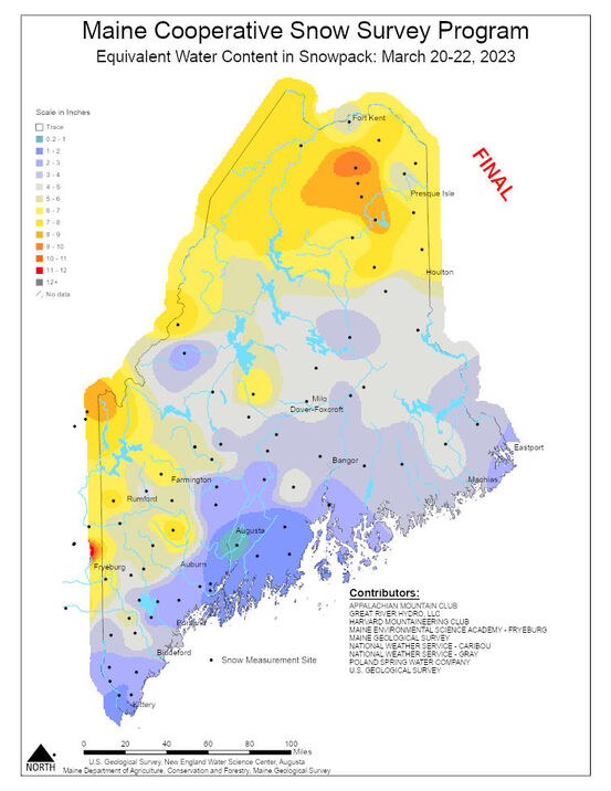
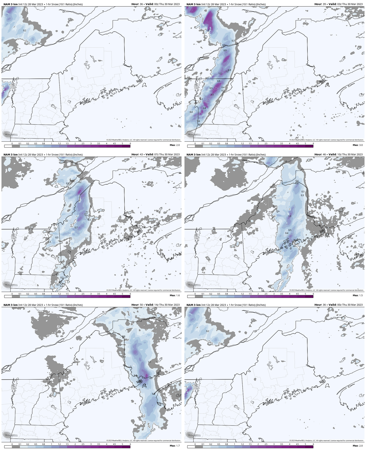
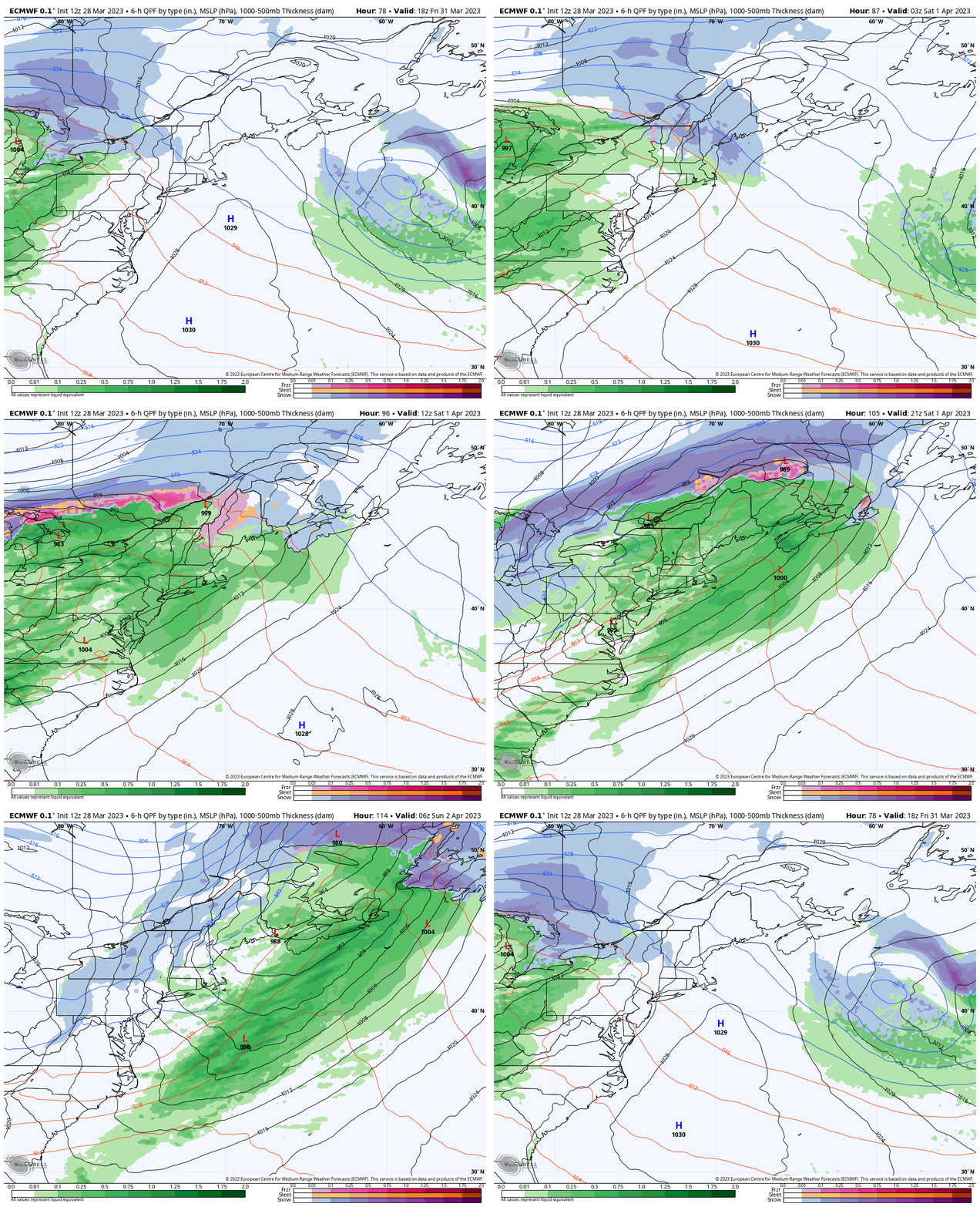
First off, a personal update. Overall, I am doing better. I've adopted a lifestyle change that works with treating rheumatoid arthritis. My food intake has switched to gluten-free, sugar-free, and low carbohydrate, which has taken quite a bit of adjustment. I walk between 4-7 miles per day. So far, I have lost ten pounds. I have more energy, feel great, and grateful for the support I am getting from friends, family, and supporters here. The arthritis is a bit better with all the changes. I have my moments, but overall, I am not feeling as much pain and discomfort as I did a month ago. Thank you for the prayers, comments, and messages of support. Also, a special thanks to those who have recently donated financially to the mission here. I am grateful that while I continue to adapt to my new normal that there are folks who have my back and appreciate my efforts. You folks know who you are, and you are the best! Outlook through mid-MayThere is nothing more polarizing to Mainers than the weather. I really notice it in the spring. Snow lovers are looking to squeeze a few more flakes, while others are tired of it and ready for green grass and warmer temperatures. Given the fact the ENSO is neutral, this sets up a cooler pattern. The backloaded winter I've warned about back in December has come to fruition, and long-term model ideas are on it. Those longing for warmer days will have to wait a while. Time for a bit of meteorological voodoo... Looking at the long-term temperature outlook compared to normal. While sampling some stations in the southern part of the state, there are very few ensembles that even hint of 60° for a high temperature at this point through mid-May. The range is upper-30s to low-50s. That is telling. The nights appear on the cool side as well. I've mentioned in the past about the stratospheric polar vortex spinning around to the north. It still is. We haven't really seen an impactful stratospheric warming event just yet. Those are incredibly difficult to predict. Bits and pieces of the tropospheric polar vortex break off and bring cool shots, like we saw with the bitter blast in February, but that is a slightly different animal at a lower level in the atmosphere. With the North Pole gradually tilting toward summer, the bubble that is the stratospheric polar vortex is going to burst, and that cold is going somewhere. For those that live around the 45th parallel, as we do here in Maine, we're on notice that the threat for cold has not ended just yet. From a hydrology standpoint, it's more or less equal chances for precipitation in the 46-day outlook. With the ENSO neutral, that keeps most of the moisture to the southeast. With the pattern generally cooler and troffy in nature in that type of scenario, it breeds clipper systems with the risk of a few Nor'Easters. Depending on what happens with both the stratospheric and tropospheric vortices will dictate what precipitation falls as frozen or in liquid form. Before the snow lovers rejoice with glee and the snow haters scream with horror, it's important to put this into context here. This chart DOES NOT mean the region will get buried over the next six weeks. I preach numerous times that 10:1 ratio snowfall charts, even in the dead of winter, aren't right for various reasons. Now that we are in spring, a higher sun angle, more heating of the atmosphere due to solar insolation (radiation), the sum of all this can quickly reduce this total. We're now in heavy, wet snow potential season. What I take away from this idea is that we aren't out of the woods for the white stuff just yet. For those who want to put the shovels and snow blowers away for the year, I wouldn't do that for now. There is just too much uncertainty with the cold aloft and to the north to say winter is over by any means. A word to the wise, now that it is heavy, wet snow season, keep the storm supplies stocked up and generators ready just in case we get whacked with a good one that could bring power outages. Spring flooding outlookThe recent water content in snowpack survey from last week shows a couple areas of concern for spring flooding, one for the north and the other in the west. A report from the National Weather Service Caribou office from a survey done on Monday 3/27 indicated water content in the snow over central Aroostook in the 9-11" range, which is enough to raise an eyebrow regarding spring flooding. For now, it does not appear to be of much concern for much of the Kennebec River basin, but other major rivers such as the Androscoggin, St. John, and Penobscot, and the smaller rivers such as the Allagash, Aroostook and Swift will need to be monitored going forward. With temperatures expected to be below normal and precipitation expected to be near average, this helps to reduce threat to some extent, but all it takes is a strong inside runner storm up the St. Lawrence River with plenty of moisture to change that idea. For those that live along tributaries or travel through areas where flooding in spring is common, stay tuned. Snow squalls Wednesday night into Thursday |
Mike Haggett
|

