A few showers around for interior areas Wednesday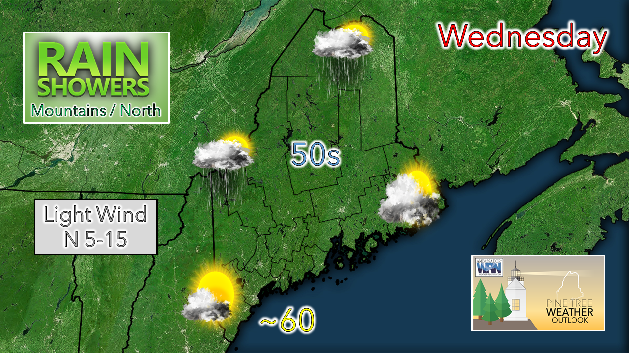 Sun starts off the day across the region. A cut-off upper-level low drops down from Quebec, increases cloud cover, and brings the threat for showers primarily over interior areas. 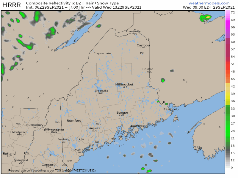 Wednesday 9 AM - Thursday Midnight: Showers become more numerous over interior areas through the afternoon into the night as the upper-low settles in and spins around overhead. Temperatures for the day range in the 50s for most of the region. Southern areas may flirt with the low 60s with a better chance for sun. Wind is expected to be generally light through the morning and increase a bit for the mountains and north heading into Wednesday night. Showers continue into Thursday, snow possible for the higher peaks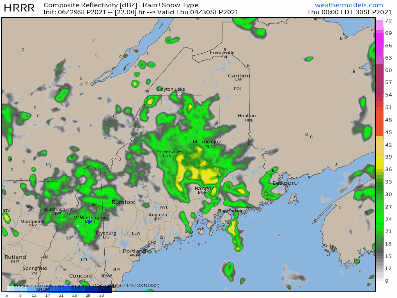 Thursday Midnight - Friday Midnight: The cut-off upper-low continues to spin around and bring more chances for shower activity through the day. It is likely to be a mainly cloudy day for the state as the waves from the upper-low work through the region. The upper-low is bringing the first chance for snow for the Presidential mountain range in New Hampshire and Mount Katahdin in Maine. 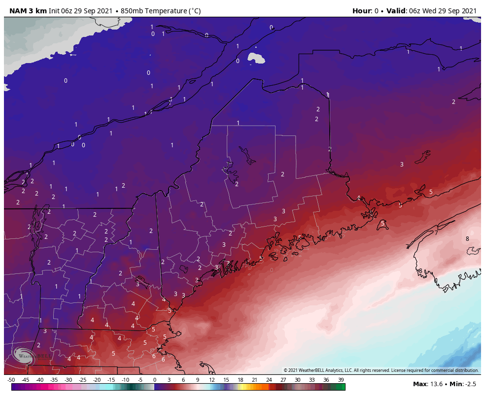 This sped-up loop of temperatures at the 850 mb (~5,000 ft) level shows the forecast cold air associated with the air mass. Temperatures flirt with the 0° C (32° F) freezing mark over into Friday. The forecast for Mount Washington indicates that a taste of winter is coming. The cold airmass works out of the region as we head into the weekend.  Weekend outlook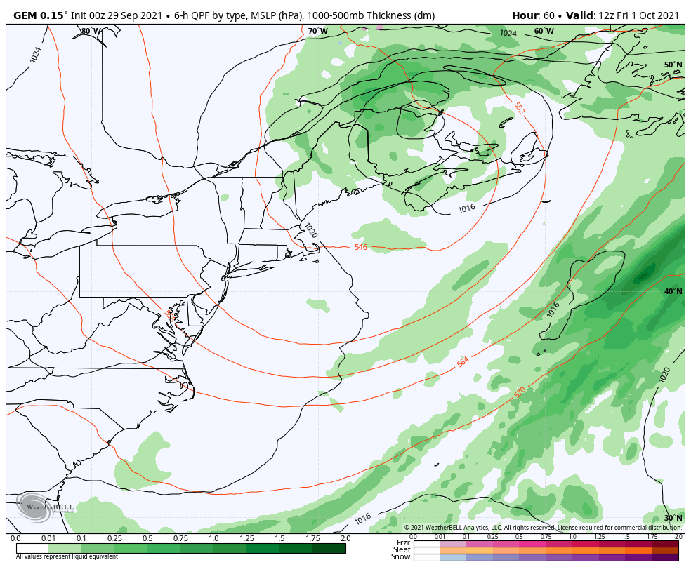 For Friday, the upper-low slowly drifts to the east, but will keep showers in the forecast for the north through the day. A ridge approaches from the west heading into Saturday, which moves the upper-low to the northeast, and will bring a mainly dry day to the region. As the ridge moves east into Sunday the combination of warmer air aloft and disturbances along the mass bring the threat of showers back into the area. The influence of this ridge is what keeps Hurricane Sam well to the east, out of harms way, other than ocean swells. A long wave frontal boundary approaches the region Sunday night into Monday, bringing the likelihood of rain to start the week. mPING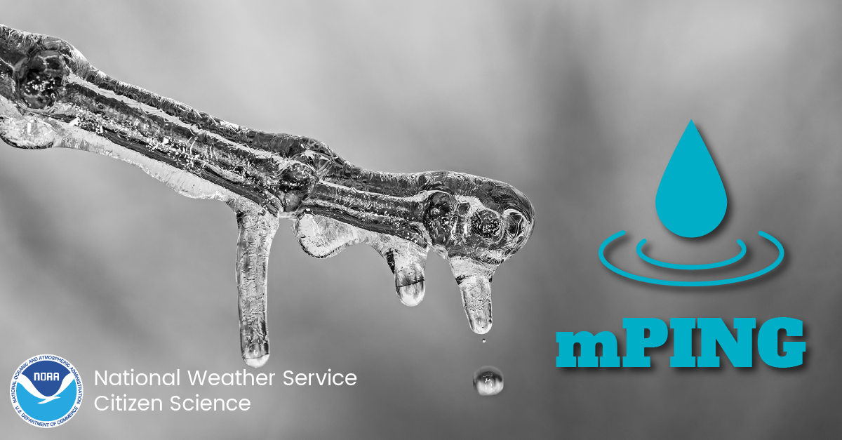 Check out mPING (Meteorological Phenomena Identification Near the Ground) project. Weird name, cool app! You can report the type of precipitation you see where you are. No need to measure! Use the free mobile app to send reports anonymously. Reports are automatically recorded into a database, which improves weather computer models. The information is even used by road maintenance operations and the aviation industry to diagnose areas of icing. mping.nssl.noaa.gov Temperature outlook through Monday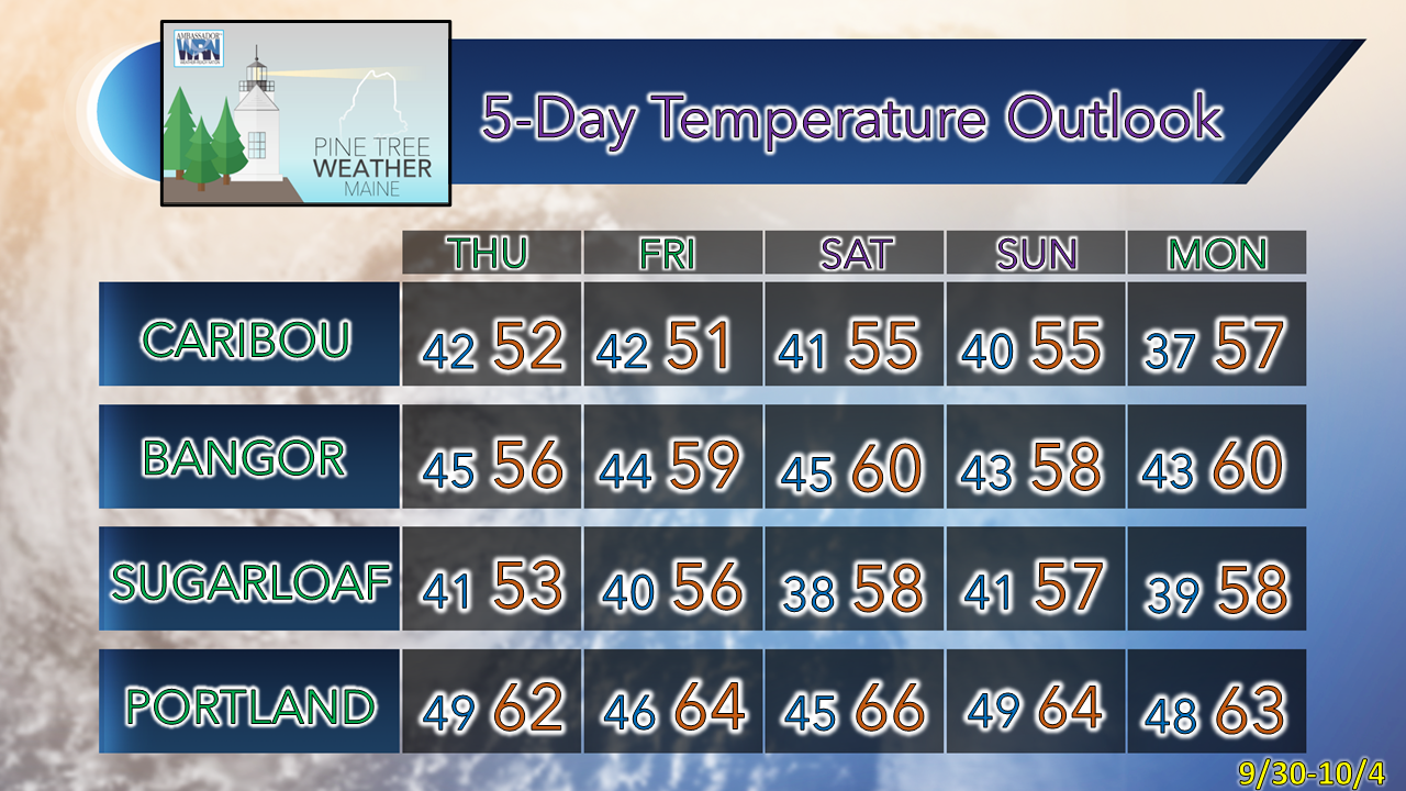 Be prepared to receive alerts and stay updated!
 For more information in between posts, please follow Pine Tree Weather on Facebook and Twitter.
Thank you for supporting this community-based weather information source which operates by reader supported financial contributions. Stay updated, stay on alert, and stay safe! - Mike |

Mike Haggett
|