|
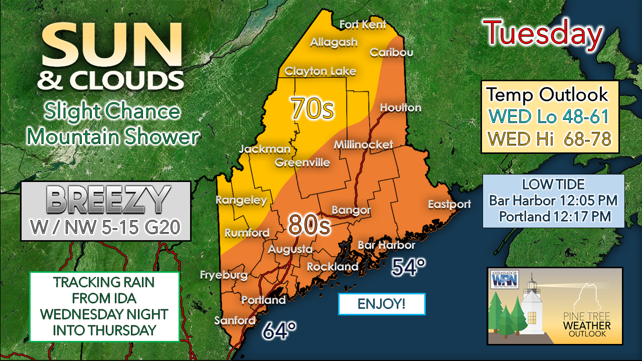
The region starts off with some areas of patchy fog around, but that dissipates quickly after sunrise. Areas start off mostly sunny. Drier, cooler air moves in aloft and that may kick up popcorn cumulous clouds and with advection with the west / northwest breeze may generate a shower / sprinkle over the western mountains in the afternoon. With dew points comfortable in the 50s, it will be a great day to open the windows and enjoy! For Tuesday night, southern areas see clouds on the increase as the remnants of Ida head northeastward. In areas where skies are clear to the north, temperatures start off around 50° for Wednesday, around 60° where cloud cover is present. For Wednesday, clouds continue to build in from southwest to northeast as moisture from Ida heads into the Mid-Atlantic region. The day appears dry overall, with clouds more numerous to the south. The $64,000 question at this point is just how much rain reaches Maine Wednesday night into Thursday. Ida's moisture will be interacting with an upper low dropping south from Quebec. The center of that upper low makes it as far south as the Saguenay region in east central part of the province. The timing of interaction between the upper low and energy from Ida will dictate rain amounts. One school of thought has the remnants of Ida turning into a NorEaster, which would be the wetter solution and would push rain well inland. The other idea has the upper level low not making the connection with Ida's energy in time which would essentially kick most of the moisture to the east. The coast has the best chance for rain in either scenario. The cut off is likely to be sharp between who gets rain and who does not. Some ideas show stark differences within 30-60 miles of variation between 1-2" and a ¼" or less. Hopefully a better consensus in ideas will come later today. Looking ahead to Labor Day Weekend, high pressure moves in for a decent start to it on Friday and Saturday, with rain chances increasing Sunday into Monday. Be prepared to receive alerts and stay updated!
For more information in between posts, please follow Pine Tree Weather on Facebook and Twitter.
Thank you for supporting this community-based weather information source which operates by reader supported financial contributions. Stay updated, stay on alert, and stay safe! - Mike |
Mike Haggett
|


