A wet end to the week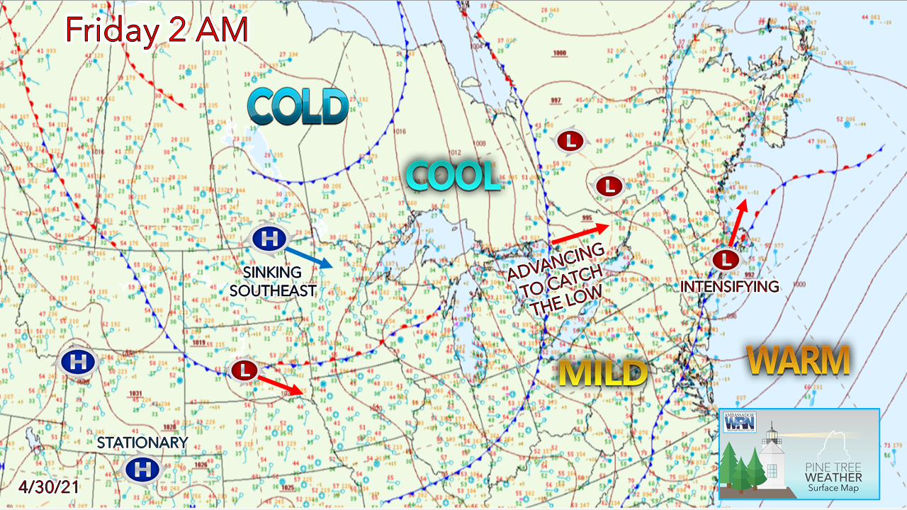 Low pressure advances into the Gulf of Maine Friday morning. The northern stream races eastward in the form of a cold front and reaches the low by Friday night. The storm intensifies as it heads into the Canadian Maritimes Friday night. A gusty west-northwest wind brings a cool start for Saturday. Rain, drizzle, and areas of fog continue through Friday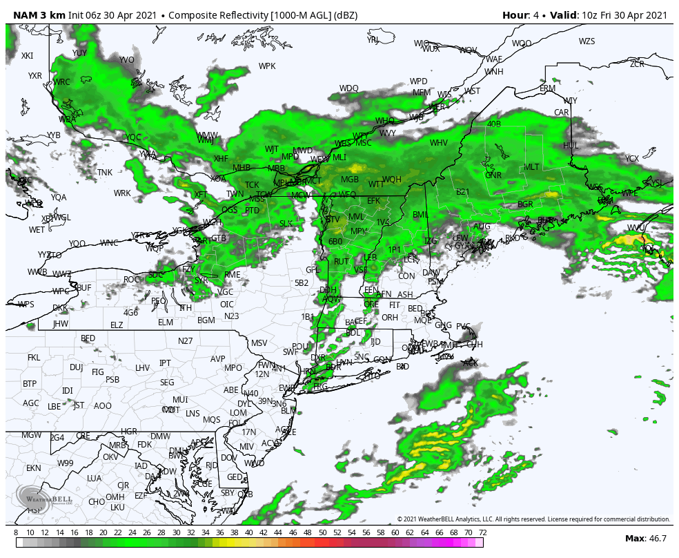 Forecast radar outlook from 6 AM to 8 PM Friday shows widespread shower activity statewide through the day. There may be some pockets of moderate accumulations rain tucked into the moisture shield, but this appears to be a steady rain event overall through the daylight hours. 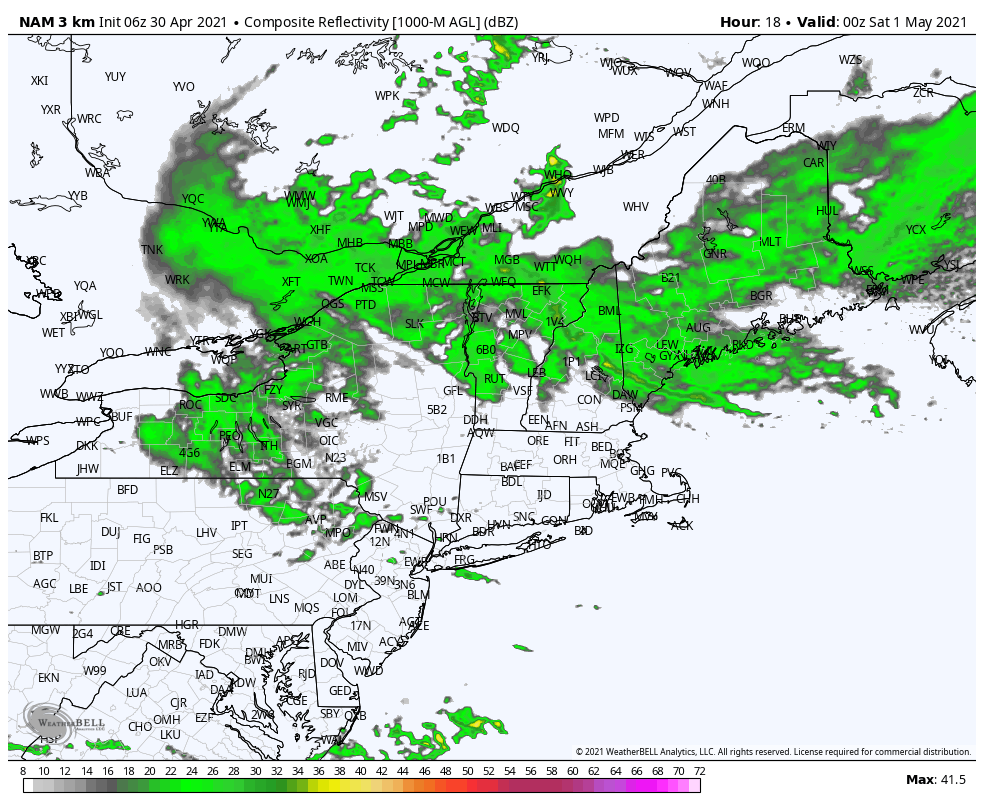 As the upper-level trough and associated northern stream of energy reaches Maine Friday evening, the two interact with the surface low and the storm intensifies as it heads northeast. Precipitation ends for most by 6 AM Saturday morning. Wind picks up Friday, remains gusty into Saturday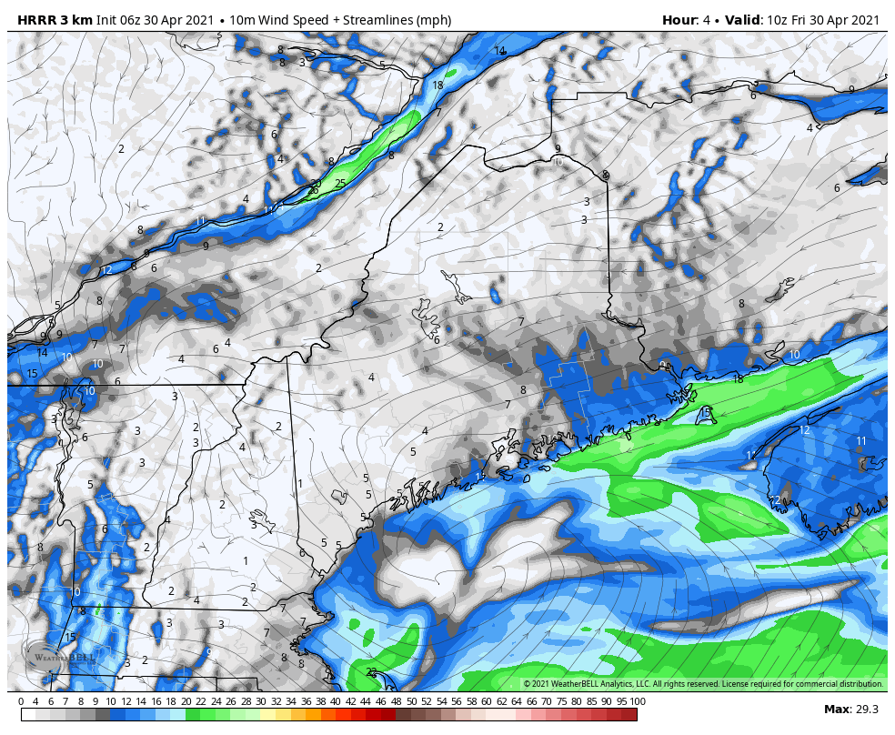 Wind speed for Friday through 8 PM vary by region. Eastern and far southwestern areas could see gusts in the 20-30 mph range in the afternoon. 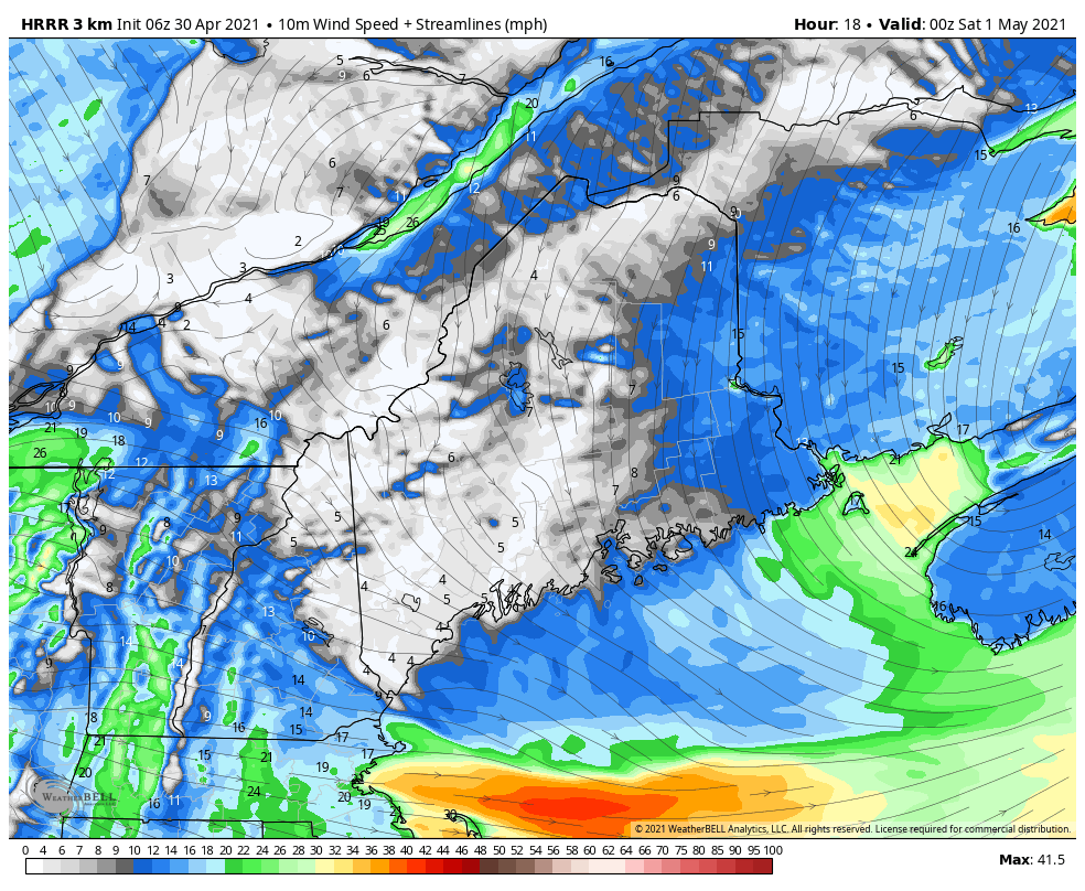 As the storm intensifies Friday night into Saturday, wind speeds climb everywhere, with the strongest gusts likely to occur Saturday morning, then gradually settling by Saturday evening as a weak area of high pressure settles in. A weak frontal passage for Sunday kicks the breeze up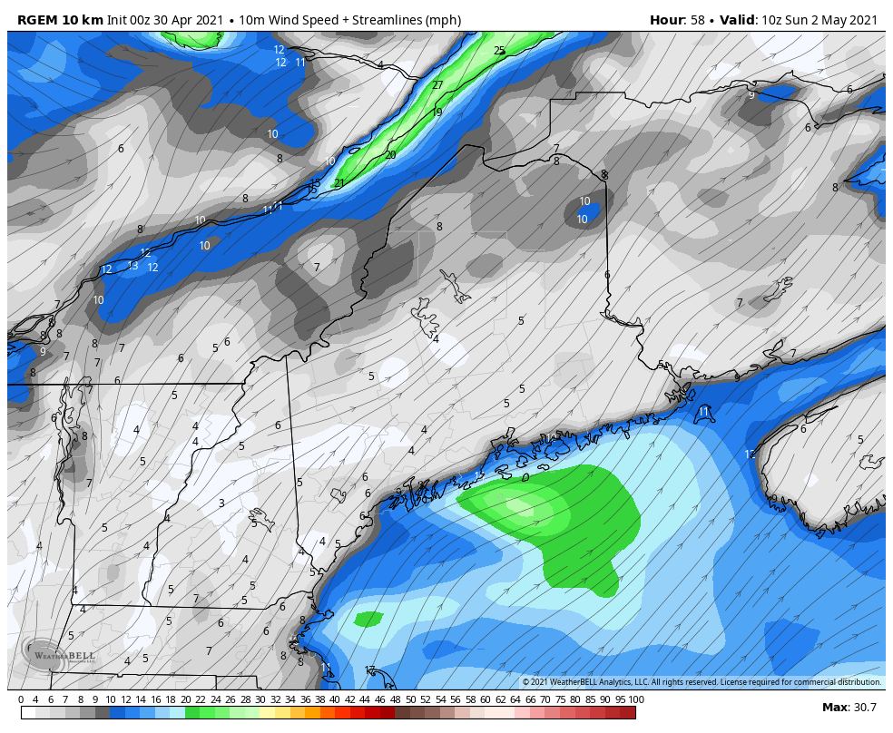 High pressure quickly slides east Sunday morning. A weak frontal boundary approaches the region during the day. Wind direction from the southwest pumps warmer air into southern areas ahead of the front, then flips to the northwest after the passage. Northern areas and the mountains may see a spot shower, but for the rest of the region, it will be a mix of sun and clouds with perhaps a sprinkle. Wind speeds range 5-15 mph with gusts reaching 25-30 mph as the front passes through, settling down Sunday night. Unsettled week ahead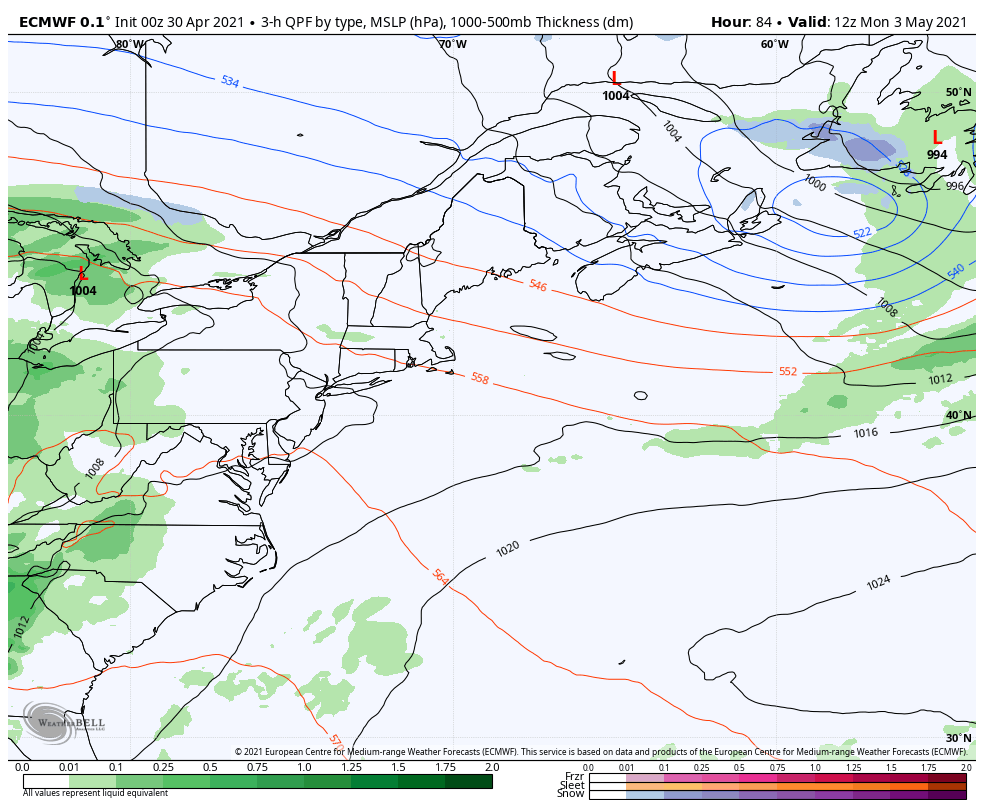 Guidance ideas beyond Sunday are scattered with ideas, which is typical in a volatile spring pattern. The next chance for rain at this point appears Monday into Tuesday. Models are unsurprisingly split on the timing of the phasing of the northern and southern streams. The European model loop shown here is the most progressive with the idea of the phase occurring in time to bring widespread shower activity, where other models are flat with the phase occurring further upstream. The one consistent feature is a blocking pattern appears to set up to the north, which keeps a steady stream of impulses passing through the northeast corridor well into next week. In that scenario, scattered showers, temperatures around seasonal average and varying amounts of clouds are the potential outcome. Join the weather community as a storm spotter! 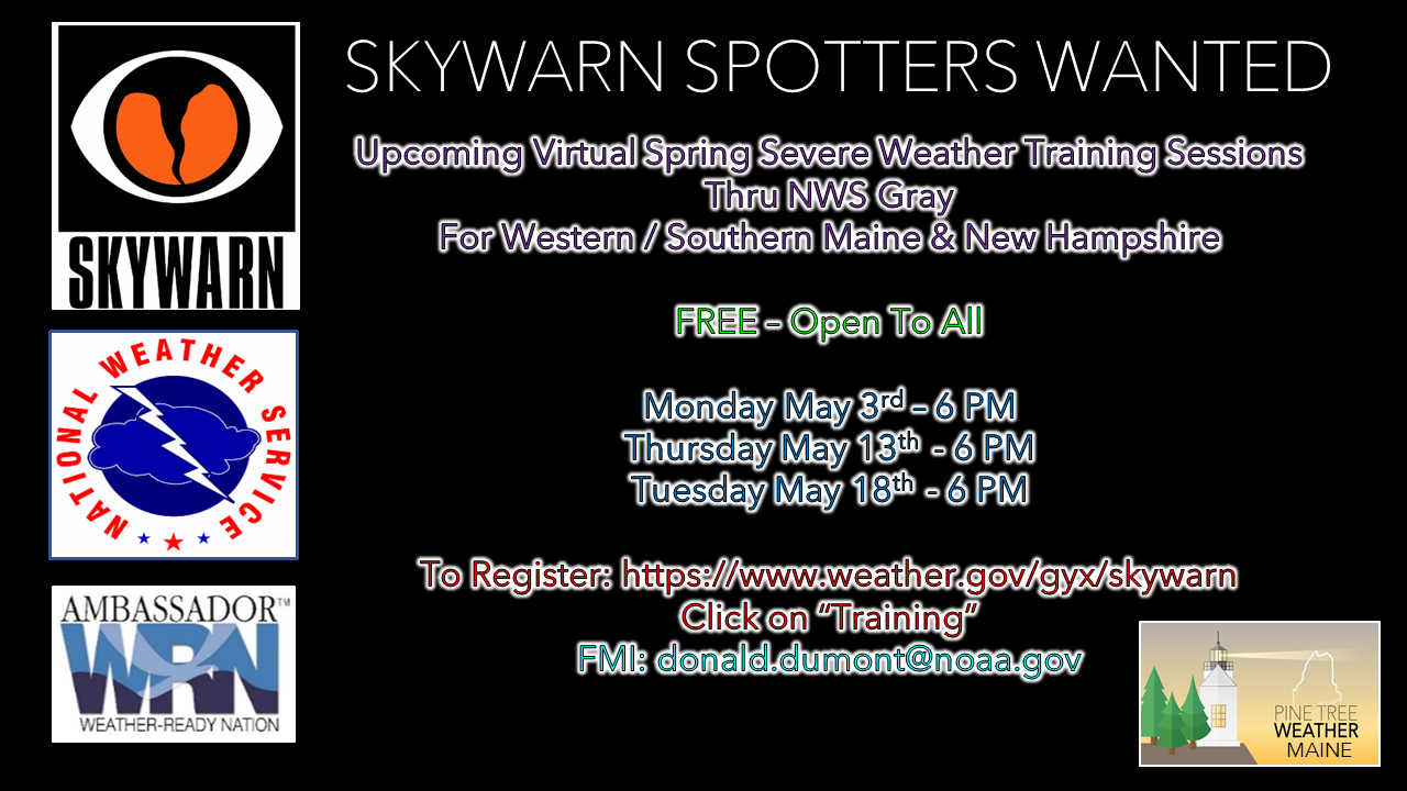 Here's a wonderful way to become active in the weather community and help the US National Weather Service Gray ME, broadcast media and forecasters like myself with storm reports. This information is vital during and after an event for forecasting and alerting purposes. I can't tell you how many times I have seen the importance of these reports in the past 9+ years I have been involved. Pine Tree Weather followers have stepped up in the past and participated, and with the readership base continuing to grow, I know there are more out there. This is the spring/summer session which discusses severe weather, what to look for, and how to report it. These sessions run for about 90 minutes. They are fact filled, educational and interesting. You can get the whole family involved from the comfort and safety of home. Once completed, you will get your spotter ID, and will be ready for the season ahead. For those who trained for the winter session, this will complete your full year training. It's important to have both sessions done. The link to register is here ► https://www.weather.gov/gyx/skywarn#fragment-2a If you need more information, please contact Donald Dumont, the Warning Coordinating Meteorologist at NWS Gray via email [email protected] or message me directly. Seven-day temperature outlook through Thursday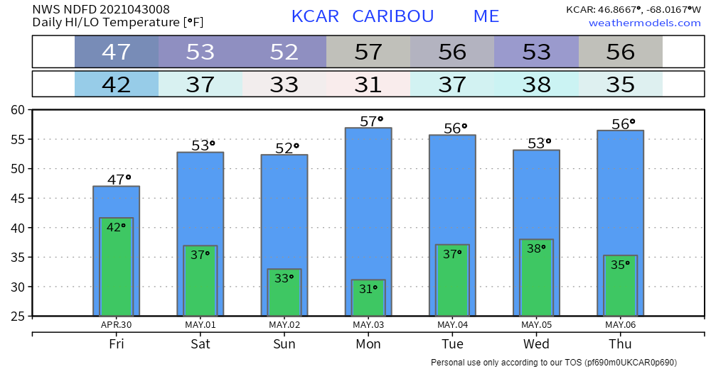 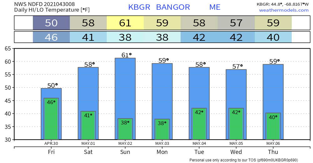 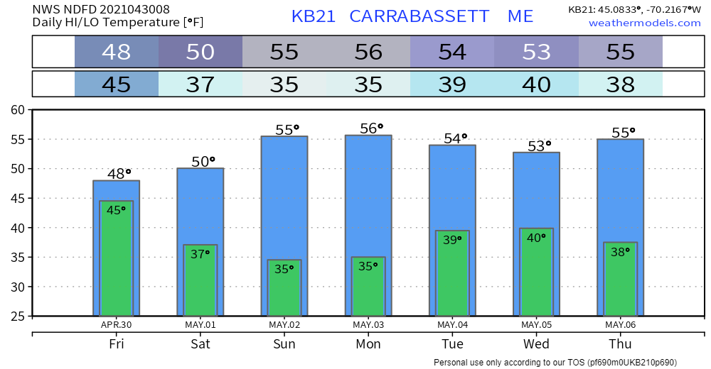 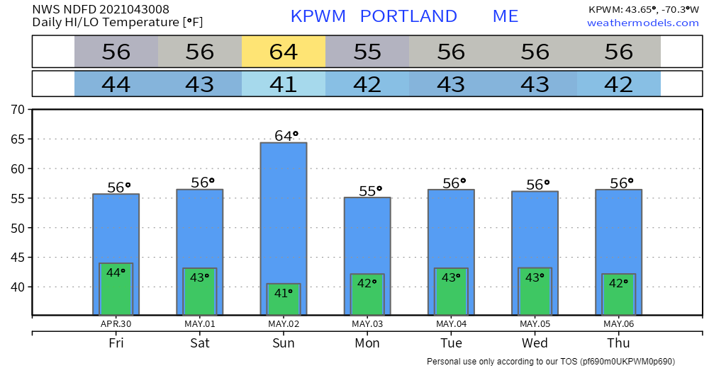 Be prepared to receive alerts and stay updated!
For more information in between posts, please follow Pine Tree Weather on Facebook and Twitter.
Thank you for supporting this community-based weather information source which operates by reader supported financial contributions. Stay updated, stay on alert, and stay safe! Thank you as always for your support! - Mike |

Mike Haggett
|