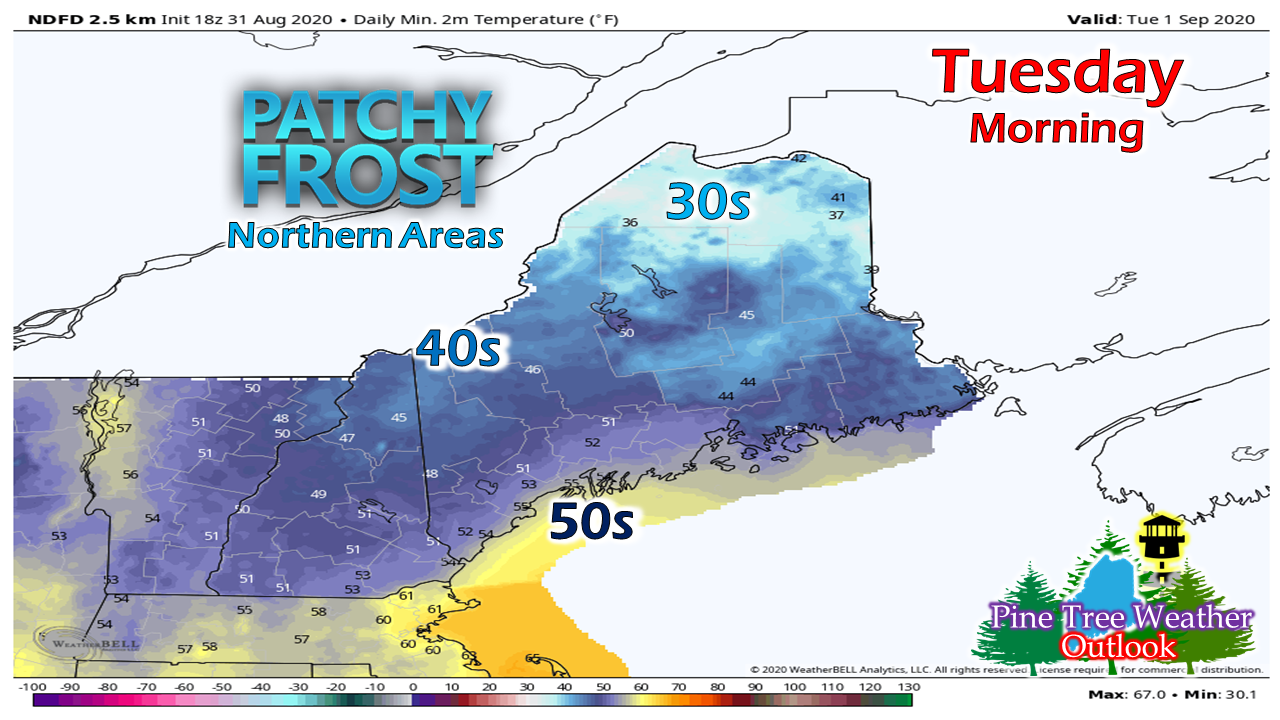
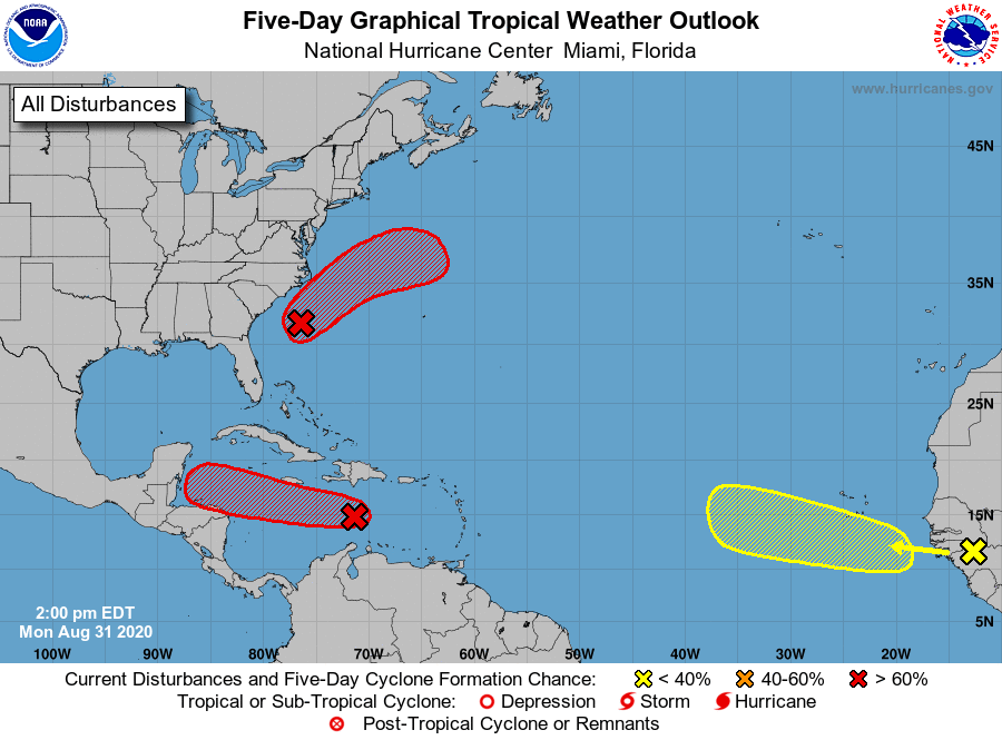
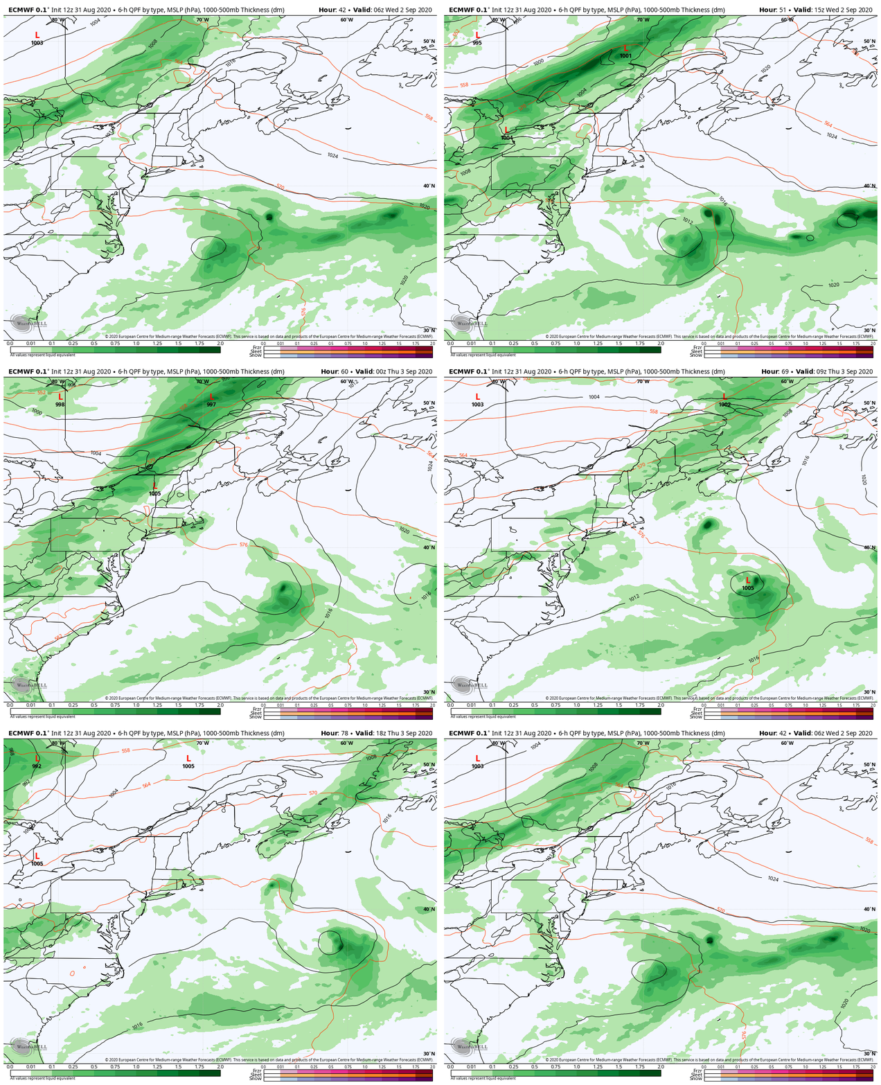
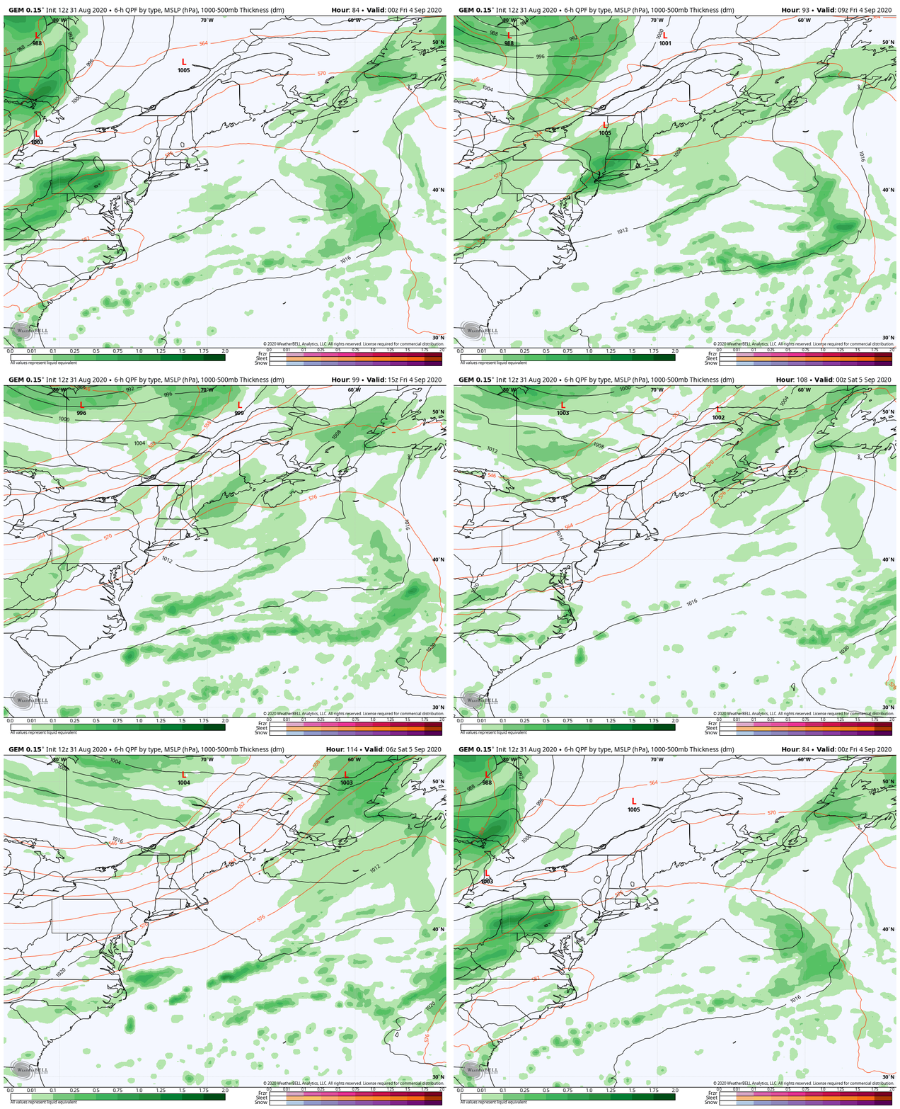
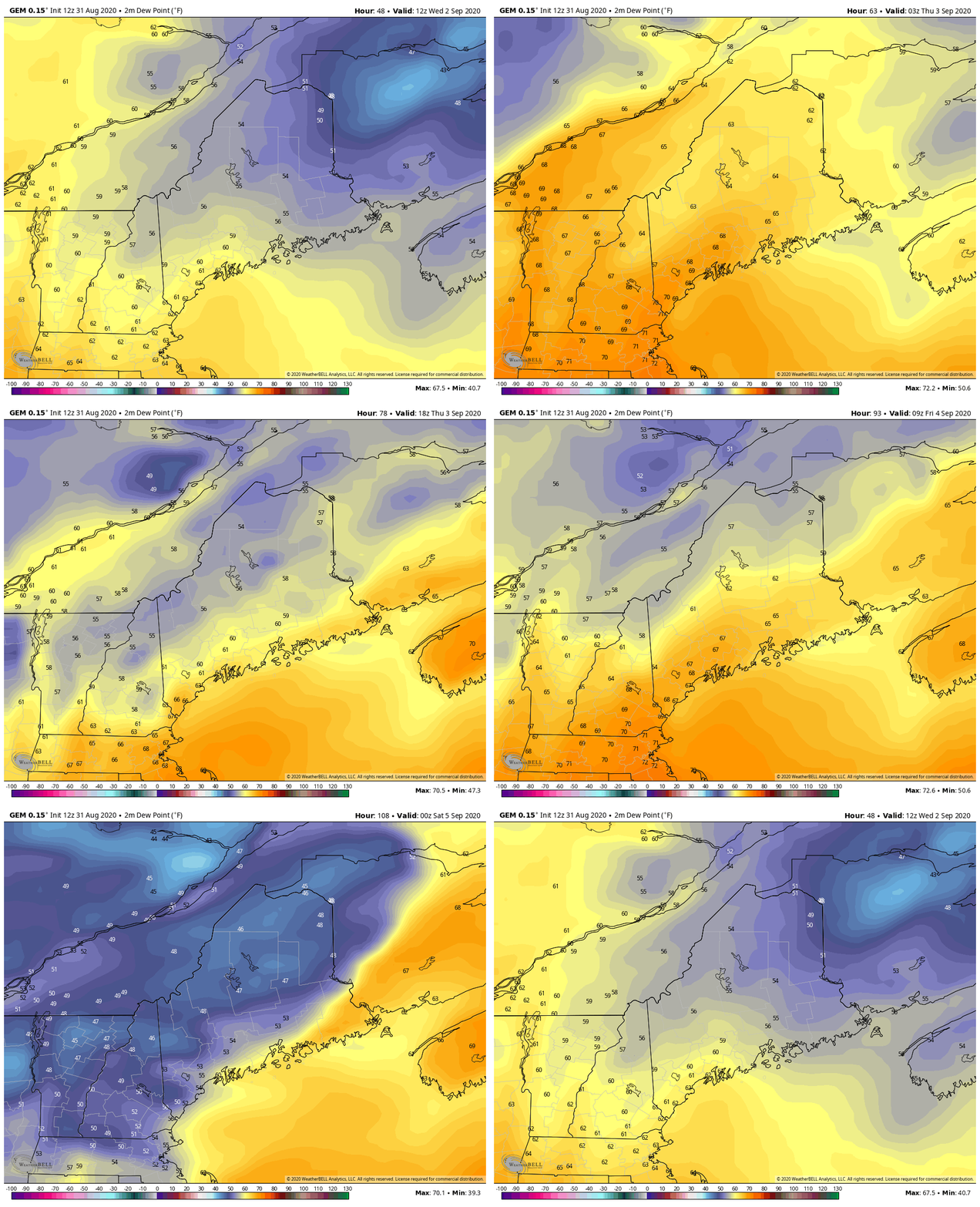
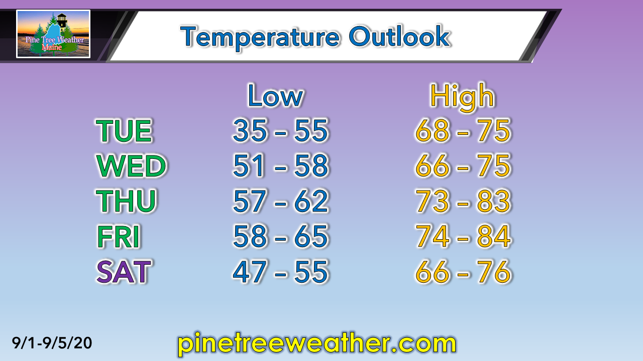
The five letter "F" word possible for the far northSeptember 1st marks the first day of meteorological fall, and right on cue, patchy frost is possible for the north country. Folks who live in well protected areas in the Allagash region over toward the New Brunswick border may wake up to sub-32° temps Tuesday morning. Estcourt Station fell to 32° Sunday morning. With record warm and near record low rainfall for the north for most of the summer, the last time Estcourt dipped below 32° was only June 15th. Summers tend to be short up north. A tip of the cap to Mike Slifer at WCSH for that piece of information. Tropical season continuesThe National Hurricane Center remains busy monitoring tropical activity as the peak of the season approaches. One area of interest just off the coast of the Carolina's may fire up into a tropical depression or a low grade tropical storm Tuesday or Wednesday, but it is no threat to Maine. It may churn up the ocean a bit, but that will about it. Outlook through SaturdayIt appears that late Wednesday into Thursday will be the next chance for rain for the state. Northern areas and the western mountains appear to get the most benefit from this, but the amounts on this one appear to be rather skinny for rainfall. Thursday runs the risk of a thunderstorm for southern areas as dew points start to rise back up again. Showers / storms from this event clear out but Thursday night. There are mixed messages from guidance as to what to expect on Friday. A weak wave may spin up a weak area of low pressure that could bring showers to the coastal plain as suggested here. If that happens, it's a quick mover. It may bring an thunderstorm before it departs DownEast areas Friday afternoon, but I consider that a low risk situation for now. For now, it's just a chance for any rain or storm activity. At the very least, a moisture starved frontal boundary may bring clouds and a the risk of a shower for the mountains & north, with varying amounts of clouds elsewhere. Expect the wind to kick up behind the frontal passage. Check back for an update on this. The recent comfortable humidity levels will step aside for a couple of days as dew points begin to build Wednesday, and could potentially hang around until Friday. Once a weak cold front / weak low passes through, cooler, more comfortable conditions return for the weekend. A brief warm up ahead of the weekendIt could be a bit uncomfortable sleeping for the coastal plain Wednesday and Thursday night with the increase of humidity. Temperatures will be cooler for interior areas and shorelines, warmer for coastal interior areas. Rain / snow observers wanted in Maine!Ever wanted to take rain or snow measurements? Join CoCoRaHS or Community Collaborative Rain, Hail, and Snow Network. This volunteer network of observers measures precipitation from their backyards. Any age can volunteer. Data is used by NWS meteorologists to help with forecasts. www.cocorahs.org Stay on alert and stay updated!
For more information, please follow Pine Tree Weather on Facebook and Twitter.
Thank you for supporting this community based weather information source that is funded by your financial contributions. Stay updated, stay on alert, and stay safe! - Mike |
Mike Haggett
|

