Pine Tree Weather
  • DISCUSSIONS
  • MAPS
  • BRIEFINGS
  • SATRAD
  • RAIN OUTLOOK
  • SNOW / ICE OUTLOOK
  • MARINE
  • CPC OUTLOOK
  • Kennebunk
  • Weather Geekdom
  • DONATE
  • Who I Am
  • My Photography
  • DISCUSSIONS
  • MAPS
  • BRIEFINGS
  • SATRAD
  • RAIN OUTLOOK
  • SNOW / ICE OUTLOOK
  • MARINE
  • CPC OUTLOOK
  • Kennebunk
  • Weather Geekdom
  • DONATE
  • Who I Am
  • My Photography

Slick roads Friday morning for interior areas

11/30/2017

Comments


Another mixed bag to end the week

Picture
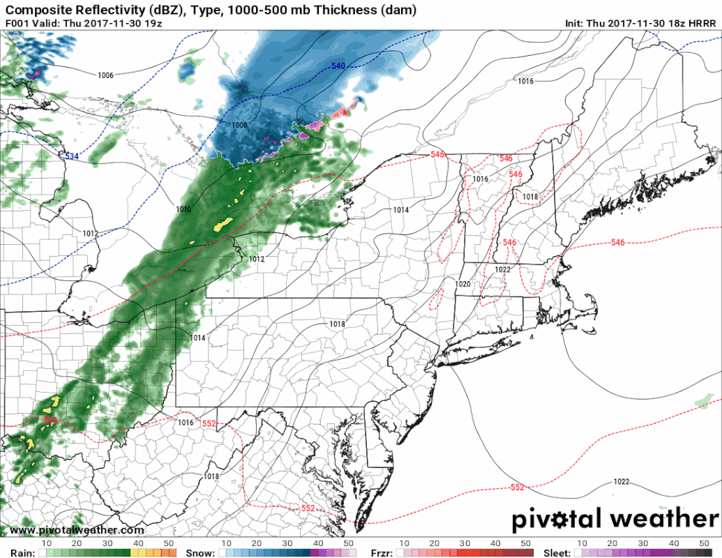
No real changes on timing or precipitation type from the update from last evening. A cold front sweeps through overnight Thursday into Friday morning. This one has a bit more moisture to work with than the one that affected the area on Wednesday. As a result, more snow is in the offing for the north and mountains.

Given the trajectory of the front, I do not expect a whole lot of freezing rain from this system. There will be some, primarily in the mountains. As warm air works in at the surface from the western foothills and mountains on up to The County, I expect a light slushy, slick mess to form on the roadways. Granted, it's not a lot of snow, but it will be enough to make driving a bit tricky for the morning commute.
Picture
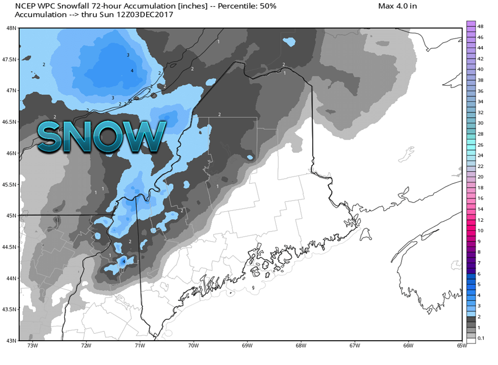
All in all, a general 1-3" is expected in the north country. It would not surprise me to see some light accumulations for northern interior York County around Cornish and Parsonfield, Sebago Lake over to Lewiston/Auburn, Augusta/Waterville. Bangor appears free from accumulations. Whatever accumulations appear in those areas would be light.  

Most of the precipitation is on track to end between 4-8 AM statewide. The north country may see some flurries and snow showers through the morning, but as high pressure moves in and dries the air out, clouds will begin to dissipate in the afternoon. 

A mix of sun & clouds with a flurry possible Saturday

Picture
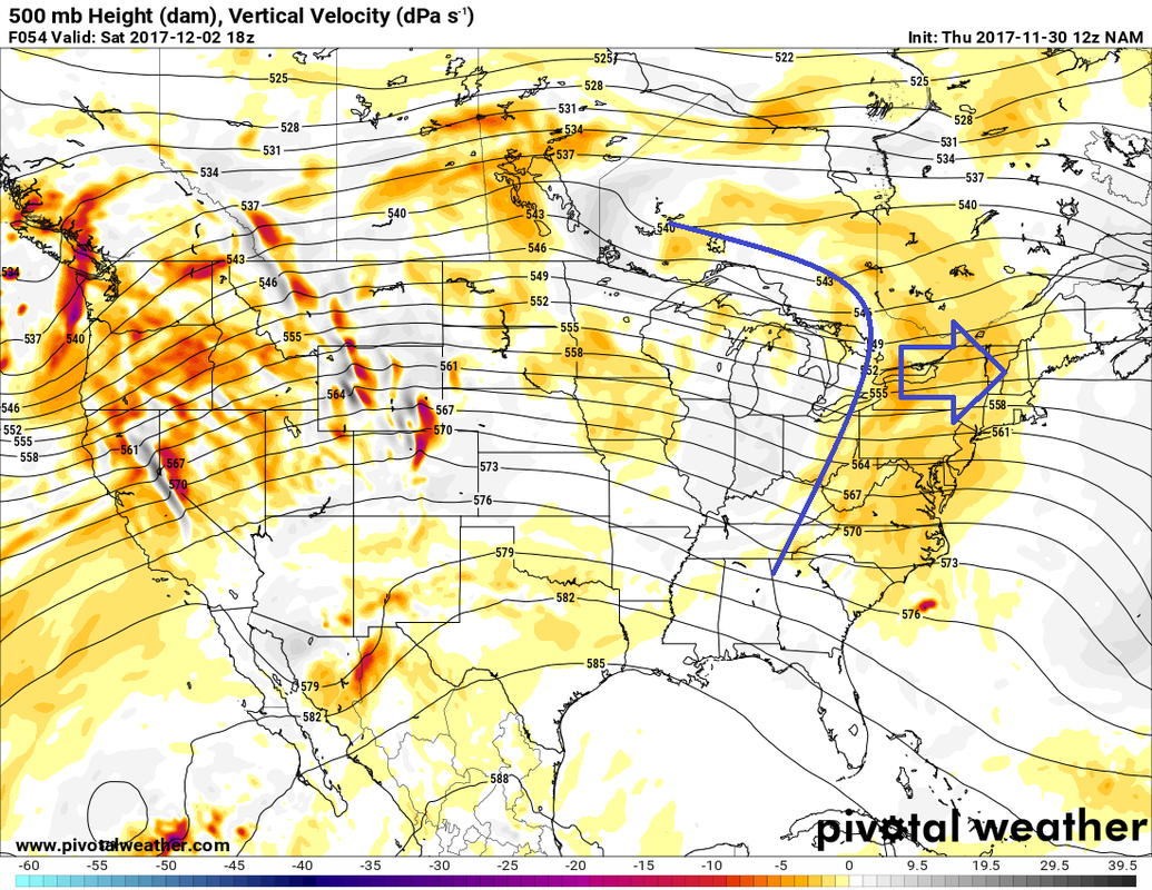
Some weak upper level energy appears to pass through the region on Saturday. This will cause clouds to increase in the afternoon, and may touch off a flurry or snow shower over the higher terrain. This wave is both moisture starved and energy starved, and as a result, not much will come out of it.

Sunday and Monday appear to be dry with varying amounts of sun, and temperatures slightly above normal. 

Next chance for precipitation appears Tuesday

Picture
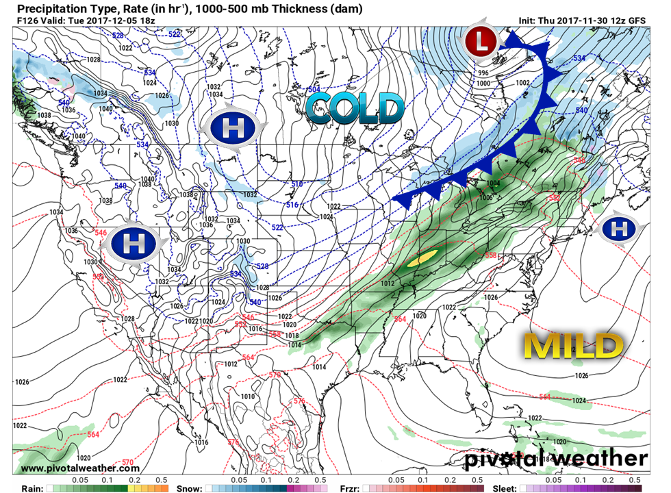
A long wave frontal boundary is on track to affect the region towards the middle of the week. It is a bit early to get into specifics on this  for now. It would not be out of bounds to consider another round of snow, mix and rain for the area. That all depends on timing, and how much mild air moves in from the southwest.

​The piece to watch in all of this is the shot of cold air coming down from Canada.

Snow chances begin statewide later next week

Picture
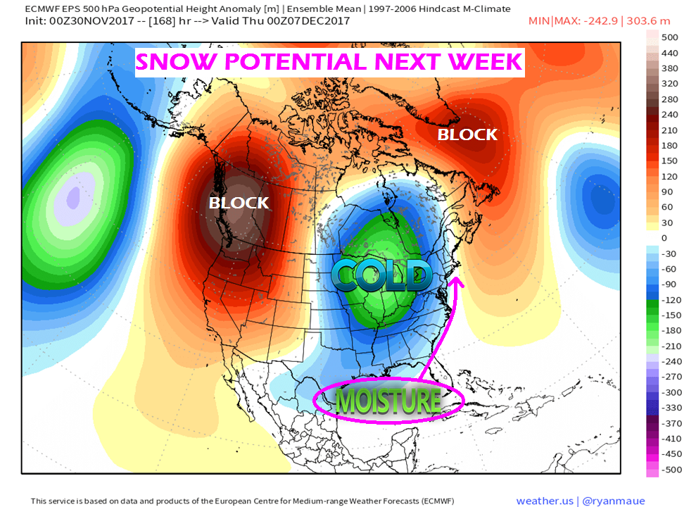
This will be something to keep close tabs on in regards to late next week and over the weekend. Models have been on this idea over the past few days, and I think there is some validity to it. Anytime there is a blocking pattern to the west, north and east with cold air in the middle, snow chances will rise. 
Picture
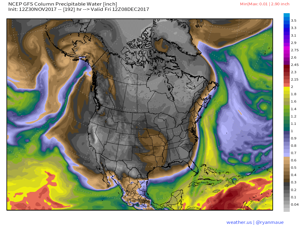
With the moisture stream riding up along the coast along with trapped upper level energy holding the cold, there is a good chance that the plows will be needed roughly Friday. The intriguing piece in this is a second wave of upper level energy that comes down once the cold has been established by next weekend. It is that scenario where I believe where a solid snow (6"+) could occur. Models indicate that this cold isn't going anywhere. It will likely modify a bit, but it will be the second week of December. The cold that comes in does not appear to be mid-January cold, but daily highs may struggle to reach above freezing for southern and eastern areas over the course of several days. With the first day of meteorological fall being this Friday, it is only a matter of time before the landscape becomes white.

The 5-Day Outlook page has been updated through Tuesday.

​- Mike
Comments

A look ahead to Friday

11/29/2017

Comments

 
Picture
Just a quick update in regards to Friday. This appears at this point to be an overnight storm, starting Thursday evening and appears all but done for the most part by the morning commute.

While the pattern is similar to the one that affected the region Wednesday, this system has a bit more moisture to work with, and as a result will cause more issues for interior areas. 
Picture
It's a decent bet for a plowable snow for the mountains, with a light scrape / treatment possible for the western foothills on up into southern Aroostook. Snow showers and flurries may persist in the north country through the morning as the atmosphere clears out. 

I will update on this again tomorrow.

This is really the only weather concern within the next 5 days. You can click on the 5-Day Forecast tab above for the latest on that.

​- Mike 
Comments

Wednesday brings a mixed bag

11/28/2017

Comments


A bit of snow, ice, and rain

Picture
It is the season for models to struggle with cold air, and trying to find charts to emulate what is likely to happen is a struggle since they are misreading what is going on. As I mentioned on the Pine Tree Weather Facebook page this morning, the western foothills on up to southern Aroostook should be prepare for a light glaze in areas early Wednesday morning. 
Picture
The north country is likely to see the most icing, and it won't be much. 
Picture
The ice threat tails off to be primarily a mountain threat for western areas, but I caution anyone living in the western foothills to around Dover-Foxcroft up to the south end of The County to be aware of slick areas for the morning drive. 
Picture
With the ice comes a bit of snow for interior areas to consider. While this model idea does not depict a whole lot of accumulation, a bit of ice with a bit of snow on top of it is all it will take to cause slide-offs and accidents. 

Southern and eastern areas are likely to get a bit of rain out this, likely a better chance for Bangor / DownEast with less of a chance for Augusta / Portland southward. Some places may not get anything out of this.
Picture
By around midday, sun is likely to come out over much of the south and east, with clouds being persistent in the north and mountains. There is a chance for some flurries for the north country with upslope wind from the northwest through the remainder of the afternoon. 
Picture
By Wednesday evening, the west / northwest wind speeds up behind the front, and temperatures drop. Wind chill values in the upper single digits to teens for the north and low to the low to mid-20s for the coast. 

High pressure returns for Thursday

Picture
As high pressure moves in Wednesday night, the breeze drops by Thursday morning. High pressure makes a brief visit, and slides eastward during the day. A southwest flow develops ahead of a cold front sweeping across the Great Lakes. Clouds will increase during the afternoon, and precipitation is expected to arrive over western areas late Thursday night. 

Another mixed event for Friday

Picture
This system is similar to the characteristics of Wednesday's event, but appears to have a bit more juice to it. The mountains and north country could see a couple of inches of snow in areas or more from this front. Early commuters may have to deal with snow / wintry mix event yet again for the western foothills on over to Southern Aroostook.  This will affect the region through the morning, ending by mid to late morning for southern areas, DownEast by mid-afternoon. Flurries may once again be persistent over the north country through the afternoon. 

A quiet weekend

Picture
By Saturday morning, high pressure settles in once again, and appears to hang around a bit longer this time. A weak front slides through north central Canada, but runs out of moisture as it heads eastward. 

Temperatures appear to run around their seasonal norms over the weekend. 

The Five-Day Outlook page has been updated, you can click on the tab above to get you there.

- Mike 
Comments

Sunday Evening Update: Snow showers return overnight; week preview

11/26/2017

Comments


A few slick spots into Monday morning

Picture
The second wave of precipitation works through the region overnight. Not expecting much in the way of accumulating snow, but it could be enough to dust up some roads and create some slick spots overnight into Monday morning. 

I suspect some areas of the mountains and north may be dealing with flurries into Monday morning and have left them in the 5-Day Outlook. 

Monday to feel like winter

Picture
In the aftermath of the trailing front comes a reinforcement of cold air. Wind will pick up during the afternoon from the west/northwest as high pressure advances into the region. Wind chill values tumble to the single digits for much of the north, with teens to around 20° by 7 PM Monday evening.

The wind drops overnight, becoming calm by Tuesday morning. 

High Pressure for Tuesday

Picture
By Tuesday morning, high pressure appears to crest over southern New England. The high moves eastward during the morning, and a southwest flow develops in the afternoon. That southwest flow will bring in warmer air, and some high clouds along with it. 

The cold front associated with the low near James Bay races eastward, and showers will approach the region Tuesday night into Wednesday.

An inclement start to Wednesday

Picture
Given the weak nature of the front, I am not expecting much in the way of precipitation amounts with this one. That said, the mountains and north are likely to see some snow shower activity Wednesday morning, and rain showers for the south and east. The snow showers may drop enough accumulation for some slick spots for the foothills, mountains, and north country.

This front appears to move quick enough so that the sun may poke out over western and southern areas in the afternoon, and perhaps the north and east by around sunset. 

High pressure returns Thursday

Picture
By Thursday morning, high pressure once again settles over New England. The long wave front by then will have taken shape over the Midwest and will slide eastward during the day. High pressure will exit to the east, and the southwest flow will pick up in the afternoon, prior to the front's arrival. 

Questions for Friday

Picture
 This is a definitely "stay tuned" forecast. The Canadian model depicted here is likely the best guesstimate in how this will play out as far as precipitation concerns. Snow showers / wintry mix for the interior, showers for the coast. It would be great to put that in a box and call it good, but that isn't the case just yet. 
Picture
There is all kinds of ensemble disagreement on where and if a secondary low forms along the front. That leaves many questions on the table to how this will play out. For now, expect a stormy day that could linger into Saturday. For now, I am going with the Canadian model as a basis for how it could start off. How it ends is a mystery for now. 

IF the secondary low does form, it could mean a plowable snow event for the mountains and the north. South and east of there is a big question mark.

I will update on this as the week unfolds.

​- Mike 
Comments

Sunday update: Mixed bag may slick roads in areas

11/26/2017

Comments


Rain changes to snow

Picture
Futurecast radar from the HRRR model shows areas of rain showers changing to snow as the frontal boundary progresses. A second wave brings snow shower activity back to the region Sunday evening. 

Folks travelling over the interior and eastern areas should expect precipitation change and potential slick spots forming through the day. This should not pose widespread problems, and will be certainly negotiable as long as reduced speeds and caution exhibited around intersections are used.
Picture
With temperatures starting off on the mild side for parts of the state this morning, the front changes that with steadily falling temperatures through the day. A west/northwest wind will pick up, and by mid-afternoon wind chill values in the teens and 20s will be prevalent around the region.

Snow showers for some Monday morning

Picture
By the time the school buses roll early Monday, most areas appear clear of any new accumulation. Any snow showers around will dissipate through the morning.

The west / northwest wind appears to continue to keep most areas feeling like the teens and 20s through the day.

High pressure moves in during the afternoon and settles over the state Monday night, which will slack the breeze for most by midnight Tuesday. 
Picture
Total snowfall from National Weather Service ideas shows the bulk over Quebec border. The mountains and ski hills should pick up a couple of inches out of this by the time this is over.

Another weak front for Wednesday;
​system to watch for late week

Picture
Low pressure cuts across central Canada, hits St. James Bay, intensifies, then races off toward Labrador. A weak frontal boundary associated with that low slides through the region on Wednesday. A light rain/snow/mix is possible with this event. Details on this system to come.

Looking at the weekend, a long wave front could bring widespread rain to start off Friday. There is potential for  low pressure to form along the front and enter into the Gulf of Maine on Saturday. This brings the chance for snow to impact several parts of the area Saturday. Many questions and not many answers on this event, and I will update on this through the week.

​- Mike
Comments
<<Previous
    Picture

    Mike Haggett
    Kennebunk, ME

    Eight year forecaster.
    A 50 year Mainer.
    Penn State Weather
    ​Forecast Certification '21.
    ​Integrity first.
    Matthew 19:26.
    ​

    DONATE
    Picture

    Archives

    December 2019
    November 2019
    October 2019
    September 2019
    August 2019
    July 2019
    June 2019
    May 2019
    April 2019
    March 2019
    February 2019
    January 2019
    December 2018
    November 2018
    October 2018
    September 2018
    August 2018
    July 2018
    June 2018
    May 2018
    April 2018
    March 2018
    February 2018
    January 2018
    December 2017
    November 2017
    October 2017

    Categories

    All
    Maine Weather
    Pine Tree Weather

    RSS Feed

Proudly powered by Weebly