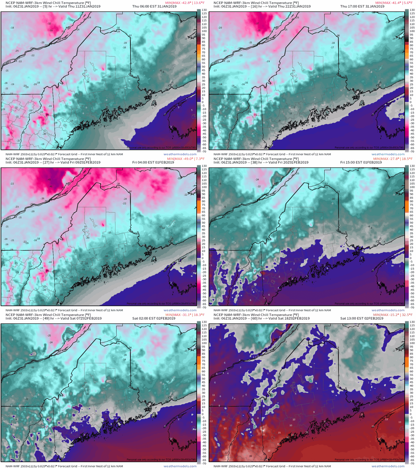
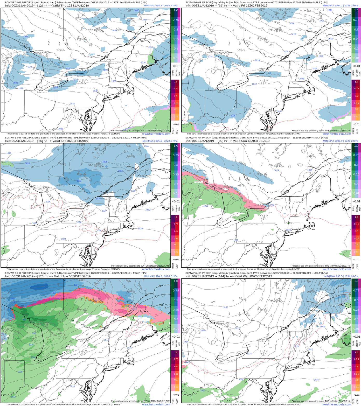
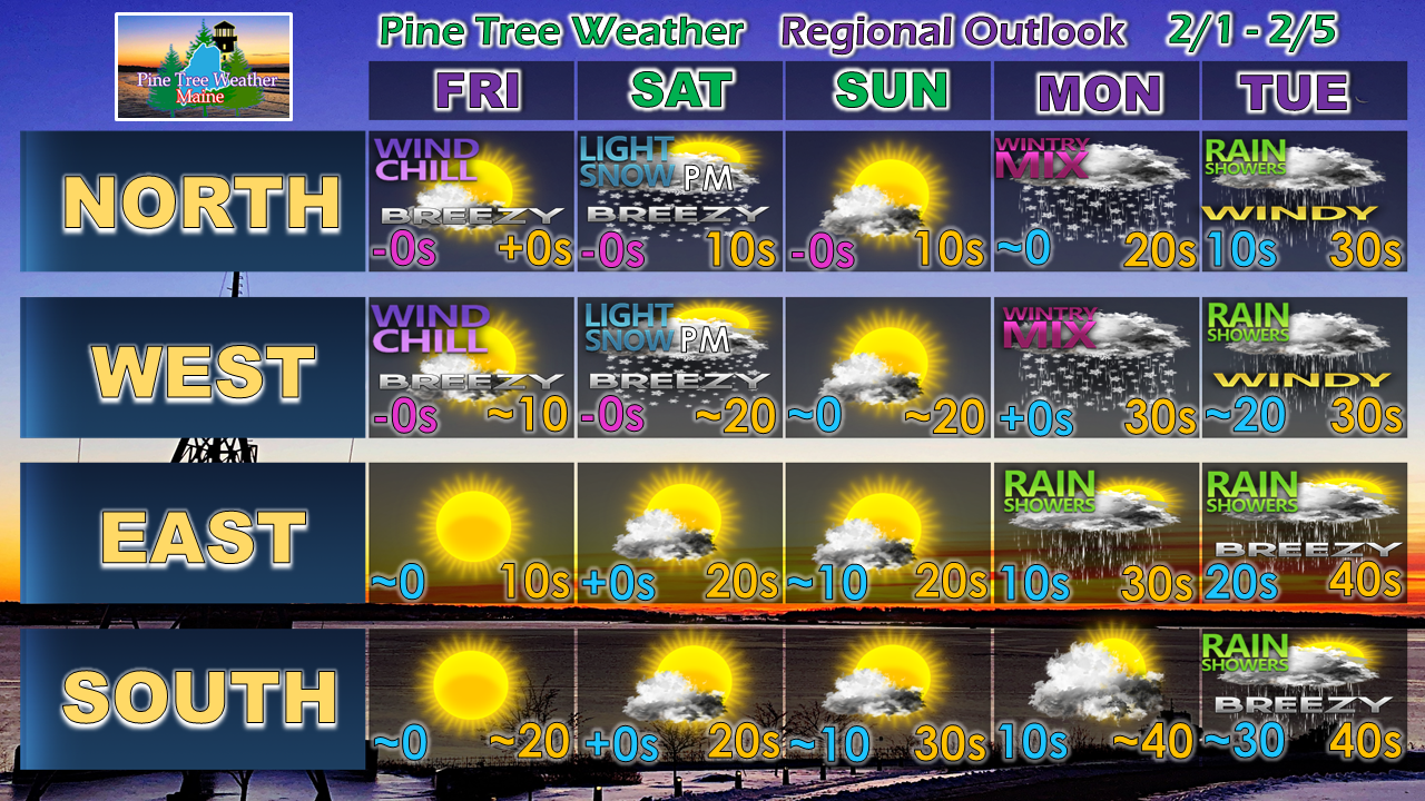
Bundle upThe region escapes the extreme cold over the Midwest, but it will be cold enough. Wind chill indices appear to remain below zero for the mountains and north until the weekend, with the coastal plain teetering with 0° Friday before the arctic high slides offshore Saturday to allow air to moderate and settle the wind, albeit briefly. Precipitation Chances through TuesdayThe mountains and north may pick up and inch or two of snow as a weak front passes through Saturday afternoon. A warm front approaches from the south late Sunday which may bring some light mixed precipitation overnight into Monday. A frontal boundary approaches the region from the west Tuesday which may bring some light rain showers during the day, switching to snow in the north country heading into the evening. Regional Outlook Through TuesdayThe trend is for warmer temperatures into the later part of next week. No significant snow events appear likely over the next 10 days.
► ► For the latest official forecasts, bulletins and advisories, please check in with the National Weather Service in Gray for western and southern areas, or Caribou for northern and eastern parts of Maine. For more information from me, please follow the Pine Tree Weather Facebook page and my Twitter feed. ► ► Your financial donations are much appreciated to keep this site funded and for further development. I sincerely appreciate your support not only financially, but also in sharing my efforts with others. Always stay weather aware! - Mike |
Mike Haggett
|


