Weekend Outlook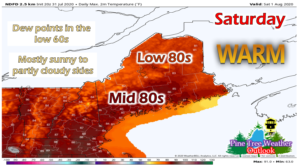 Saturday is looking like a beautiful day, with temperatures in the 80s and dew points mainly in the low 60s! We'll start off the day with mostly sunny skies, then some clouds will begin to move in during the afternoon hours. There is a slight chance for isolated showers in northeastern areas as a weak shortwave passes through the region. Overnight, temperatures will drop into the upper 50s in northern areas and low 60s elsewhere. Fog is possible along northeastern areas. 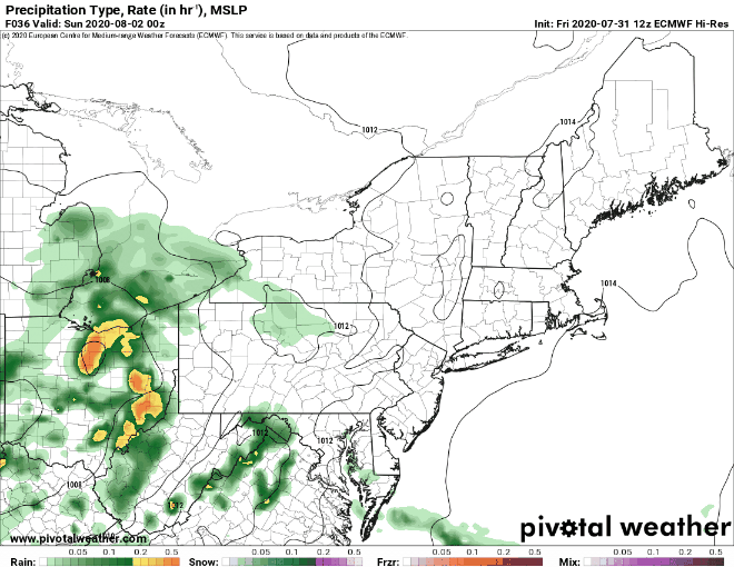 Temperatures will be similar on Sunday, lingering in the low to mid 80s. Cloud cover will increase as the day progresses before showers move in during the evening hours. Showers will linger overnight and into Monday, with the highest precipitation totals expected over northwest regions (a quarter to a half of an inch). Temperatures will drop back into the upper 70s in northern regions on Monday, while coastal areas may still get into the mid 80s. Hurricane Isaias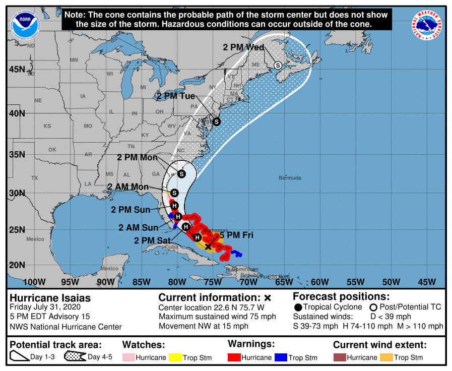 This is the updated track of Hurricane Isaias (was Tropical Storm Isaias), according to the National Hurricane Center (NHC). The rain from Hurricane Isaias is expected to arrive in New England Tuesday morning with the center of the storm passing over the area Wednesday afternoon. By the time the cyclone makes it to New England, it should be a Post Tropical Storm but can still produce heavy rain, gusty winds and storm surge along coastal areas. The system will begin to make its way out of our area by Wednesday night. 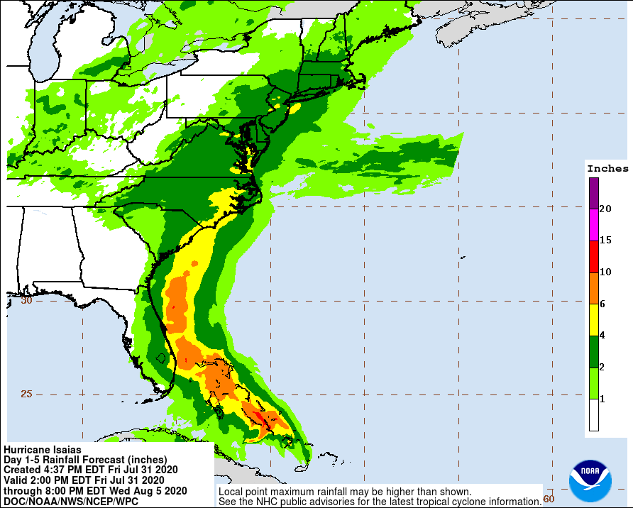 This map from the Weather Prediction Center (WPC) shows the rainfall forecast for the eastern U.S. as of now. Connecticut, Rhode Island and most of Massachusetts could see up to 4 inches of rain, while New Hampshire and Maine may only see up to 2 inches. However, given the drought that Maine has been in, this rain will hopefully be beneficial. More on hurricane safety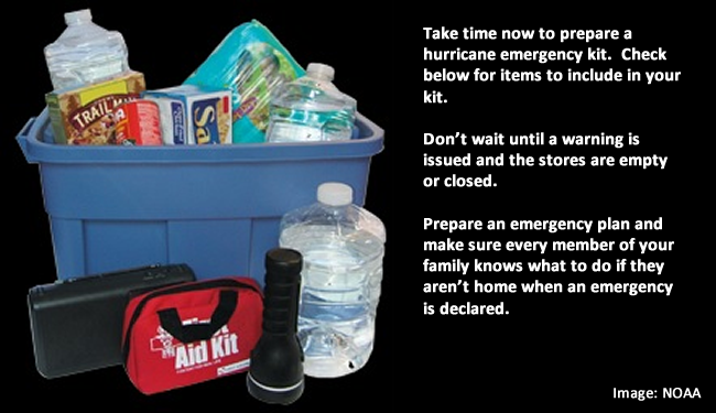 Mike and I have both already talked about preparing your home and yard for potentially damaging winds, so it's time to start preparing inside of your home. If you have a generator in your home or business, make sure it's working and get it prepared however it needs to be. If you don't have a generator, make sure to have candles and flashlights on hand and some extra batteries, don't wait until you lose power. Also, make sure you have enough perishable foods and water incase you do lose power for an extended amount of time. Though we are not 100% certain on the impacts to our area yet, it's better to be prepared for the worst than to be panicking at the last minute! We will be sure to keep you updated as the time grows closer. Help forecast verification, and stay informed!
For more information, please follow Pine Tree Weather on Facebook and Twitter.
Thank you for supporting this community based weather information source that is funded by your financial contributions. Stay updated, stay on alert, and stay safe! Thank you so much for all of your continued support! This is my Venmo if you'd like to contribute: @Alex-Hatfield-7 Have a great weekend! - Alex :) |

Mike Haggett
|