Pine Tree Weather
  • DISCUSSIONS
  • DONATE
  • WEATHER WALL
  • MAPS
  • RAIN OUTLOOK
  • SEVERE
  • MARINE
  • CPC OUTLOOK
  • Kennebunk
  • MY BIO
  • PTW IN MEDIA
  • OBSERVING WEATHER
  • INTERNSHIPS
  • INTERN ALUMNI
  • DISCUSSIONS
  • DONATE
  • WEATHER WALL
  • MAPS
  • RAIN OUTLOOK
  • SEVERE
  • MARINE
  • CPC OUTLOOK
  • Kennebunk
  • MY BIO
  • PTW IN MEDIA
  • OBSERVING WEATHER
  • INTERNSHIPS
  • INTERN ALUMNI

A couple chances for frost to start the week

5/31/2020

Comments


Monday a cool one

Picture
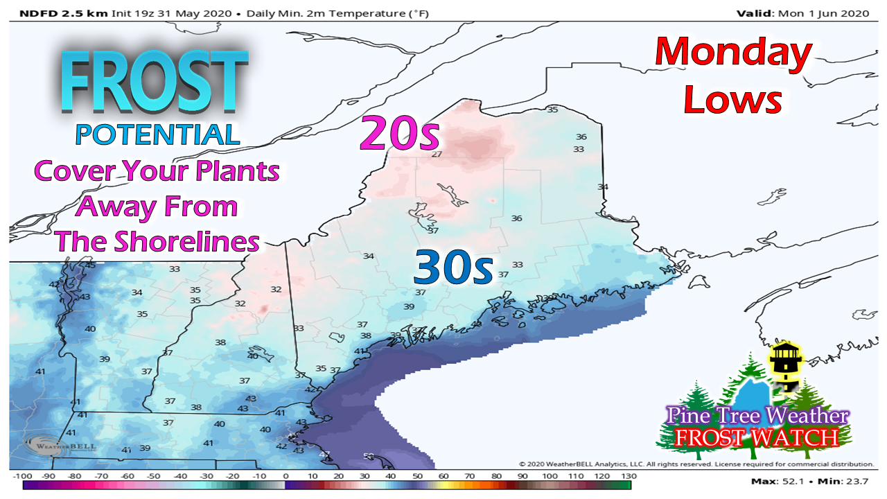
Folks away from the shoreline are advised to cover their plants tonight as the risk of frost is possible. A freeze warning is in effect for far northwestern areas. A frost advisory is posted for the western mountains, foothills eastward into northern Washington counties. If your area is well protected and susceptible to frost, it would be wise to cover up.
Picture
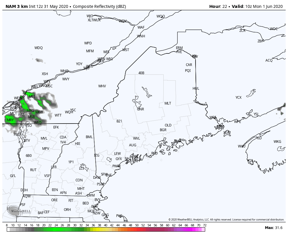
NAM simulated radar forecast from 5 AM to 8 PM Monday
The day itself features a weak shortwave passing through western and southern areas, which may touch off a light shower or sprinkle, but most likely will not provide any measurable rainfall.

Northern and eastern areas may get varying amounts of clouds, but not much else from the sky.
Picture
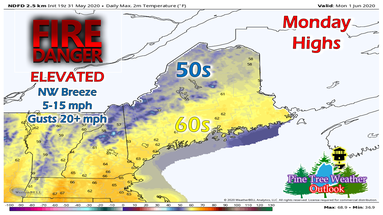
A northwest breeze associated with the shortwave will increase during the day and peak out in the afternoon. With dew points in the 20s, this sets up potential for wildfires due to the dry conditions. Check with your local FD or the Maine Forestry Service for guidance before burning. Use caution with any flame or flammable material. 

Temperatures rebound Tuesday, shower chance

Picture
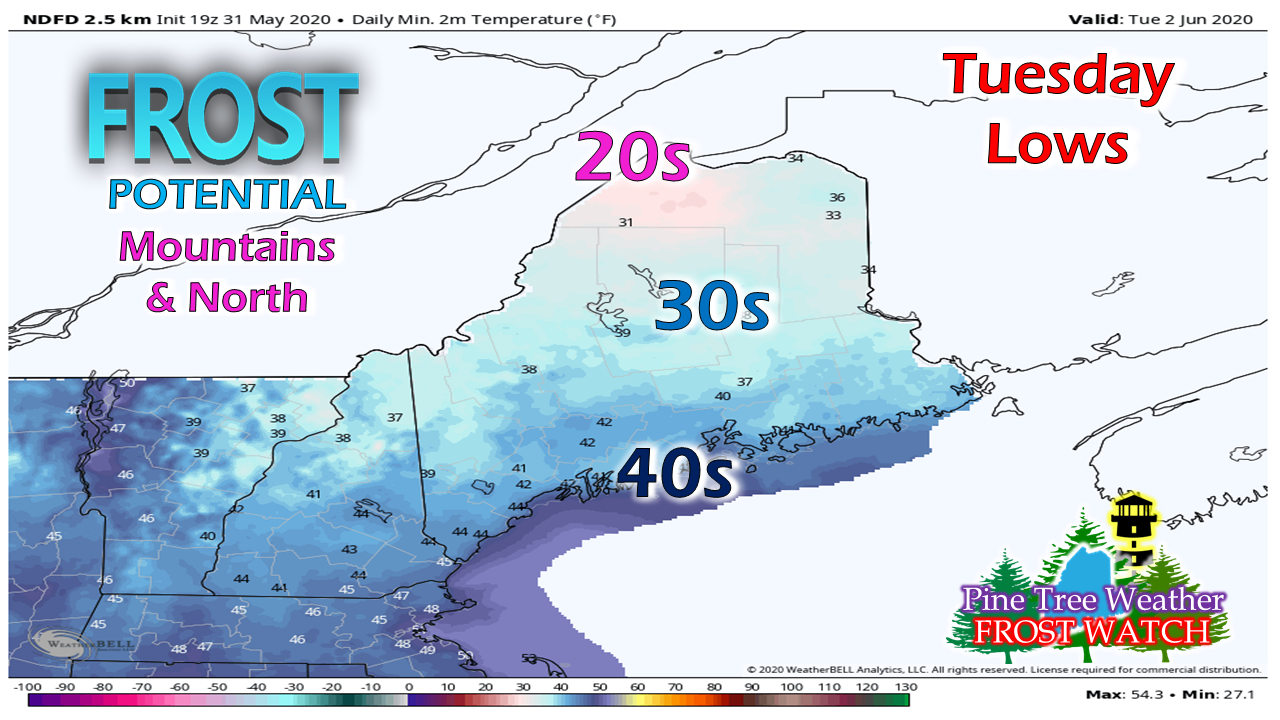
With the wind tapering Monday night, this sets up another frost threat for the north and mountains as the last of this cool shot moves to the northeast. For those in the interior, it would be wise to cover up the gardens once again.
Picture
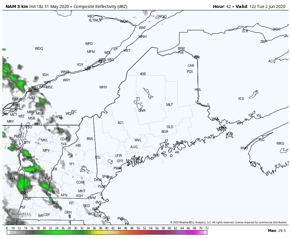
NAM forecast radar idea from 8 AM to 8 PM Tuesday
Another shortwave  advances toward the region Tuesday afternoon and may bring a light shower or sprinkle to western and southern areas by mid-evening. 
Picture
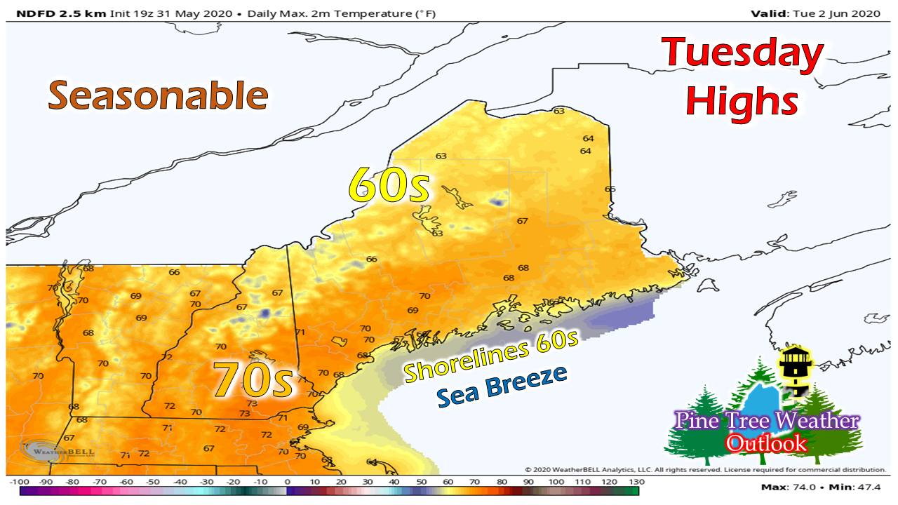
With more of a southwest flow associated with a weak shortwave passing through the region, temperatures climb up to seasonal average.

The thermometer appears to gradually increase through the end of the week, with widespread 70s and a few 80s possible by Saturday.

No real rain is sight for now

Picture
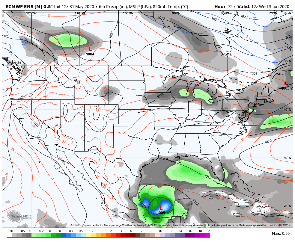
European ensemble forecast idea from 8 AM Wednesday to 8 PM Saturday
The forecast trend at this point is that of a zonal one, which may bring a shower/sprinkle chance here or there, but not a good soaker that the area could use right now. If there is any hope at all for rain, the Gulf of Mexico may be source, and for now, that is a remote idea. Guidance is all over the place as to what happens there. If tropical trouble does form, time will tell if moisture associated with it gets tapped into and brought northeast. 

For now, expect to water your gardens without much help from Mother Nature at least through the week, perhaps longer. 

Over 500 wildfires in Maine already this spring

Picture

Picture
Hiking, camping or boating this summer?
BE PREPARED WITH A
 
NOAA Weather Radio.

​For $20-$40, it could provide important information to you when you need it. The weather bands are standard on most public safety scanners, and newer scanner models and weather radios can be programmed for auto alert.  
Click here for more information. ​

Picture
► ► For the latest official forecasts, bulletins and advisories, please check in with the National Weather Service in Gray for western and southern areas, or Caribou for northern and eastern parts of Maine.

For more information, please follow Pine Tree Weather on Facebook and Twitter. 

Thank you for supporting this community based weather information source that is funded by your financial contributions. 

Stay on alert, stay updated, and stay safe!

​- Mike

Comments
<<Previous
    Picture

    Mike Haggett
    Kennebunk, ME

    Weather-Ready Nation
    Ambassador

    Certified Weather
    Forecaster
    Penn State '21

    American Meteorological Society

    National Weather Association
    ​
    ​SKYWARN-CWOP

    Matthew 19:26


    DONATE

    Picture
    Picture
    Picture
    Picture
    Picture

    Picture

    Picture

    Picture

    Picture

    Picture

    Picture

    Picture

    Picture

    Picture

    Picture

    Picture

    Picture


    Archives

    May 2025
    April 2025
    March 2025
    February 2025
    January 2025
    December 2024
    November 2024
    October 2024
    September 2024
    August 2024
    July 2024
    June 2024
    May 2024
    April 2024
    March 2024
    February 2024
    January 2024
    December 2023
    November 2023
    October 2023
    September 2023
    August 2023
    July 2023
    June 2023
    May 2023
    April 2023
    March 2023
    February 2023
    January 2023
    December 2022
    November 2022
    October 2022
    September 2022
    August 2022
    July 2022
    June 2022
    May 2022
    April 2022
    March 2022
    February 2022
    January 2022
    December 2021
    November 2021
    October 2021
    September 2021
    August 2021
    July 2021
    June 2021
    May 2021
    April 2021
    March 2021
    February 2021
    January 2021
    December 2020
    November 2020
    October 2020
    September 2020
    August 2020
    July 2020
    June 2020
    May 2020
    April 2020
    March 2020
    February 2020
    January 2020
    December 2019
    November 2019
    October 2019
    September 2019
    August 2019
    July 2019
    June 2019
    May 2019
    April 2019
    March 2019
    February 2019
    January 2019
    December 2018
    November 2018
    October 2018
    September 2018
    August 2018
    July 2018
    June 2018
    May 2018
    April 2018
    March 2018
    February 2018
    January 2018
    December 2017
    November 2017
    October 2017

Proudly powered by Weebly