
Thanks for your patienceI want to say thanks for hanging in there with me as I work on my education along with real job, family, my wife and daughter out of town, and everything else I have going on. I am grateful that the pattern is quiet, which allows me to focus on all of that. Rest assured I will continue to update either here or on Facebook and Twitter if any impactful comes our way. Storm may bring some light precipitation for the coast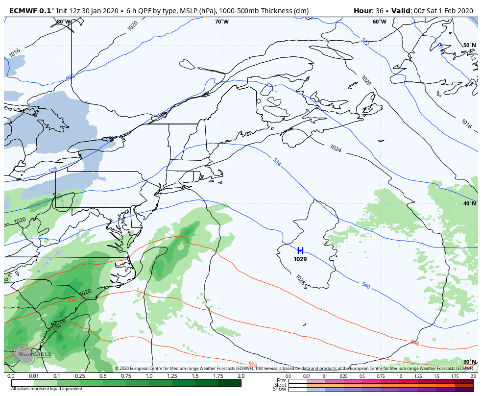 For those who followed my Facebook posts, I mentioned the fact that this storm was a big IF for the region. The consensus at this point is 90% no, which at this point in the forecast means it's more than likely to be a miss. The concern I have at this point is for an inverted trough to set up which may bring light precipitation Saturday and possibly Monday. Most guidance brings nothing outside of some flakes, and the European model depicted here may be a bit generous on potential precipitation here on Saturday. I can't completely rule it out, so there is a chance for some light rain / snow / mix Saturday afternoon into the evening, clearing out early Sunday morning. Upper level disturbances appear likely to pass through the region Sunday into Monday. There is another potential chance for light snow showers for the mountains and north on Monday, with little accumulation expected for now. Outlook for the week ahead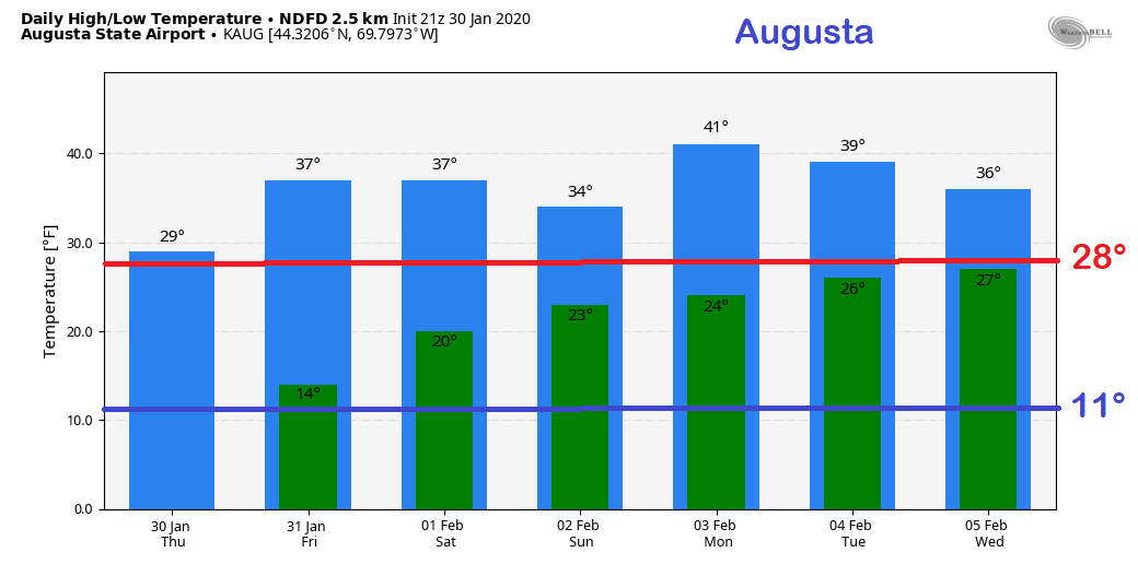 January will go into the record books as a top 5 warmest month on record, and that trend appears likely to start in February. What is causing this? I could boggle your mind on a bunch of teleconnection jargon that would take me a church sermon to explain in a three part series to explain, but I will skip that. The key ingredients we need for snow is deep cold (not getting it for long enough periods of time), a strong western ridge (that is coming) a deep trough in the east (not strong enough currently, and does not appear to be) and upstream blocking around Labrador / Greenland (not happening).
I know there is some chatter about winter being over that is being tossed around on social media for the Mid-Atlantic and southern New England, which for those regions may be true. This is Maine. We aren't done yet. We do appear to be going into zonal pattern which will help ski country out starting the middle part of next week. Models are depicting a series of mix bag events to end out next week. For now, I do not trust models as far as I can throw a cannonball, because they have been horrible beyond 5 days, and struggling enough 3 days out. As you can see, temperatures are likely to be above normal going into next week. At least this saves money on the heat bill. I will keep you posted. ► ► For the latest official forecasts, bulletins and advisories, please check in with the National Weather Service in Gray for western and southern areas, or Caribou for northern and eastern parts of Maine. ► ► Due to a revised budget there is a $125 shortfall for the year ahead! You can help keep Pine Tree Weather going with a donation of ANY amount now through VENMO @PineTreeWeather, a monthly donation on Patreon or messaging me on Facebook or Twitter to send a check in the mail. Thank you for your support! For more information from me, please check the Pine Tree Weather Facebook page as well as my Twitter feed. Always stay weather aware! - Mike |

Mike Haggett
|


