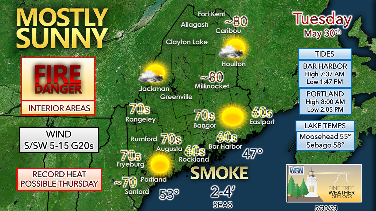
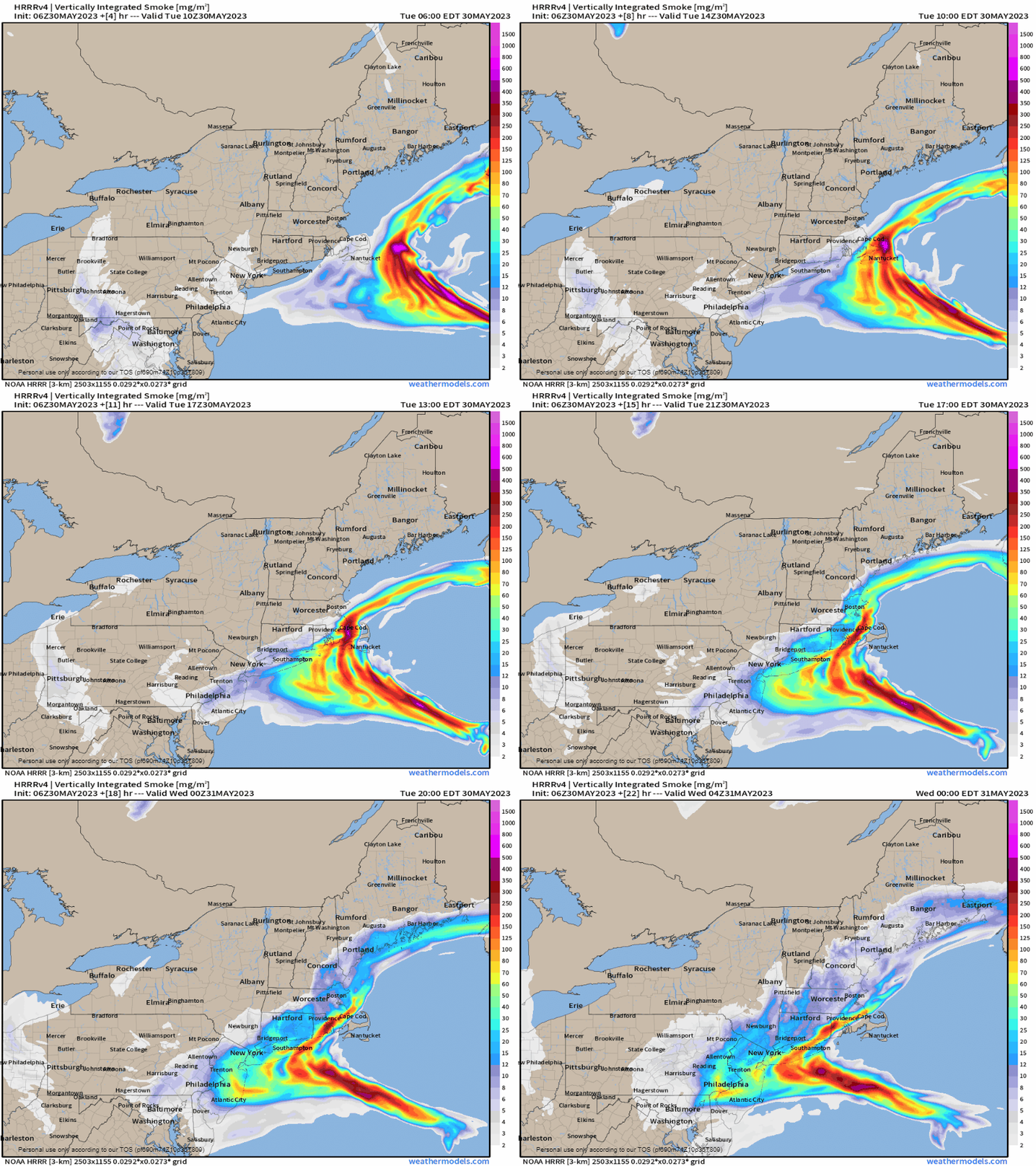
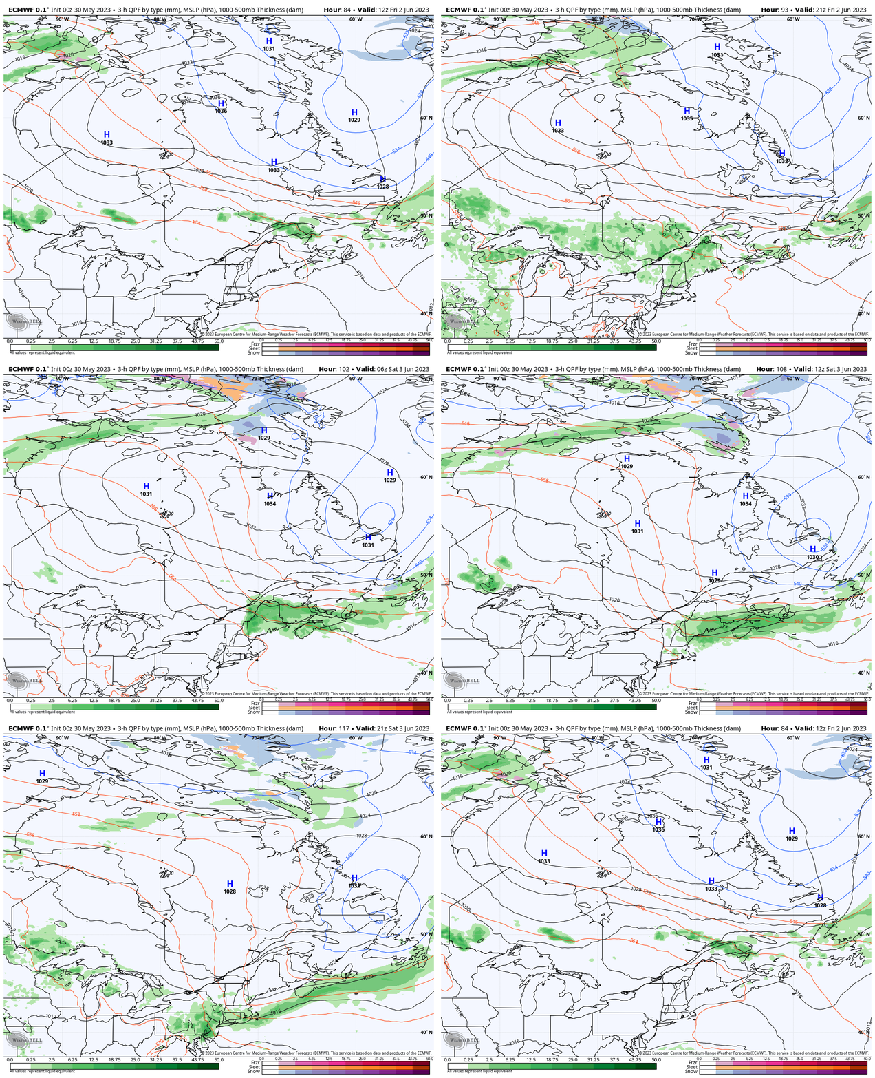
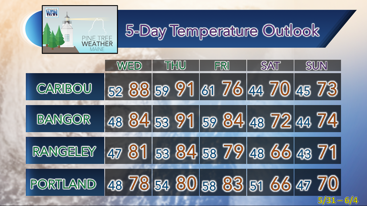
Sun for all and smoke for the coast TuesdayHigh pressure shifts to the east during the day which will bring a southerly wind flow into the area. This will raise temperatures and dew points through the day and into Wednesday. Northern areas make a run at 80° while the shorelines stay cool, thanks to the breeze off the chilly ocean. Lake temperatures are climbing thanks to the abundant sun as of late. There may be some relief seekers as temperatures are expected to climb into the upper 80s and low 90s on Thursday, with new records likely to be established for interior reporting stations. Wildfires burning near Halifax, Nova Scotia spurn smoke to the west around the area of high pressure. Tuesday 6 AM to Wednesday Midnight - The smoke is expected to be more noticeable over the coast heading into Tuesday afternoon. Given the mixing of air flow aloft, the smell of it may be noticeable. The Maine DEP is noting moderate particle pollution in its air quality forecast for the day. Worthy to note, northern areas may see some dimming effects from wildfire smoke in western Canada Wednesday as the high shifts further east and the jet stream dips down ahead of a building ridge that brings the heat in heading into Thursday. Rain with possible storms Friday into early SaturdayFriday 8 AM to Saturday 11 PM - An upper-level low over Baffin Island cuts off the heat ridge and descends towards Labrador, thus pushing a backdoor cold front through the region Friday. The timing of the boundary passage will be indicative of any severe thunderstorm threat. For now, the passage occurs Friday night. That said, there could be some nocturnal rumbles associated with it. Showers are possible along with an isolated storm on Friday afternoon. Stay tuned for updates. Temperature outlook through SundayRecord high temperatures are expected for interior areas Wednesday and Thursday. The shoreline towns (Portland, Rockland, and Bar Harbor) are expected to stay below record for now. A more westerly wind would change the temperature expectations there. While dew points begin to rise Tuesday, the stickiness won't arrive until Thursday when values soar into the 60s, with some isolated areas reaching 70°. The heat will be short lived as the backdoor cold front passes through Friday night, bringing cooler temperatures back in over the weekend. Pine Tree Weather is funded from followers like you. I would appreciate your financial support. Click here for how you can contribute. You may not like the weather, but I hope you like what I do! Please hit the like button on Twitter and Facebook, and share! I sincerely appreciate your support! Stay updated, stay on alert, and stay safe! - Mike NOTE: The forecast information depicted on this platform is for general information purposes only for the public and is not designed or intended for commercial use. For those seeking pinpoint weather information for business operations, you should use a private sector source. For information about where to find commercial forecasters to assist your business, please message me and I will be happy to help you. |
Mike Haggett
|


