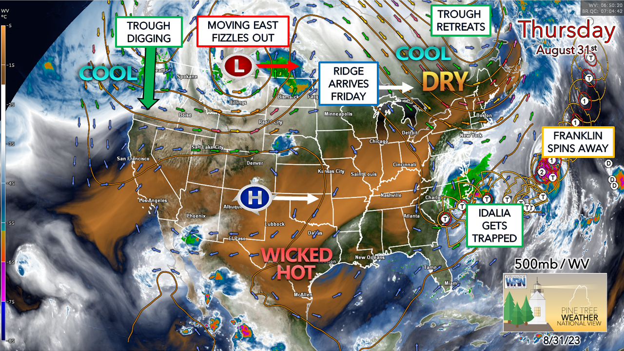
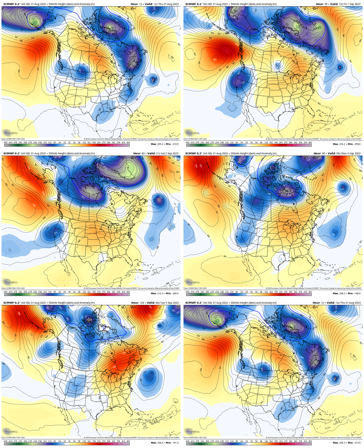
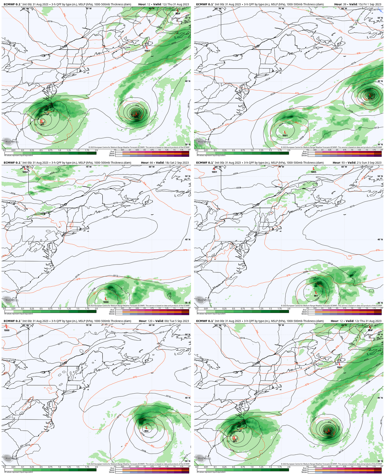
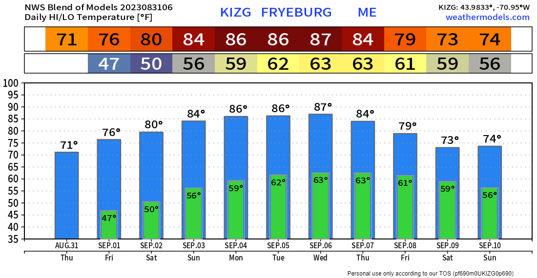
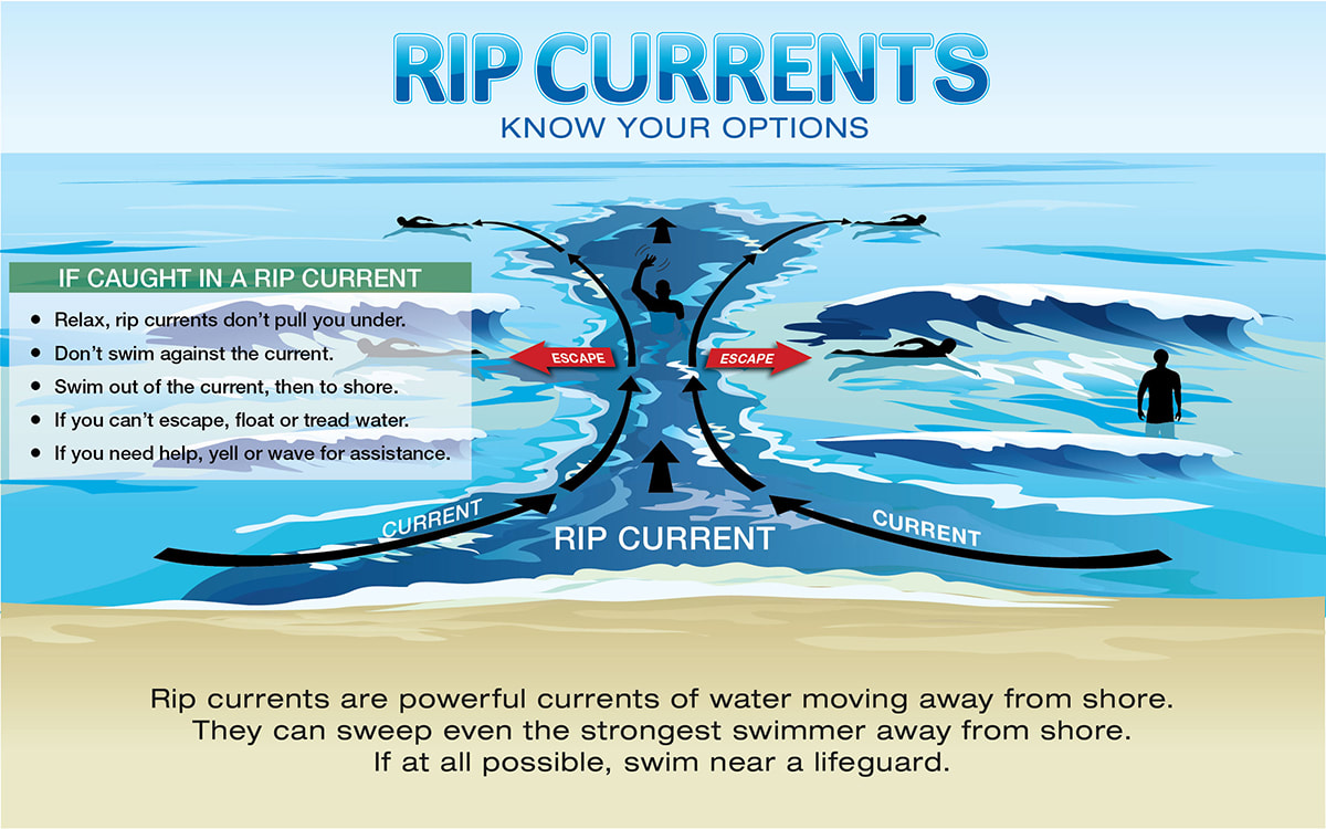
OverviewLabor Day weekend is upon us and the summer that wasn't heads off into the sunset. Looking at climatological data, temperature wise it appears to be a top ten warmest summer for Caribou thanks to the humidity around. It'll be a top ten wettest summer for Portland, top five for Bangor, top three for Augusta, and top two for Millinocket. Houlton and Caribou round out in the top twenty. We'll flip the calendars up a page on Friday and start off dry for a few days. I will say that I am not expecting a big shift in pattern in the long term, but for the short term we'll dry out for a few days to start September and enjoy a bit of warmth along with it. I am thinking of the folks in Florida that dealt with Idalia's wrath. It was tough to watch. One of the hardest things about forecasting weather is you can see the train coming and know the impacts are going to be bad, no matter what weather extreme is projected to occur. These major storms disrupt lives and rearrange the geographical landscape. Perhaps the greatest insult in all of this is the storm will continue to be talked about in the coming days, not only due to the aftermath, but it is going to continue in the Atlantic. Summer arrives in time for the start of meteorological fallThursday 8 AM to Wednesday 8 AM - A look at atmospheric heights at the 500mb (~20,000ft) level of the atmosphere sped up over the next week shows the trough dropped down over the region Wednesday departing on Thursday. While coastal areas got a good soaker out of this, it did its job and steered Franklin way, and we're grateful for that. The ridge takes over and brings summer to the region next week. That blue blob spinning around over the Atlantic to the east is Idalia. The storm becomes trapped, gets cut off and will spin around. It's a bit close for comfort and will need to be monitored. In the long term, it's the only concern for impactful precipitation for the region in the next week. Thursday 8 AM to Tuesday 8 PM - Franklin heads off to the north Atlantic and Idalia heads for Bermuda and becomes a pest for them for the weekend. A weak wave passes through Maine on Sunday which may bring a light shower or two for the mountains and north, but that is about it. As we head into next week, the ridge is expected to relax a bit. As that happens, Idalia spins to the northwest. How close it gets to the region is yet to be seen, but at the very least the shorelines can expect some surf, and time will tell if the region gets more than that. An overview on temperatures using Fryeburg as the example shows a couple of cool days ahead before the warmup. I would not be surprised to see some 30s in the far north and well protected mountain valleys Friday morning. As the ridge takes hold and high surface pressure settles in, the heat pump gets turned on and humidity builds along with it through midweek. The ridge is expected to retreat to the west later in the week, with an unsettled period with rain chances taking shape the following weekend. Rip currents will be an ongoing concern into next weekThe National Weather Service has issued a High Rip Current risk for the Maine coast for Thursday. As Franklin departs, the risk subsides somewhat into the weekend, but is likely to be a feature over the long weekend. With many beaches without lifeguards at this point of the year, there is little in the way of rescue assistance available. It's important to know your surroundings and pay attention to the path of the currents. Spend time at the beach, and swim safe! The United States Lifesaving Association (USLA) estimates that over 100 people die each year due to rip currents in the US. Break the Grip of the Rip®! weather.gov/safety/ripcurrent Pine Tree Weather is funded from followers like you. I would appreciate your financial support. Click here for how you can contribute. You may not like the weather, but I hope you like what I do, and support my efforts. Thank you! Stay updated, stay on alert, and stay safe! - Mike NOTE: The forecast information depicted on this platform is for general information purposes only for the public and is not designed or intended for commercial use. For those seeking pinpoint weather information for business operations, you should use a private sector source. For information about where to find commercial forecasters to assist your business, please message me and I will be happy to help you. |
Mike Haggett
|

