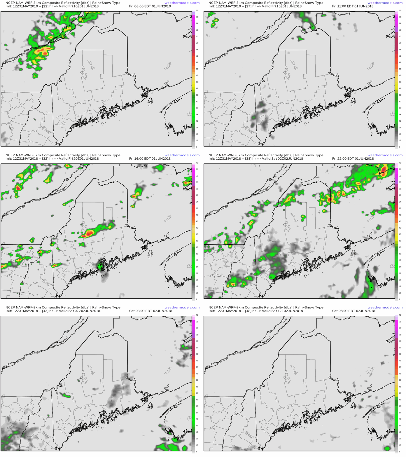
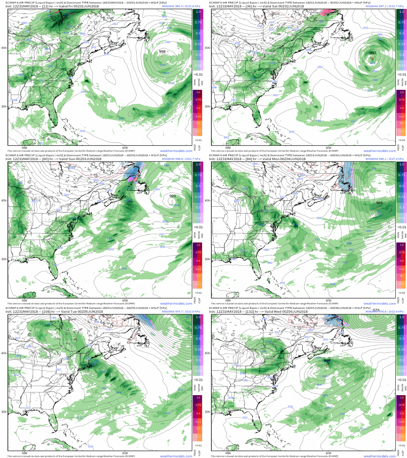
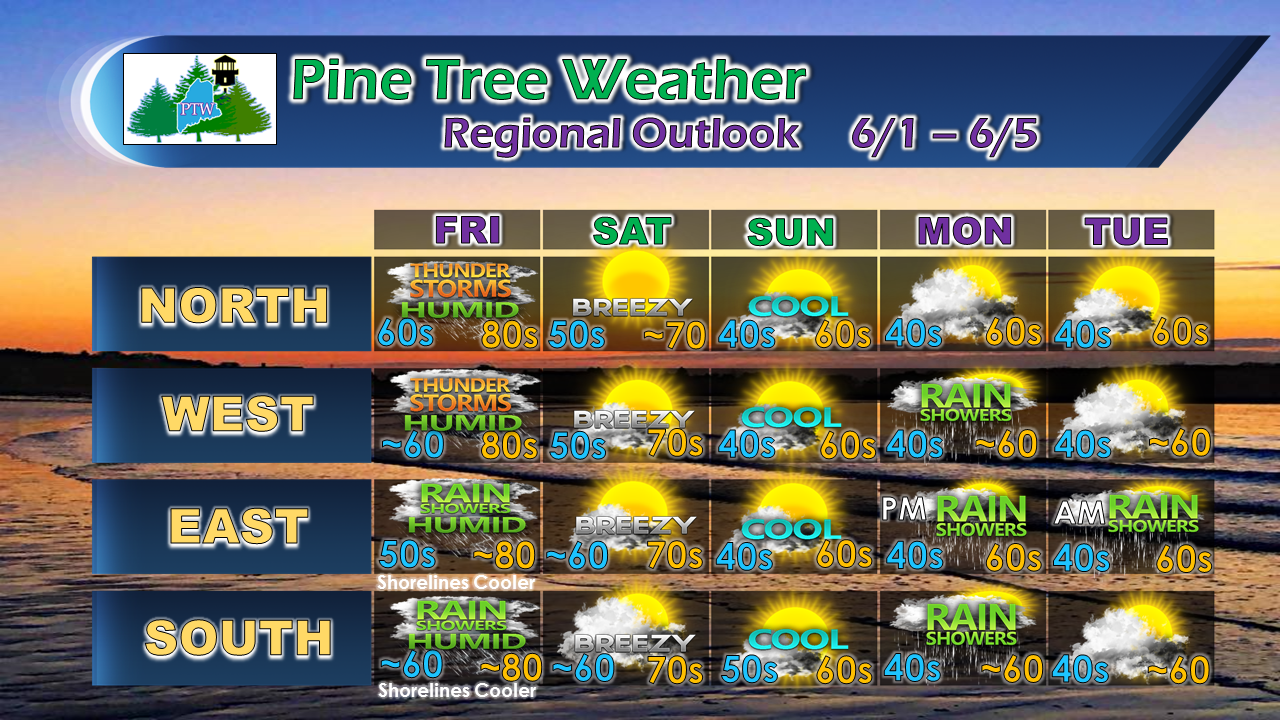
The mountains and north could get isolated stormsGiven the lack of atmospheric forcing with the frontal boundary, the chance for severe storms has been reduced to isolated for western and northern areas. As I stated in my update yesterday, what is likely to occur are slow moving pulse storms which could bring flash flooding from heavy rain. Southern and western areas may get a shower around midday ahead of the frontal approach in the afternoon. It will be a "weather you can wear" type of day as dew points climb into the 60s to perhaps the low 70s for southwest interior areas. It will be uncomfortable, but short lived. Coastal areas may see some fog Saturday morning, but as the northwest breeze picks up, that should blow out by mid-morning, with a nice day on tap statewide. More showers on the way Monday into TuesdayThis loop gives a general idea of what to expect precipitation wise through early next week. After the cold front slides through on Friday, it will be a dry, but cool weekend. Clouds will be on the increase from west to east Monday and showers are in the offing Monday into early Tuesday. We could have another rain event for the middle part of next week. Given the lack of moisture from the southwest, these rain events next week are likely to be scattered in nature. When systems approach us from the northwest, there generally isn't a whole lot of rainfall that comes out of these. As like the clipper snow makers in winter, there is often little moisture to work with and the impacts are minimal for most. And yes, your eyes aren't deceiving you... yes, that is snow (blue shaded) in the forecast for Newfoundland over the weekend. The cold air continues to lurk to our northeast. Mother Nature could care less that the calendar is about to flip to June. Outlook through TuesdayIf you like the heat and humidity, Friday will be your day. The cooler trend that occurs after that will be with us for the next several days. June appears to be on the cool and generally dry side for much of the northeast through the first half of the month. Summer may show up on it's official astronomical start date come the third week of the month.
As always, please stay in touch with NWS Caribou for northern and eastern areas, and NWS Gray for western and southern regions for the latest bulletins and forecast information. Feel free to follow the Pine Tree Weather Facebook page and my Twitter account for more information from me. Thanks as always for your support! - Mike |
Mike Haggett
|


