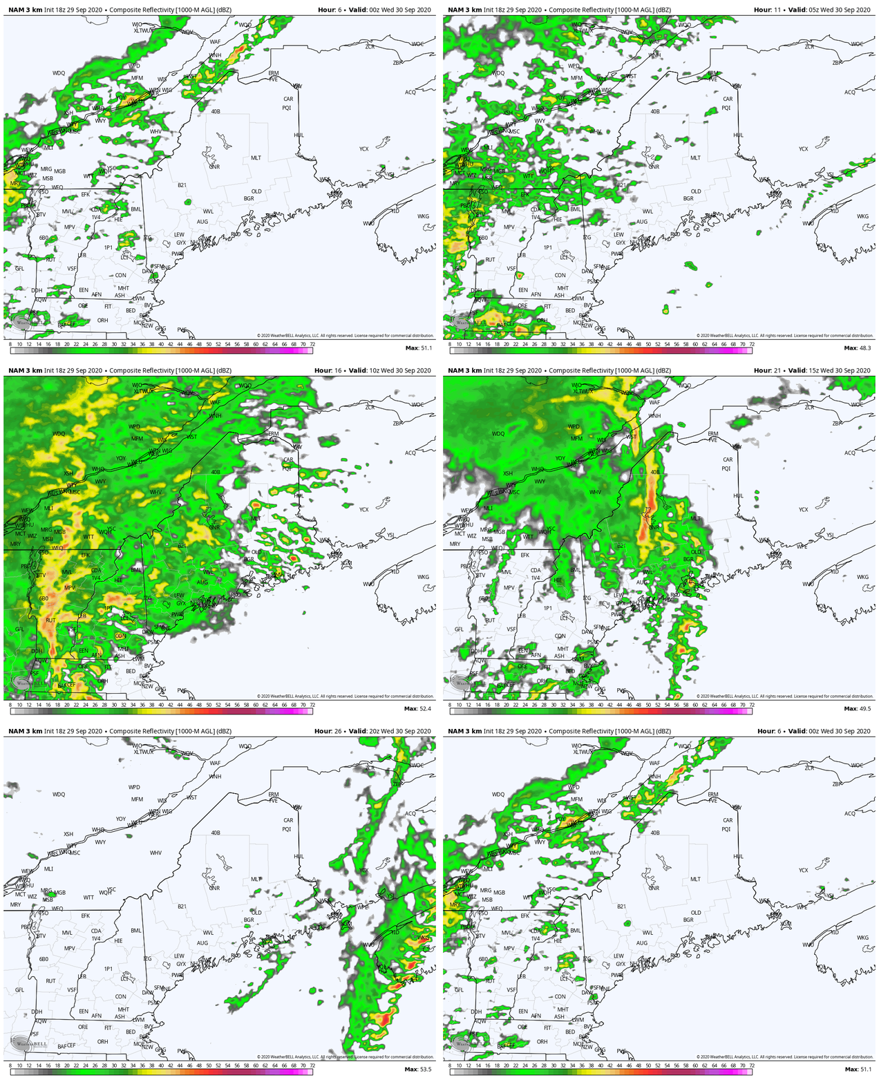
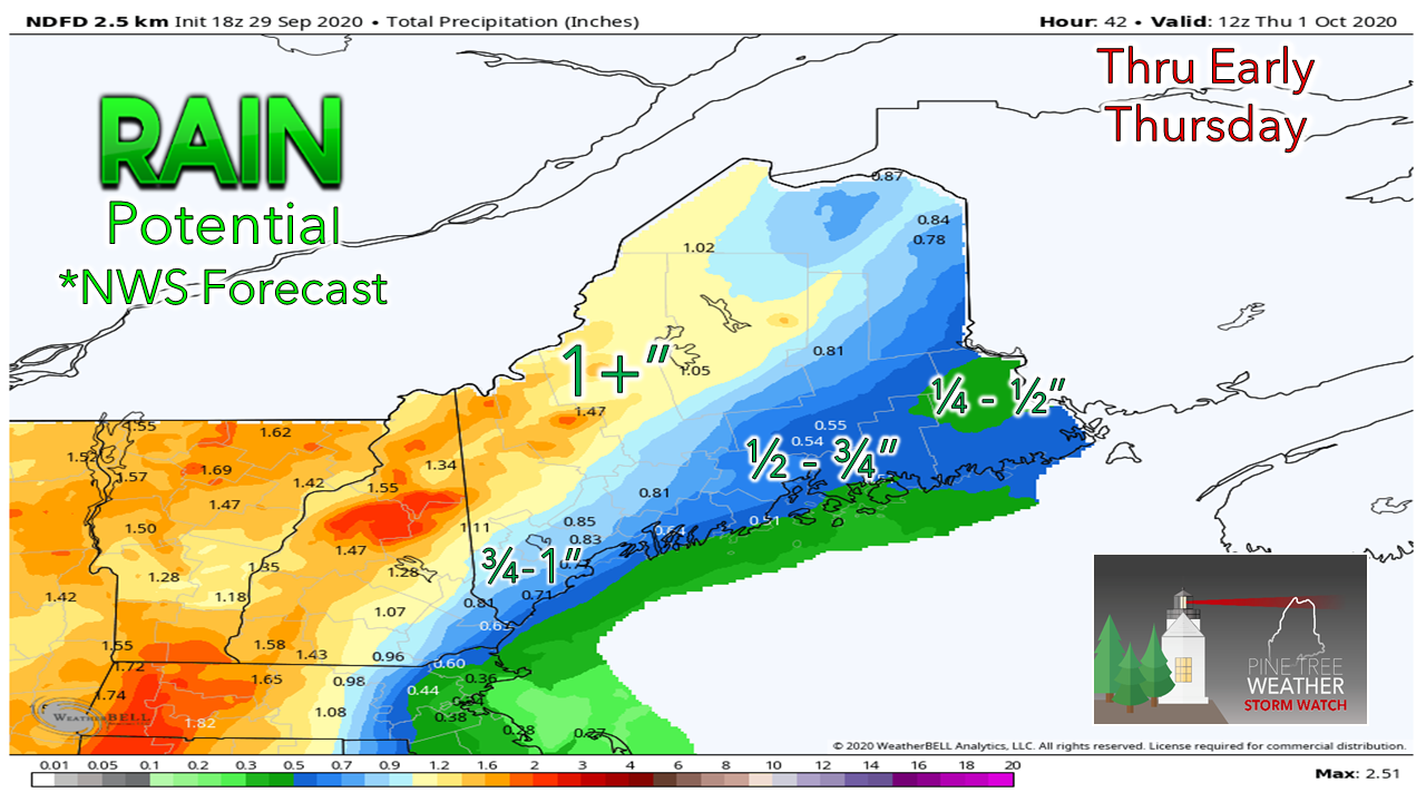
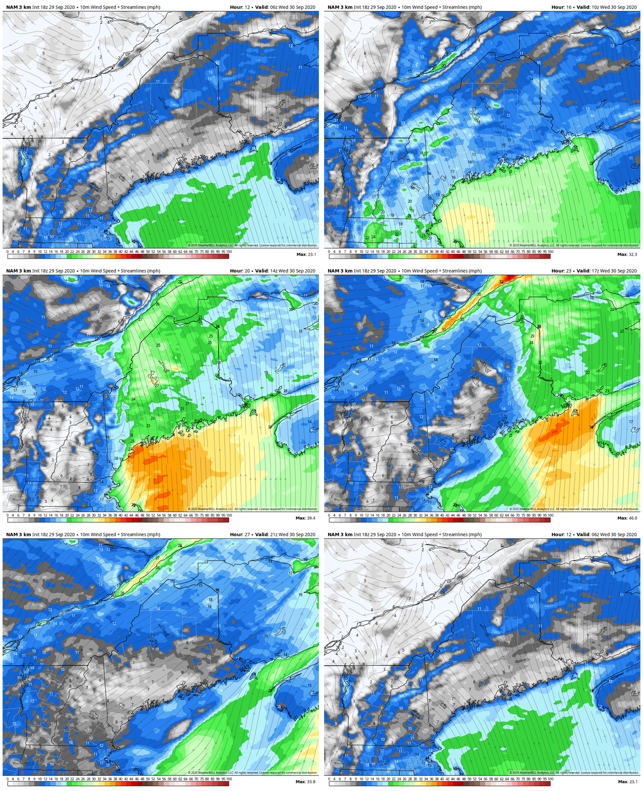
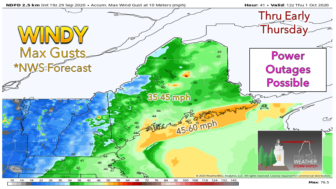
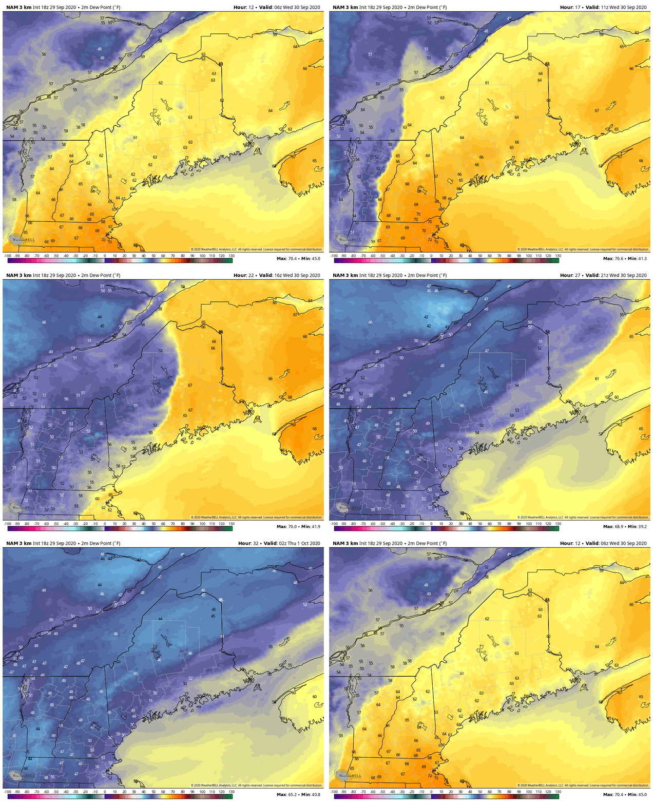
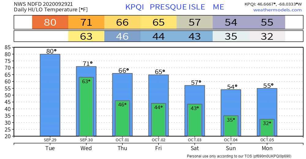
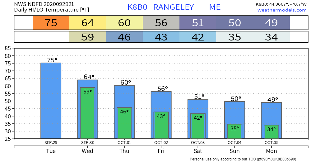
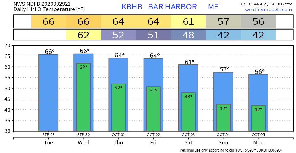
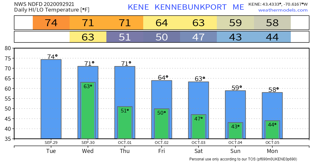
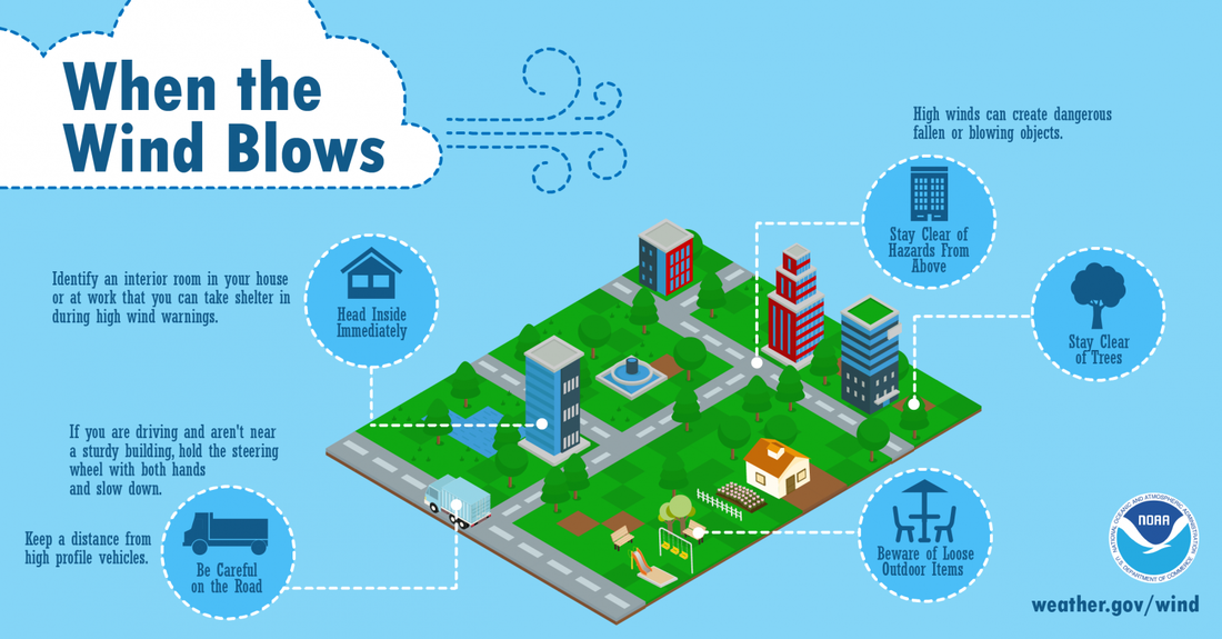
Liquid reliefTiming remains roughly the same here. Showers overspread the region from west to east Wednesday morning. A rumble of thunder is possible over western and southern areas as the front passes through mid-morning. Steady rain turns to widely scattered showers over western and southern areas by around midday. The last of the showers clear out over eastern areas by late afternoon. As mentioned previously, the mountains will fair well with this with strong southerly winds contributing to upslope rainfall. Amounts will be less to the south and the east. Guidance continues to tease that there may be some enhancement for coastal DownEast areas, which if that happens could bring totals around an inch. Wind the main concernA very strong low level jet that could reach speeds in excess of 70 mph will add the roar factor to the ears. The wind picks up Wednesday morning and will be strong during the morning commute over southern and western areas. It will be two hands on the steering wheel for the ride to work as wind gusts could reach 30-40 mph or higher along the Turnpike and 295. As the front passes through, the wind will shift to the west northwest and settle down for a time by Thursday evening. The breeze will return as high pressure works into the region Thursday. This is a leaf stripper event, unfortunately. Expect blowing debris from trees and anything else that is not nailed down. Spotty power outages are possible. A High Wind Warning is in effect for DownEast areas. A Wind Advisory is in effect for northern and eastern areas, along with MidCoast, Capitol District and southwest coastal areas. Say goodbye to the humidityThe southerly wind will cause the humidity a bit more as the front approaches. Once the front passes through, it will drop the dew points rather quickly. Wednesday evening will be much more comfortable for sleeping, and sweater weather season will begin. Outlook / temperature forecastOur next chance for rain appears late Friday into early Saturday, with the north and mountain areas having the best chance for accumulations. There is a chance for stronger storm to impact the region Monday into Tuesday. Stay tuned for updates on that. Stay safe when the wind blows!High winds can be dangerous! If possible, stay inside. When driving, slow down, keep both hands on the wheel, and keep away from high profile vehicles. Be aware of loose outdoor items and stay clear of trees. Visit weather.gov/wind for more information. Be prepared to receive alerts and stay updated!
For more information, please follow Pine Tree Weather on Facebook and Twitter.
** FUNDING NEEDED FOR 2021 ** Thank you for supporting this community based weather information source that is funded by your financial contributions. Stay updated, stay on alert, and stay safe! - Mike |
Mike Haggett
|

