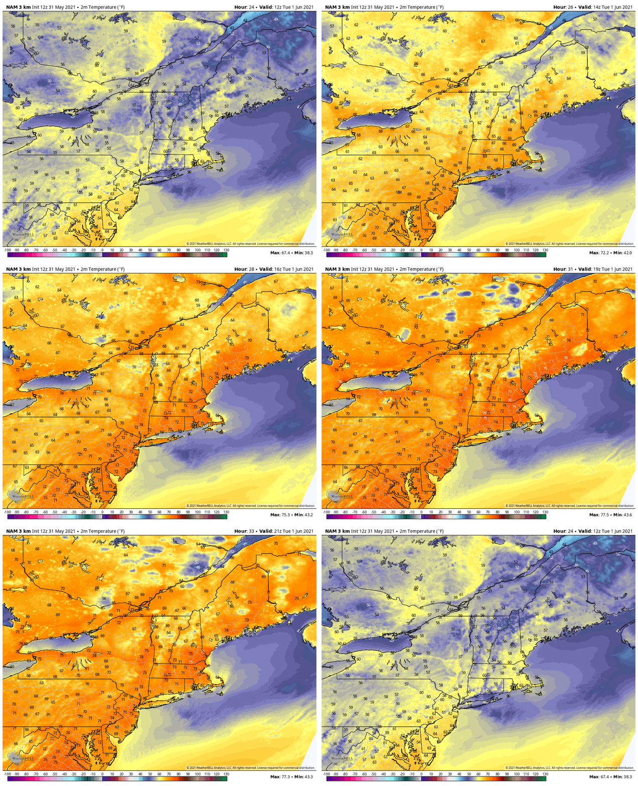
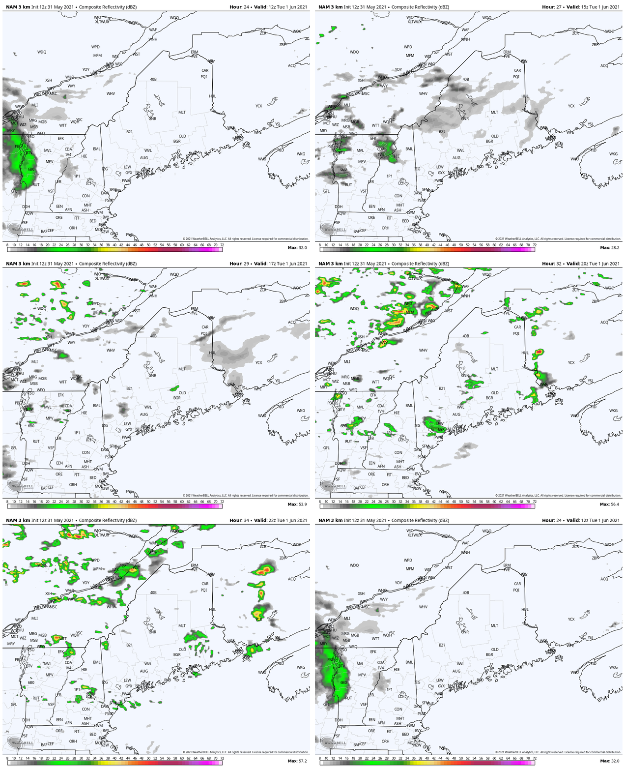
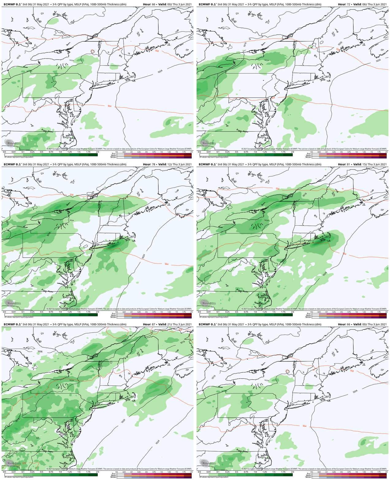
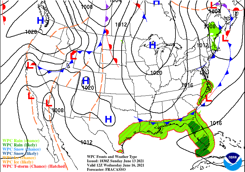
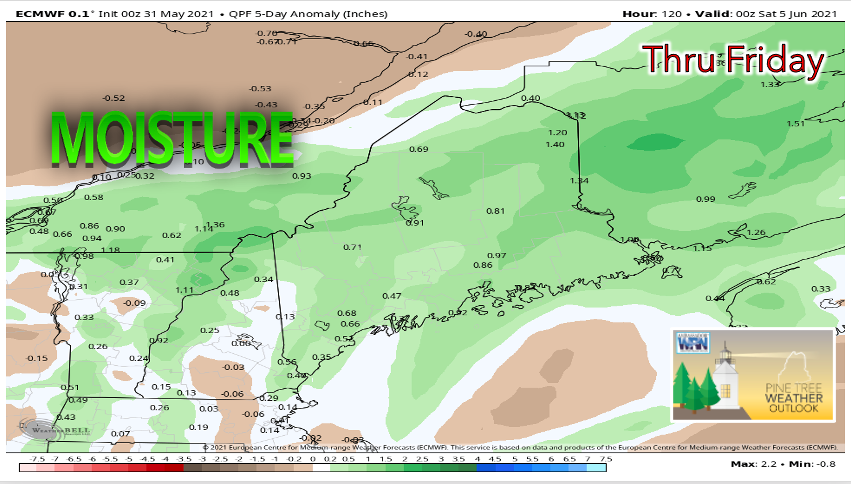
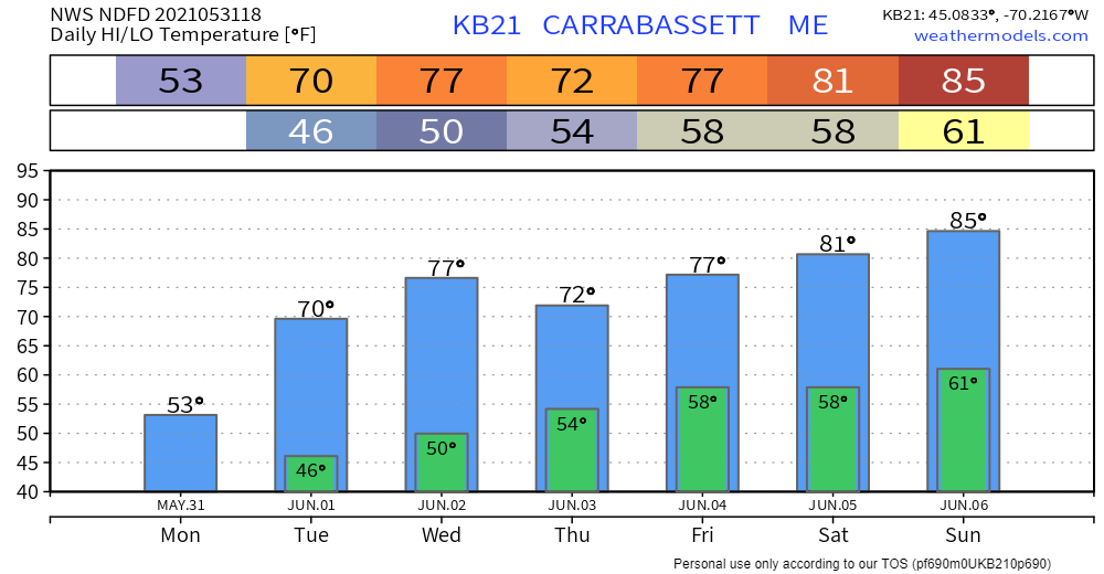
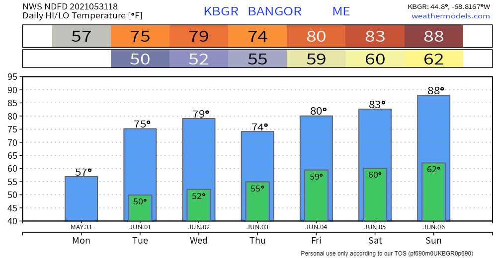
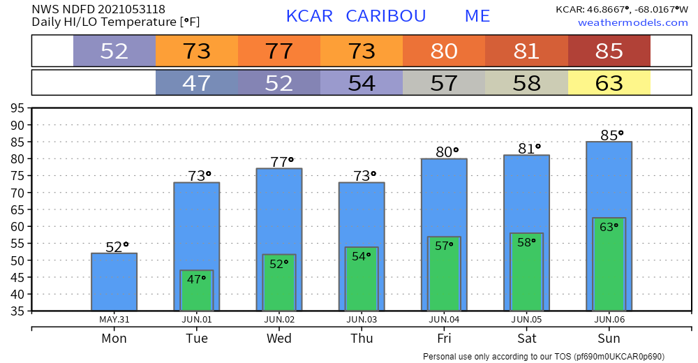
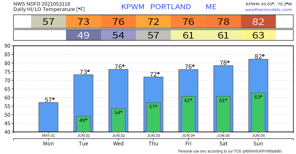
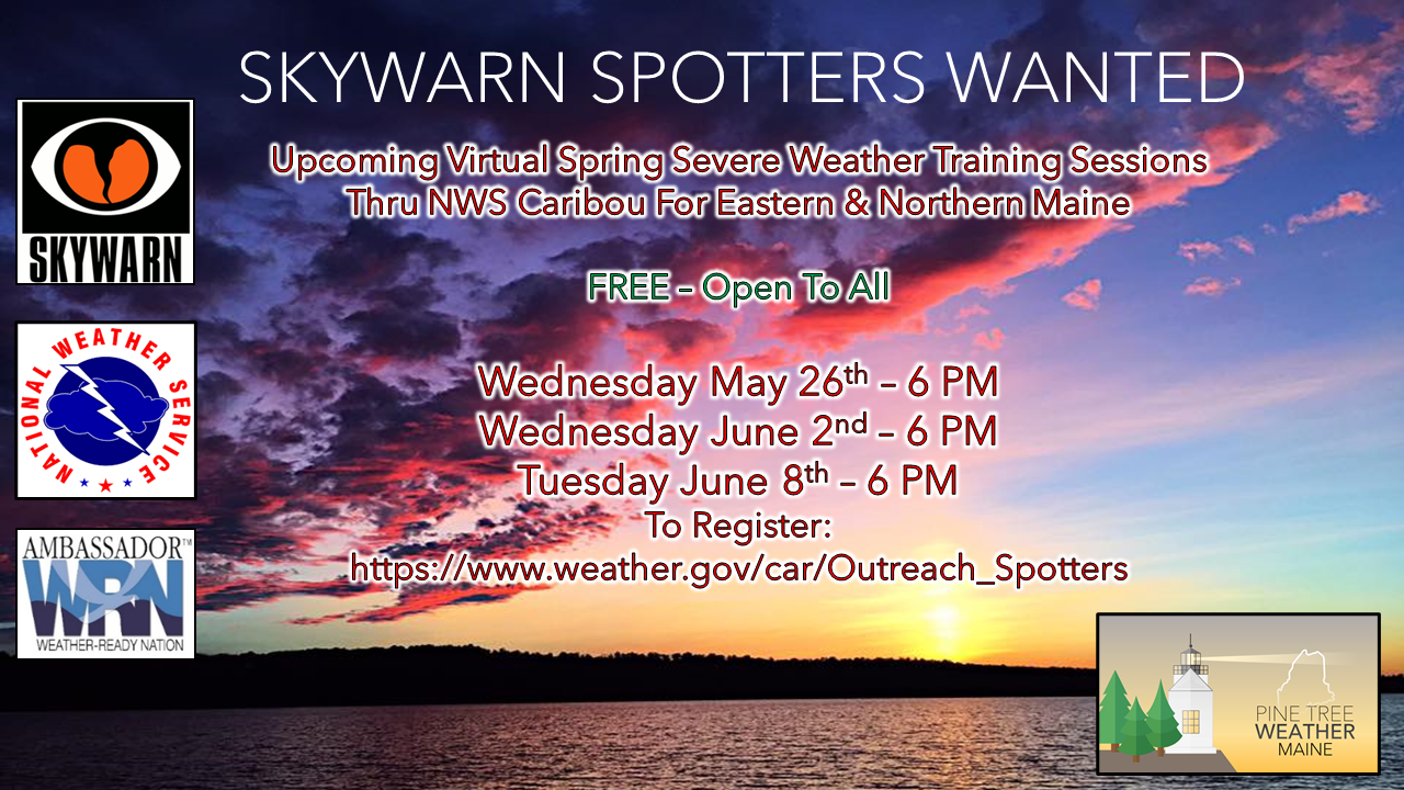
Mild, more seasonable temperatures on Tuesday with a few showers possibleAlthough Memorial Day weekend did not feature the summer-like weather many had hoped for, conditions are likely to improve this week. Most of the lingering showers from Monday night should clear out of the region by Tuesday morning. The model above shows temperatures rising to the mid 70s in the southern half of the state, with northern areas reaching the upper 60s to lower 70s. Compared to the unseasonably cool temperatures this weekend, Tuesday is shaping up to be a much more pleasant day. While Tuesday starts out clear and dry as high pressure begins to build, the potential for some scattered showers comes in the afternoon due to disturbances aloft. A rumble of thunder is possible with these storms. The positioning of the upper-level disturbance gives northern areas the greatest chance to see precipitation, but the chance is still there for southern and interior regions. More widespread showers and storms return late this week as moisture buildsThe Bermuda High centered to the east is likely to hinder the chance for significant rainfall through Wednesday. By Thursday, however, the potential for heavier showers and thunderstorms returns. A trough of low-pressure approaching from the Great Lakes region will likely result in an unsettled atmosphere, bringing the possibility for more precipitation in Maine. This model shows the synoptic set-up for 8am Thursday. The low approaching from the west coupled with the warm front brings a significant possibility for rain in the northern half of Maine, with a chance for southern areas. More information on timing and precipitation amounts will come later this week as forecast confidence increases. If this late-week forecast holds true, areas on the verge of drought could begin to feel some relief. Even with the precipitation seen this weekend, most areas will benefit from more rain due to the prolonged dry spell seen during the month of May. Temperature outlook through SundayWhile Memorial Day is quite cool, a warming trend appears to be in store. Temperatures are expected to steadily rise throughout the work week, potentially reaching the 80s by the weekend. Join the weather community as a storm spotter!Here's a wonderful way to become active in the weather community and help the broadcast media and forecasters like myself with storm reports. This information is vital during and after an event for forecasting and alerting purposes. I can't tell you how many times I have seen the importance of these reports in the past 9+ years I have been involved. Pine Tree Weather followers have stepped up in the past and participated, and with the readership base continuing to grow, I know there are more out there. This is the spring/summer session which discusses severe weather, what to look for, and how to report it. These sessions run for about 90 minutes. They are fact filled, educational and interesting. You can get the whole family involved from the comfort and safety of home. Once completed, you will get your spotter ID, and will be ready for the season ahead. For those who trained for the winter session, this will complete your full year training. It's important to have both sessions done. The link to register is here ► https://www.weather.gov/car/Outreach_Spotters Be prepared to receive alerts and stay updated!
For more information in between posts, please follow Pine Tree Weather on Facebook and Twitter.
Thank you for supporting this community-based weather information source which operates by reader supported financial contributions. Stay updated, stay on alert, and stay safe! |
Mike Haggett
|

