|
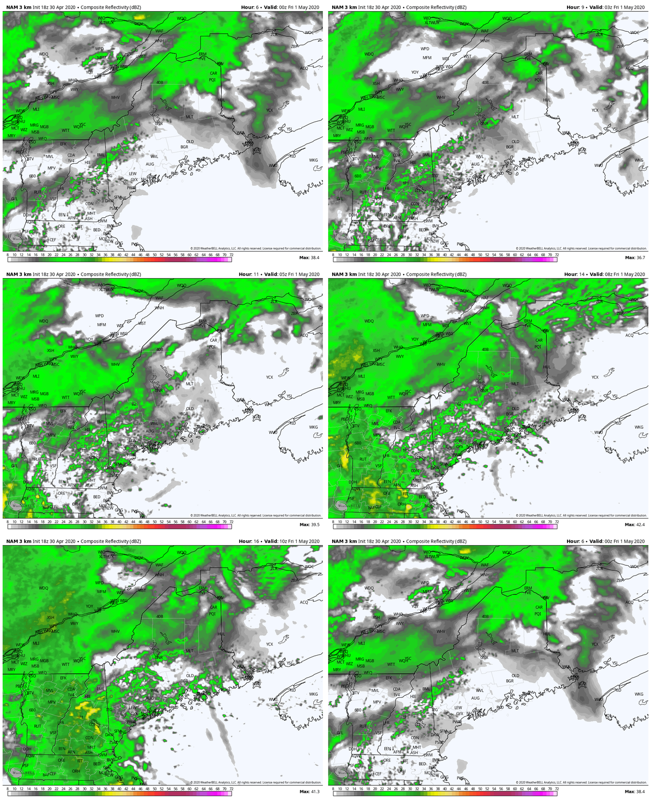
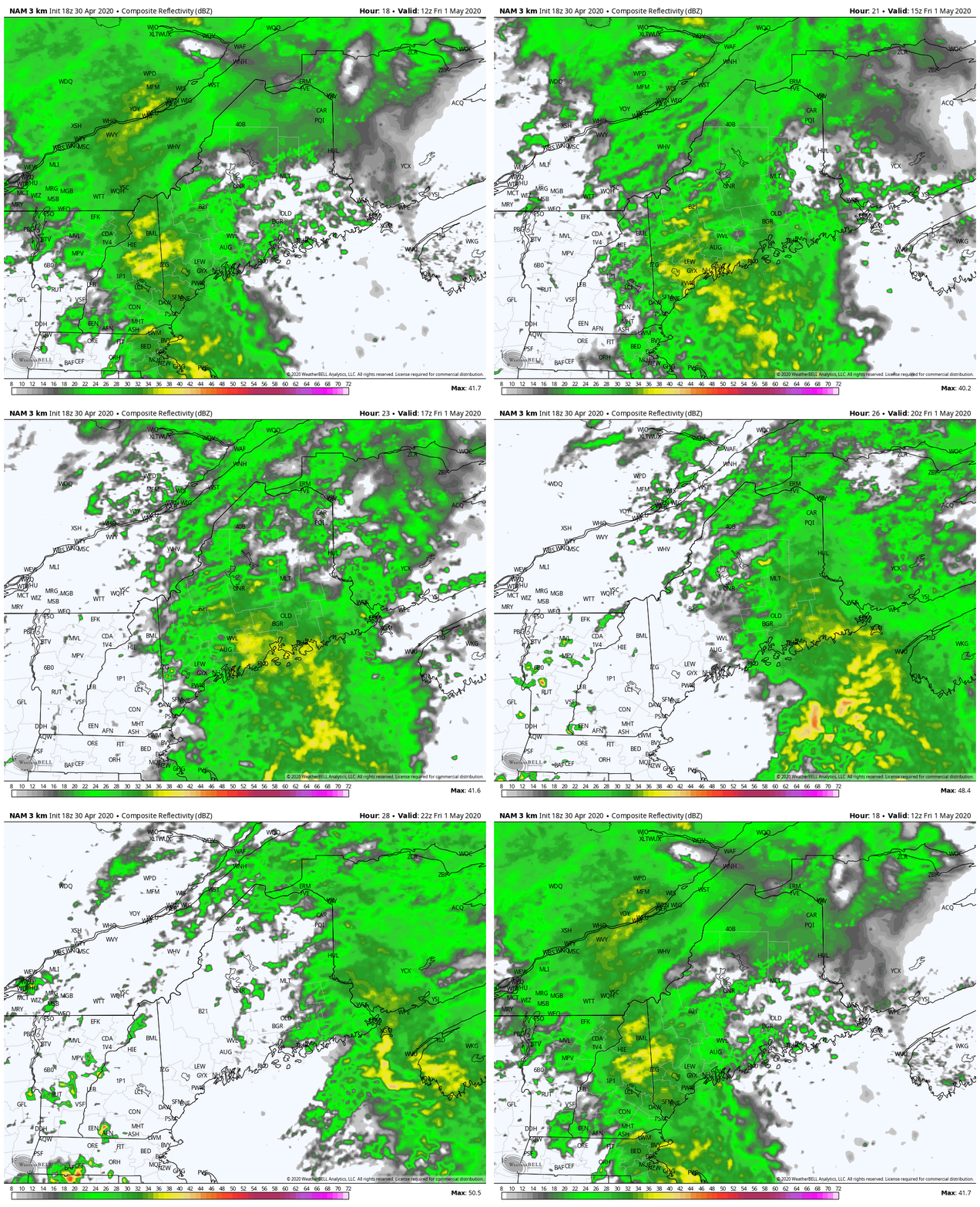
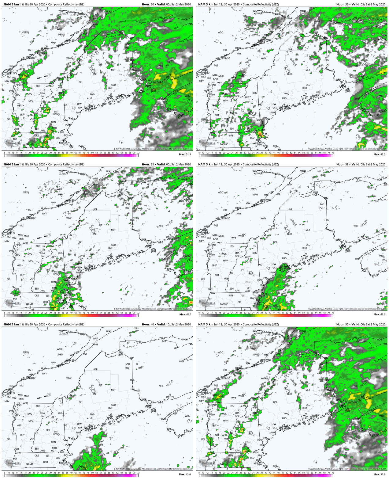
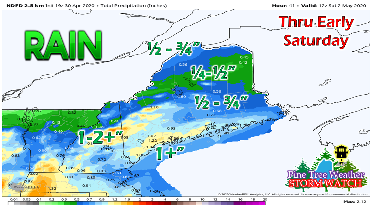
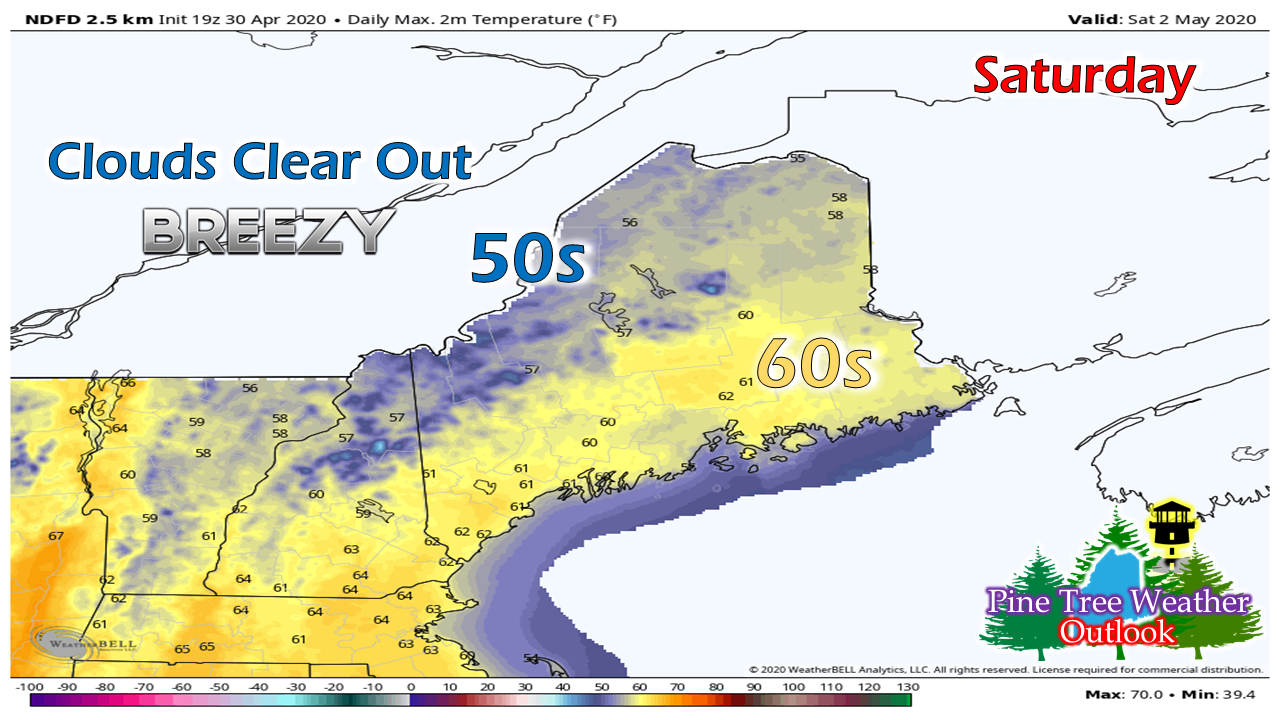
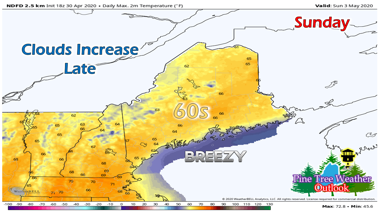
It's been a stormy cool stretch over the past couple of weeks. Thankfully, that trend is going to change a bit. The outlook for the week ahead overall remains a bit on the cool side, but less stormy overall. This is good news as COVID restrictions loosen a bit and folks are able to get outside and get some fresh air and sunshine. A wet FridayShower activity begins to increase and spread out from west to east overnight. The low level jet stream will pick up speed as well, gusting between 40-50 knots. There is a chance that strong wind may make the surface in heavier downpours, but it does not appear to be too much of a concern overnight into Friday morning. The soaking rain band moves west to east during the day on Friday. Steady, heavy rain tapers to scattered showers over western and southern areas in the afternoon, and by mid-evening over northern and eastern areas. Southerly wind gusts from 15-25 mph, and settles down after the steadier rain moves east. Scattered showers continue into the overnight Friday into early Saturday. There could be a few isolated showers around after sunrise behind a cold front Saturday morning, but those appear to taper off by mid-morning. After that, the sky clears out, and a sunny, breezy day will be on tap to start the weekend. With the southerly wind direction, south facing mountain peaks will see the most rainfall out of this. This may melt off snow and the combination of the two are likely to raise brooks, streams and rivers. Flooding at this point appears minor, if any does occur. The weekend looks brightAfter the clouds clear out Saturday, the temperature goes up for most areas. The mountains and north will stay on the cool side due to the northwest breeze, which could gust between 15-30 mph before settling down Saturday night. Sunday appears splendid. Widespread 60s except for the mountain tops and shorelines from Harpswell to Eastport as a southwest flow develops. It will be a mostly sunny day, with clouds on the increase in the afternoon over western and southern areas. Scattered showers are possible for Monday, but after that, next week appears mainly dry. Help the weather community and stay informed!
► ► For the latest official forecasts, bulletins and advisories, please check in with the National Weather Service in Gray for western and southern areas, or Caribou for northern and eastern parts of Maine.
Thanks as always for your support! - Mike |
Mike Haggett
|

