
Pattern more and more like fall As September is about ready to close, the pattern of zonal systems, stalled frontal boundaries, and cooler temperatures appears on the horizon. The days are getting shorter, the Arctic is becoming more active, and the heat dome which pumped well over a months worth of steamy days and nights the past few months is slowly beginning to erode. The sum total of all of these atmospheric ingredients is that an unsettled period is ahead as we march into October. 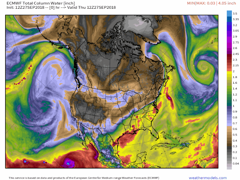 We're not completely done with muggy weather just yet as a strong ridge over the western part of the country will act as a block and allow moisture to flare up from the south, just to get knocked back down as west to east frontal boundaries cut across the northeast. Hurricane Rosa in the eastern Pacific, an active pattern around the Bering Straits, along the deep low from Leslie over the North Atlantic will be the significant weather features to watch for clues for how the second week in October plays out. I don't want to sound alarmist here, but as we flip the calendar, the threat for more potent storms is on the horizon. Make sure you are prepared, and keep tabs on the forecast. Nuisance showers for Friday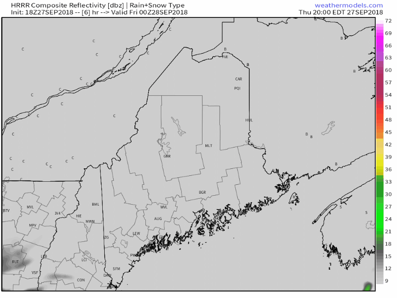 Showers overspread the region Thursday night into Friday morning as a weak low travels along a stalled frontal boundary to the south. This is a quick event. The showers over the mountains and north are on track to dissipate by mid to late morning, and will be all but over for southern and eastern areas by mid-afternoon. 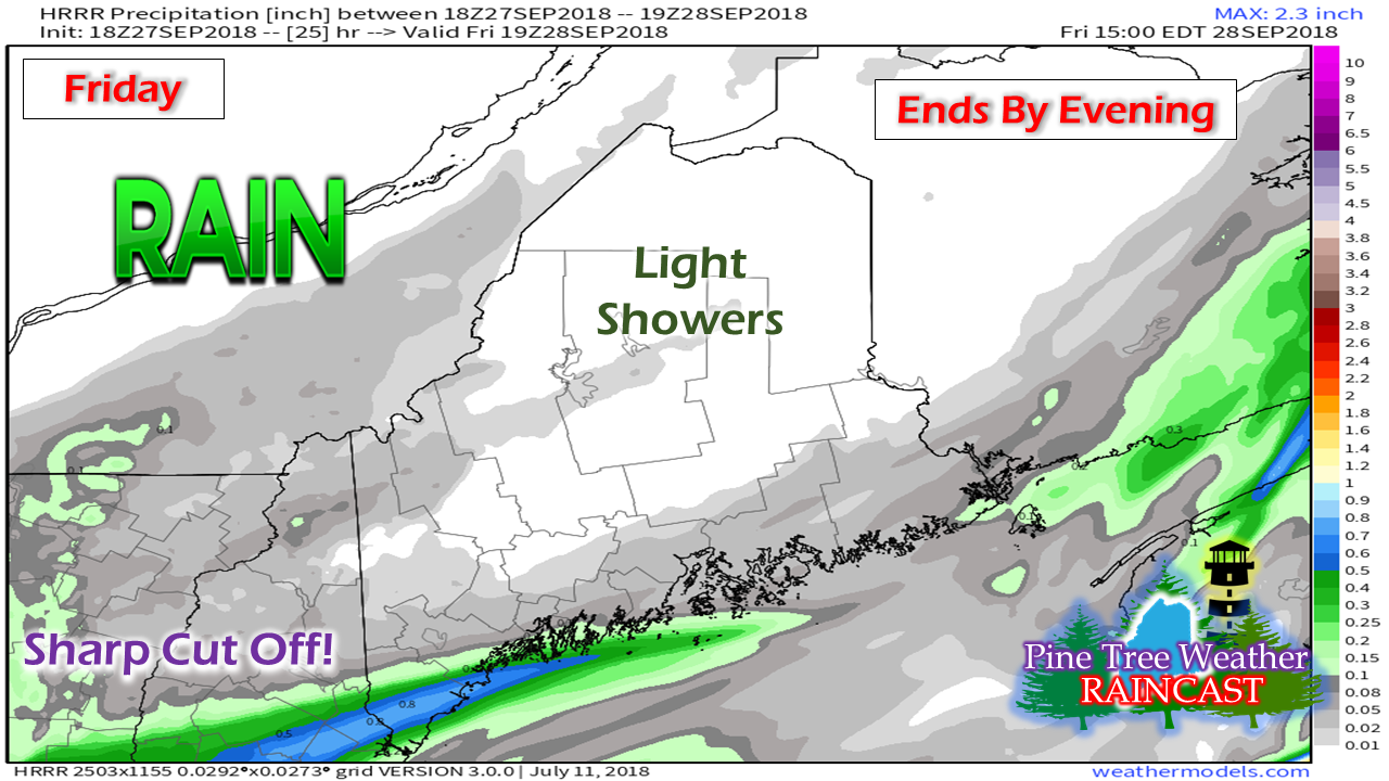 There is not a whole lot of accumulation expected with this. Northern areas may not register much in measurable rainfall. The coastal plain likely sees the most out of this, and that isn't a whole lot. Southern areas provide some intrigue for a bit of over performance potential due to the track of the impulse and energy associated with it. Friday evening football activity should be precipitation free, but with falling temperatures as most areas will be in the 40s by the time games wrap up in the evening. Outlook through Tuesday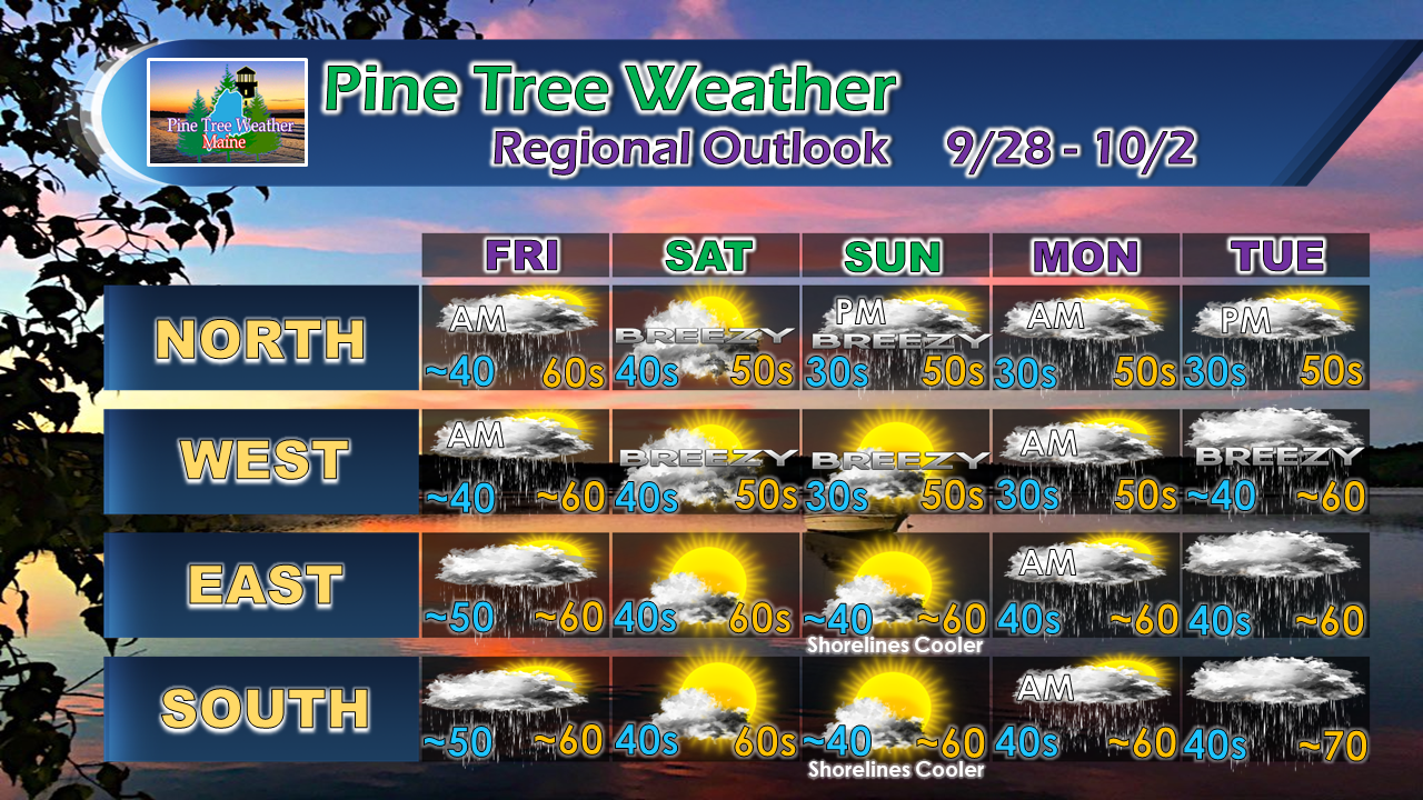 While the outlook is unsettled, there is not a whole lot of rain that will come out of this as the fronts appear to be somewhat moisture starved. The northern and western areas may see a brief shower on Saturday as a disturbance sweeps through. Sunday will be a chilly start. If you are still growing, you'll want to cover up the plants Saturday night. A frontal boundary to the south pushes north into the region Monday which may bring more scattered showers in the morning. The front stalls and another impulse forms along it and arrives Tuesday and appears to linger into Wednesday. As we head into the latter part of next week, a cold front appears to approach the region Thursday and the Columbus Day Weekend may start off unsettled as well. Stay updated! For the latest official forecasts, bulletins and advisories, please check in with the National Weather Service in Gray for western and southern areas, or Caribou for northern and eastern parts of Maine.
For more information from me, please follow the Pine Tree Weather Facebook page and my Twitter feed. Thanks as always for your support! Please consider making a donation to keep Pine Tree Weather going. Check out the donate page on how to contribute. Always stay weather aware! - Mike |

Mike Haggett
|


