 Keep your phones charged, generators on standby and other storm supplies ready to go. It's shaping up to be a rough couple of days, especially for the Penobscot Bay region and DownEast areas. Buckle up. Since this is a long duration event. I will go through this forecast in steps. Timing and impacts of the windIn the past couple of days I have discussed the low-level jet stream and potential impacts ad nauseum. This is one of the key features of the storm. I mentioned in Sunday's post that there are two areas of concern with the wind, one from the surface, the other from the sky. If there is one thing that could spare strong downdraft wind along the coast, it is a surface warm front. This inversion could divert the 70-80+ knot wind depicted in this GIF runs from reaching the surface. While that may be the case, there could be situations where it could reach the surface in the form of heavy downpours and thunderstorms. The wind, whether horizontal or vertical, is going to bring impacts. This is another southeast directional wind event with more strength than the recent storms. There will be power outages. How many outages and how long until service is restored, only time will tell. 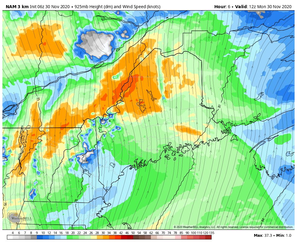 NAM3km forecast idea of 925mb wind speeds from 7 AM to 7 PM Monday Between 7 AM to 7 PM Monday is where the low level jet begins its approach in southwestern and MidCoast areas. I do expect a stiff breeze for the evening commute, and two hands on the wheel and reduced speed is strongly suggested from 3 PM onward. 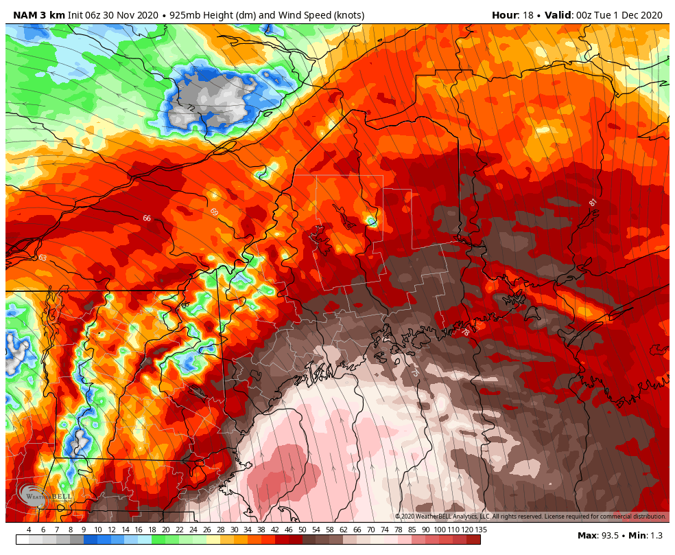 NAM3km forecast idea of 925mb wind speeds from 7 PM Monday to 7 AM Tuesday The wind expands into DownEast areas by 9-10 PM and will continue strong overnight. The overnight hours is where the wind will howl the strongest for the southwest coast, and also end. If you still have power after 1 AM over western and southern areas, your odds of keeping it go on the increase. 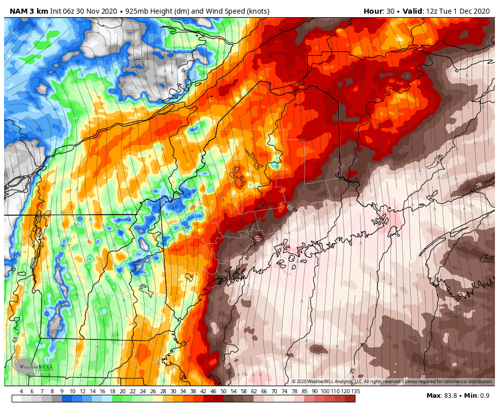 NAM3km forecast idea of 925mb wind speeds from 7 AM to 7 PM Tuesday The wind field ever so slowly moves to the east. MidCoast areas see the strong wind settle by noon to 1 PM, along with Bangor. Bar Harbor will be late afternoon, and for the Eastport / Machias region it appears to be around 9-10 PM (outside of the range of this loop) before the strong wind passes. 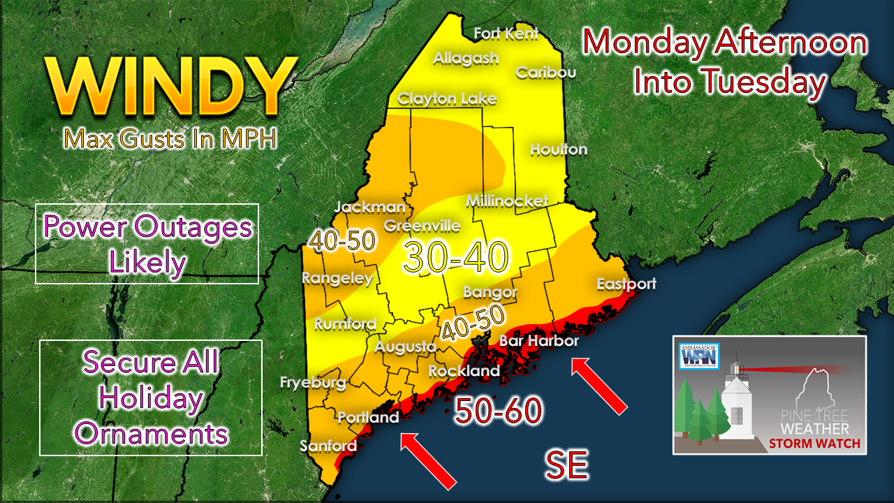 No changes to predicted gusts posted here Sunday. The shorelines get the brunt of it. MidCoast and DownEast areas get the longer duration impacts. Higher elevations inland and open areas get higher gusts. While the strong wind passes, a stiff breeze continues in its wake and that will be an issue into Wednesday and will ever so slowly diminish Thursday. Then there is the rain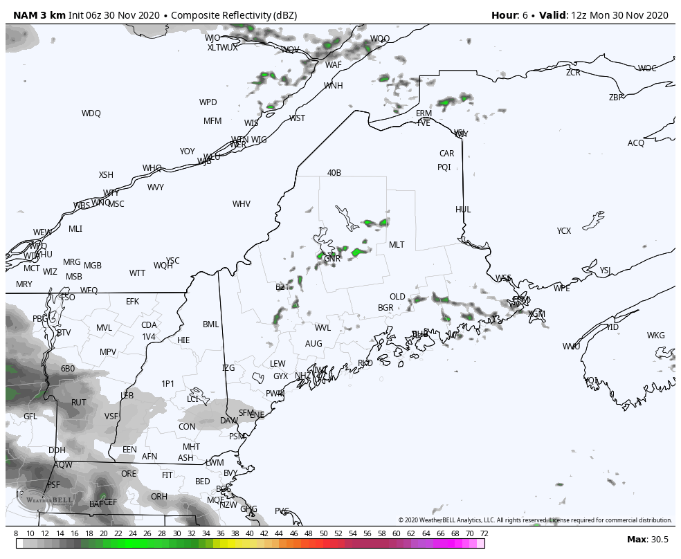 NAM3km forecast idea of radar activity from 7 AM to 7 PM Monday The first twelve hours of the storm shows shower breaking out in the morning with heavier rain moving in in the afternoon. 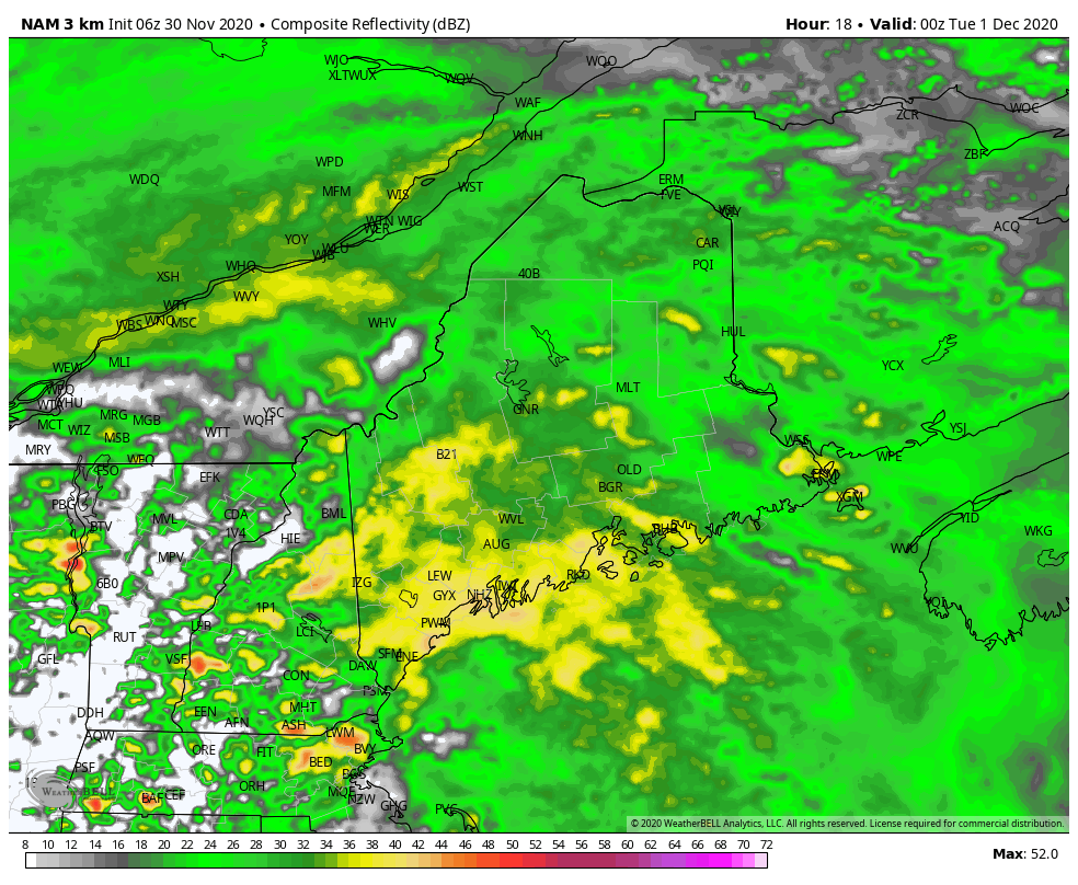 NAM3km forecast idea of radar activity from 7 PM Monday to 7 AM Tuesday As the storm shifts eastward, the rain moves east with it. A dry slot forms and tapers the steady, heavier rain to showers over southern and western areas soon after the wind shield moves east in the wee hours of Tuesday morning. For eastern areas, there may be a few breaks in the rain intensity, but that will be short lived. 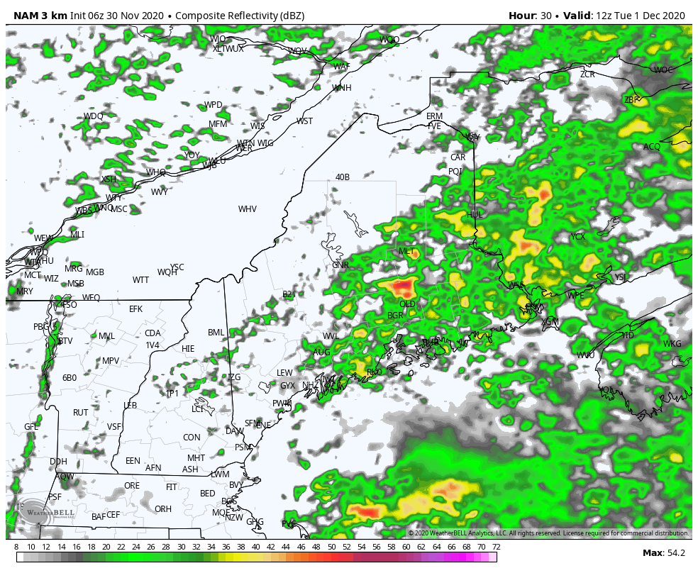 NAM3km forecast idea of radar activity from 7 AM to 7 PM Tuesday Off and on shower activity continues for western and southern areas. The storm stalls out, and consequently the fire hose continues over eastern areas through Tuesday. 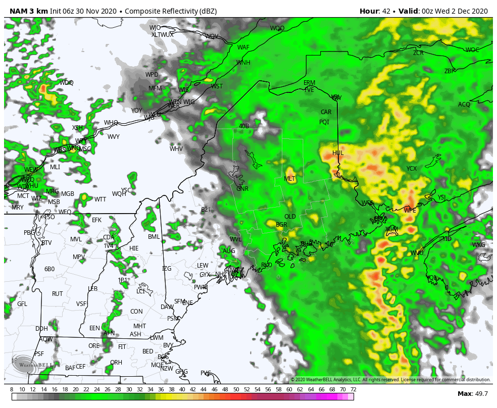 NAM3km forecast idea of radar activity from 7 PM Tuesday to 7 PM Wednesday The storm begins to weaken over western Quebec and moves to the northeast. Rain tapers off from west to east overnight into Wednesday morning. Cold air creeps back in a loft. Some snow showers are possible for the western mountains during the day on Wednesday. 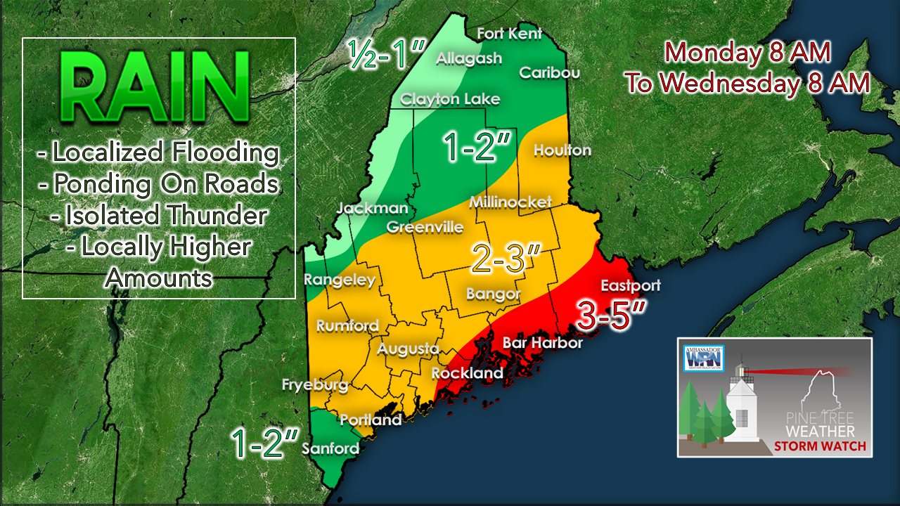 No changes to the rain forecast posted here on Sunday. I do suspect there will areas of flooding with the small creeks and streams, localized flash flooding with downpours in thunderstorms, and locally higher amounts of rainfall where this occurs. I haven't discussed shoreline impacts much since we are on the low end of the astronomical tide cycle. There may be some splash over and minor beach erosion in the usual places, but overall impacts appear minimal.  Temperature forecast through SundayAfter this storm clears out, southern and eastern areas see the sun return Thursday. Guidance is mixed on what happens after that, so expect updates on that. Above normal temperatures continue everywhere through the weekend. 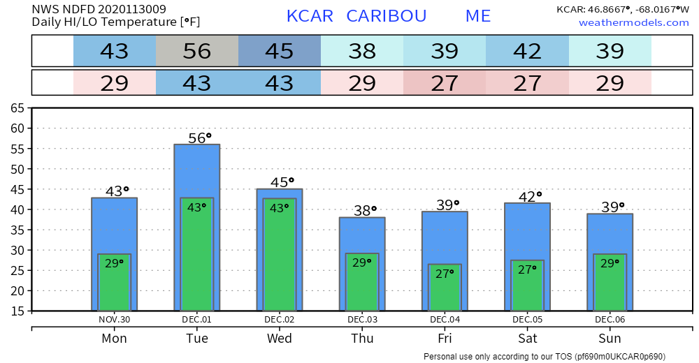 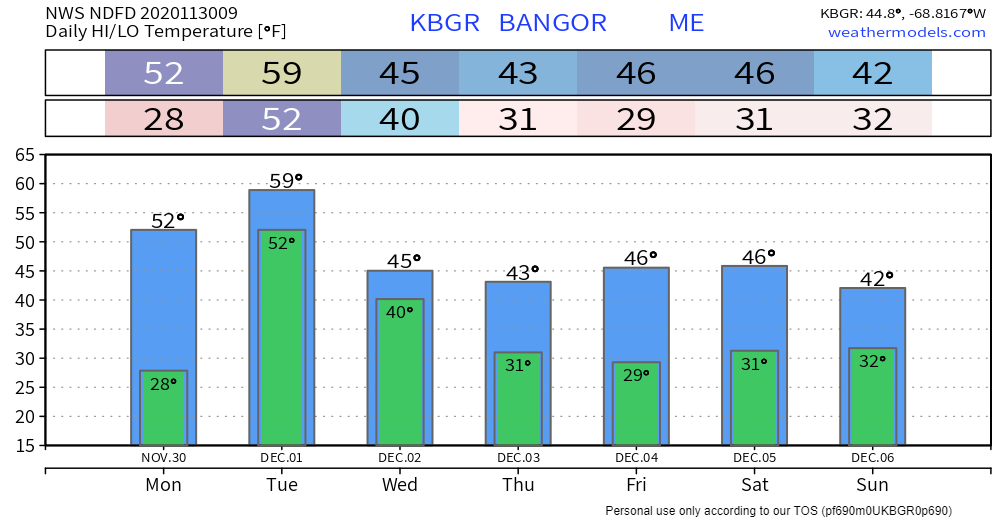 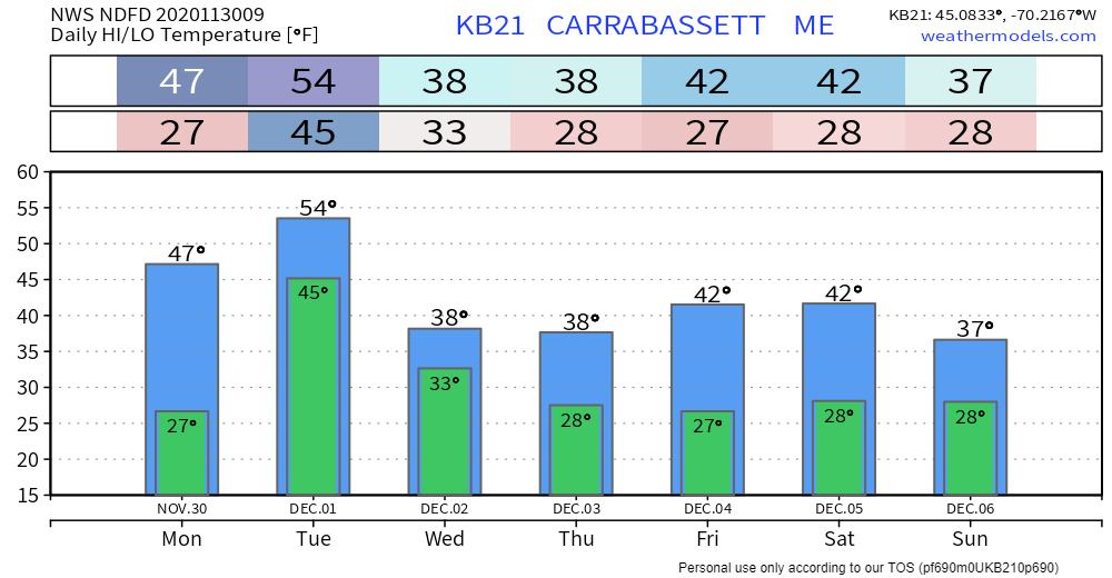 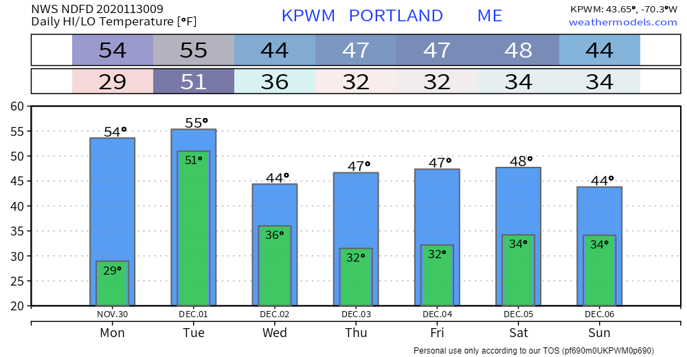 Driving During Windy Conditions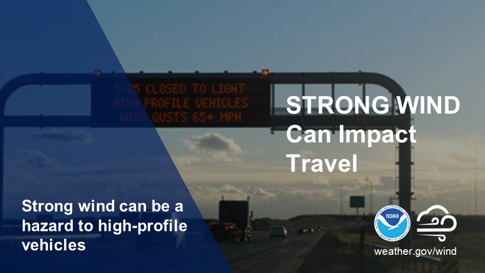 High winds can make driving dangerous. If driving during windy conditions, slow down and keep two hands on the wheel, avoid large trucks and trailers, and watch for downed tree branches or downed trees and power lines. Bridges and overpasses can be particularly dangerous to drive over when it is extremely windy, so choose routes to avoid them. weather.gov/safety/wind-during Be prepared to receive alerts and stay updated!
For more information, please follow Pine Tree Weather on Facebook and Twitter.
** FUNDING NEEDED FOR 2021 ** Thank you for supporting this community based weather information source that is funded by your financial contributions. Stay updated, stay on alert, and stay safe! - Mike |

Mike Haggett
|