This is going to be a mess I'll say it again as I did on Facebook Friday night, if you have to travel in or out of Maine, do it today. At the time of this post at 6 AM Saturday, winter storm warnings have gone into effect for western Massachusetts. Winter storm watches have been expanded across Southern New England and New Hampshire. While Cumberland and York County in Maine are the only two counties under watch now, there may be more areas that will be added to that list. Timing, wind, and snowfall through Monday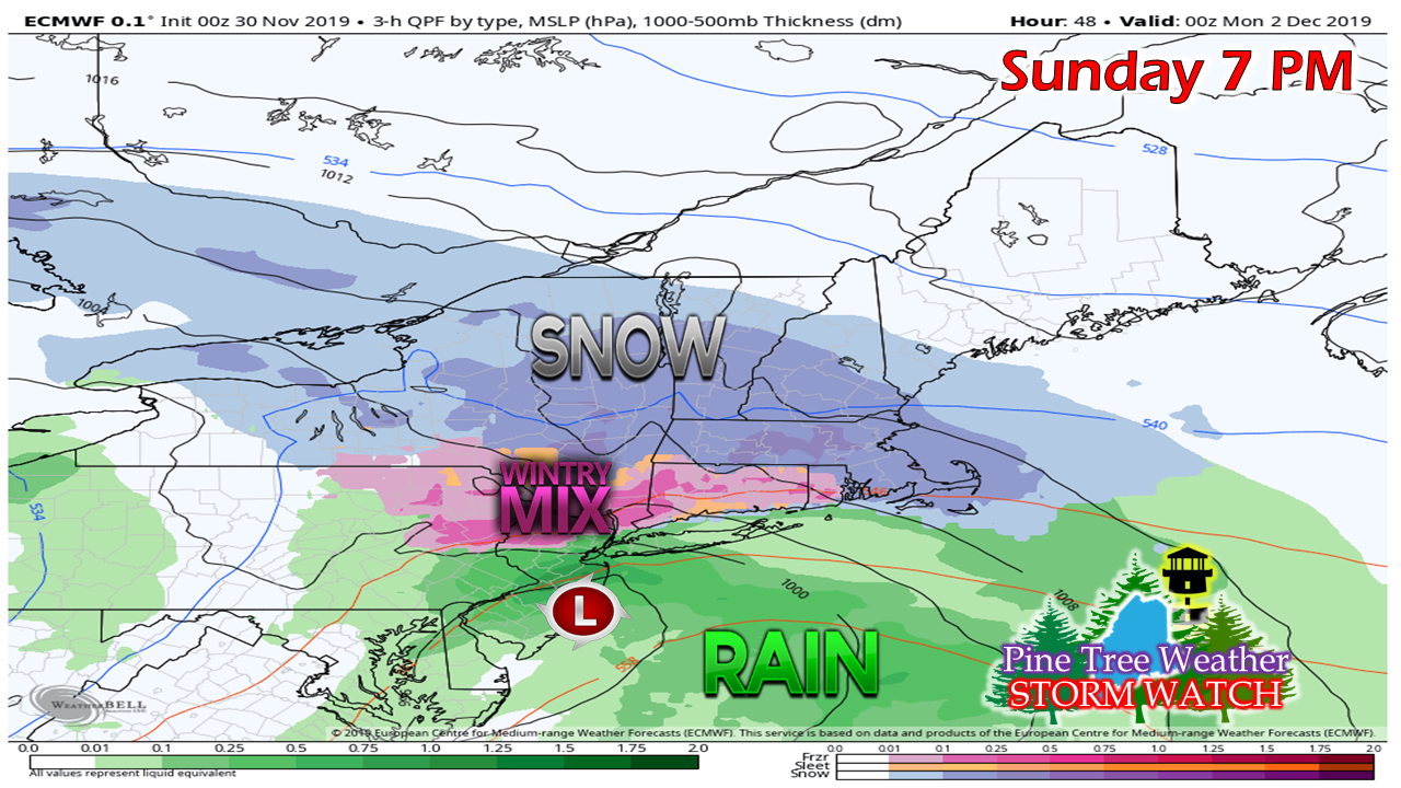 Southwestern Maine may not see much in the way of snowfall until late afternoon Sunday. By that time, it is well underway to the south and west. This is going cause big problems for southern New England, and will do so through Tuesday. 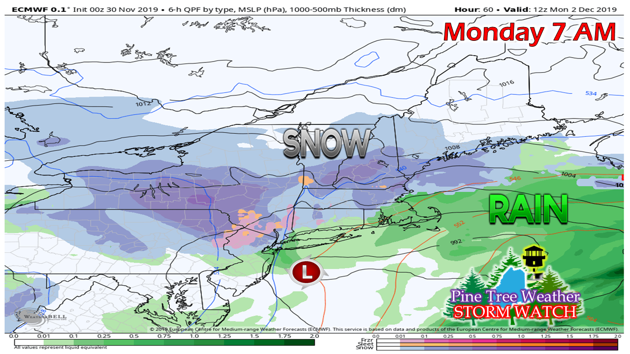 The storm isn't going to move a whole lot. It will be trapped within the region due to blocking. A cut-off upper level low won't get the kick it needs to move until Tuesday. 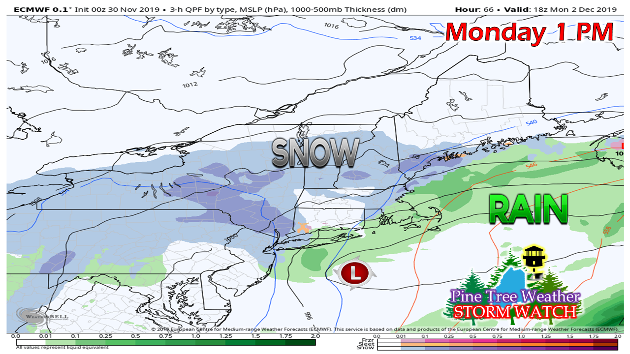 I mentioned on Facebook Friday that the storm is not vertically stacked. Given that fact, and that it is a slow mover, this presents all kinds of forecasting headaches. With due credit to the National Weather Service Gray office, the idea of a TROWAL comes into play. A TROWAL is the acronym for TRough Of Warm air ALoft which could bring sleet into the picture by midday on Monday. 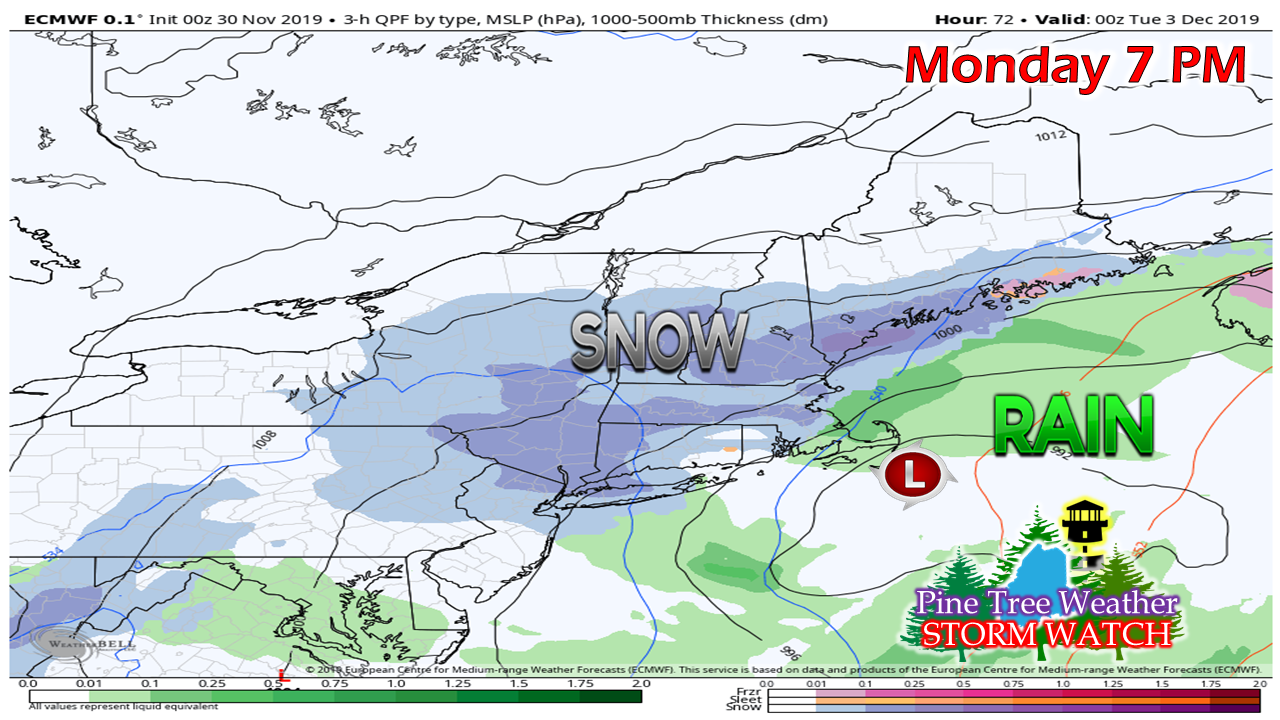 The next wrench is as the storm center approaches the benchmark point (40° N / 70° W) a new surface low begins to form to the northeast. It will be around this time that begins to happen. If it all stacks up right, it will get interesting. 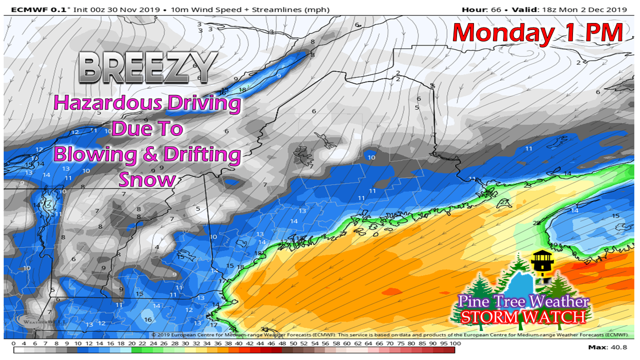 Northeast winds will gradually increase Sunday night into Monday, and continue into Tuesday. As the storm shifts east, the direction shifts to the northwest and will continue to blow snow around Tuesday night into Wednesday. 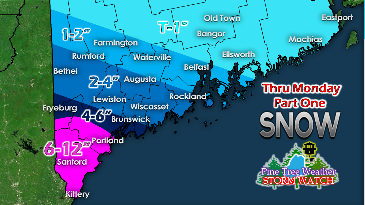 Due to forecast uncertainty for Tuesday, and to clarify what to expect through Monday, I opted to provide the snowfall idea in stages to help you plan accordingly. With the TROWAL effect, along with a coastal front a likely possibility, that may cut snow totals down for a bit. This idea also contains the possibility of deformation bands developing, and if and where that happens, expect totals higher than this. With this type of set up, it would be wise to expect the unexpected. Tuesday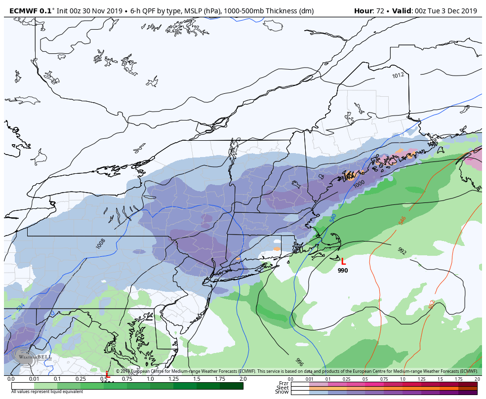 This loop at 3 hour stages starts Monday at 7 PM and runs through Wednesday 7 PM. This shows the new surface low forming to the northeast and then runs into an atmospheric road block, moves north into the Bay of Fundy before moving eastward. At least that is the idea for now. Northern and eastern areas may get their load from this before it is over. Stay tuned. ► ► For the latest official forecasts, bulletins and advisories, please check in with the National Weather Service in Gray for western and southern areas, or Caribou for northern and eastern parts of Maine. Your support to keep this site going |

Mike Haggett
|