
The ante has been raised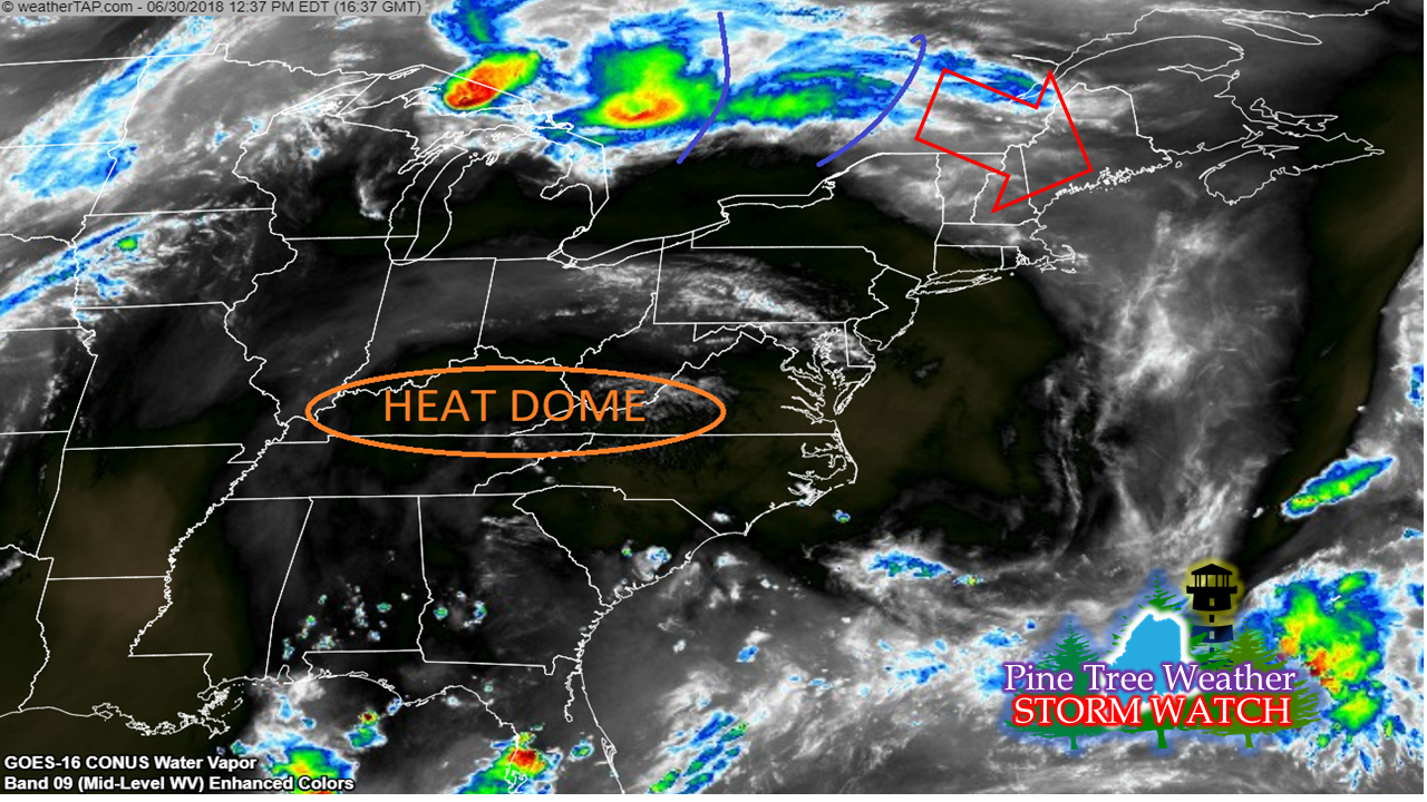 From Storm Prediction Center: Day 1 Convective Outlook NWS Storm Prediction Center Norman OK 1112 AM CDT Sat Jun 30 2018 Valid 301630Z - 011200Z ...THERE IS AN ENHANCED RISK OF SEVERE THUNDERSTORMS OVER PARTS OF THE CENTRAL PLAINS...AND OVER PORTIONS OF NEW YORK...VERMONT...NEW HAMPSHIRE...AND MAINE.... ...SUMMARY... Scattered severe thunderstorms are expected from the central Plains to the Upper Midwest this afternoon and evening, as well as across parts of northern New York and northern New England. ...NY/New England... Fast west-northwesterly flow aloft extends across Ontario/Quebec into the northeast states today, with the core of 500mb flow exceeding 60 knots. Water vapor imagery shows multiple subtle embedded shortwave troughs within the flow that will track into NY/New England later today, posing a risk of severe storms. The scenario with highest potential is for fast-moving cluster(s) of storms currently north/northwest of Georgian Bay to track eastward into parts of NY/VT/NE/ME this afternoon and early evening. Forecast soundings in this region show fast, deep westerly flow and moderate CAPE values. A severe bowing complex is possible, capable of rather widespread strong/damaging wind gusts. Therefore, have upgraded to ENH risk for this region. Discussion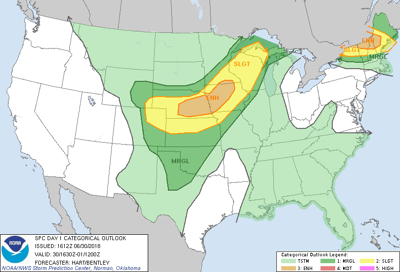 The weather could get real interesting for the southwestern half of the state this evening. It's rather rare we get an "enhanced" outlook, so it is important to define it: 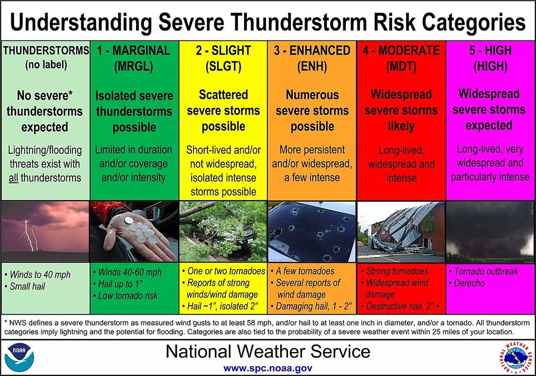 The chance for a severe outbreak is good. The players are all on the table. Instability from the upper level energy riding along the heat dome entering an area with plenty of humidity and convective energy (CAPE) that is just looking for a spark to touch off the gas can. That spark comes this evening as the sun goes down. Cold air moves in aloft against the very warm surface temperatures. Heat rises and with the upper level energy, then storms break out. 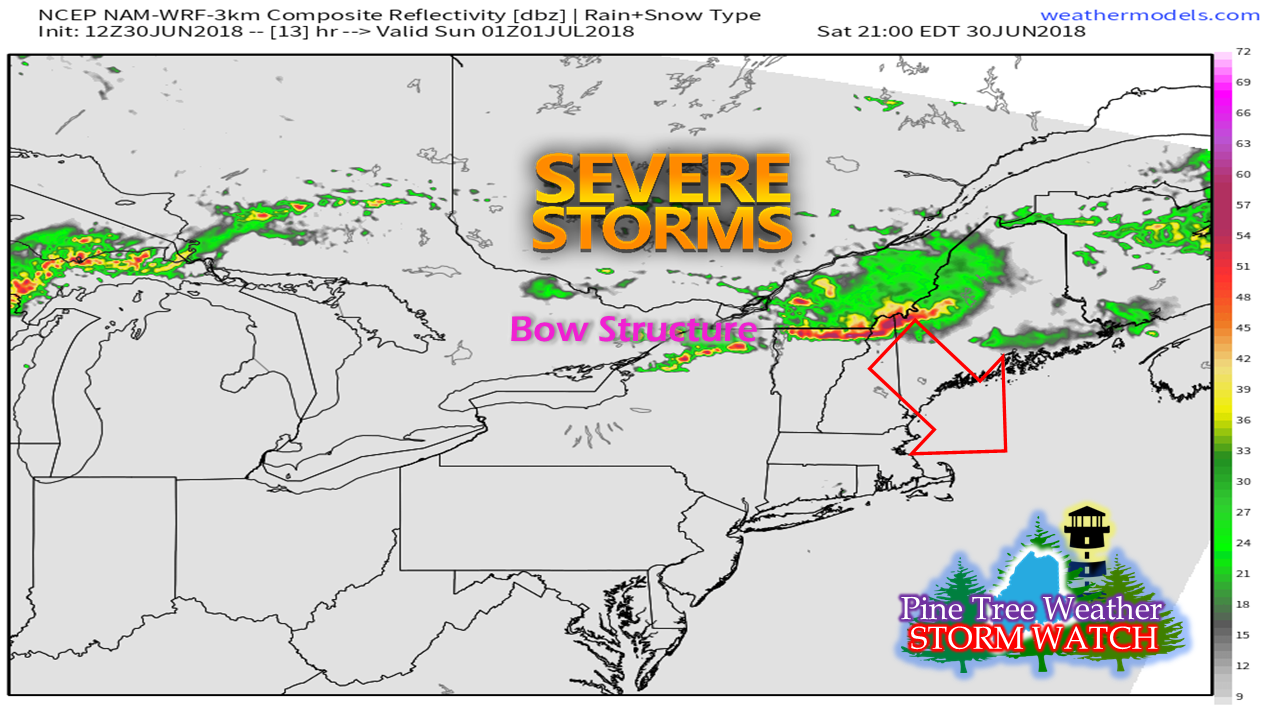 It's these bow structure type set ups that are the most concerning. These types of storms bring damaging wind, flooding downpours, plenty of lightning, potential for large hail and could spin off tornadoes. Damaging wind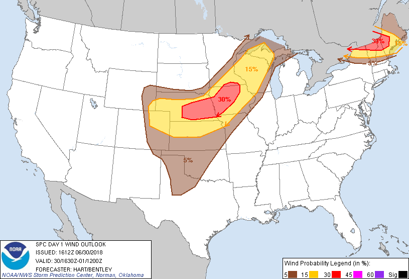 While the percentages appear low, it is this type of forecast that makes it a bit ominous. It is safe to say there is a high chance for scattered areas of wind damage. This could cause damage to structures and to power lines. The last time the region had an outbreak like this a year ago, it turned into a mess is in areas. This has potential to do that also. Large hail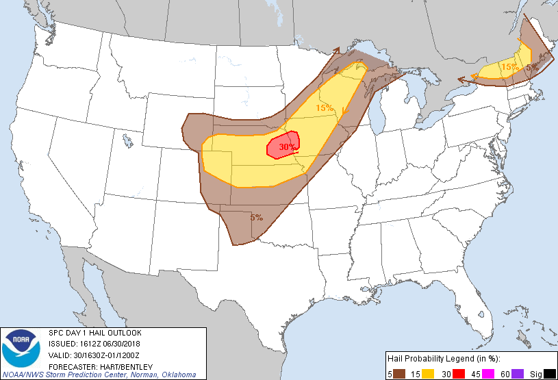 Again, it's rare that we see 15% hail potential over the region. That is a clear indicator that some scattered areas could see damage from hail stones in the 1-2" range. Isolated tornado(es) possible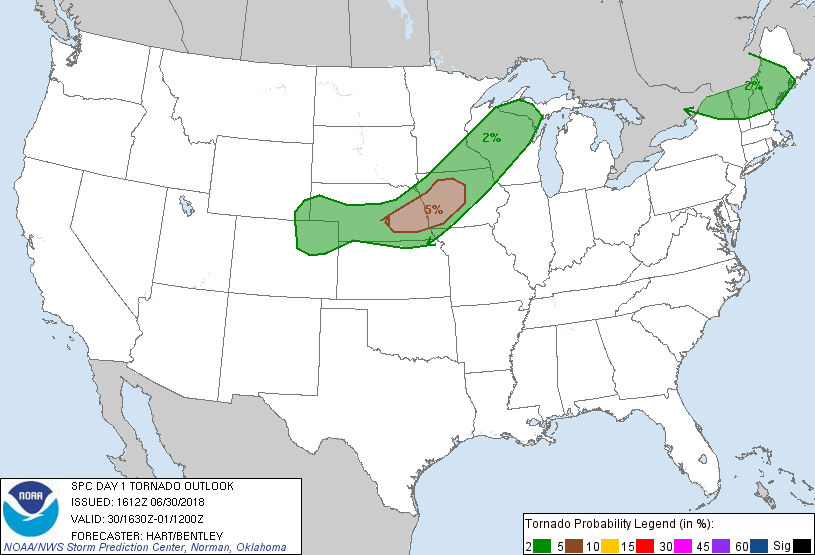 Anytime there is a bow structured system, there is always the chance for funnel cloud rotation to occur. What you need to knowWhat is to understand that there is POTENTIAL for this to happen. There are enough indications that it COULD occur. These are complex systems, much has to go right for it to happen. It would be wise to PREPARE by tidying up the yard of anything that could go airborne in case it does happen. I suspect severe thunderstorm watches could be posted at anytime in regards to this event. Understand that a WATCH means possible and a WARNING means likely.
If you are reading this from Jackman to Bar Harbor and all points west inside the state boundary, you need to stay on alert. These night time storms of this type can be dangerous, and that is what is going on here. Bust potential with these systems can be quite high, but betting on a bust could cause injury or death if on the wrong end of the bet. The storm threat will diminish as we head into daylight on Sunday morning. Stay in touch with the National Weather Service in Gray for western and southern Maine and Caribou for eastern and northern Maine. Prepare, and stay safe. - Mike |

Mike Haggett
|


