
Widely scattered showers and maybe a rumble Friday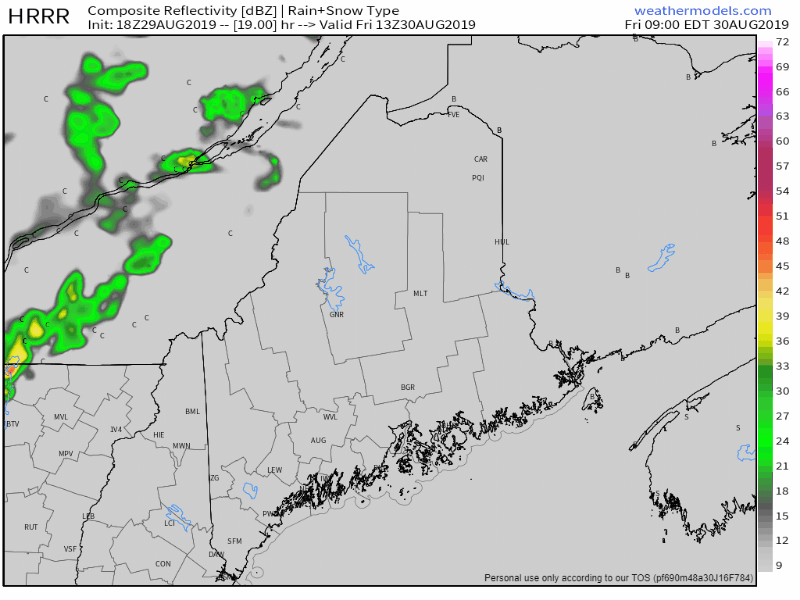 There could be some areas of fog around the lakes and rivers to start the day. A cold front will pass through the region as the day progresses. There will be low chance for a brief shower or an isolated thunderstorm for the mountains and Allagash region primarily, but a spot shower or sprinkle may pop along the coastal plain. After the front passes through, humidity levels will drop down as northwest airflow will cool things off. After a start with most areas in the 50s for morning lows, the area warms up to the 70s for northern, mountain, eastern and MidCoast shoreline towns, and 80s for the southwestern area. Mainly dry and cool Saturday & Sunday Saturday appears to be a bit chilly to start off with upper 40s for the mountains and Allagash and 50s elsewhere. There may be a few morning clouds and it could be a bit breezy as high pressure moves in from Quebec. Any clouds will give way to more sun in the afternoon. 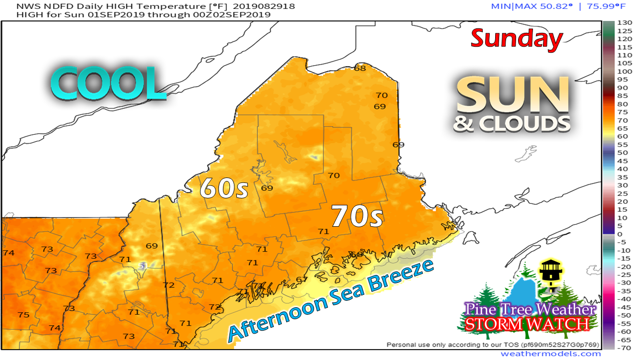 Sunday starts off with mainly clear skies, and perhaps some areas of fog around the lakes and rivers. The fog would come from morning low temperatures in the 40s for much of state away from the coast, where the low 50s appear to be the starting point. Cool high pressure begins to slide east during the day, with clouds on the increase as the morning turns into afternoon. If you are going to plan your holiday weekend barbecue, this may be the last day you can get it in before showers arrive Monday. A rainy Labor Day appears likely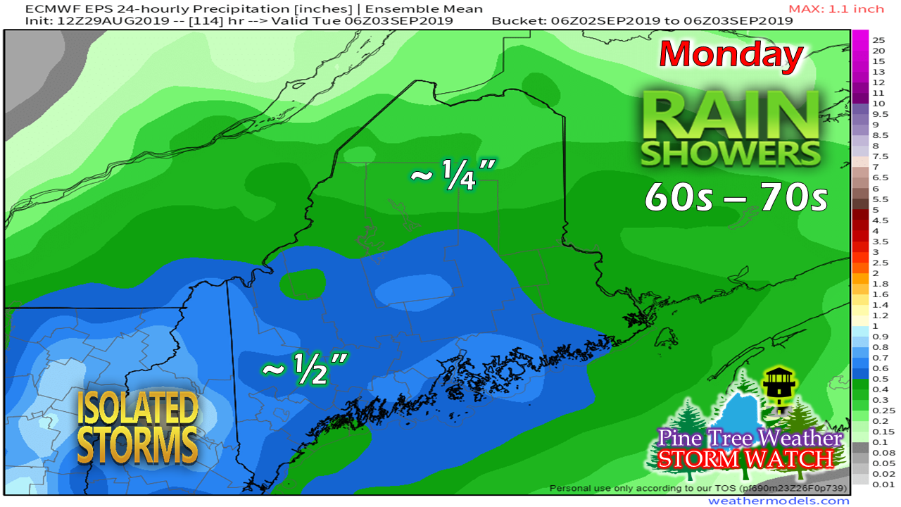 Timing at this point is to be determined, but showers and perhaps some isolated thunderstorms are possible for Monday. This kicks off an unsettled period for the state, where showers remain in the forecast Tuesday and Wednesday as a cold front ever so slowly drops down into the area. If you have travelling plans on Monday, it may not be a bad idea to get an early start for anyone heading south. If you have outdoor plans, you'll need rain gear. I will update on the timing of this over the weekend. Hurricane Dorian Update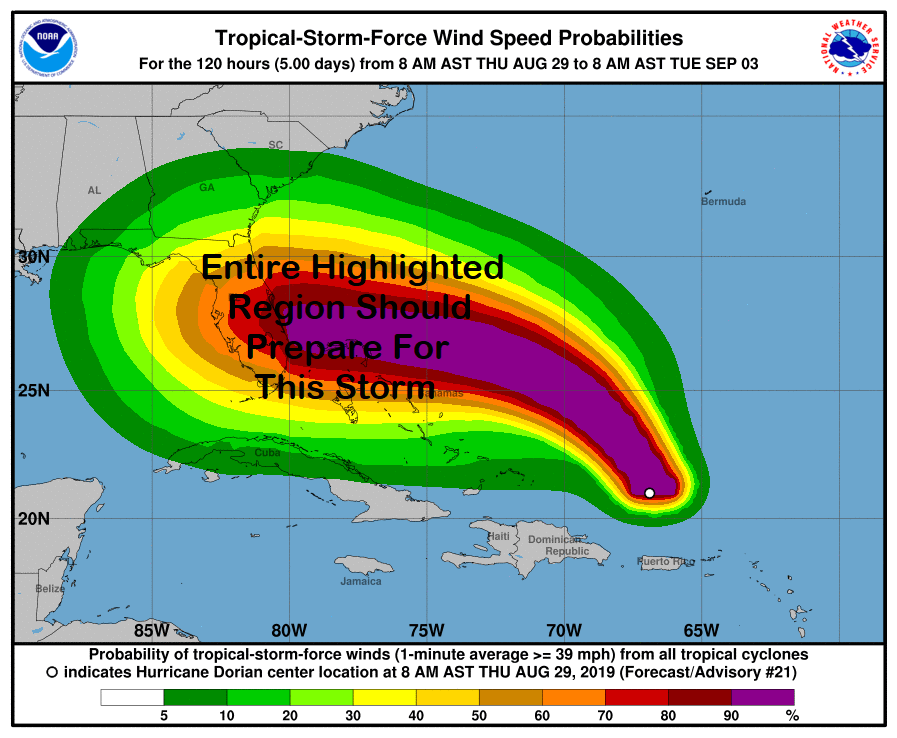 Silly season for hurricane forecast models is in high gear at the moment. There are some pretty crazy ideas going around, so buyer beware on where you are getting your information. There is a great deal of uncertainty as to where Dorian makes landfall, IF the storm makes landfall, and what happens after that.
I have adapted this tropical storm wind map and turned it into a highlighted area of potential. Put the shade of colors aside, the whole region could see flooding rain, strong wind, and severe weather. Where the eye of the storm goes is still in question. What is not in question, is the whole southeast region is likely to get something out of this, and there will be plenty of what is coming. As always, stay tuned to the National Hurricane Center for the latest forecasts and information. Stay tuned for further updates on Twitter and Facebook. ► ► For the latest official forecasts, bulletins and advisories, please check in with the National Weather Service in Gray for western and southern areas, or Caribou for northern and eastern parts of Maine. Please consider supporting Pine Tree Weather ► ► Your financial donations are much appreciated to keep this site funded and for further development. FUNDRAISING FOR 2020 BEGINS SOON! I sincerely appreciate your support not only financially, but also in sharing my efforts with others. For more information from me, please check the Pine Tree Weather Facebook page as well as my Twitter feed. Always stay weather aware! - Mike |

Mike Haggett
|


