|
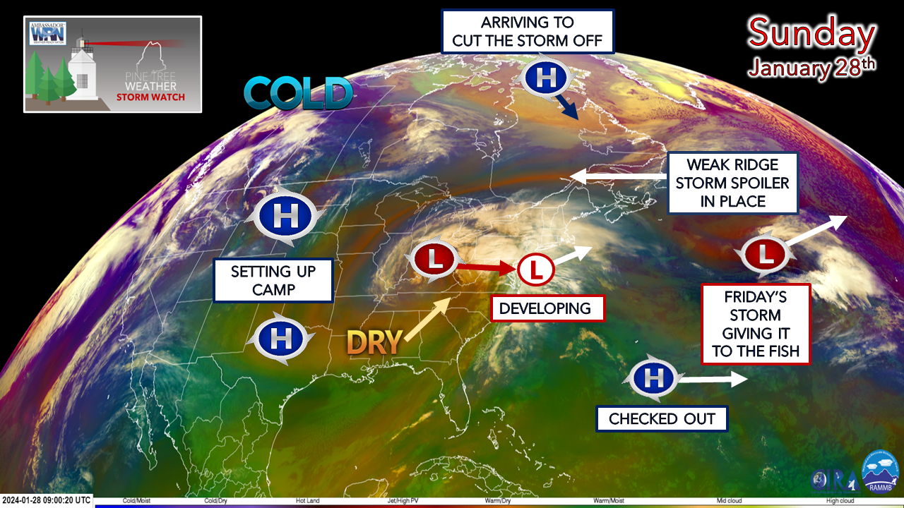
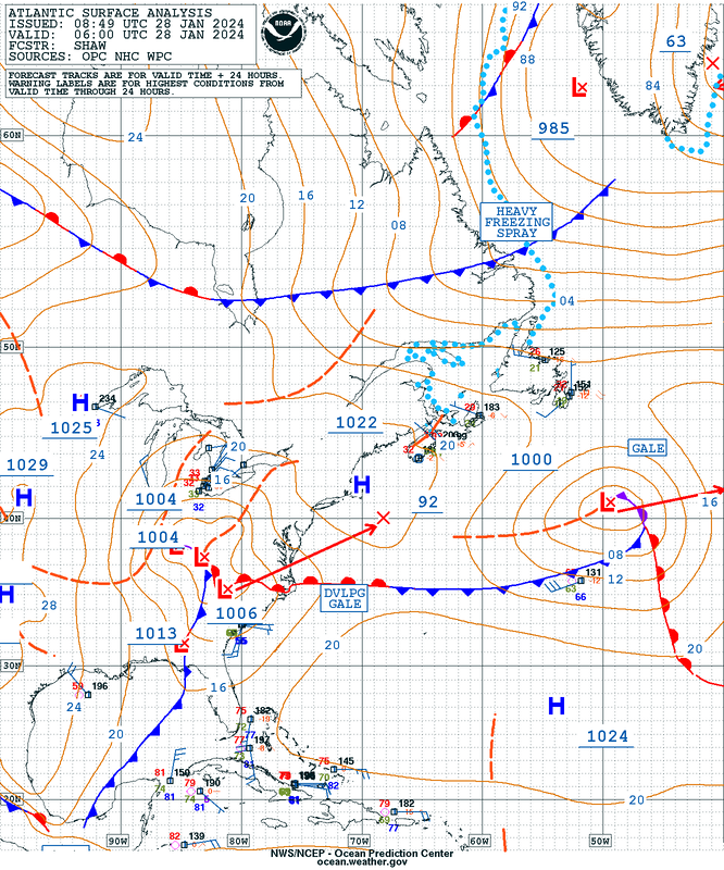
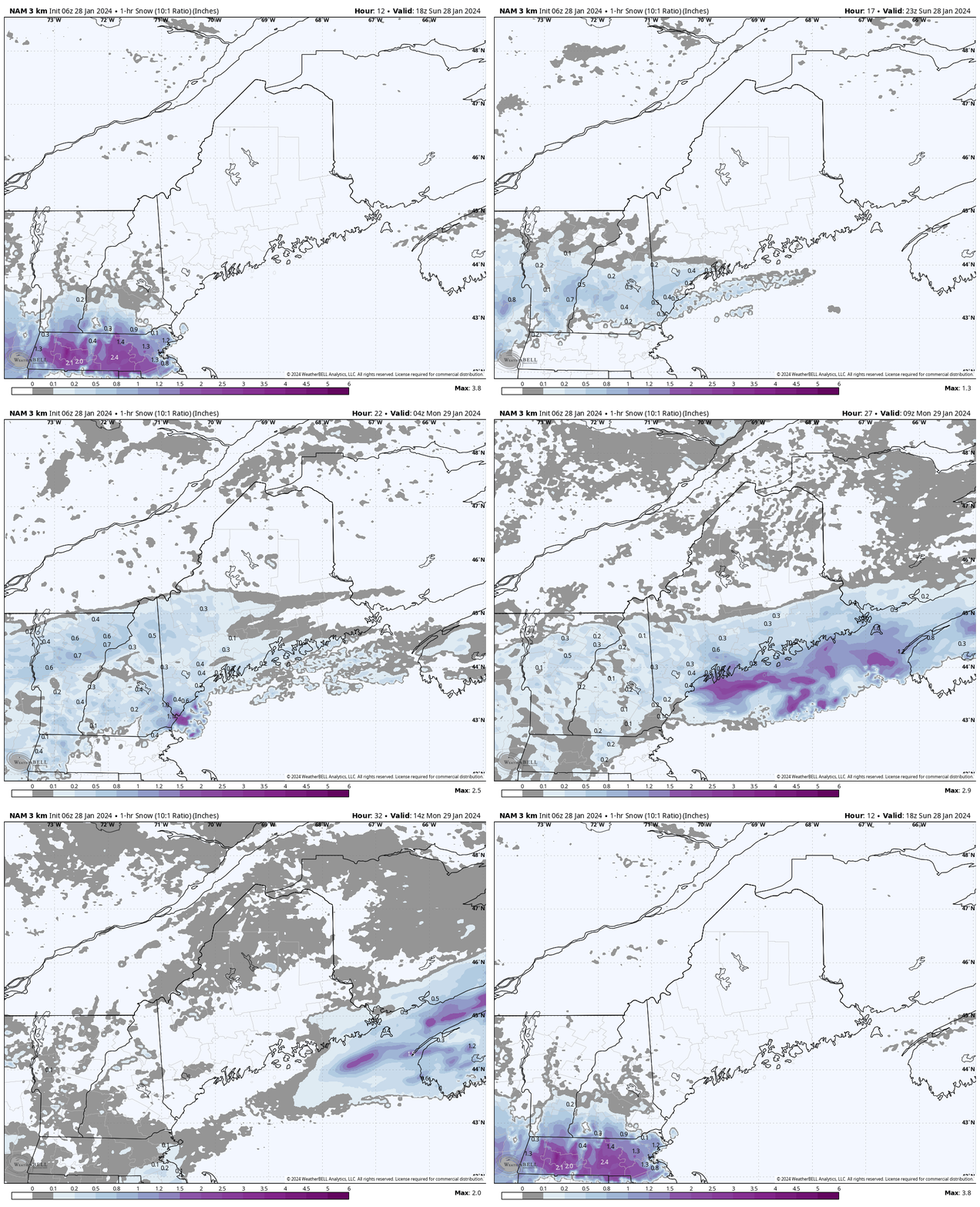
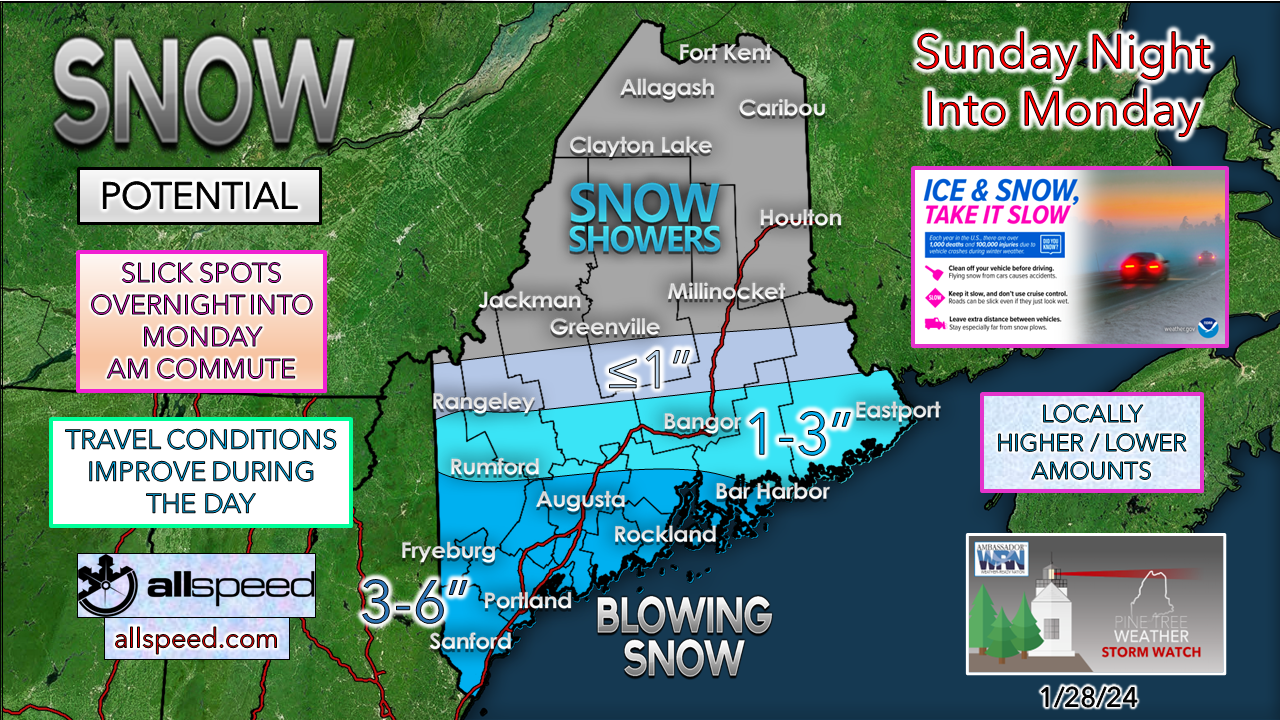
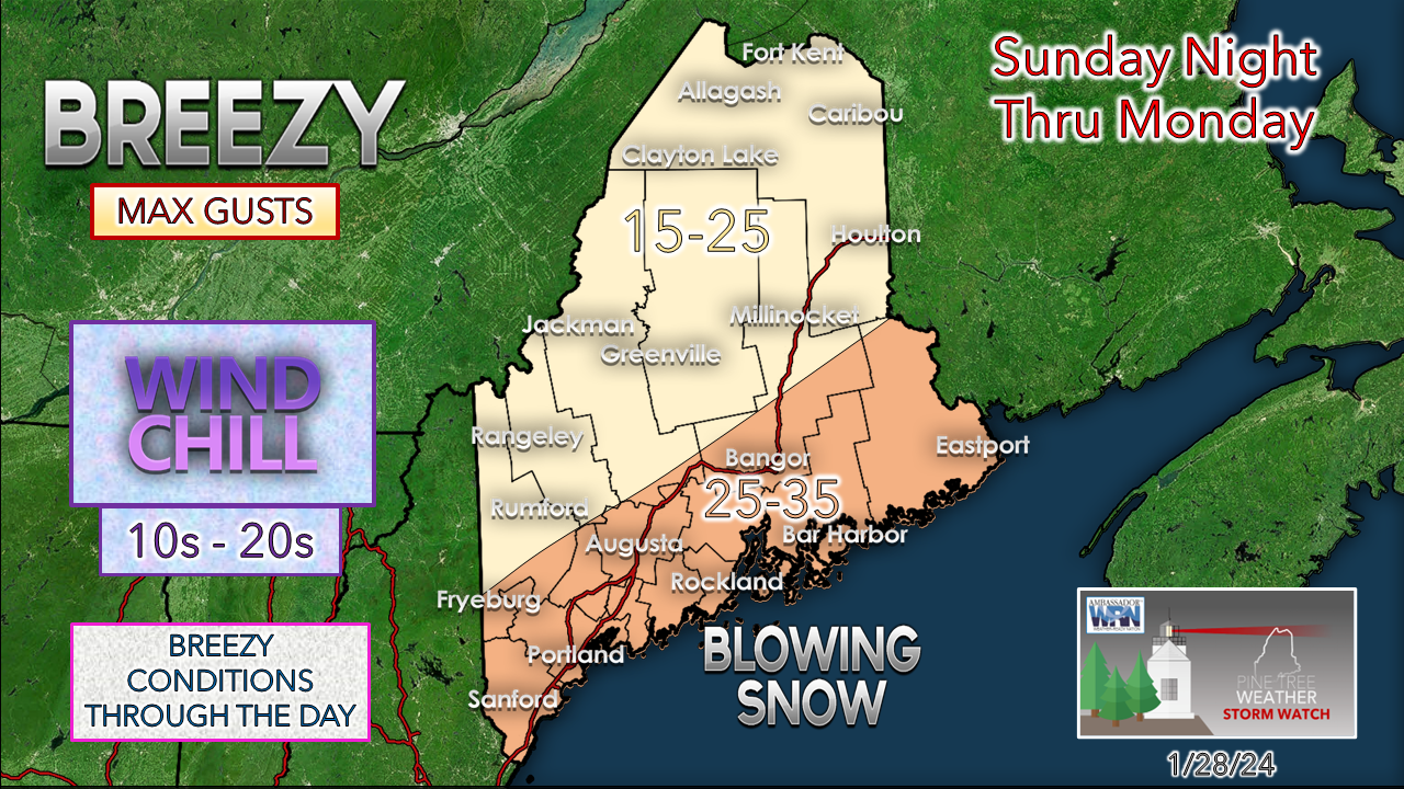
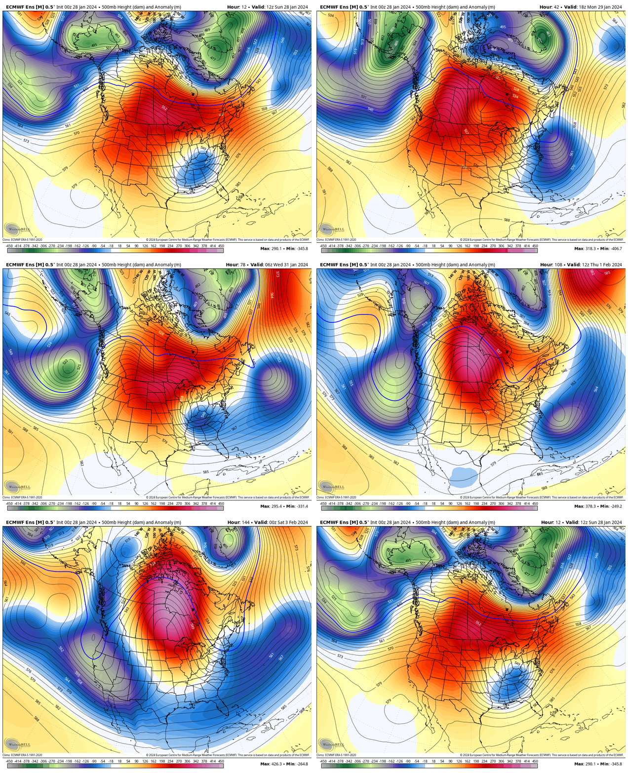
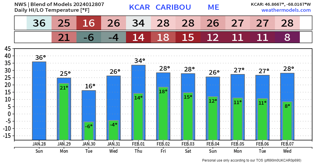
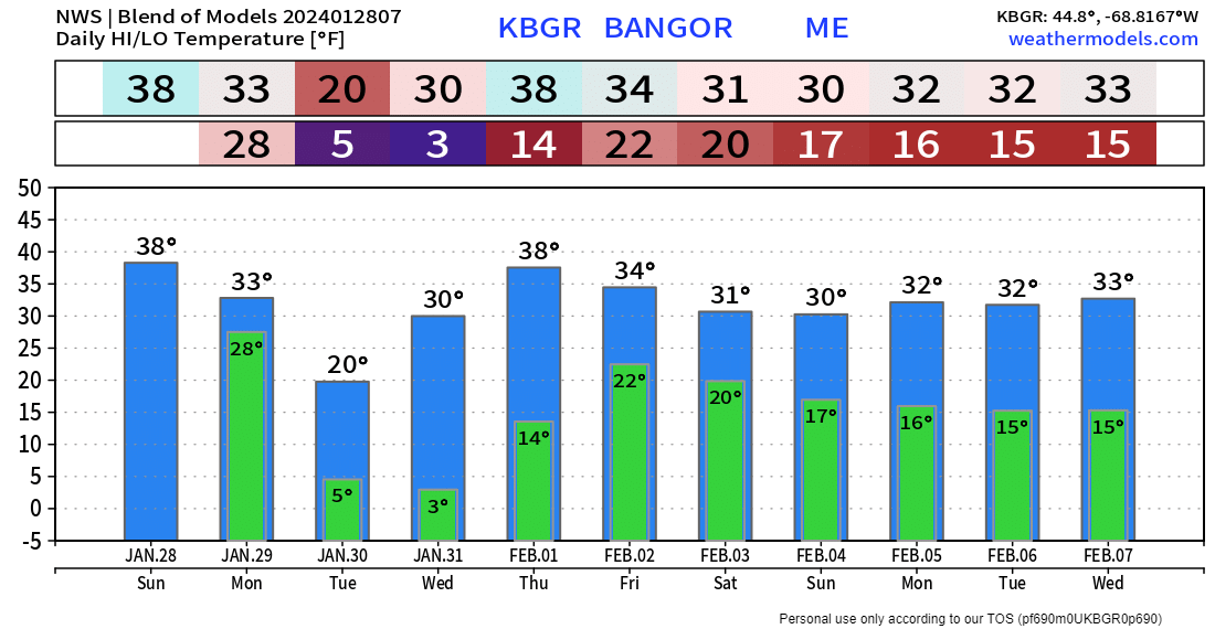
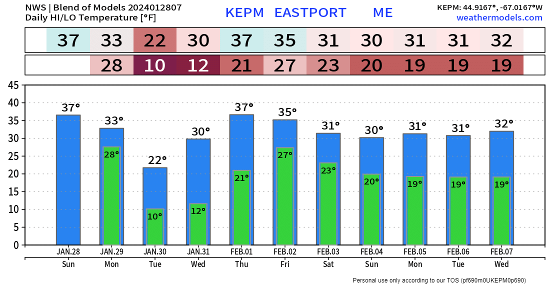
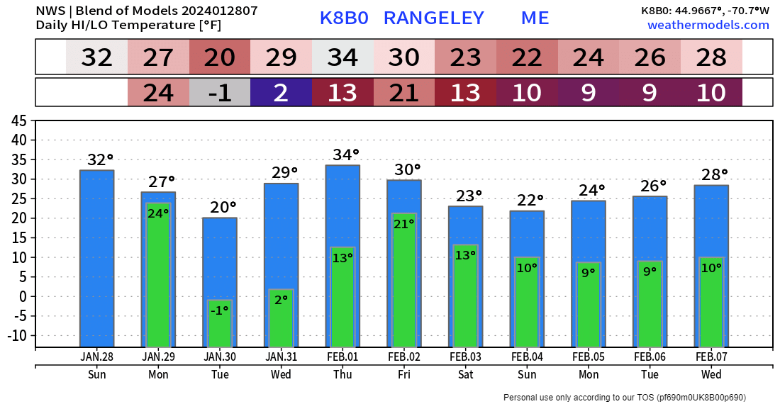
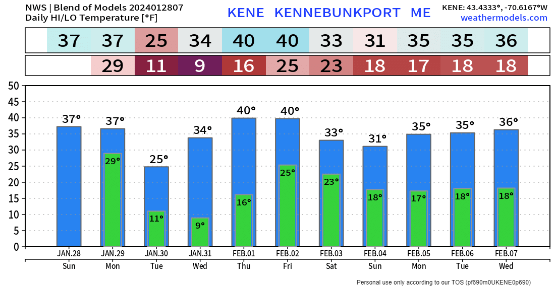
Before I get into the forecast and extended outlook, I want give a heartfelt thank you to the generosity of individuals and businesses who have chipped in to support the mission. It's because of you folks is the reason why I work as hard as I do to continue to learn, grow, and expand my efforts here. For every contribution that comes in, it emphasizes to me how important the work is that I do, and how it is appreciated. I don't profess to be God's gift to forecasting as there is no way I can win against Mother Nature, but I make it my passion to make sure you are aware of potential and that you are prepared for it. The day is getting closer where I retire from the day job and do this full time. For every donation and business who climbs on board, I inch closer to that goal. I am most grateful for your support. Living the edgeAll of the pieces are in place, and it is clear as a bell on this image. The parent low south of the Great Lakes is fizzling out as dry air has worked in to occlude (weaken) the storm and is transferring energy into the developing coastal low. The weak ridge to the north has set up with high pressure over Baffin Island racing in to hold that in place. A bit of a weather nerd note here, it's rather impressive to see the dry air from the weak ridge wrap completely around the parent low. That is a clear indication of a spoiler alert. Storm track southeast of benchmarkTo the east, Friday's storm is past maturity and is beginning to weaken. High pressure that has dominated the pattern for a week has been beaten down and is heading out. The storm on the way is running into the weak ridge and then gets shoved to the southeast as the high advancing in from the north cuts it off. Timing, snowfall amounts, and windSunday 1 PM (18z) to Monday 1 PM (18z) 1-hour snowfall rates- Snow moves into York County in the 3-5 PM window. There could be some mixing at the onset along the shorelines, which may bring a period of wet snow, a light mix of junk, and possibly rain. As dynamic cooling sets up, that changes to a drier snow heading into the evening. Precipitation expands into the western mountains over into eastern areas overnight. Some pretty impressive snow bands lurk just offshore in the wee hours of Monday morning, which adds intrigue as a slight jog to the north on track could bring bonus inches to the shorelines, and cause forecast amounts to bust on the high end. There could be some brief whiteout conditions with the wind whipping areas of more robust snowfall. Be aware of that if travelling overnight. The steady snow is expected to taper off from northwest to southeast Monday morning, with all but snow showers remaining heading into Monday afternoon. Any wobbles in track to the north increase totals, a jog to the south lessens the amount. York County is likely to see the most, unless the banding offshore noses inland enough to bring additional accumulation to MidCoast shoreline areas and the islands. The morning commute looks messy for the more populated areas in the south, but by midday, the roads should be in fair shape. No changes in thinking on forecast wind speeds. The breeze is expected to continue through the day, then relax heading into Monday night. There could be some areas of blowing snow in the wide open areas, but nothing too crazy. No concerns for power outages, but there could be isolated ones. Outlook for the weekSunday 7 AM (12z) - Saturday 7 PM (00z Sunday) - A look at the 500mb (~20,000 ft) steering level of the atmosphere height anomaly here shows the Sunday / Monday storm working in tandem with the approaching high setting up a deep trough over the Atlantic. That brings a cool start to the week. A ridge moves in midweek to warm the region up a bit. Troughing works back in later in the week which sets up the opportunity for some white gold over the north. A most impressive ridge sets up over central Canada heading into the weekend. There is potential for an ocean storm next weekend. How close that gets is one to stay tuned for. Overall temperatures average out a bit on the warm side for the week as compared to normal for this time of year. The region will be on the dry side after Monday's storm passes through until later in the week. POSTING STATUS: Check the Facebook page Monday and Tuesday for updates there. I will post an update here on Wednesday morning to preview the weekend. Independent - No hype - Honest - Dedicated - ReliableThank you to Allspeed Cyclery & Snow in Portland, Downeast Aerial Photography in Rockland, Dutch Elm Golf Club in Arundel, and Sunrise Property Services in Bridgton, for partnering with Pine Tree Weather. Special thanks to all the individuals and businesses who financially contribute. I sincerely appreciate your support. Always have MULTIPLE ways to receive weather alerts. Stay updated, stay on alert, and stay safe! - Mike PRINT MEDIA: Feel free to quote and cite my work here for your stories. Please give me the professional courtesy of knowing that you are referencing my material so I can read your final product and acknowledge it on my media and link it on the PTW IN MEDIA page here on the website. Feel free to send me a message via the Facebook page or Twitter (X) to get my phone number if necessary. Thank you! NOTE: The forecast information depicted on this platform is for general information purposes only for the public and is not designed or intended for commercial use. For those seeking pinpoint weather information for business operations, you should use a private sector source. For information about where to find commercial forecasters to assist your business, please message me and I will be happy to help you. |
Mike Haggett
|

