
Another Sou'easter storm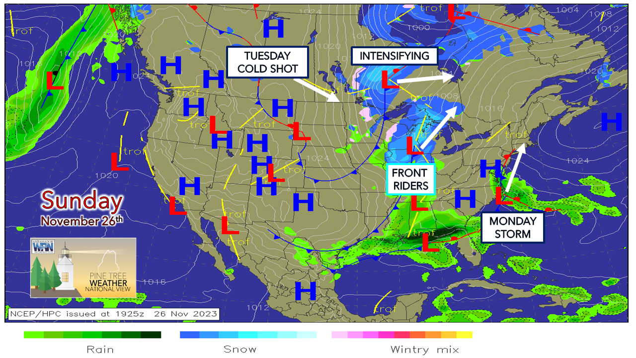 The Sou'easter storms are like a bad song on repeat here as of late. Fortunately, they haven't been too bad. There is enough cold air around to keep snow on the hills, but they cause forecasters fits in figuring out where the rain/snow line forms and how much frozen precipitation falls. Seeing the jerk west in track early Sunday morning and knowing wind and coastal implications would become more of an issue, I waited to see what day guidance had to offer before fine tuning the forecast. The parent low north of Lake Superior and the trough forcing it is what will scoop up the systems to the south and east and bring them to Maine overnight into Monday. Timing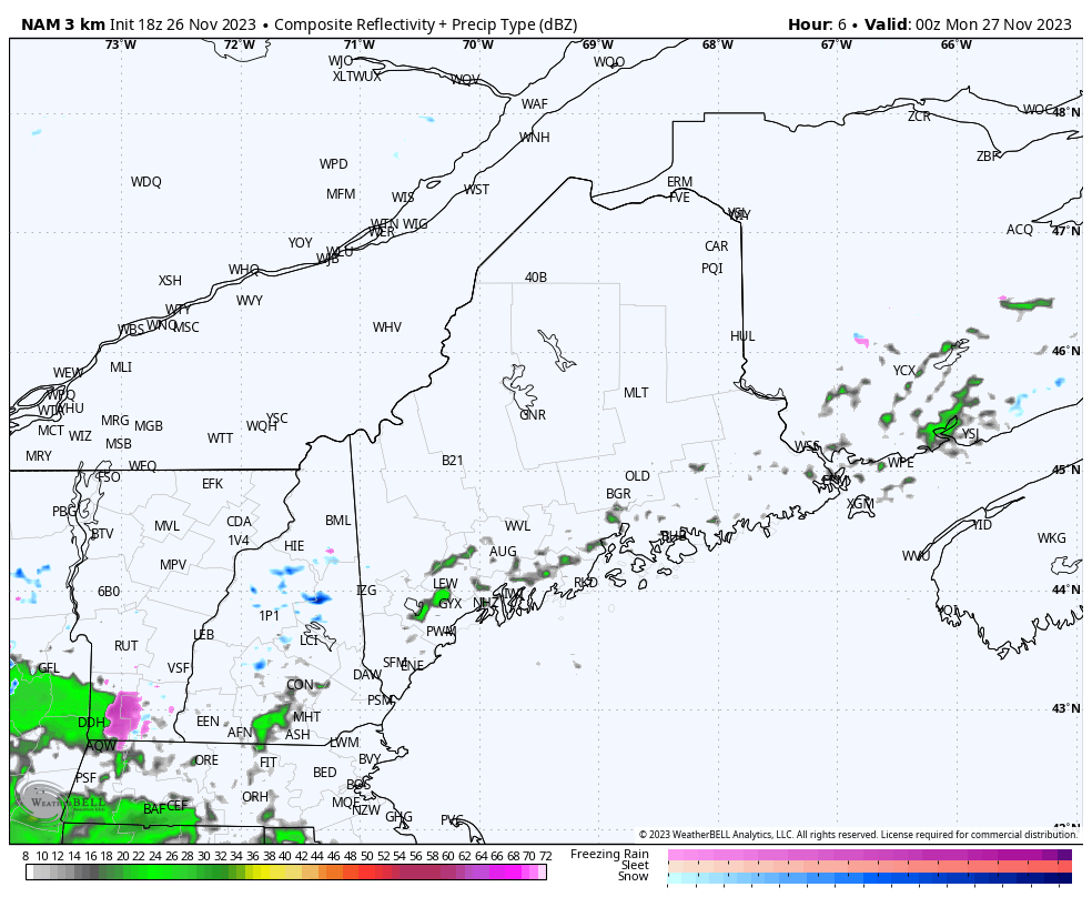 Sunday 7 PM to Monday 4 PM - The good news this will be a quick hitter. The morning commute is going to be rough with wind, snow over the interior and heavy rain moving through south of the mountains. Where the rain/snow line forms could see intense precipitation rates on either side of it. The strong southeast winds will be hurling water into the region as the parent low hauls off the moisture straw of the low that will slice southwest to northeast through the region. Precipitation ends over the south in the morning, west and east by around midday, and over the north by mid-afternoon. After that, the blow dryer comes. Precipitation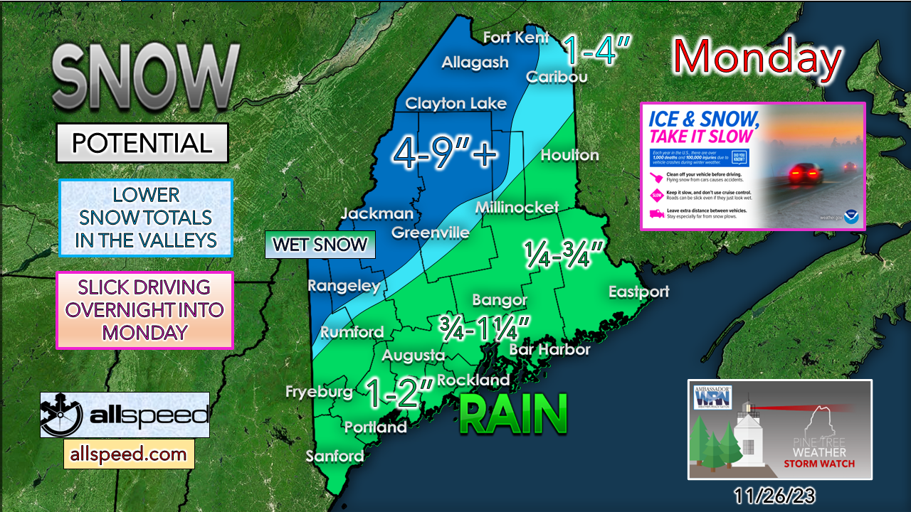 Another sharp gradient storm between the snow and the rain. With the track coming up though York County to Caribou and the warm air associated with it, this is shaping up to be more of a sloppier affair for western areas. Snowfall is likely to be elevation dependent as well. Valleys in the 4-9" region may only get an inch or two of slush, where the peaks cold to snow longer. Guidance is mixed in solutions of whether it stays all snow or ends with rain, so it may end with a bit of liquid, and I can't rule out a bit of a sleety / icy mix as well. Southern areas get hit with heavier rainfall, with lesser amounts over central, and less than that over eastern areas. Given the recent rain, there is the risk of some minor flooding. Downpours could cause standing water on the roadways, and the risk of urban street flooding if storm drains clog from leaves and litter. Be advised that any puddles will freeze up on Monday night, which may cause some black ice in spots. Wind advisory up and down the coast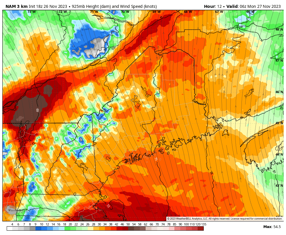 Monday 1 AM to 1 PM - Wind speeds are expected to pick up as the low-level jet (above) howls overhead. Peak wind gusts are expected over southern areas between 5-8 AM, MidCoast from 7-10 AM, DownEast from 7 AM to noon. Since DownEast areas could deal with the wind longer, that region has the best chance for power outages. The worst of the wind passes east into the Bay of Fundy by early afternoon. 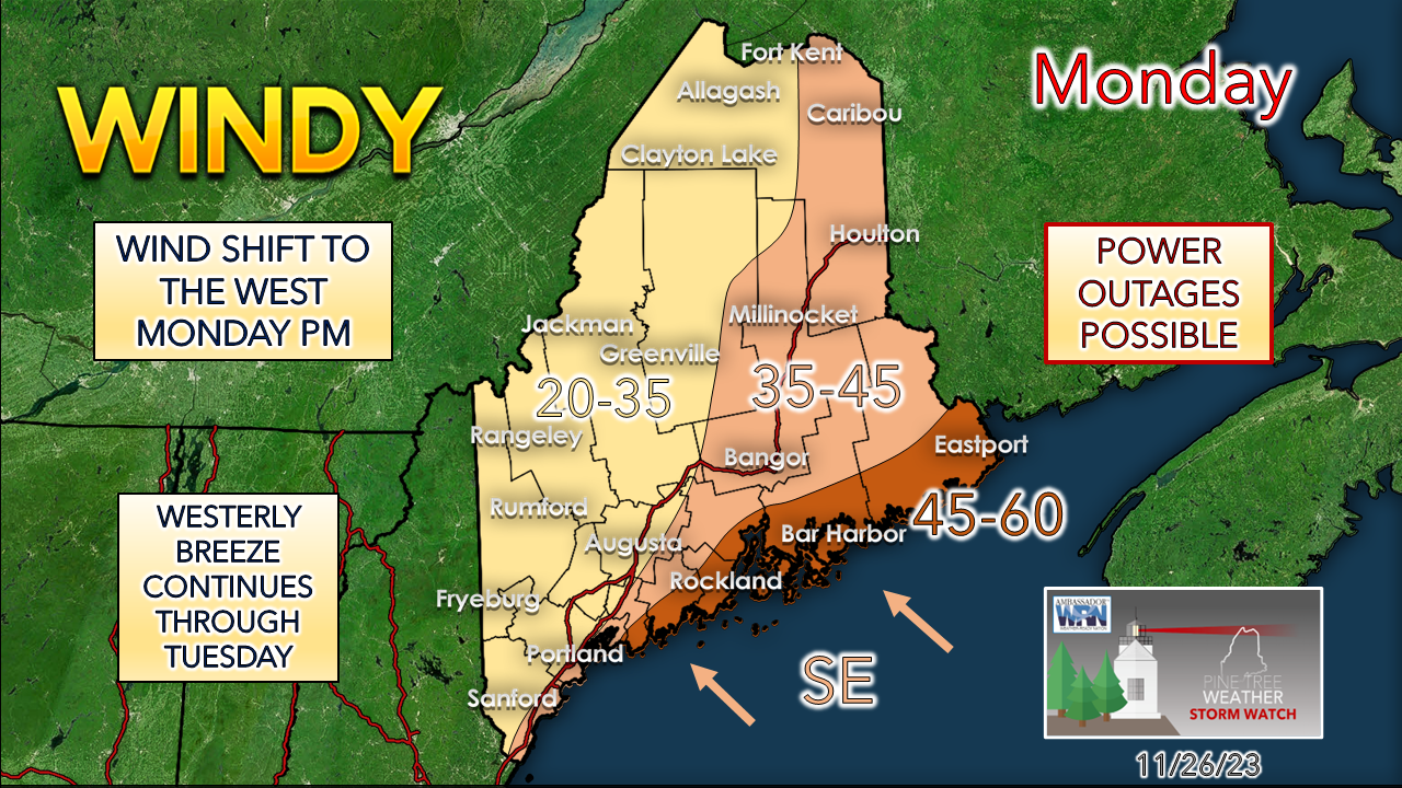 With the wind and heavy rain south of the mountains comes the risk of vertical winds along with the horizontal. Blowing debris along with flying trash cans is all a part of it. If Monday is your day for refuse pick up, the streets could turn into an obstacle course. Folks with holiday decorations outside need to secure them Sunday night. Coastal flood advisory from 8 AM to noon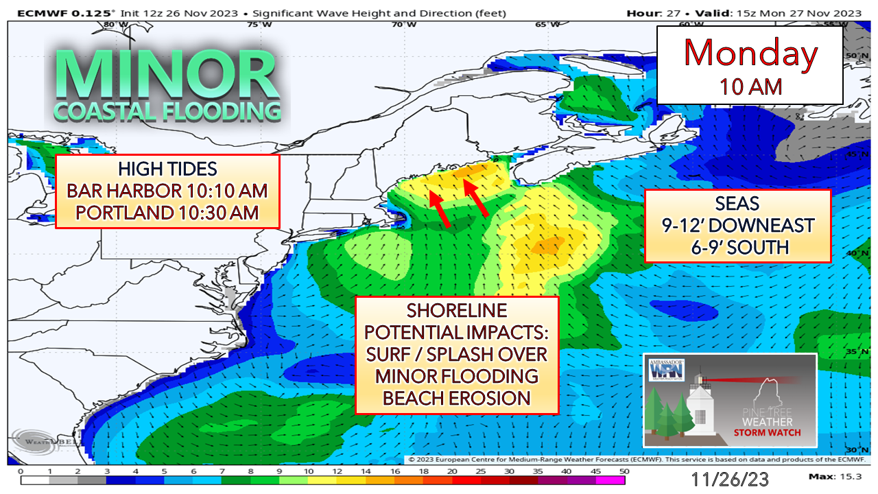 The peak of the surf and surge is expected to arrive at the time of high tide in the 10 AM hour. Full moon is Monday so astronomical tides will be at the high point. Some shoreline abuse is expected along with some minor flooding. With the wind shifting to the west after the low passes through, that will help blow out and dry out any low-lying areas that flood. Expect the shoreline roads susceptible to ocean debris to have that to clean up.  Outlook through next weekendTuesday and Wednesday appear breezy and cold. We'll get a bit if a break from the breeze on Thursday. Another storm is expected roughly Friday / Saturday, with details on that to ironed out as the week unfolds. 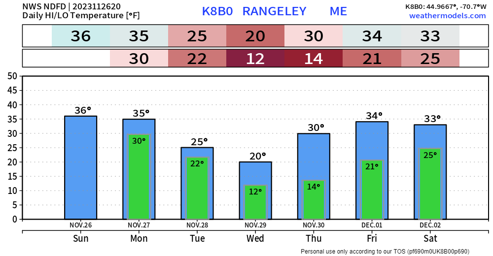 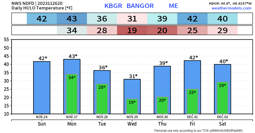 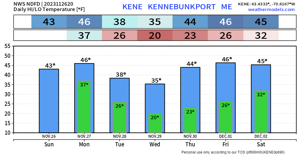 PTW is 80% funded for 2024... please help me pay the bills If you appreciate independent, unbiased weather information, please support my efforts. I can't do this without you! Stay updated, stay on alert, and stay safe! - Mike NOTE: The forecast information depicted on this platform is for general information purposes only for the public and is not designed or intended for commercial use. For those seeking pinpoint weather information for business operations, you should use a private sector source. For information about where to find commercial forecasters to assist your business, please message me and I will be happy to help you. |

Mike Haggett
|


