
The storm is likely to bring a punch to Atlantic Canada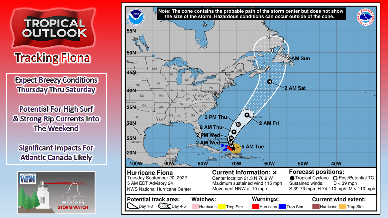 For my followers in the Canadian Maritimes, it's time to prepare for Fiona now. Many areas are likely to deal with strong wind that will surely knock hydro (power) offline and could be out for several days. Rain in the range of 25-75mm (1-3") with some areas in the 125-150mm (5-6") range is fair bet at this point. While there will be some changes in the forecast, a high impact event from this storm is high confidence. Check and fuel up your generators, stock up on supplies, have batteries for flashlights and to charge phones. For Maine interests, the storm will be close enough to bring breezy conditions and surf to the region.  With all due respect to the National Hurricane Center for their incredible forecasting ability, the one thing that needs improvement is to incorporate that into a map that combines that with areas of potential impact. For that, I appreciate the US Navy forecast outlook that focuses on the wind field around the system and shows the areas that could see impacts from it. The blue shaded area shows potential for winds ≥ 34 knots which encompasses 90% of the Canadian Maritimes. Folks in far eastern Maine are also noted as seeing that potential. The short-term hurricane force and tropical storm force wind fields on this map will eventually include Atlantic Canada over the next couple of days, without a doubt as the warm core nature of the storm should hold potentially as far north as 45° latitude. For now, the forecast shows the storm center to come as close as 460 nautical miles of Bath Iron Works, 480 of the Portsmouth Naval Shipyard, and 195 to Halifax, Nova Scotia. This is NOT the final answer. 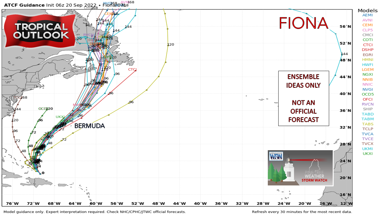 Ensemble ideas as of 2 AM Tuesday show a heavier eastern trend which may spare Cape Breton of a direct hit, but not so much for the Port-Aux-Basques region in Newfoundland. This is NOT a guarantee. The key here is the timing of a cold front that will pass through Maine on Thursday.  Wednesday 8 PM to Saturday 8 PM - The cold front that passes through Maine on Thursday is the main steering mechanism for what happens to the east. Fiona splits the goal crease on the inside upper-right top shelf corner to the west of Bermuda Friday morning and then heads over warm water of the Gulf stream towards Nova Scotia. Please take the European deterministic solution with a grain of salt here for now as it may be biased with the negative tilt of the upper-level trough that steers the storm towards Cape Breton; this track is NOT certain yet. Where the storm ends up will have much to do with this frontal boundary.  Thursday 8 AM to Sunday 8 AM - The 10m sustained windspeed forecast from the GFS model shows the strongest winds on the eastern flank of the storm, which is typical, and why the track is going to dictate which areas will receive the brunt of it. Keep in mind that as the storm tracks above 30° latitude that the wind field will expand as the storm begins its transition to extra-tropical. Given the variances in potential track ideas, this is why the Navy included far eastern Maine to potentially see wind speeds ≥ 34 knots. For Maine interests, expect a stiff breeze on Friday as the northwest wind increases with Fiona's passage to the east, with it slowly subsiding on Saturday.  Thursday 8 AM to Sunday 8 AM - The combination of the passage of the frontal boundary and Fiona will dump cold air into much of the eastern United States as the Canadian Maritimes in its wake. Frost concerns are possible Saturday morning over interior areas IF the wind subsides in time. Expect temperatures to modify to near normal on Sunday as a southwesterly flow returns ahead of the next system that brings rain to the area early next week.  Wednesday 8 PM to Sunday 8 PM - Seas begin to build on Thursday and reach their peak for the Maine shorelines on Friday. The shorelines of Newfoundland and northeastern Nova Scotia could see some epic surf with waves 40'+. While the surf from Earl was uninspiring to Maine overall, given the projected strength of Fiona and closer track should bring higher waves and potential for beach erosion. High tide at the 9 AM Friday hour could be one to watch for some potential splash-over in the low-lying areas. For now, the surf forecast is in the 7 to 9-foot range for Maine, but that could move upwards to double digits if the track moves to the west. Thank you for supporting this community-based weather information source which operates by financial contributions from people like you. Stay updated, stay on alert, and stay safe! - Mike NOTE: The forecast information depicted on this platform is for general information purposes only for the public and is not designed or intended for commercial use. For those seeking pinpoint weather information for business operations, you should use a private sector source. For information about where to find commercial forecasters to assist your business, please message me and I will be happy to help you. |

Mike Haggett
|


