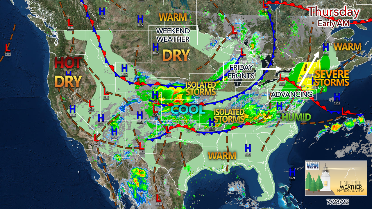
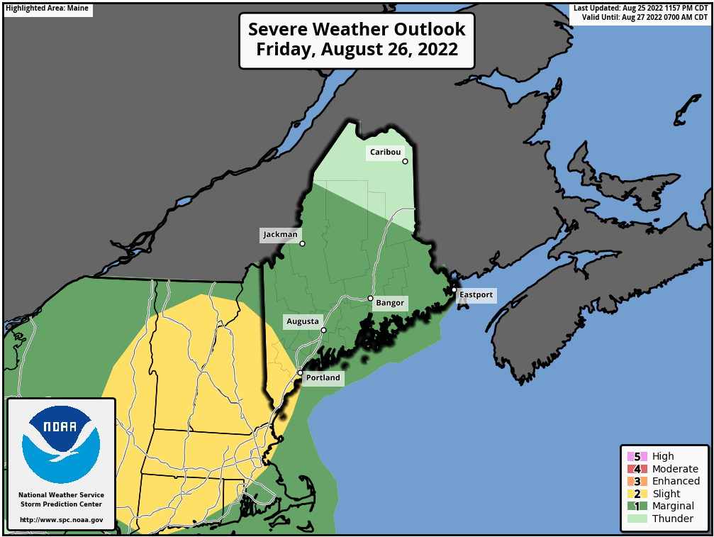
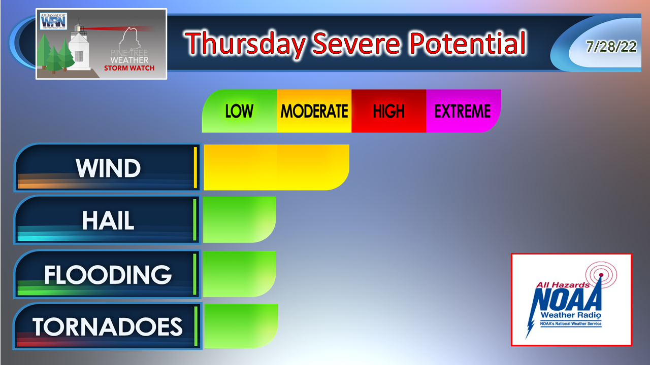
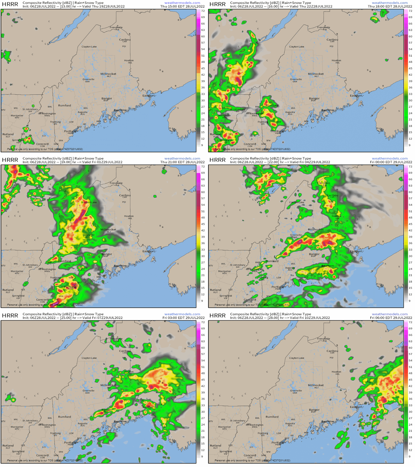
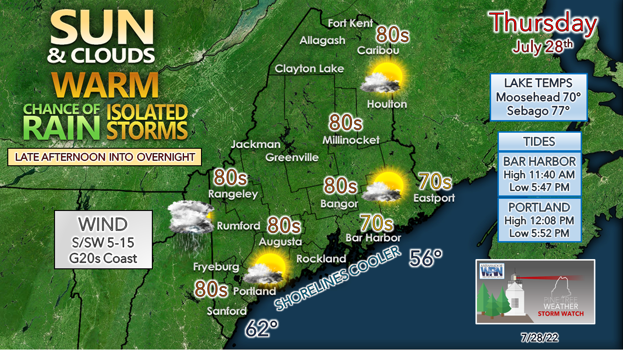
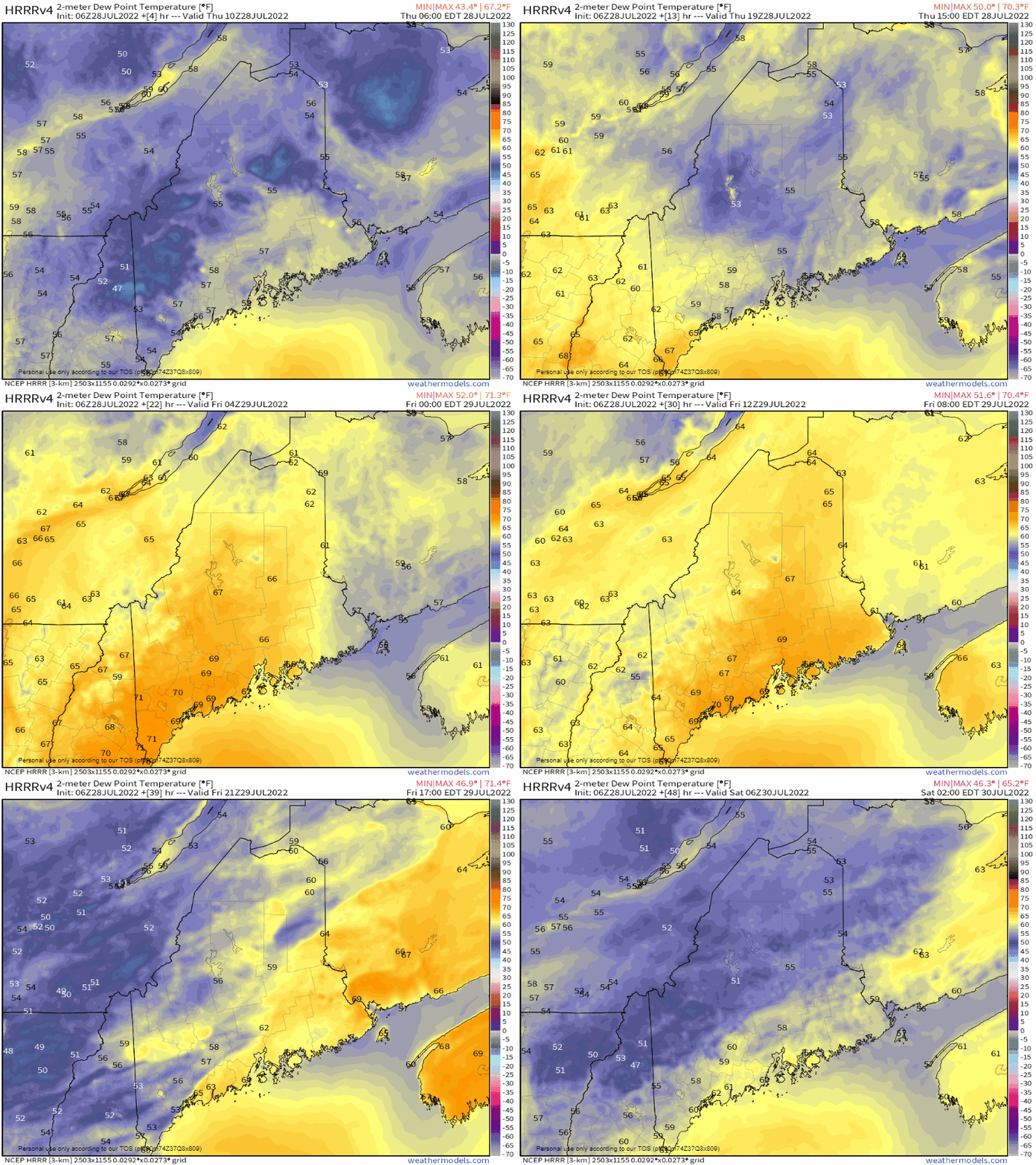
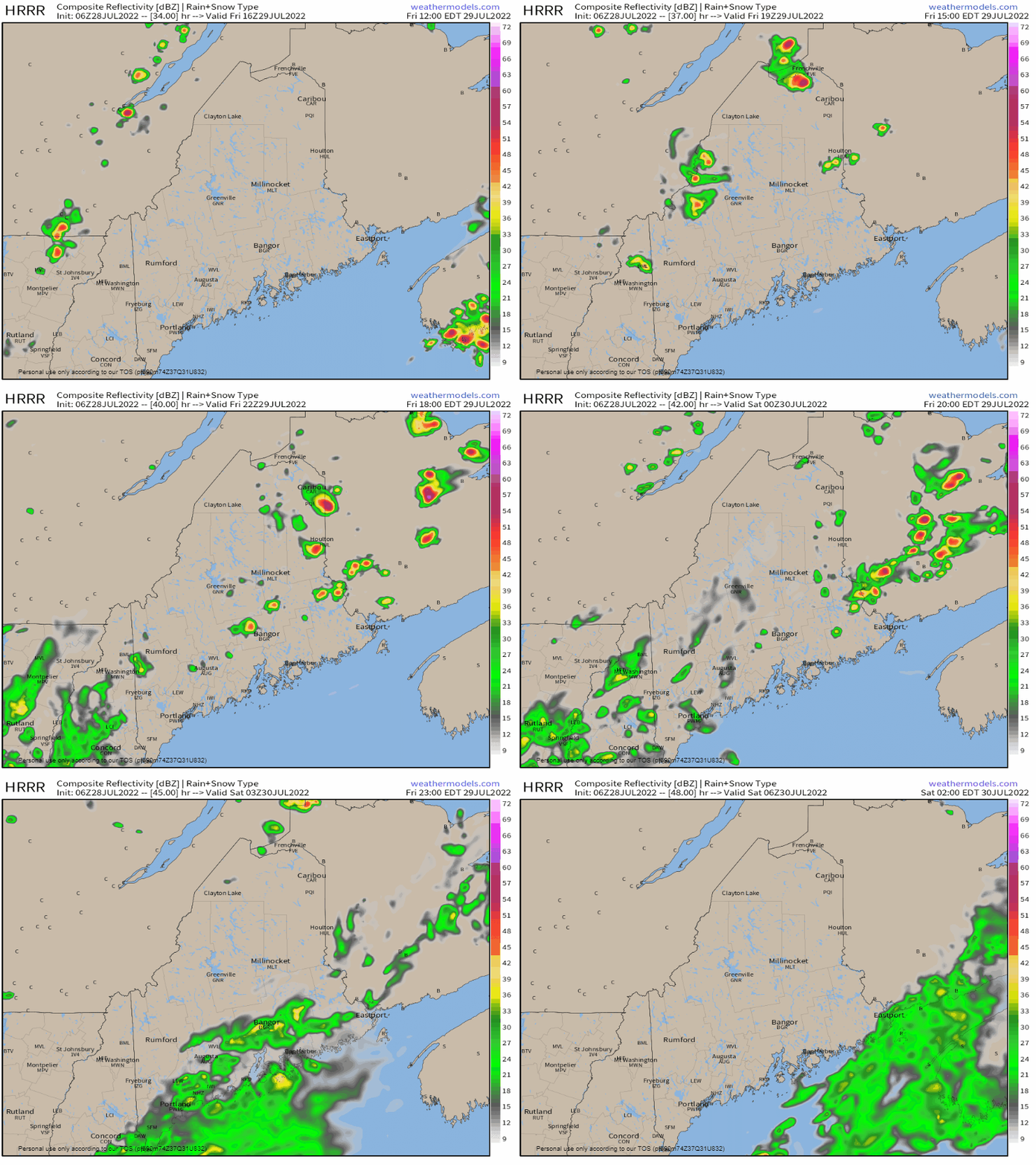
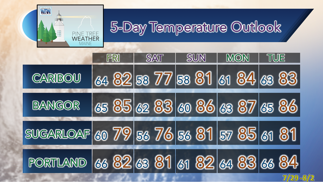
Warm front on the wayThe recent two-day break from the humidity hits the pause button as a warm front from the southwest moves into the region on Thursday. Dewpoints in the 50s to low 60s surge into the upper 60s to low 70s Thursday night. A pair of cold fronts pass through the region, one early on Friday, another in the late afternoon, which will take the moisture to the east. For those looking at the longer term, please note the hot conditions over the Pacific northwest. That is a strong ridge that is developing there and is expected to crawl eastward across the country next week. A "ring of fire" is expected to set up over the Midwest by late next week, which could bring a blast of heat to the northeast by next weekend. Strong to severe storms possible ThursdayThe 06z / 2 AM Day 1 Outlook via Storm Prediction Center upped the ante for severe storm threat over central and western New England. I mentioned in Wednesday's post that warm fronts are something I watch closely, especially this time of the year, for surprise severe potential to the unsuspecting. This is a sneaky one. Given the timing of the approaching warm front, the main threat for western and southern areas of the state appears to be damaging wind. Just to the west of the state, the threats for hail and the low risk of tornadic activity increases. Thursday 3 PM to Friday 6 AM - The main threat for strong to severe storms comes in the late afternoon into the early evening hours as the front approaches the area. Storms that form over Vermont and New Hampshire are expected to run into some stiff wind shear as they cross over into Maine, which minimizes a widespread severe threat. That said, a supercell or two over western and southern areas cannot be ruled out, and with those storms comes an elevated risk for damaging wind, hail, torrential rainfall, and the outside chance of a brief tornado. Heading into the overnight hours, the threat of thunder continues as the tropical air mass continues its northeasterly surge. I can't rule out isolated strong to severe storms that may disturb sleep for some. Showers and storms end from west to east overnight into early Friday as the warm front heads into the Canadian Maritimes. Fingers are crossed for some localized drought relief. This may be our best chance for rain at any time over the next week at least, outside of some shower activity possible on Tuesday. For the early birds, pockets of fog are possible around the lakes, ponds and bigger rivers to start off, but that dissipates by mid-morning. For eastern and northern areas, a dry day is on tap with showers and storms not entering those regions until Thursday night. Folks headed for the beach can expect more space in the afternoon, but stay aware of the storm threat later in the afternoon. A surge of moisture in, then quickly departsThursday 6 AM to Saturday 2 AM - This sped up loop of dew point temperatures shows the surge of tropical moisture moving in with the front Thursday into Friday. A pair of cold fronts pass through the region Friday, one clearing out most of the humidity, then a trailer that kicks out whatever remains. Moisture levels return to comfortable levels for rest for all areas Friday night. Isolated showers with a storm possible FridayFriday Noon to Saturday 2 AM - Showers and storms appear isolated as the fronts pass through Friday afternoon. The HRRR model idea may be a bit overdone given the influx of dry air that enters into the region from the initial cold front, but the conditions may pop a shower or storm as the air column clears out. The jury is out at this point if a disturbance rides along the second front and brings showers for the coastal plain Friday night into early Saturday. At this point, the severe threat appears minimal in any storms that form Friday afternoon. This will be updated here Friday morning. Temperature outlook through TuesdayThank you for supporting this community-based weather information source which operates by financial contributions from people like you. Stay updated, stay on alert, and stay safe! NEXT UPDATE: FRIDAY - Mike NOTE: The forecast information depicted on this platform is for general information purposes only for the public and is not designed or intended for commercial use. For those seeking pinpoint weather information for business operations, you should use a private sector source. For information about where to find commercial forecasters to assist your business, please message me and I will be happy to help you. |
Mike Haggett
|

