|
With the holiday approaching, I expect updates here to be inconsistent. Sean and Madelyn will begin morning Facebook updates starting Tuesday (12/21). I may drop a light afternoon discussion here pending on how my workday goes. My family and I will be out of town over Christmas weekend. With a potential storm coming, we will do our best to prepare you for it leading up to the latter part of the week. A cool start to the week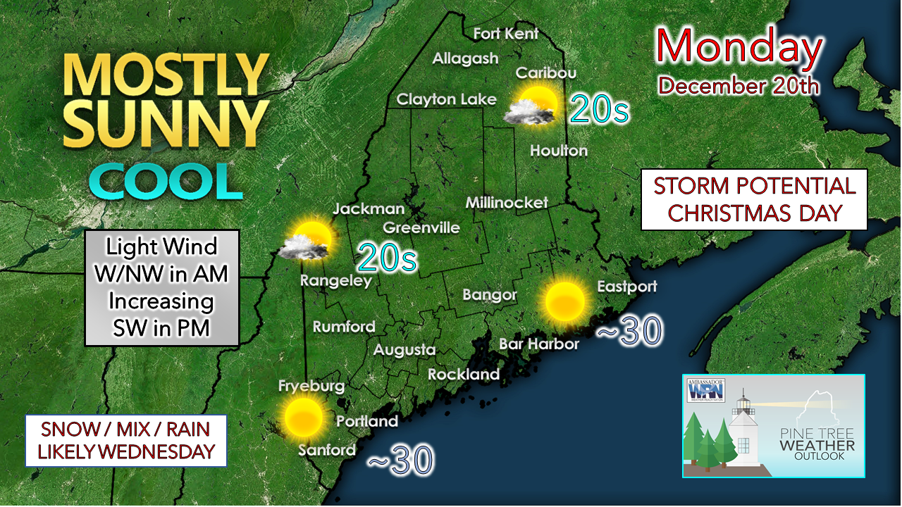 A fair and cool final day of the autumnal equinox for 2021 as high pressure controls the day. The high slides to the east today and a southwest flow develops this afternoon. A weak cold front approaches the region on Monday night. Snow showers are possible in the mountains and far north overnight heading into Tuesday morning, with a dusting to 1" possible. Expect a breezy start to Tuesday as high pressure works into the region. Cold air advection keeps the mountains below freezing for the day. Coastal areas could make a run at 40° thanks to the warming downslope wind. The breeze slacks off late in the day heading into Tuesday night. Slick driving potential for Wednesday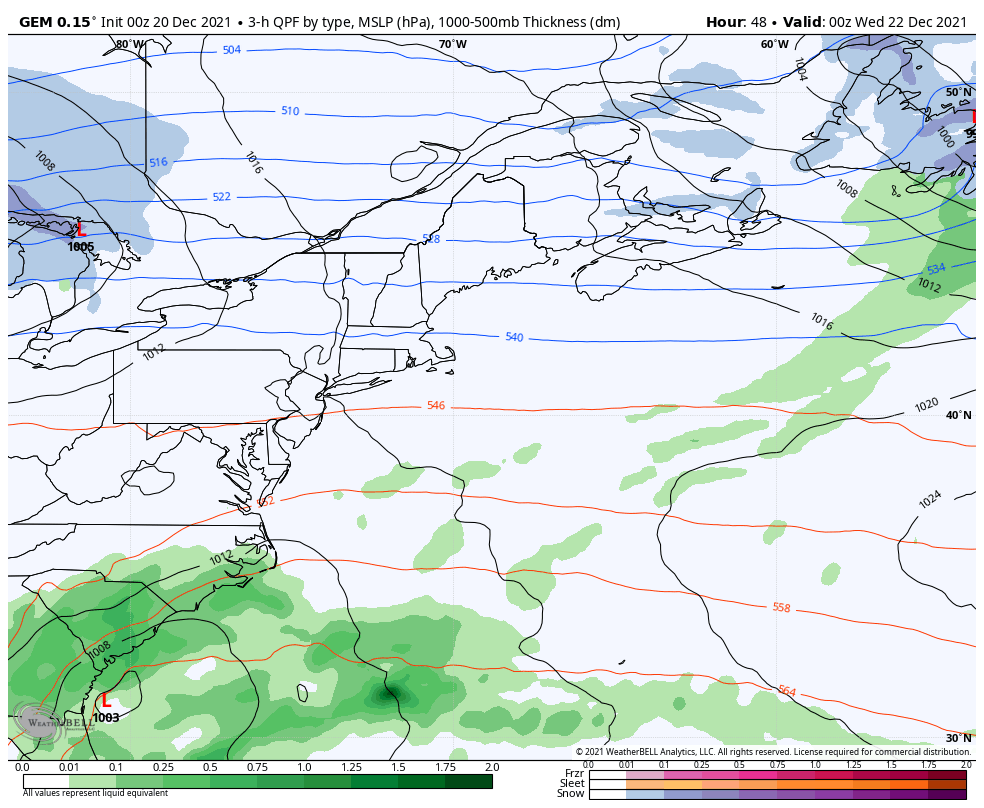 Tuesday 7 PM to Thursday 7 AM - An ocean storm fires up over the southeast as the polar jet stream cuts across the Great Lakes heading into Wednesday. The polar jet energy interacts with the subtropical jet energy from the ocean storm and sets up an inverted trough scenario. Timing of the interaction will dictate outcome. There is a fair bet at this point where light snow is possible over the interior Wednesday morning, with freezing rain & drizzle possible for the southwest coast up into the foothills. Short term ideas also indicate potential for a period of heavy snow for the interior but disagree as to where this occurs. Northern and eastern areas have the best chance for that at this point, but I can't rule out potential for the western mountains and foothills just yet. Regardless, slick travel is a strong possibility for much of the region for the Wednesday morning commute as it appears for now. Outlook heading into Christmas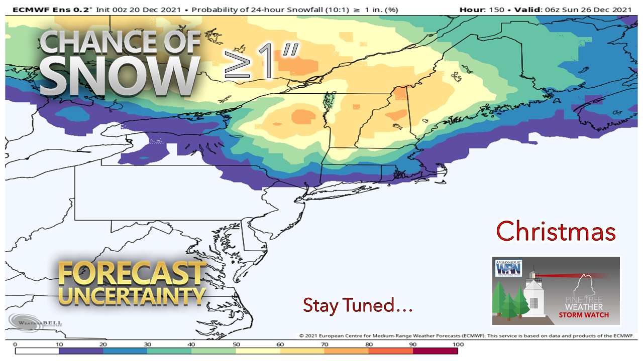 An upper-level trough and associated surface high bring cooler than normal temperatures into the region for Thursday. A weak ridge noses in for Christmas Eve which keeps conditions fair and continues cool. Christmas Day appears like a box of chocolates at this point with varying ideas between nothing and a solid thump. Seeing where the upper-level energy associated with this potential storm is over on the other side of the planet and may not be accurately read by radiosondes until late week, I suspect operational ideas to bounce around. For now, there is a chance for snow. For those who are planning to travel on Christmas Day, you may want to keep in mind the potential for slick conditions at this point and plan accordingly.  Temperature outlook through Christmas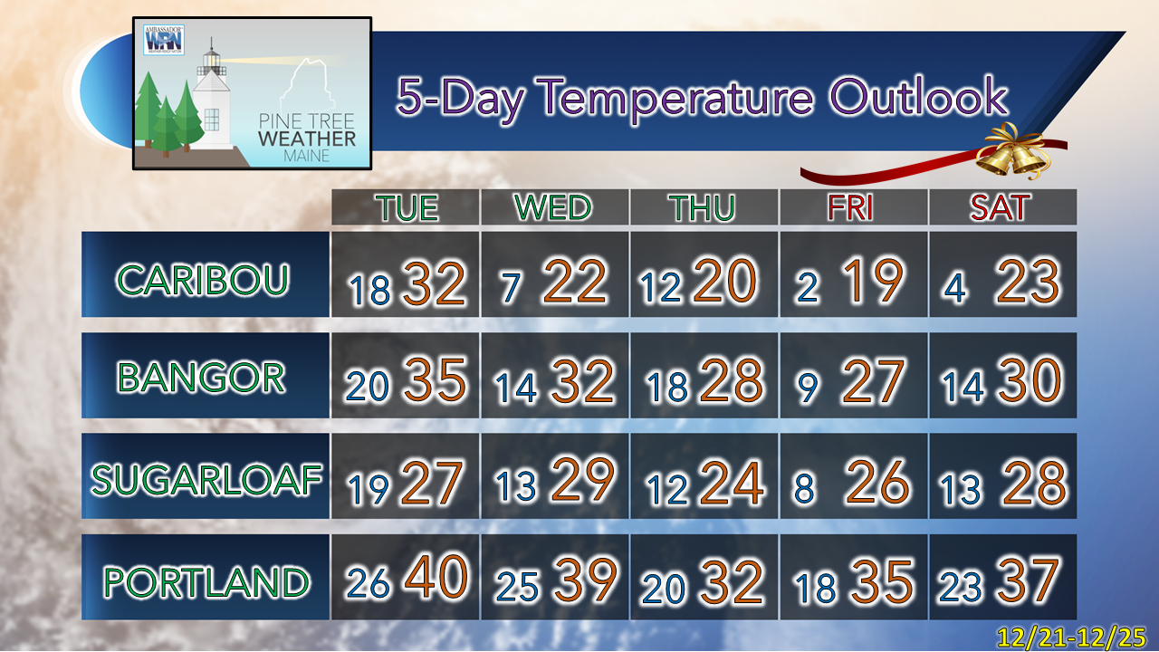 Winter Vehicle PrepIs your vehicle ready for the winter? Watch this brief video to know what needs to be in your emergency kit and how to winterize your vehicle. Be prepared to receive alerts and stay updated!
 For more information in between posts, please follow Pine Tree Weather on Facebook and Twitter.
Thank you for supporting this community-based weather information source which operates by reader supported financial contributions. - Mike |

Mike Haggett
|