
Winter Weather Advisories posted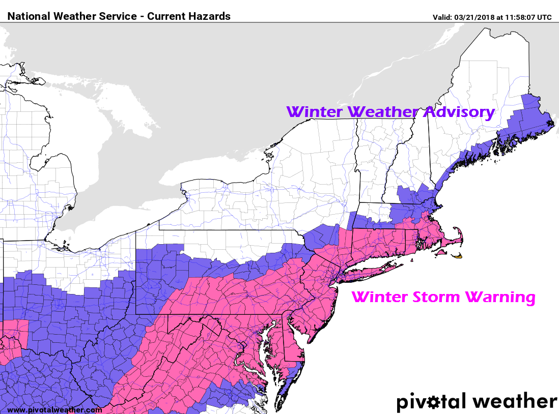 The National Weather Service offices in Gray and Caribou posted a Winter Weather Advisory for the shoreline counties for the snow event on the way. There could be some slick spots around Thursday morning, pending on how this plays out. Coastal areas remain on the fringe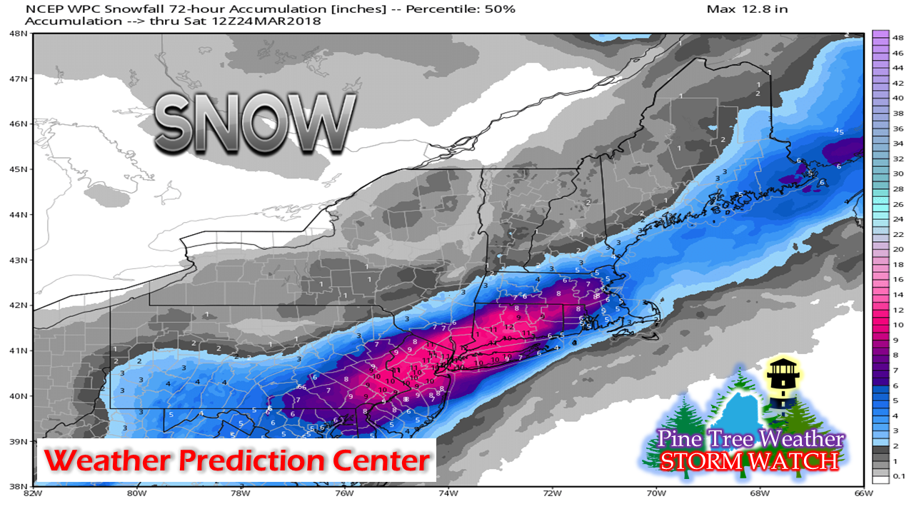 This chart here is from the Weather Prediction Center on their outlook for the event. Southern New England into the Mid-Atlantic get a solid snow event out of this. This will be disruptive for air and ground transportation. Expect cancellations and delays as the areas dig out over the next couple of days. It's a battle over dry air for accumulations I have talked about this ad nauseam for the past two days. I've smelled a bust from when models began pitching this storm idea last week. The European model came around to closely similar outcome in its runs yesterday and held it overnight. The American NAM and GFS models are hanging onto dear life that the snow will make it along the coast. I don't completely disagree with that idea, hence why I posted this snowfall idea last night...  From the NWS Gray Area Forecast Discussion at 6:50 AM Wednesday morning:
"Dew point depressions continue to be significant indicating very dry air draining south from northern Maine and New Hampshire. This dry air will determine how far north the precipitation will reach tonight, limiting any potential snowfall to southern areas." As a result, I am not changing anything. With dew points in the single digits above and below zero in the mountains and north (as of 7 AM this morning), a north/northeast wind funneling down even drier air as the storm gets organized today, this is going to be real tough for interior areas to get more than a dusting out of this south of Route 2 and east of Route 11 in northern Maine. I will monitor the storm today and will update on Facebook later on if necessary. I will be covering on Twitter all day long. As always, stay updated with NWS Gray and NWS Caribou. - Mike |

Mike Haggett
|


