
Two named tropical systems in the Atlantic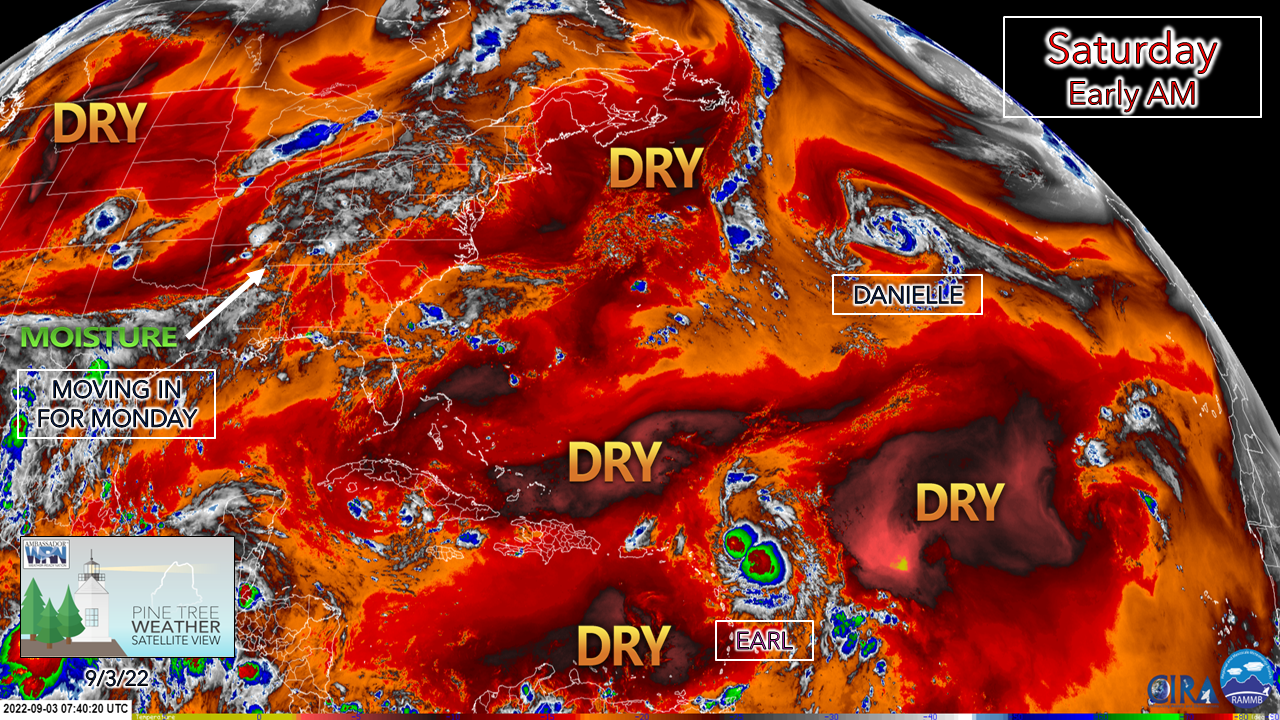 The 60-day drought of tropical activity ended with the recent naming of Danielle well to the east of Maine and in the overnight hours Earl was named near the Leeward Islands. If are an early bird like me and woke up to overnight lows in the 40s for the second straight morning for the first time since June 20th and 21st, the idea of tropical rain and humidity may not quite compute. While neither of these two storms are expected to be a threat to Maine directly, the reality is summer temperatures and humidity isn't over yet and fall storm season is coming. This recent break from humidity is about to change as moisture streams in from the southwest on Sunday, with rain likely for southern areas on Monday. 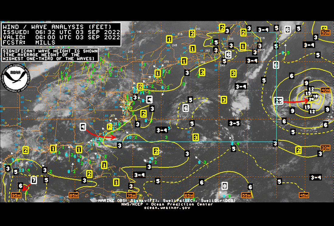 It does not appear at this point that the region will see much in the way of significant surf from Danielle as the storm drifts to the northeast over the next few days. The shorelines may see an uptick in long wave swells Tuesday through the end of the week, which the wave riding enthusiasts will appreciate.  The threats from hurricanes or strong fall storms can vary widely depending on where you live. It’s not just those along the coast that can experience significant, life-threatening impacts. Labor Day weekend is a good time to evaluate what you need to do to protect your home and family NOW, well before the storms. For more information hurricanes.gov/prepare The best day of the weekend is Saturday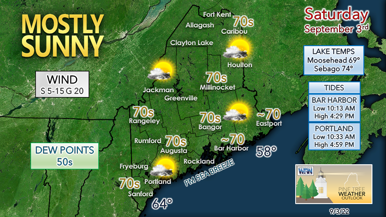 While it isn't exactly a beach day, it will be a great one. In fact, those living or spending time near the ocean may need a light sweater as the southerly breeze picks up in the afternoon. It will be a great day for whatever outdoor activity you like. Get outside and enjoy! We don't have too many of these days left. A chance for showers and storms for Sunday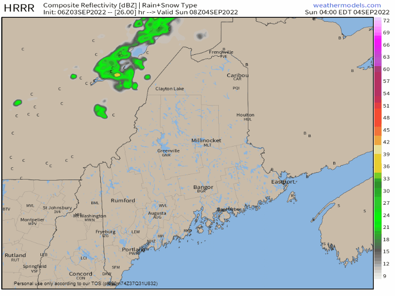 Sunday 4 AM to Monday Midnight - A cold front passes through the region through the day and brings the risk of a shower and/or thunderstorm. Northern areas have the best chance for activity in the morning, southern areas in the afternoon and early evening. For those engaged in outdoor activity, be aware you may get damp. The risk for severe storms is very low, but regardless, if thunder roars, head indoors to be safe. Humidity builds in for the second half of the weekend Saturday 2 AM to Wednesday 2 AM - A look at precipitable water values (PWATs) through the European model ensemble lens shows the cool, dry air moving to the east and a surge of moisture moving in from the southwest. In this loop, it shows the frontal boundary stalling out over central Maine by Monday morning. Northern areas above Houlton are expected to stay on the dry side of it, where to the south dew points will become elevated and could feel tropical by Sunday afternoon, especially for the coastal plain. How far south the front moves south before it stalls over Southern New England will dictate how much rainfall comes to southern areas Monday into Tuesday. 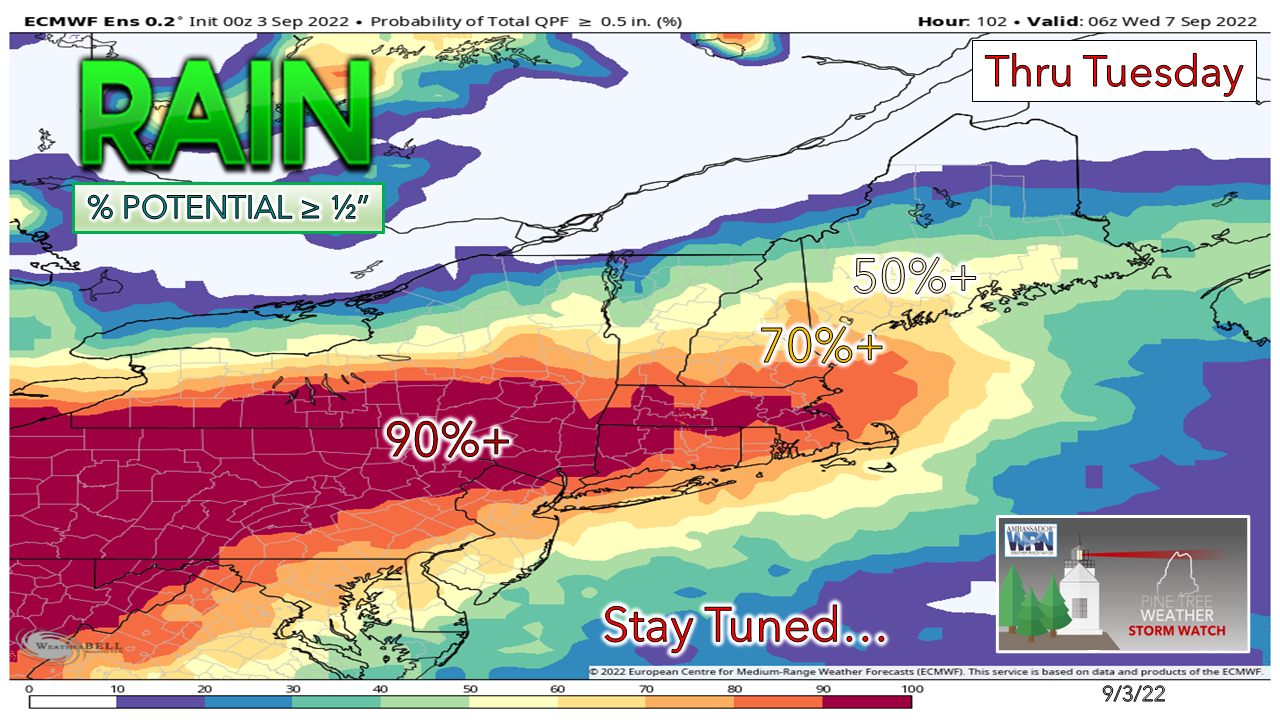 I see some ideas out there for the potential for a couple inches of rainfall for southern areas, but I am not sold on that notion just yet due to low confidence of where the front stalls out. I do believe this will be a York County Special where the highest totals are likely to be recorded. Shower chances are expected to increase Monday as disturbances along the boundary bring a surge of moisture in during the afternoon. Temperature outlook through ThursdayAfter a cool start to the week, temperatures are expected to climb heading into next weekend. 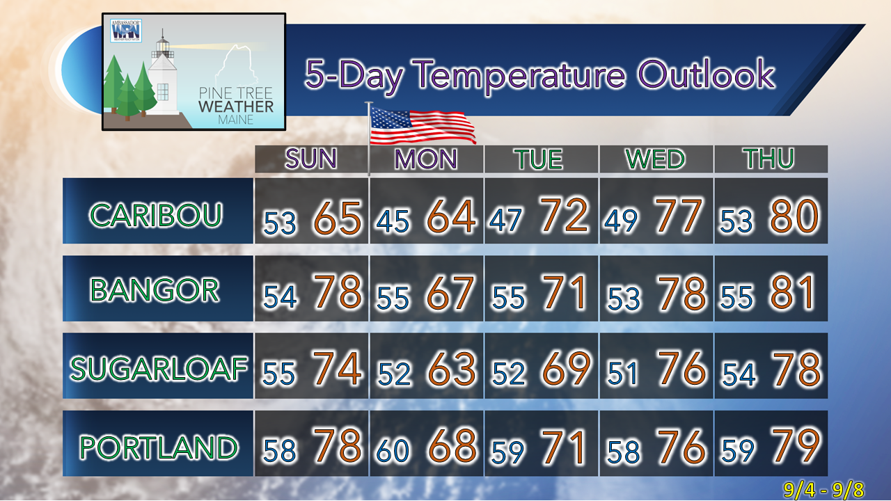 Thank you for supporting this community-based weather information source which operates by financial contributions from people like you. NEXT UPDATE: SUNDAY Stay updated, stay on alert, and stay safe! - Mike NOTE: The forecast information depicted on this platform is for general information purposes only for the public and is not designed or intended for commercial use. For those seeking pinpoint weather information for business operations, you should use a private sector source. For information about where to find commercial forecasters to assist your business, please message me and I will be happy to help you. |

Mike Haggett
|


