|
Hello again, everyone! Thanks again for hanging in there with me as I continue to work through school, the day job, and family. Updates will continue to be erratic, but as you will see as you read here, there isn't really a whole lot going on. Rest assured if stormy weather flares up, you will hear from me and you will know. While I am forecasting for other areas for school, I am keeping watch on what is going on here. Are you ready for spring? It's coming. A brush of precipitation Thursday and Friday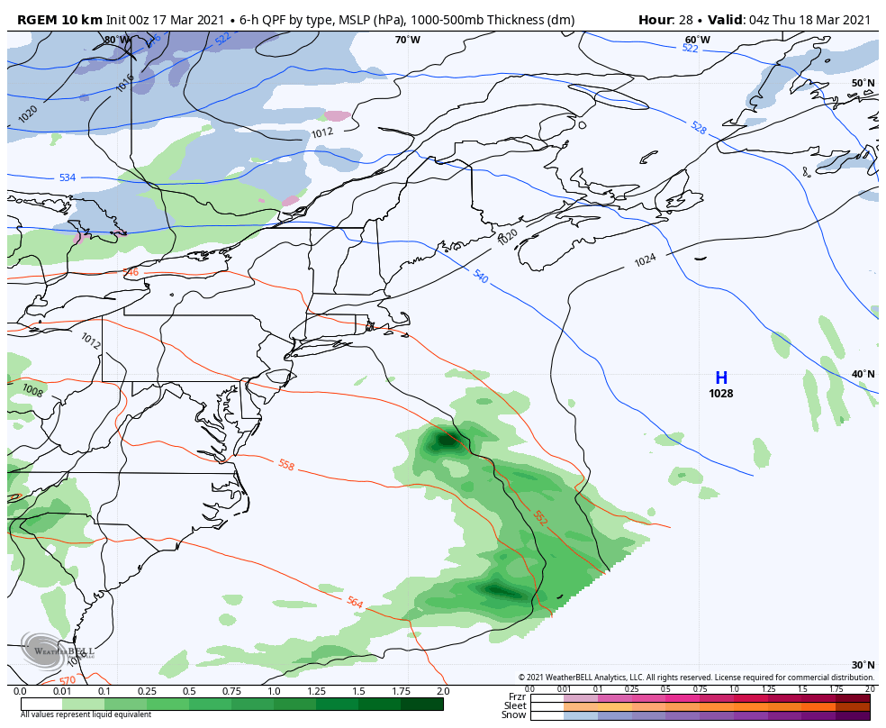 Two disturbances to work through the region. The first is Thursday for northern areas. A weak trough sets in from the northwest and a weak area of low pressure passes through the north country during the day. A cold front passes through the state Thursday afternoon. While this is going on, an area of low pressure works through the MidAtlantic region and brings rain to southern areas Thursday afternoon into the evening. As the cold front sags south, that cools the air column and switches rain to snow overnight into the wee hours of Friday morning. Precipitation ends by around mid-morning for coastal areas, and high pressure brings drier, cooler air in for a brief visit for the day. Warmer and more seasonable air works in as an upper-level ridge moves into the region Saturday and appears to be the key weather feature for the weekend and into next week. 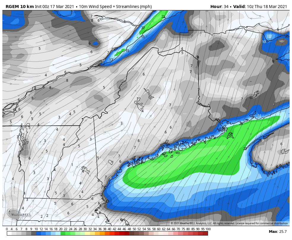 Looking at wind from 6 AM Thursday to 6 AM Saturday indicates the northerly flow feeding cold air into low pressure passing to the south. Wind speeds increase Thursday, peak by around daybreak Friday morning and then settle down in the afternoon into early Saturday. Wind gusts may reach the 20-30 mph level by Friday morning. Friday appears to be chilly one temperature wise with below zero wind chills to start off in the mountains and north, with single digits above of the south. As the wind settles and the sky begins to clear, the feels like temperatures modify to the positive teens and 20s by Friday afternoon. This will be the last day the subject of wind chills will be brought up anytime soon. 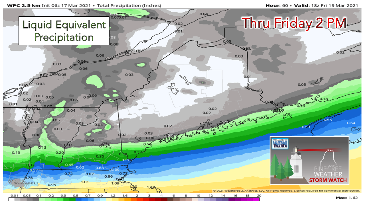 Overall, not a whole lot of precipitation here. Total amounts are generally light, with most of what falls along the coast being in liquid form. 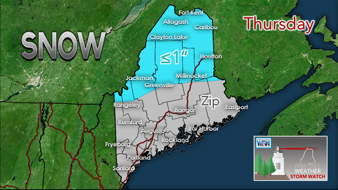 Snow amount for Thursday primarily in the north. The higher elevations see the most. Timing may cause some slick spots for The County for the morning drive, but it will be manageable. 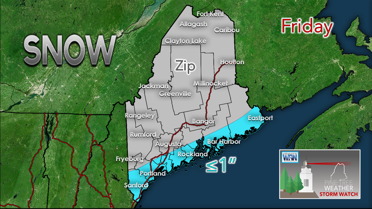 Slick spots are possible for the coast Friday morning as liquid freezes up. The main concern is for the roads less traveled. Treatment of the roadways are likely, but not likely a plowable event. York County appears to pick up the most from this one. There is an outside chance the region from Lebanon over to Wells and south may see upwards of 2" if the storm tracks a hair north, but for most of the region this appears to be an inch or less. Shoveling will be optional. If there are any changes of significance to the forecast, I will post a quick update on Facebook. Outlook into next week: generally dry and warm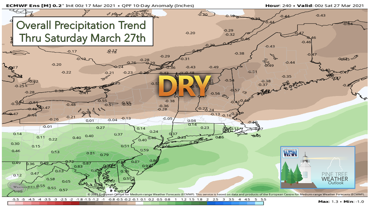 After the storms pass through Friday, the region sees an upper-level ridge set up shop and holds over the area through next week. Weak waves may travel along it which could bring a risk of light precipitation here and there, but any storms of significance stay away. The ten-day outlook for temperatures for the region indicates the mercury running 10-15° above normal starting Sunday through the week ahead. Cue mud season and prepare for posted roads and frost heaves! 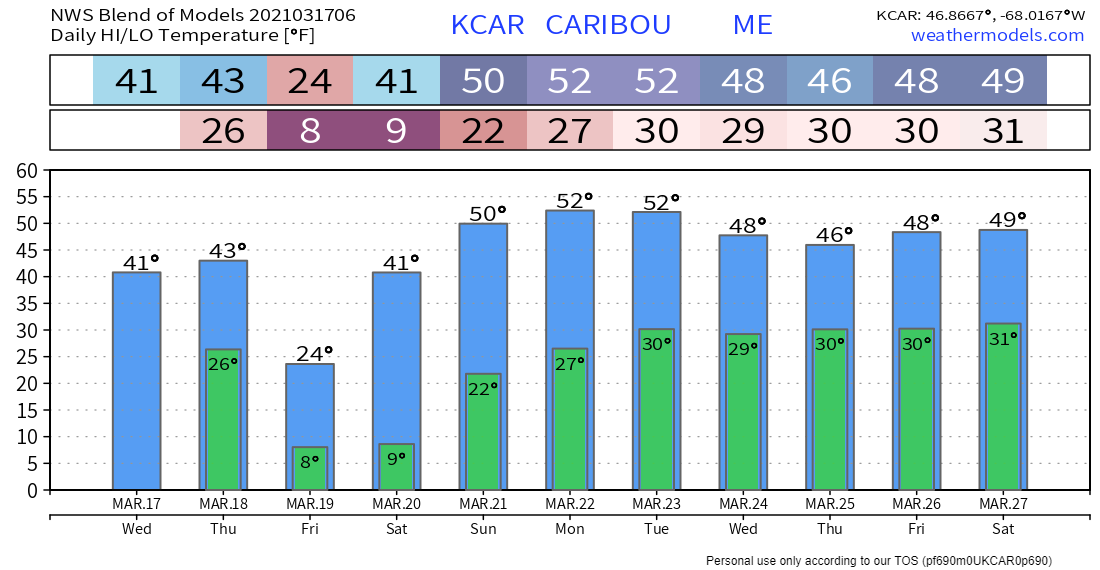 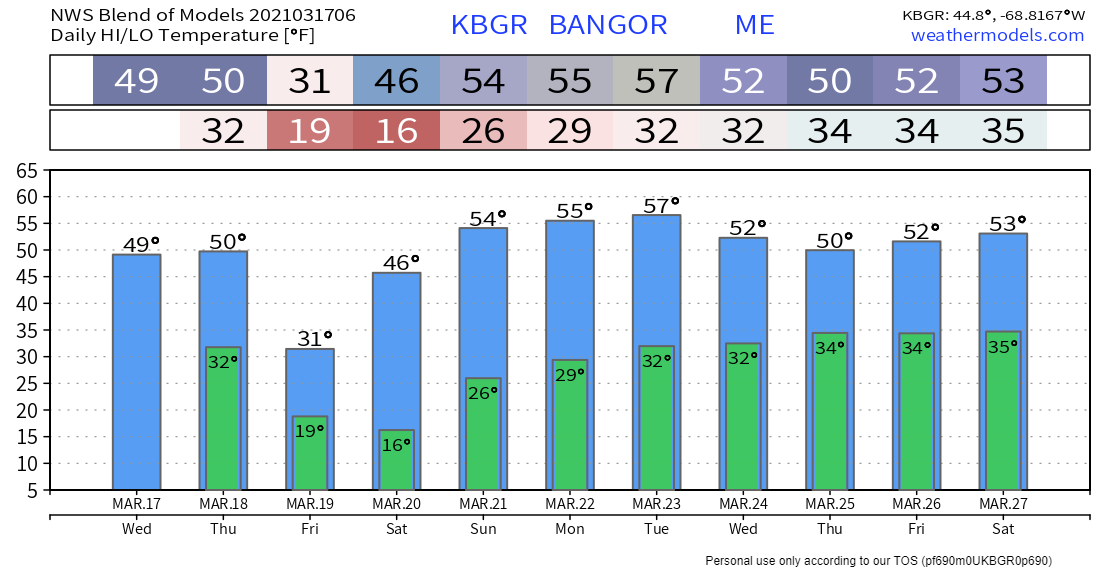 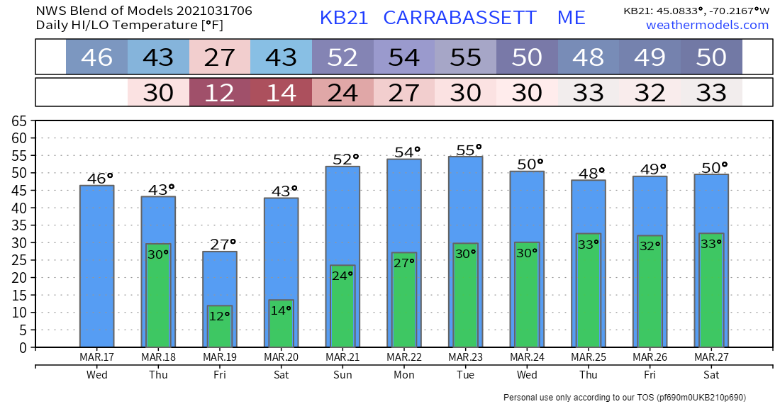 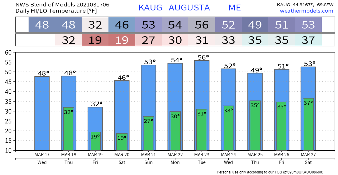 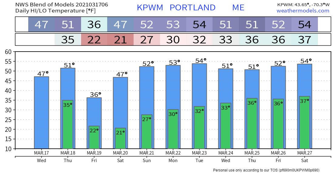 Help fill the gaps!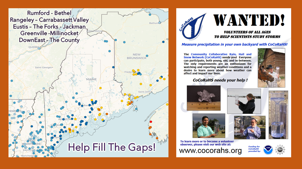 For folks in western, eastern, and northern areas, the Community Collaborative Rain, Hail and Snow Network could use your support! Verification of precipitation is especially important to improve forecasts. All ages can participate. Reporting is easy, and it takes little time to do. For more information, please check the CoCoRaHS Maine website. I would be more than happy to answer any questions you may have about the program! Be prepared to receive alerts and stay updated!
For more information in between posts, please follow Pine Tree Weather on Facebook and Twitter.
Thank you for supporting this community-based weather information source which operates by reader supported financial contributions. Stay updated, stay on alert, and stay safe! Thank you as always for your support! - Mike |

Mike Haggett
|