A few slick spots possible Friday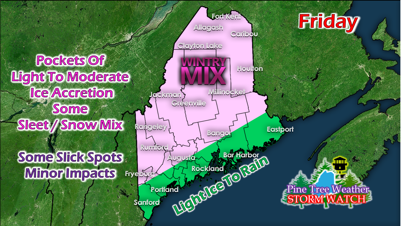 A winter weather advisory has been posted for parts of the state for some light icing, mainly for interior areas away from the shorelines. Warm air is expected to move in aloft while cold air holds on at the surface. In that situation, cold air damming becomes the concern. The good news is the amount of precipitation associated with this event is light. However, a light amount of ice is all it takes to cause problems on the roads, parking lots, and walkways. 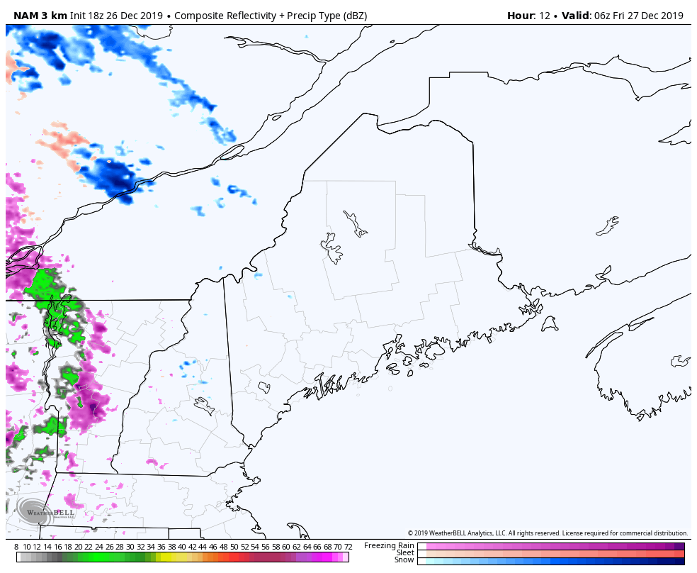 The main concern for ice accretion is for interior areas around and north of Route 2 in western areas, along with Greenville / Millinocket / Houlton areas and the central highlands. It will be greasy in spots Friday morning as precipitation overspreads the area. Conditions improve over western and southern areas Friday afternoon, and in the early evening over eastern and northern areas. If you are traveling, allow for extra time, and take it easy.  Snow potential to start off next week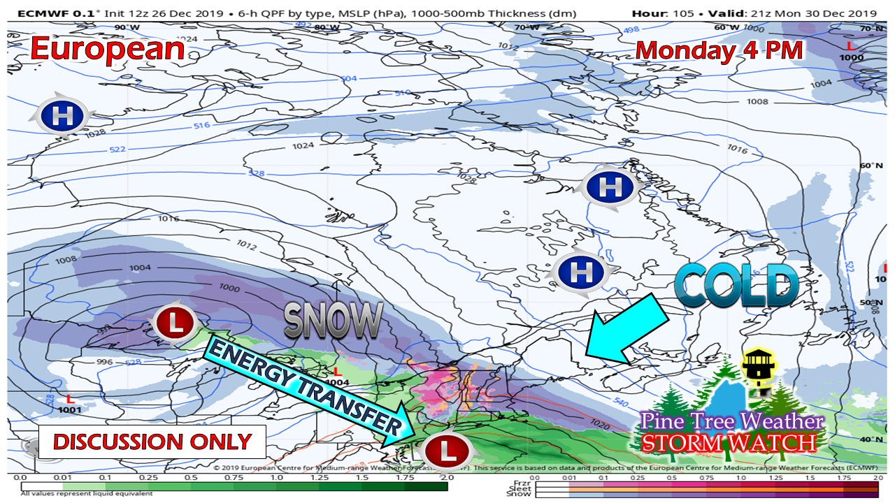 There is potential for a two day snow event for western and southern areas of the state Monday into Tuesday. Eastern areas may get in on the action Tuesday. Northern areas are a bit of a toss up of whether or not they get any snow accumulation out of this. A Colorado low moves into the Great Lakes and drags up moisture from the southwest and tries to bring a warm front into northern New England. It appears to run into a strong area of cold high pressure, and then stall. Where the warm front stalls will dictate who gets snow and/or a wintry mix and who won't on Monday. Energy from the Great Lakes low transfers into a coastal low, which intensifies as it moves eastward. With plenty of cold air and blocking to the north, the ingredients are on the table for a decent snow event. With the event four days out, it's early to anticipate snowfall amounts, and I caution the use 10:1 snow to water ratio deterministic / operational charts as a reference as there are potential changes. 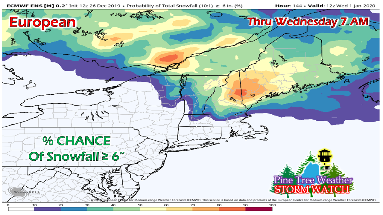 The European ensemble mean shows a healthy snow event, with 50%+ potential for 6"+ over western & southern areas, into the central highlands. This is the coldest solution. While it makes sense given the potential set up of the cold and blocking high pressure areas to the north, it depends on the strength of the high being strong to bring snow this far to south, and by that amount. 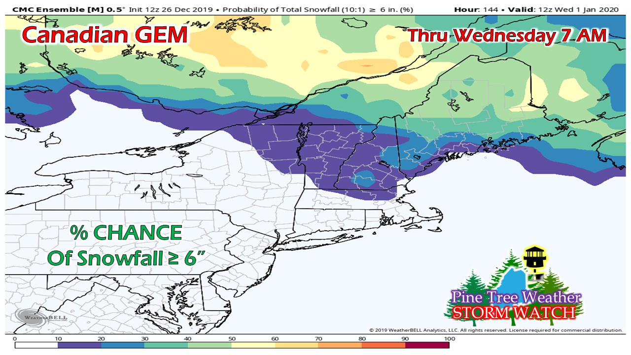 The Canadian GEM ensemble is not as strong with the high pressure, nor is it as bullish on precipitation amount. This has the warm front moving further north, and increases the chance for higher end snow over northern areas. 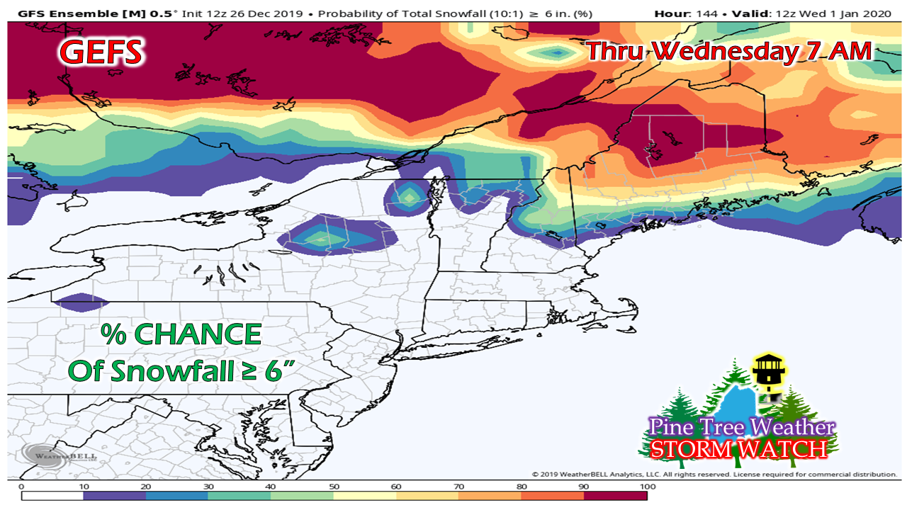 The GEFS ensemble shows a potential heavy snow event further to the north, with potential for 6" or more in the 90-100% range, which then the idea comes of potential of a foot or more in areas. This is also the warmest solution, with the warm front moving well into the state. This is three different ideas, with significant differences in outcomes. The sum total of this means there is potential for a decent snow event for the entire state. What will dictate the final outcome, will be the cold air,the strength and position of high pressure to the north and east, and where the coastal low organizes, intensifies, and tracks. Rule of thumb: never underestimate the influence of cold air. ► ► For the latest official forecasts, bulletins and advisories, please check in with the National Weather Service in Gray for western and southern areas, or Caribou for northern and eastern parts of Maine. Your support is greatly appreciated |

Mike Haggett
|