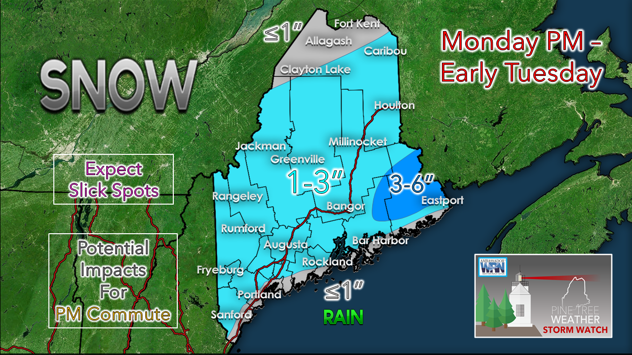
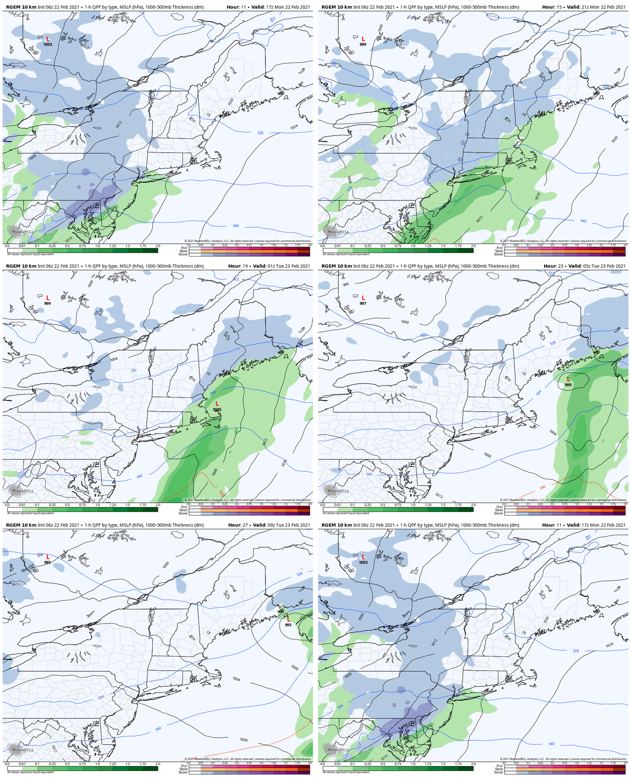
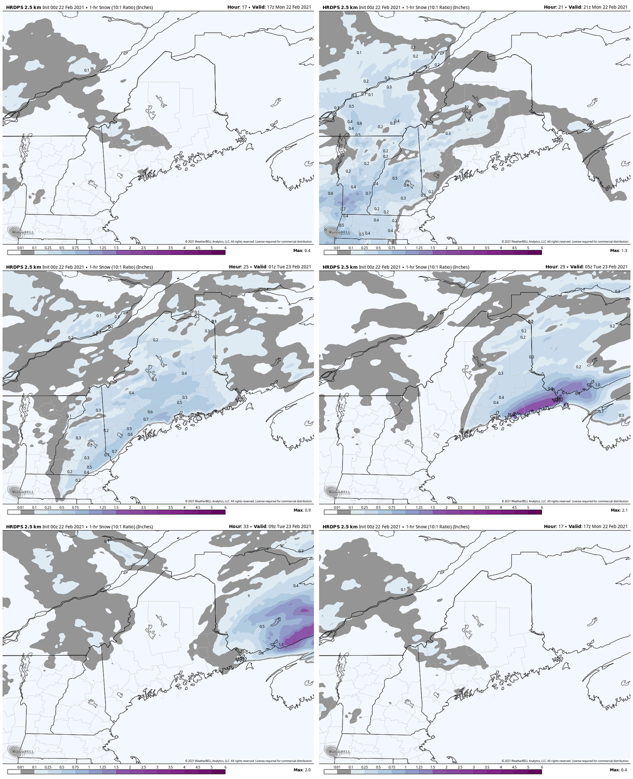
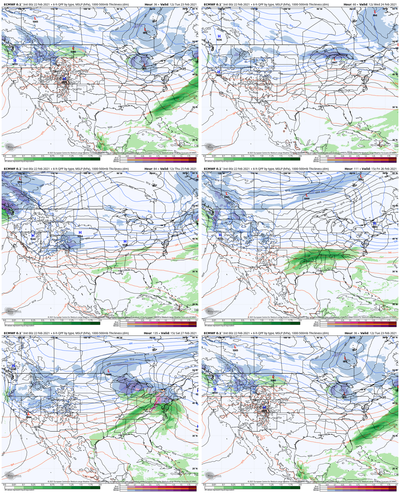
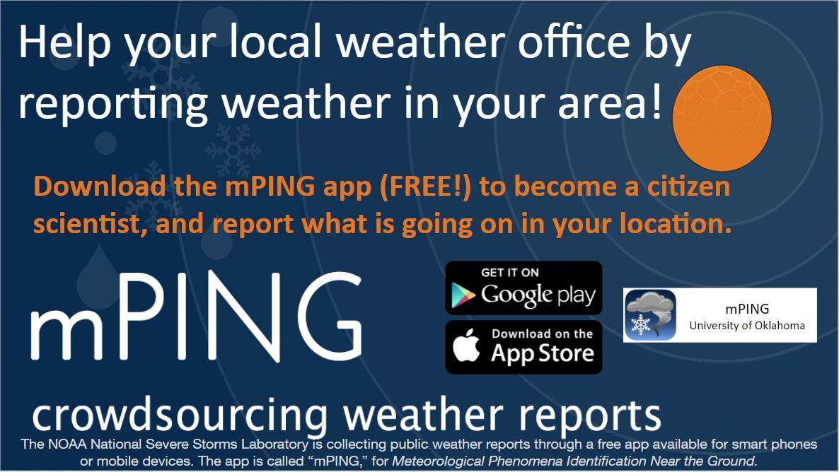
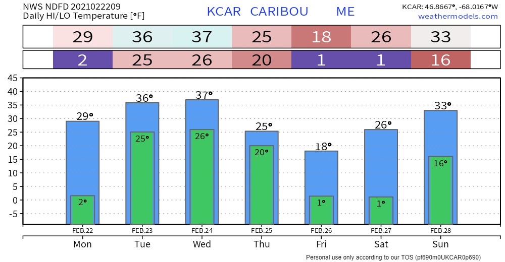
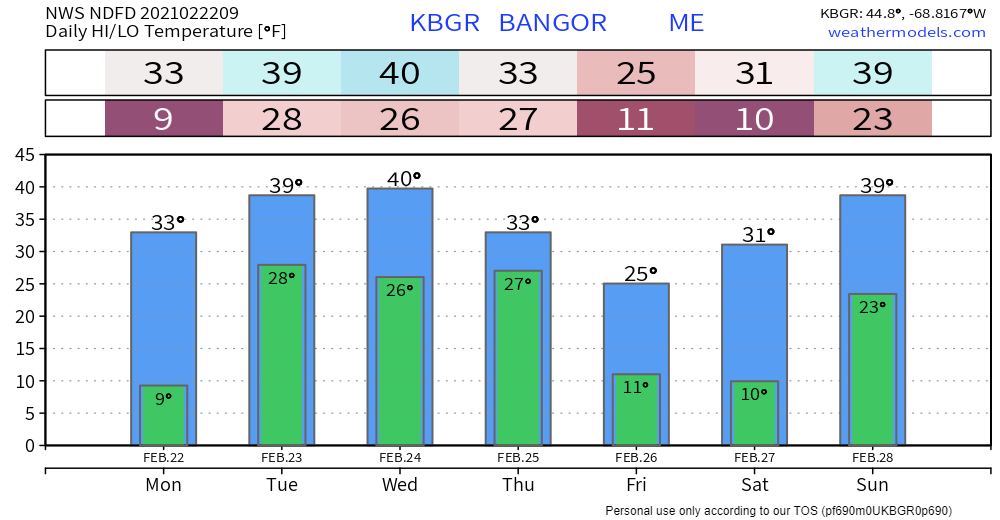
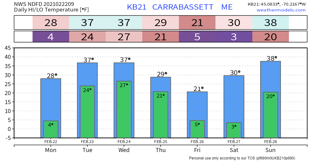
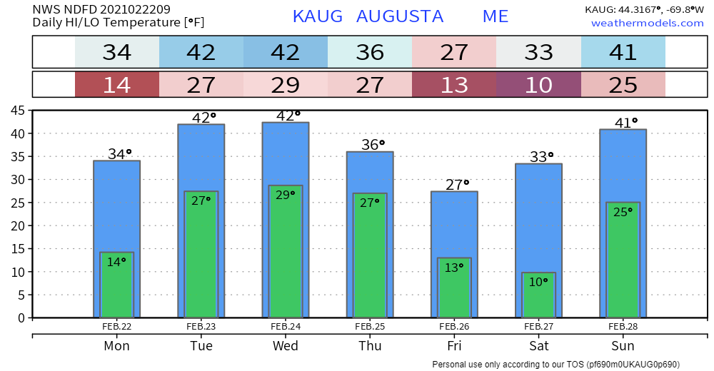
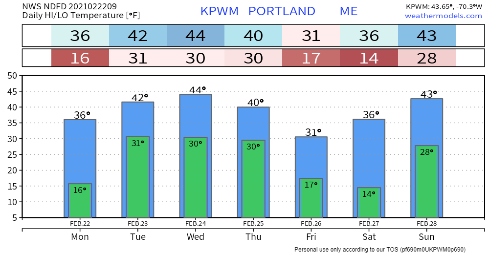
The closer to the coast, the wetter the snowAnother start to the traditional work week, another storm to contend with. The evening commute across much of the state could be dealing with slick roads, potential reduction in visibility, along with slow travel. A coastal hugger type system works into the region Monday afternoon. It's a quick hitter, over and done for western and southern areas by around mid-evening, around midnight for the north and Bangor, and just before daylight over far eastern areas. With this storm comes some gusty southerly winds with gusts in the 20-30 mph range for the coast and higher elevations, 10-20 mph elsewhere. The wind shifts to the northwest after the surface low passes east and gust in the 15-25 mph range through Tuesday morning, before settling down towards evening. The main concern for this one is banding that could develop over DownEast areas tonight which could bring a thump of heavy snow. What makes this forecast tricky is the position of the low along the shorelines and how rapidly it intensifies. While I think the immediate shorelines (Bar Harbor, Jonesport, Machias, Eastport) escape with heavy rain saturated slop, a handful of miles inland could end up in a winter wonderland with 3-6" of snow, with potential for double-digit totals over interior Washington County pending on how it all lines up. I would love to see some snow totals from that area Tuesday morning from followers there. Chances are that the snow that forms over interior DownEast areas could be heavy and wet. A risk of power outages are possible there. A couple more storm chances later in the weekAfter the Monday storm departs, the ski hills could see snow showers off and on Tuesday into Wednesday. A sneaky area of low pressure pops around the Great Lakes Wednesday and moves quickly eastward and could bring snow to northern and western areas Wednesday night into Thursday. A longwave storm with a mixed bag of precipitation is possible to start the weekend. Stay tuned for timing and precipitation outlooks on this. Monday is an mPING day!Check out mPING (Meteorological Phenomena Identification Near the Ground) project. Weird name, cool app! You can report the type of precipitation you see where you are. No need to measure! Use the free mobile app to send reports anonymously. Reports are automatically recorded into a database, which improves weather computer models. The information is even used by road maintenance operations and the aviation industry to diagnose areas of icing. mping.nssl.noaa.gov Temperature outlook through SundayThe normal high and low for Caribou is 26° and 6°. For Portland, 36° and 18°. Temperatures appear to be generally above normal through the period, with a cool shot potential for northern areas to wrap the week. Be prepared to receive alerts and stay updated!
For more information in between posts, please follow Pine Tree Weather on Facebook and Twitter.
Thank you for supporting this community based weather information source which operates by reader supported financial contributions. Stay updated, stay on alert, and stay safe! Thank you as always for your support! - Mike |
Mike Haggett
|

