Face coverings to come in handy Tuesday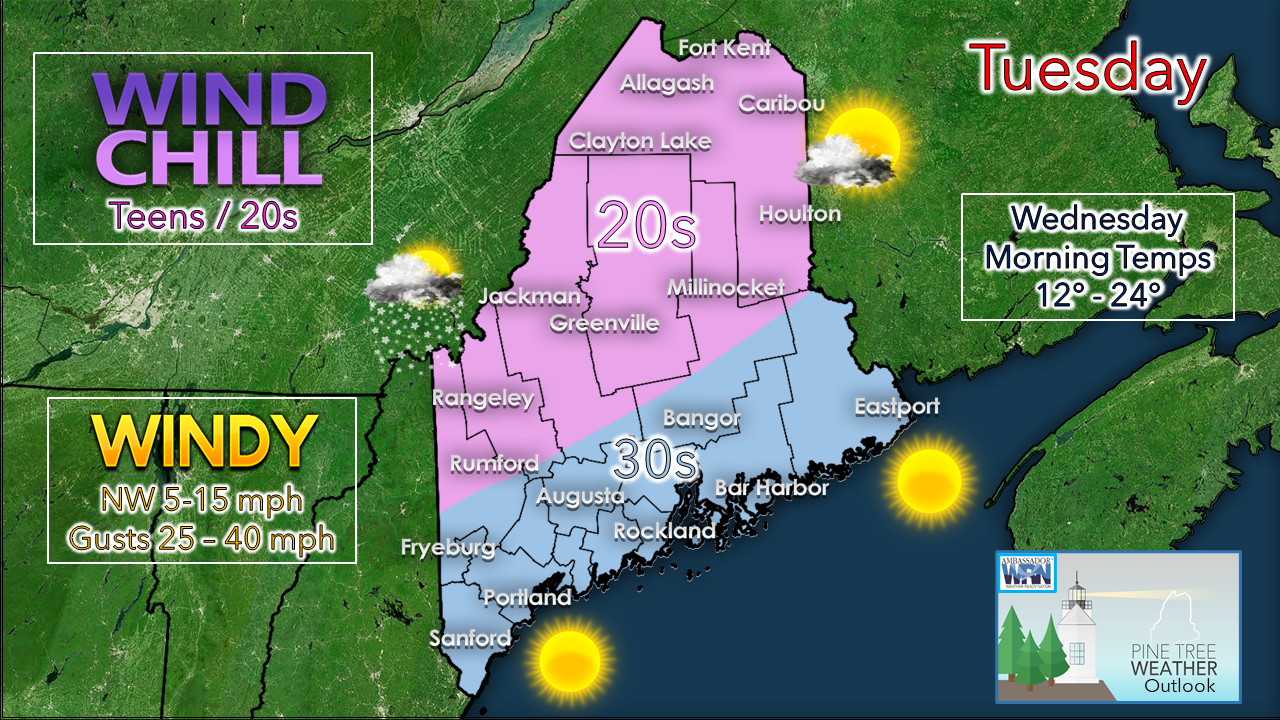 Not to stir the pot on the debate of the use of face coverings, but passing along my personal experience using them on cold days so far, I don't mind them. We use scarves, gaiters or dickeys on days like this when the wind has a bite, so they will come in handy while being out and about for the day. Prepare for wind chill values in the single digits / teens to start off, and teens / 20s this afternoon. The breeze will slowly diminish Tuesday afternoon into the night as high pressure arrives in the wake of the storm that passed through the region yesterday. The higher mountain peaks may pick up a couple inches of snow with the upslope wind direction. A few clouds are possible for the north. Mainly sunny skies are expected elsewhere. High pressure passes through overnight, with clouds on the increase ahead of our next system. Expect a cold start Wednesday morning, but with little wind. Light snow for most areas Wednesday As high pressure passes east early Wednesday, a southwest flow develops bringing warmer temperatures aloft. A weak disturbance engages with it, and light snow develops. The morning commute appears to be precipitation free, but flakes develop soon after that and overspread the region through the midday, tapering west to east in the afternoon. 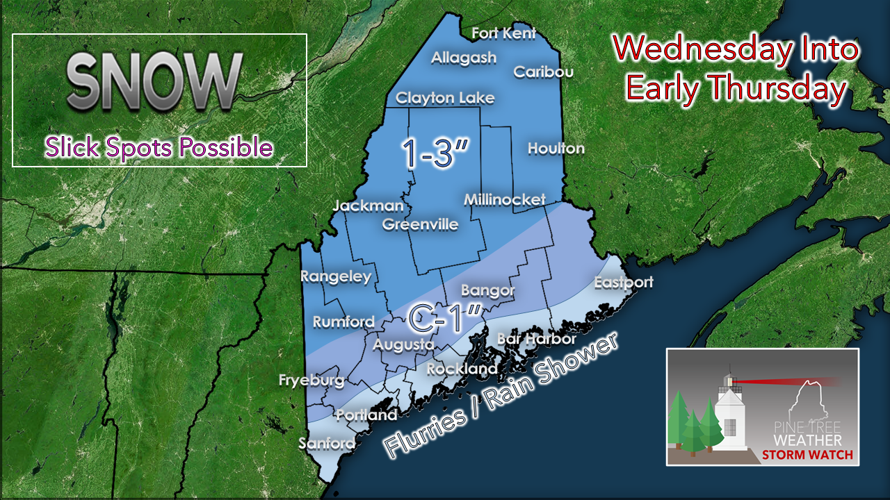 I think there is a good chance that everyone sees at least a few flakes out of this. The shoreline towns may pick up a shower as the southwest flow warms the temperatures thanks to the ocean. It will be just enough snow to send out the snow removal crews for at least a sand or salt run. Higher elevations have the best chance to pick up a couple of inches.  Outlook for Thanksgiving and the weekend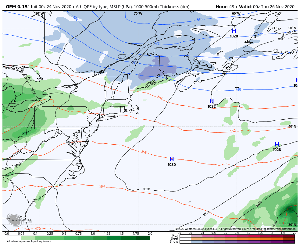 After the disturbance passes through Wednesday, a warm front noses northward for Thanksgiving. I am thinking at this point there could be a concern for freezing rain as cold air damming near the surface may be stubborn to leave. Above freezing air will win out, but it may take time to do so, perhaps as late as early Friday for northern areas. For those that do travel for the holiday, plan for icy conditions away from the shorelines, and plan for plenty of extra time to arrive at your destination. 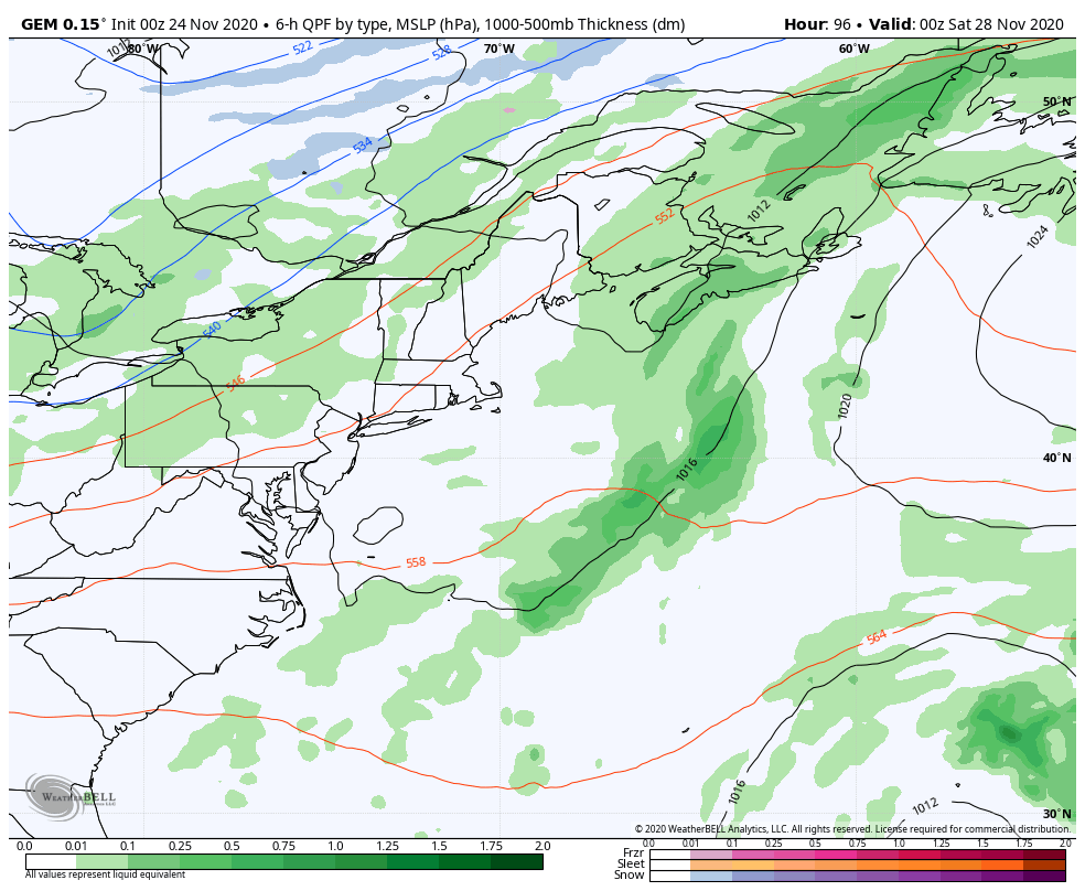 Friday night sees scattered rain showers as a weak area of low pressure slides through from the northwest to southeast. Saturday appears to bring snow showers for the mountains and north, with rain showers possible for the coastal plain to start off, and may end with flakes later in the day. High pressure takes over and brings a fair day Sunday. Our next storm of concern appears to be Monday afternoon and may linger into Wednesday. Guidance ideas are mixed on timing and precipitation type for now. Stay tuned for updates on that. Temperature outlook through MondayThe normal high / low temperature for Frenchville is 33° / 21°. For central Maine, 42° / 28°. The region appears to run below normal until Thanksgiving, then above normal through the weekend into early next week. 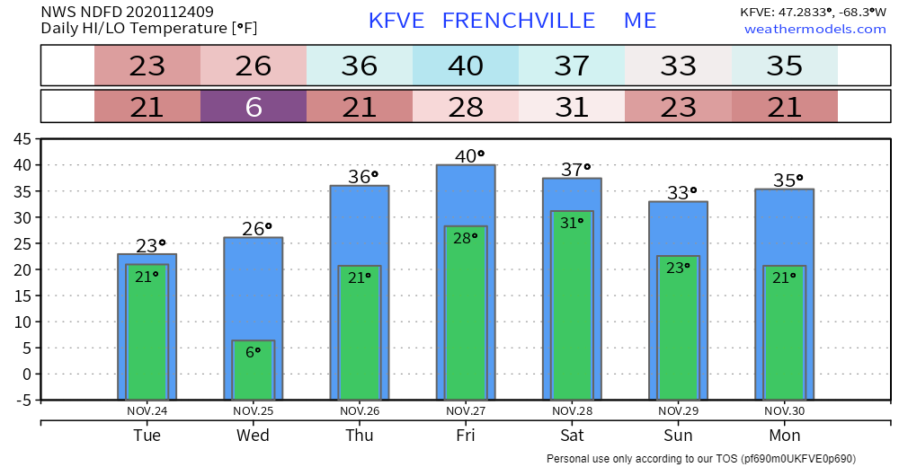 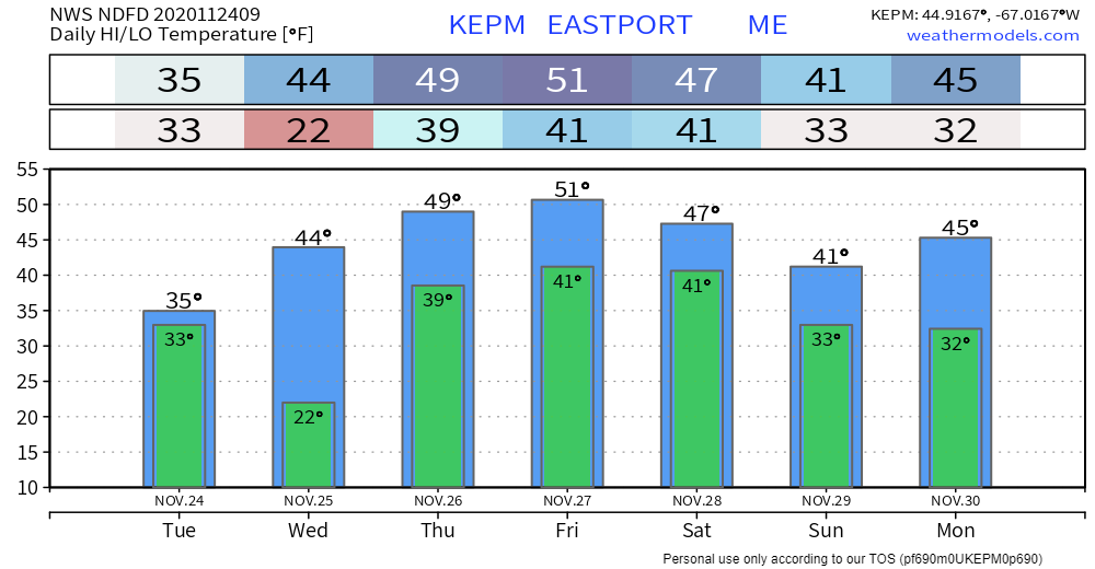 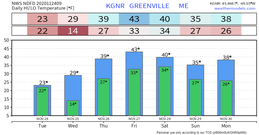 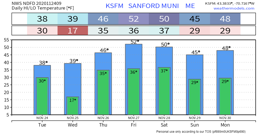 The Science of Wind Chill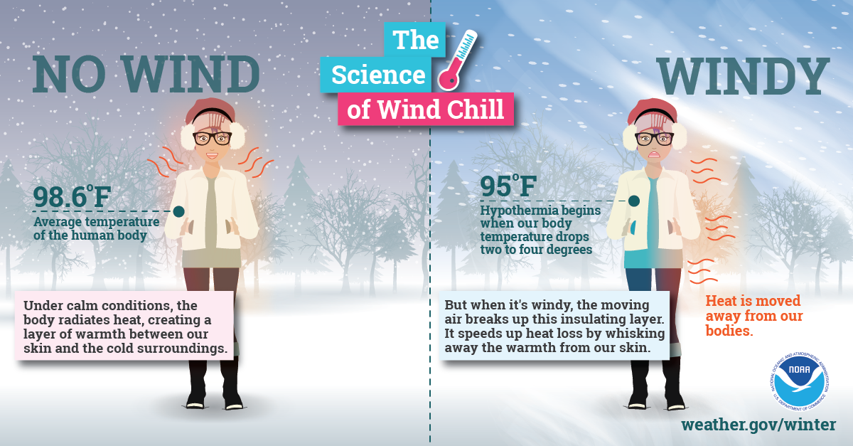 With little wind, your body is able to maintain a thin layer of warmer air between your skin and colder air surrounding you. However, higher winds can eliminate that thin layer, and your body can begin to cool at a dangerously fast rate. Visit weather.gov/safety/cold for more winter science! Be prepared to receive alerts and stay updated!
For more information, please follow Pine Tree Weather on Facebook and Twitter.
** FUNDING NEEDED FOR 2021 ** Thank you for supporting this community based weather information source that is funded by your financial contributions. Stay updated, stay on alert, and stay safe! - Mike |

Mike Haggett
|