
Bundle up for the day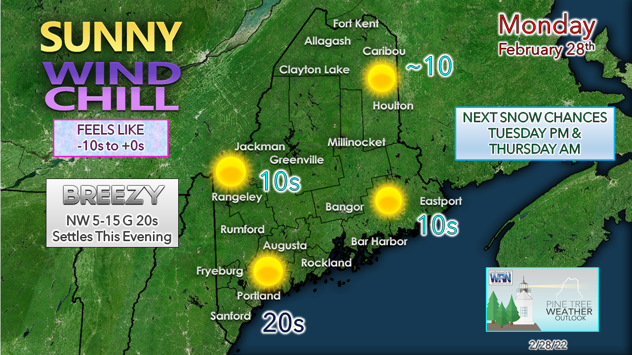 The clipper system that brought snow squalls to the area Sunday afternoon intensified in its departure into the Canadian Maritimes and is dragging a cold arctic high into the region in its wake. Below zero wind chills are expected for the interior for much of day along with gusty northwest winds that are on track to settle down Monday evening. A bluebird sky brings a bit of warmth to the soul for the final day of meteorological winter. March starts off as a lamb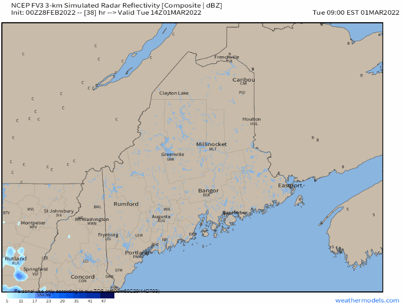 Tuesday 9 AM to Wednesday 7 AM - The first of two clipper systems for the week are on track to pass through the region Tuesday. As the arctic high quickly moves to the east, a south/southwest flow develops and increases clouds Tuesday morning. With cold air locked in place and ocean temperatures in the 40s, that sets up potential for ocean effect snow for the MidCoast and DownEast areas Tuesday afternoon ahead of the system that passes through Tuesday night into early Wednesday morning. Light snow / snow showers are possible for the Tuesday evening commute over southern and western area and move into the rest of the region Tuesday night. Snow ends from west to east in the wee hours of Wednesday, with the last of the flakes clearing way DownEast by around daylight Wednesday morning. 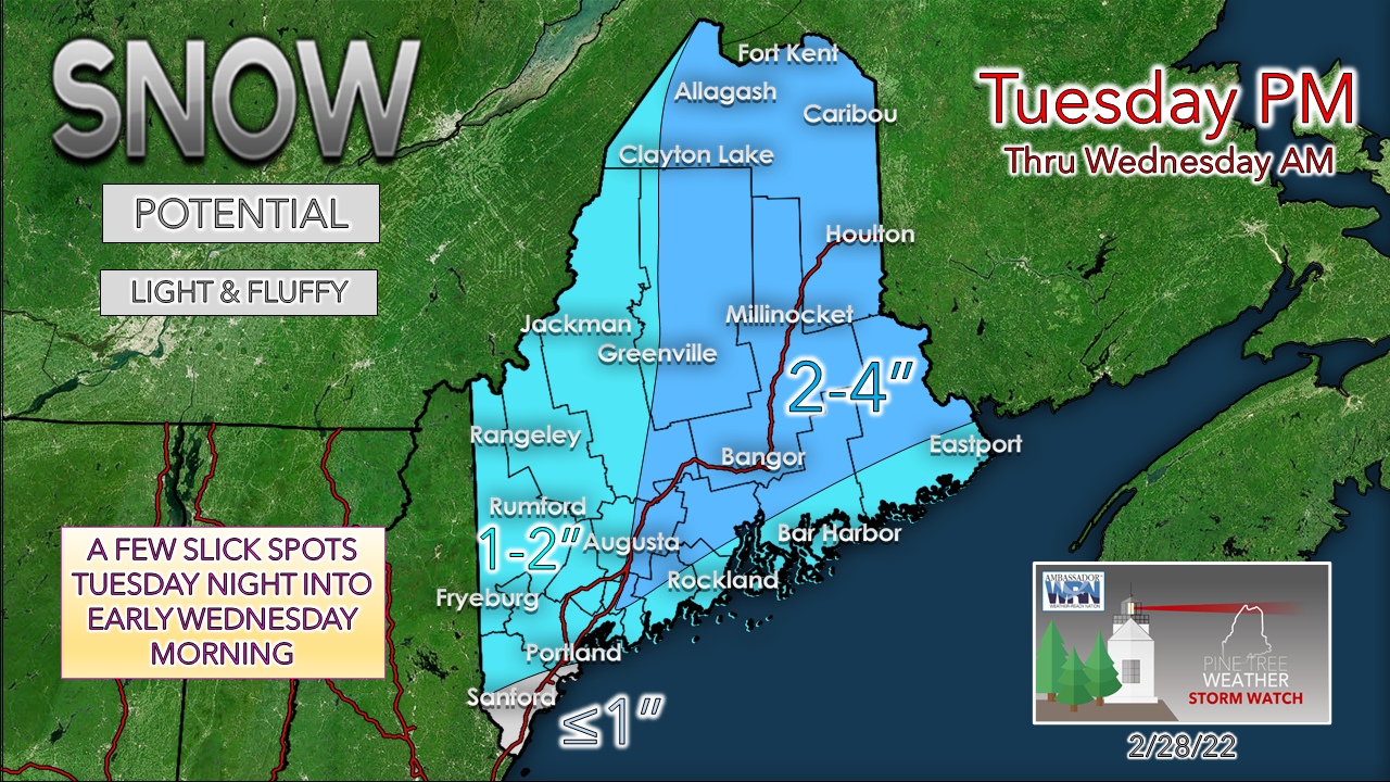 As the clipper moves eastward, it taps into moisture and energy well to the south. which turns the clipper into a pseudo-inverted trough situation and could enhance snowfall a bit over central, eastern and northern areas. Ocean effect snow may enhance snow amounts by an inch, but a coastal front may develop and bring a wintry mix of sleet and freezing rain along with straight rain during the overnight into the wee hours of Wednesday. Another easy storm to clean up from with high fluff factor keeps this powdery for the much of the region. Areas that see mixing may see it stick a bit heavy over MidCoast and DownEast shoreline regions. Another system to watch for Thursday Wednesday 7 PM to Thursday 7 PM - An upper-level trough moves into the region Wednesday night and a weak disturbance fires up along it and could bring snow to the coastal areas Thursday morning. This could make the morning commute greasy in spots to start the day. Anytime low-pressure forms over the Gulf of Maine are a cause for concern with cold air around. With the storm predicted to intensify in its departure, I am concerned that models may be undercutting snow potential from it. To the credit of the forecast ideas at this point, it is progressive and predicted to pass through the area quickly. 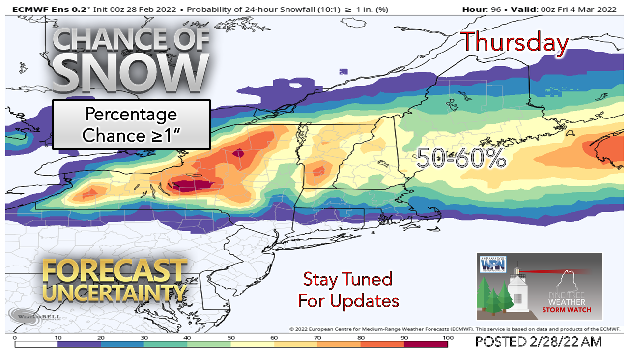 There is a fair bet for a couple inches of snow for the coastal plain out of this. Time will tell if my senses are right that it could bring a bit more than that. Stay tuned for updates on this.  Temperature outlook through SaturdayThe normal high and low for Caribou is 29° and 9°. For Portland, 38° and 21°. Temperatures are expected to run below normal in the north, and a bit of a roller coaster ride for the south through the week. Temperatures are expected to warm up for the weekend, and a chance for an inside runner is possible for the weekend. 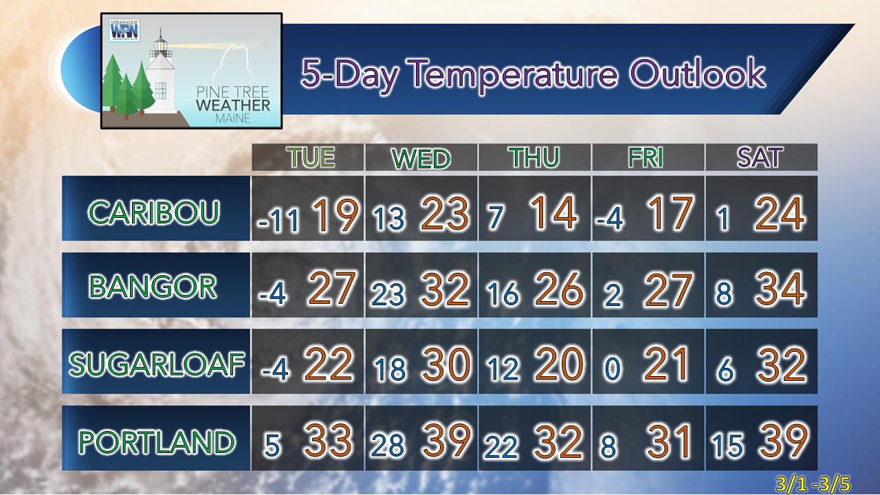 Snow Squalls & WEAs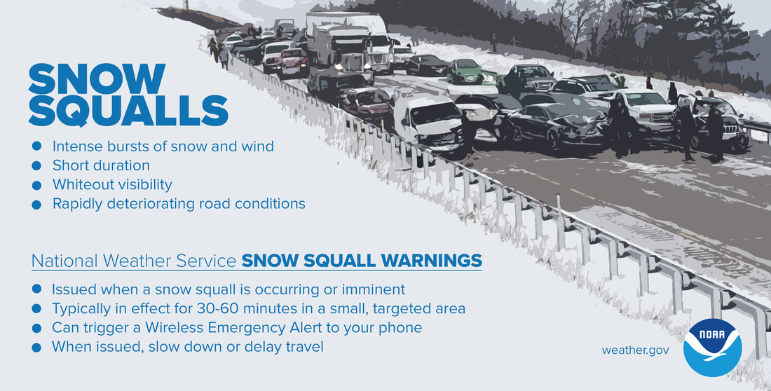 Snow squalls are intense bursts of snow and wind with whiteout visibility that are extremely dangerous, especially while on the road. The National Weather Service helps you be ready by issuing Snow Squall Warnings that can trigger a Wireless Emergency Alert on your phone. If you receive one, know that a snow squall is occurring or imminent, and slow down or delay travel. weather.gov/safety/winter-snow-squall Be prepared to receive alerts and stay updated!
 For more information in between posts, please follow Pine Tree Weather on Facebook and Twitter. Thank you for supporting this community-based weather information source which operates by reader supported financial contributions. Thank you as always for your support! - Mike NOTE: The forecast information depicted on this platform is for general information purposes only for the public and is not designed or intended for commercial use. For those seeking pinpoint weather information for business operations should use a private sector source. For information about where to find commercial forecasters to assist your business, please message me and I will be happy to help you. |

Mike Haggett
|


