|
First off, I hope you had a great Thanksgiving. It's my favorite holiday of the year. It's a great time to reflect on the past, present and future, and spend time with family. One thing I am grateful for is your support. As we enter the season of giving, I would appreciate your financial help. I am $900 short to pay the bills for the year ahead. No contributions are too small. I have no problem continuing what I do here so long as I get my expenses taken care of. If you want to know more about the mission here, check out the DONATE page for more information. If you are a new follower, I appreciate you giving me a chance. I try to keep it real here, without hype and drama. Saturday feels like winter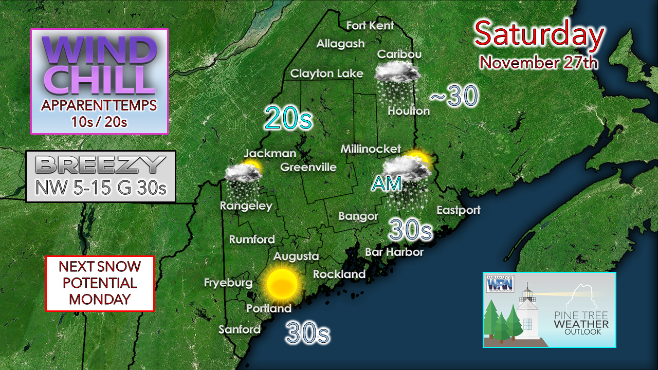 As the storm departs, the wind shall crank. The area of low pressure responsible for the recent snow and rain intensifies over the Canadian Maritimes today. Northwesterly winds will add a bite to the air. Gusts in the 30+ mph range may cause some isolated power outages. The ski hills may be dealing with wind holds on the lifts. 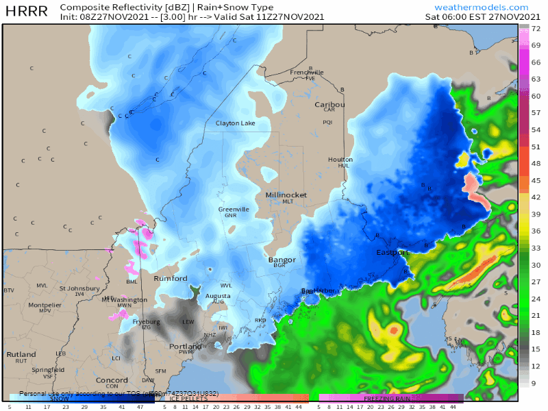 Saturday 6 AM to 9 PM - Southern areas clear out and see the sun come out. Snow showers are possible for the western mountains through the day. Snowfall wraps up over eastern areas in the morning, and by evening over the north. A storm to watch for Monday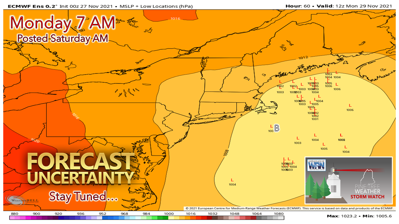 This is an update to an image I posted on Facebook Friday afternoon. There is still a rather wide spread in ensemble ideas, but it has tightened up a bit. The problem nailing this storm down is that the energy associated with the parent wave that will flare this storm is located in the bowels of the Arctic away from radiosonde coverage. The sampling received from the balloons released Saturday evening will help bring the forecast model ideas into better focus. 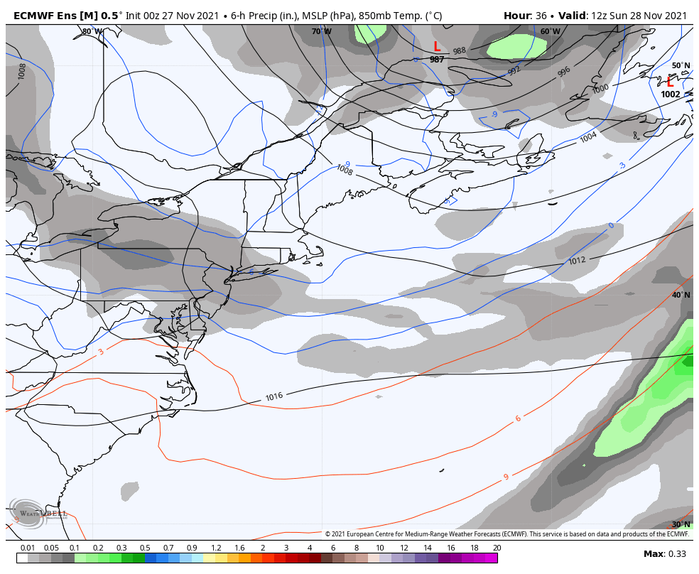 Sunday 7 AM - Tuesday 7 AM - The ballgame for this one is the timing of the energy of the new trough coming in under the trough that exits the region Saturday night into Sunday. This ensemble idea from the Euro provides a "middle of the road" solution which given the uncertainty is a fair idea for this forecaster to go with for now. 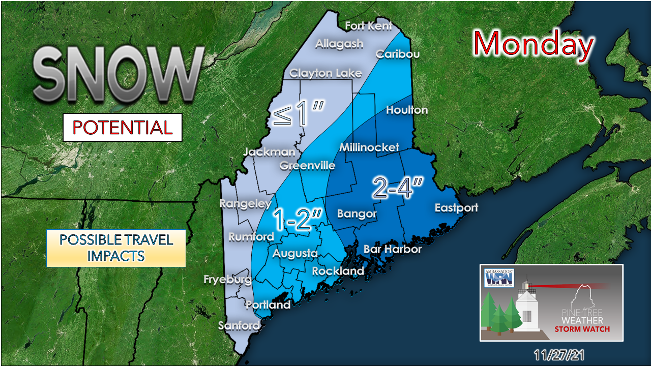 At this point, I don't see this being a big deal. I am a bit concerned for potential travel impacts for southwest coastal areas who have not seen snow of any amount as of yet. There is potential for flakes to be in the air for the morning commute, but the jury is out on the notion of any greasy roads to deal with at this point. Given the uncertainty, it may be wise to keep that potential on your mind as you plan to start your week in case the ideas shift. Stay tuned for fine tuning on this forecast, along with timing.  Outlook through the week and temperature forecast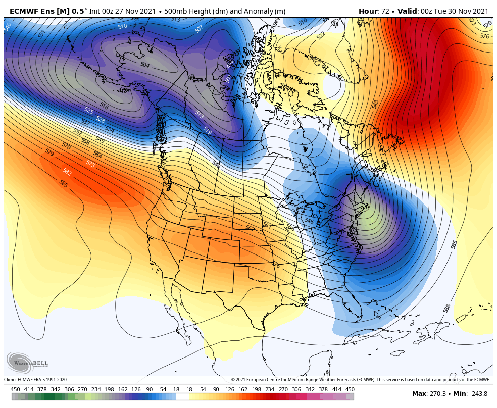 Monday 7 PM to Sunday 7 PM - Troughs continue to roll as the western ridge is locked in. The result of this means below average temperatures and chances for light snow, primarily in the mountains through the remainder of the week. There are some distant signals for storm potential next weekend, but it's way too early to give that any validity. 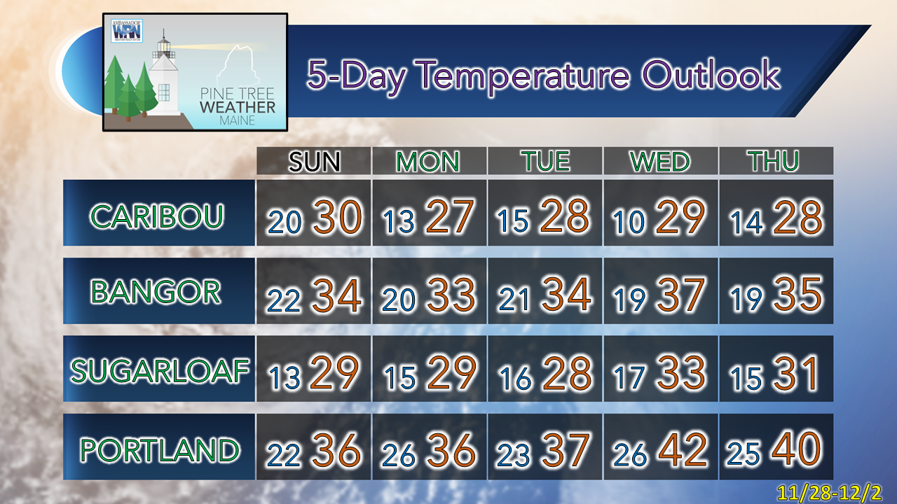 Winter Precipitation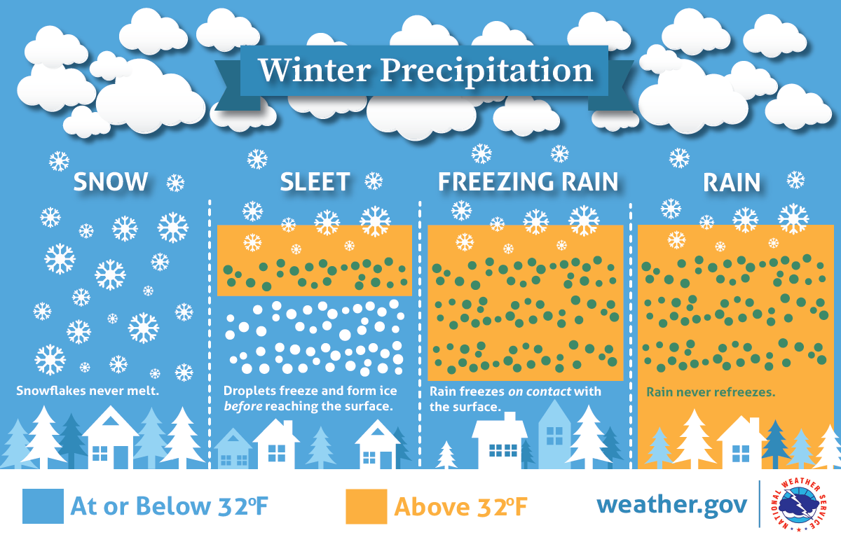 Will there be rain, ice, or snow? This graphic explains how having different layers of warm and cold air between the clouds and the ground determines the type of precipitation that hits the ground. nssl.noaa.gov/education/svrwx101/winter/types/ Be prepared to receive alerts and stay updated!
 For more information in between posts, please follow Pine Tree Weather on Facebook and Twitter.
Thank you for supporting this community-based weather information source which operates by reader supported financial contributions. - Mike |

Mike Haggett
|