|
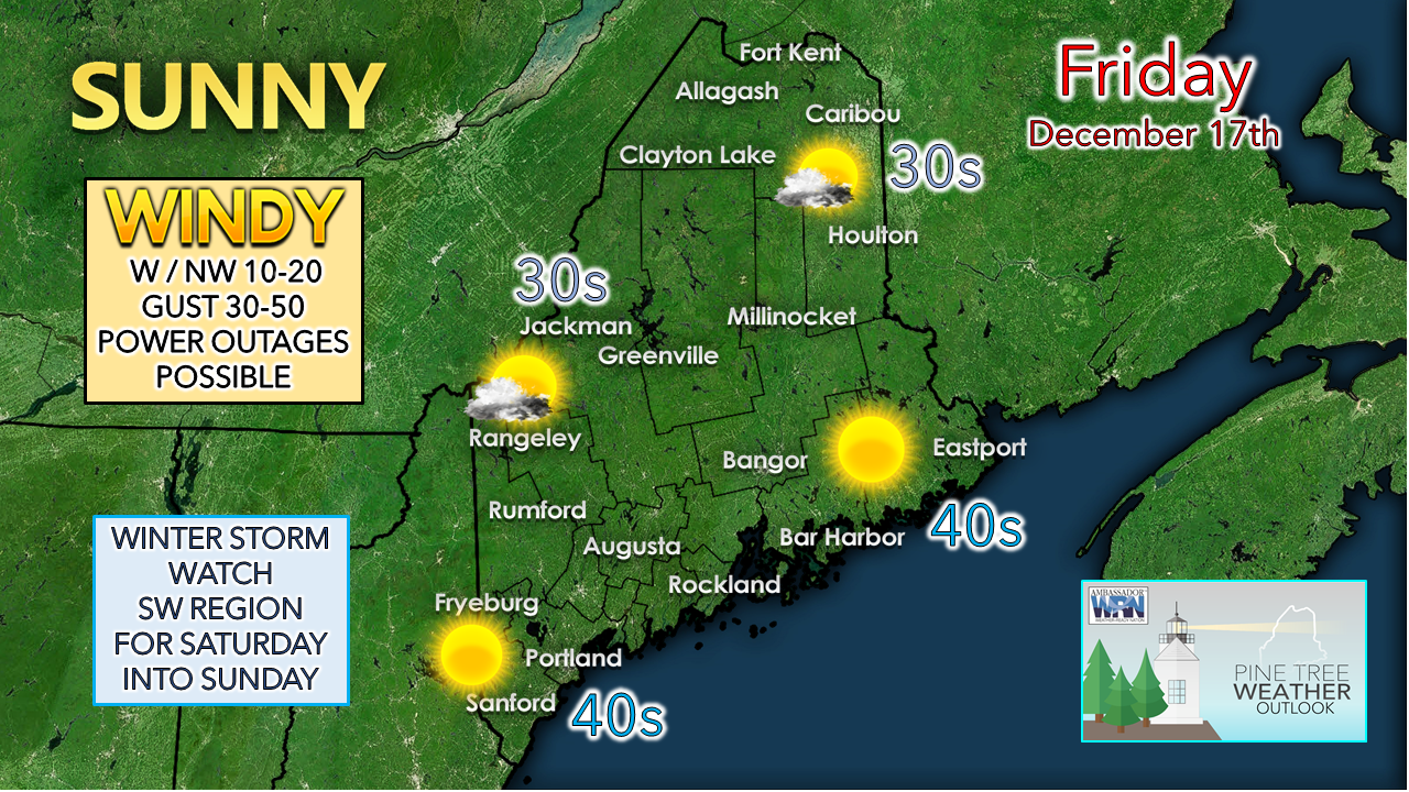
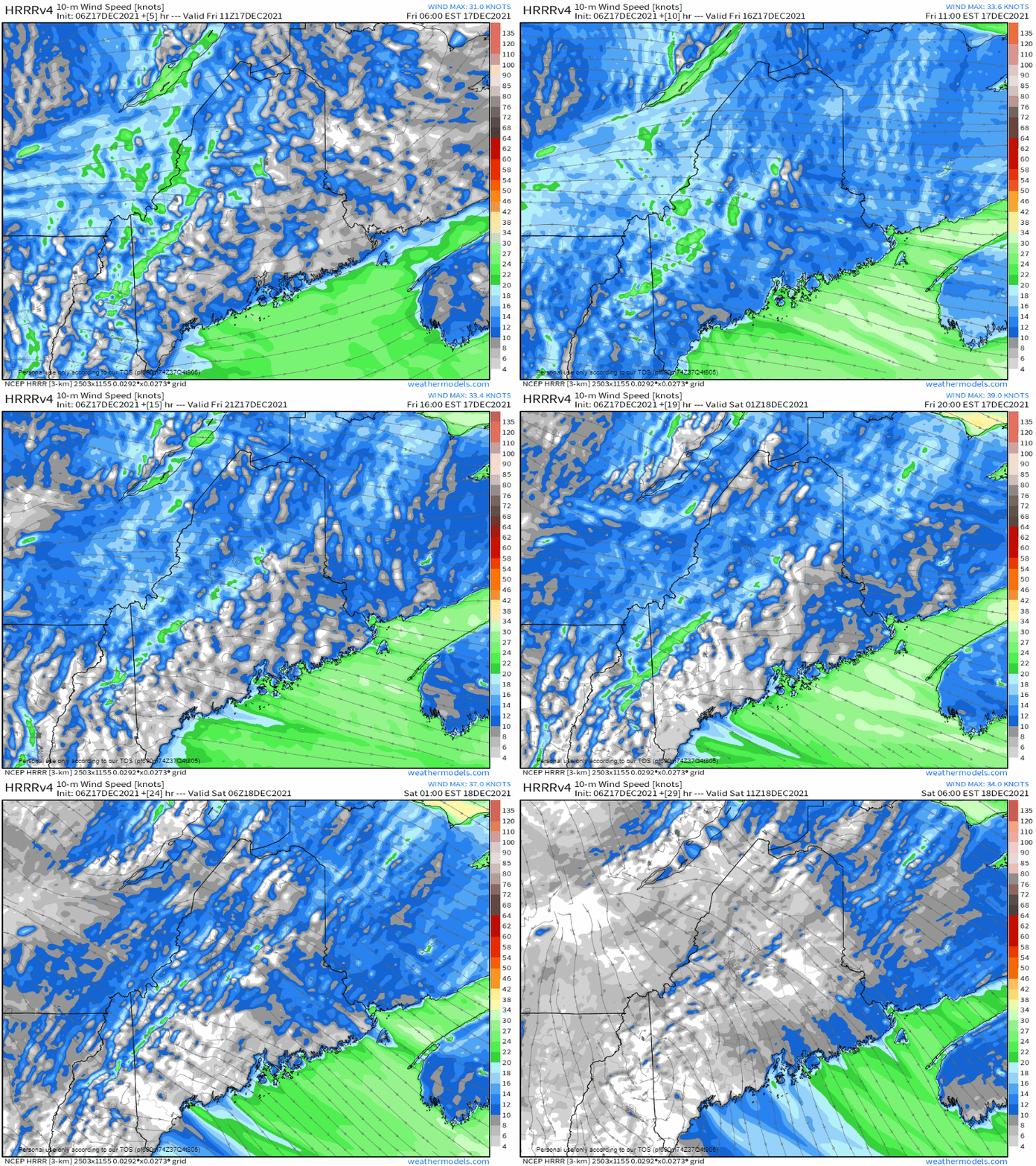
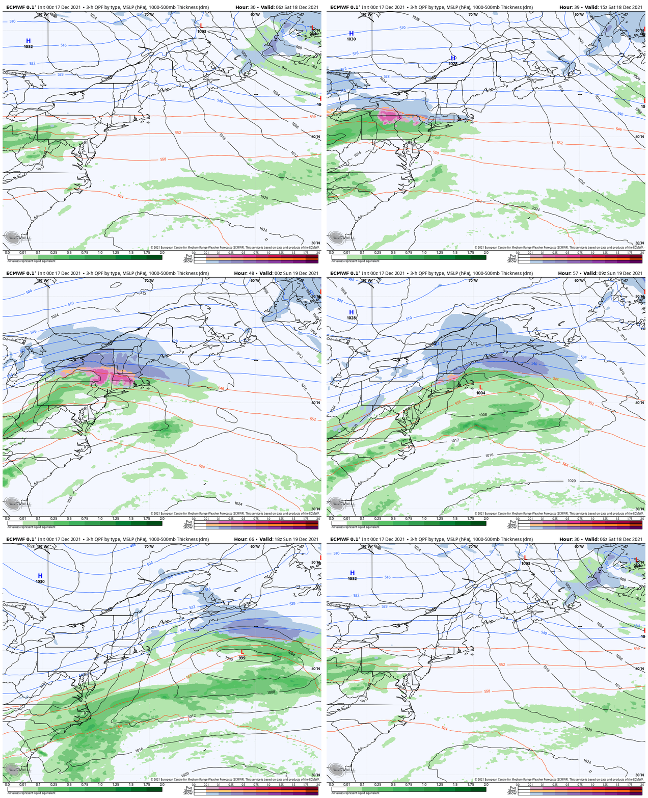
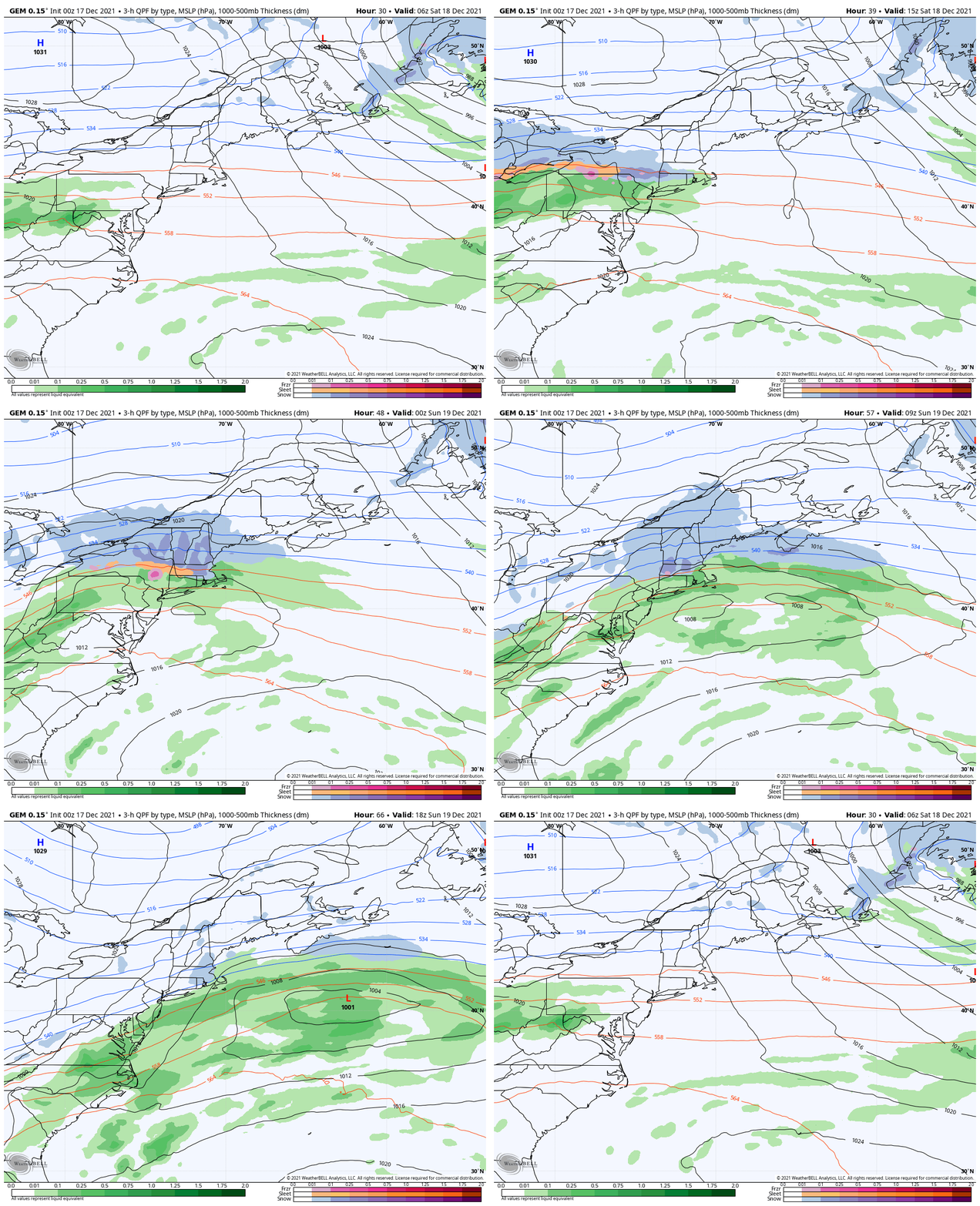
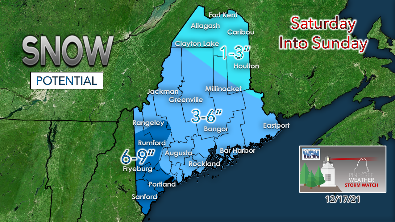
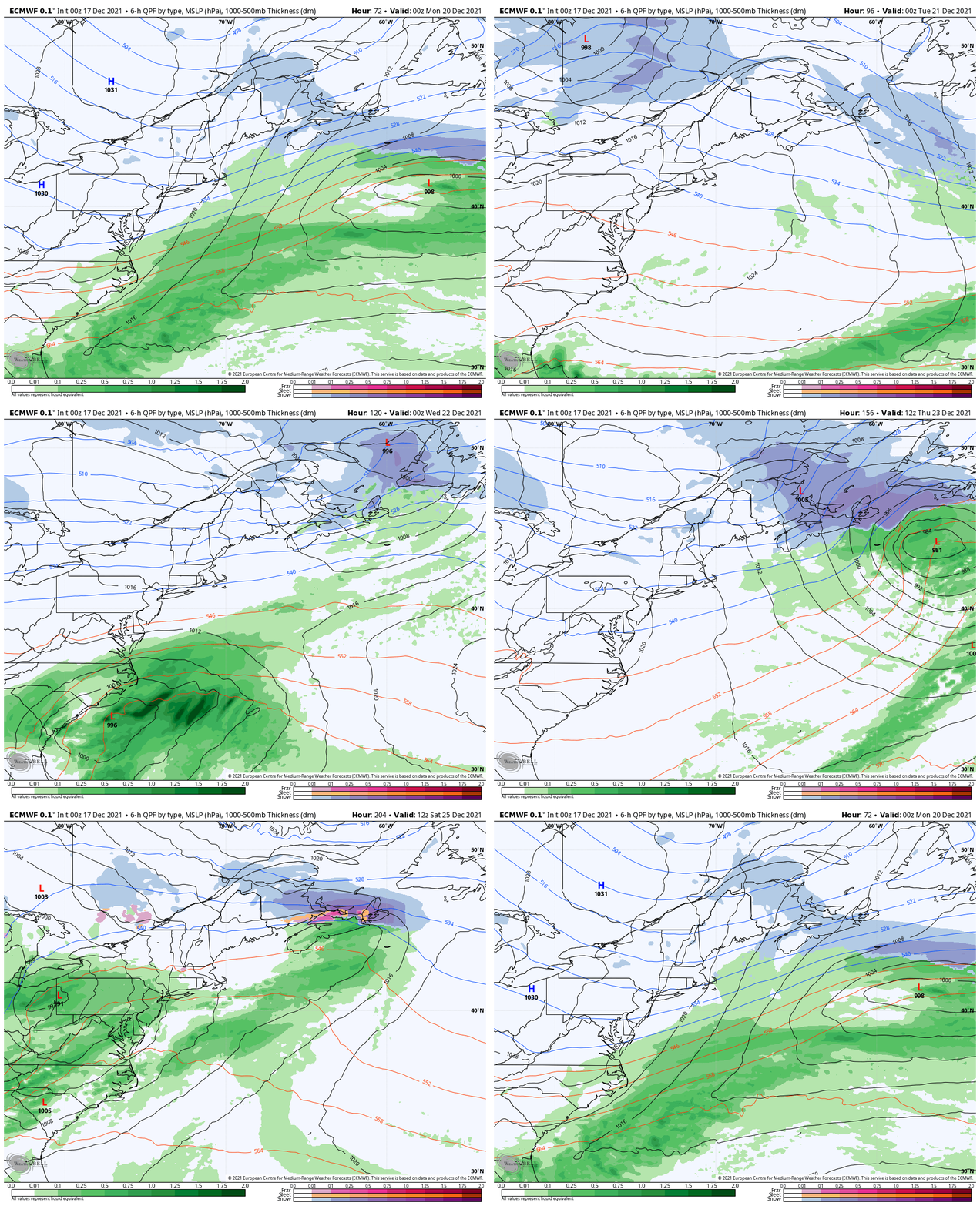
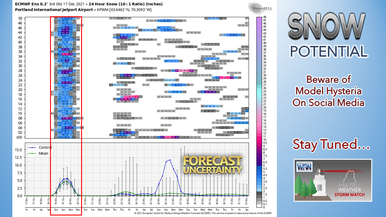
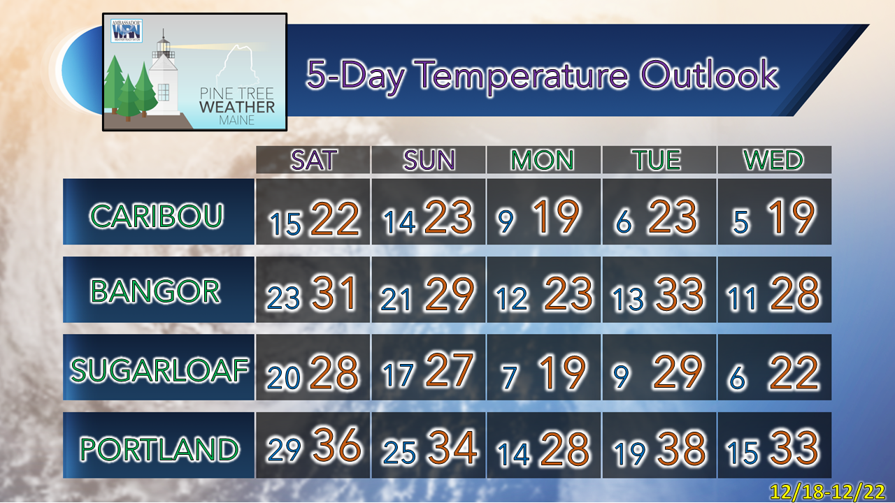
Before I get into the forecast, I would like to congratulate Nicholas Deamer and Aidan Toomey for graduation from Penn State. These two young men muscled through a tough four-year atmospheric science program with semester to spare, which deserves a tip of the hat in respect. Along those lines, Madelyn Skinner and Sean Melanson will return to assist over winter break, which I look forward to. All the students who have worked with me over the past couple of years have been wonderful to work with. Thanks to those who financially support Pine Tree Weather, this gives them an opportunity to sharpen their forecasting skills and communication of forecast impacts. I compensate each of these individuals for their efforts with a portion of the donations that I am blessed with, and I could not be more grateful to do so. A stiff breeze to end the weekIf you have any holiday decorations that could go airborne, you'll want to secure them before you head out for the day. A wind advisory is in effect for the mountains and north through the afternoon where gusts could reach 50+ mph. Flying trash can status is on tap for urban areas, also. Friday 6 AM to Saturday 6 PM - The breeze cranks up Friday morning and then slowly diminishes in the afternoon into early Saturday morning. This sets up the cold necessary for the snow event on the way Saturday afternoon into Sunday. The first solid snow event for southwestern areas on tapSaturday 1 AM to Sunday 7 PM - A winter storm watch has been issued for southwestern areas of the state for the potential of 4-8" of snow starting Saturday afternoon through Sunday morning. The European model (above) and the American based guidance is more or less on board with that idea, but one model that is not is the Canadian (below) which has me a bit concerned for bust potential. The European is a bit more robust, which is not a surprise as that is one of its faults. The Canadian operational idea here takes an already flat system and makes it flatter, ingesting more dry air into it with a bit less mid-level energy and thus reduces snowfall amounts. Keep this idea in mind if the forecast busts on the low end. There is enough of a case made here for around a 6" snowfall for southwestern areas. Most of this falls Saturday night and could fall at 1"+ per hour rates in spots during the overnight. Snow ends from west to east Sunday morning. Expect a breezy day to clean up on Sunday as the storm intensifies on its way eastward. Model madness heading into the holiday weekMonday 1 AM to Sunday 7 PM - The idea that is relatively clear at this point is for a weak clipper to pass through Tuesday which brings snow showers to the mountains along with a reinforcing shot of cold air behind it for midweek. Operational models then present an idea of a coastal storm around Wednesday into Thursday, and a potential mess over the holiday weekend. The only thing that possesses any real certainty is the storm this weekend. After that, there is a lot of noise on the operational ideas, but not a lot to back it up. Looking at teleconnection forecasts heading into late next week does give some credence to a storm around Christmas and the day after. For now, it is wait and see. Stay tuned. Winter Forecasting: UncertaintyThe National Weather Service works hard to provide you with the most accurate forecasts possible, and their forecasts get more precise the closer to a big weather event. Learn more about how they update forecasts by watching this short video. Be prepared to receive alerts and stay updated!
For more information in between posts, please follow Pine Tree Weather on Facebook and Twitter.
Thank you for supporting this community-based weather information source which operates by reader supported financial contributions. - Mike |
Mike Haggett
|

