A storm synonymous to early April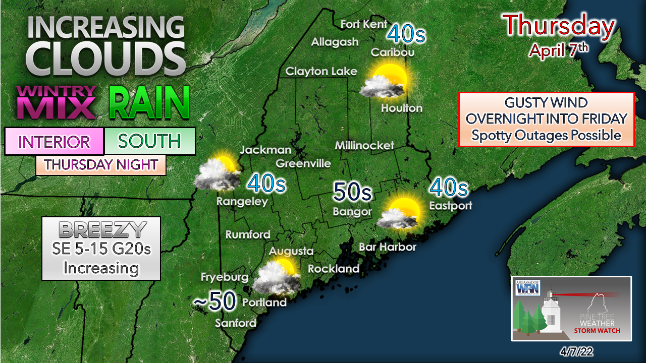 Low pressure over the Great Lakes heads northeast into Quebec. A long wave frontal boundary attached to it moves eastward. A secondary area of low pressure is expected to form along the front and moves into the region Thursday night. The storm tracks into New Brunswick Friday, clearing the area Friday night. Unsettled weather continues into the weekend as an upper-level trough pinwheels disturbances through the region. Timing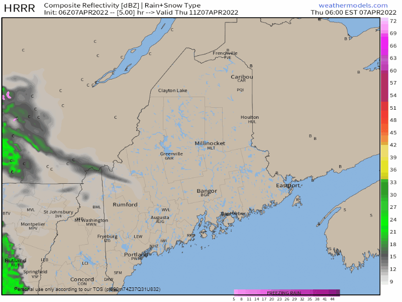 Thursday 6 AM to Friday Midnight - The idea of Thursday being a mainly dry day for the region mentioned on Facebook Wednesday continues to hold true. High pressure to the northeast is holding dry air over the area, and as a result it will take some time for the air column to be saturated. Oxford County has the best chance to see a light shower / sprinkle during the day. Until the high moves further east and the approaching frontal boundary spins off the secondary coastal low heading into Thursday night, increasing clouds and a bit of a southeast breeze is the main weather feature for the area. 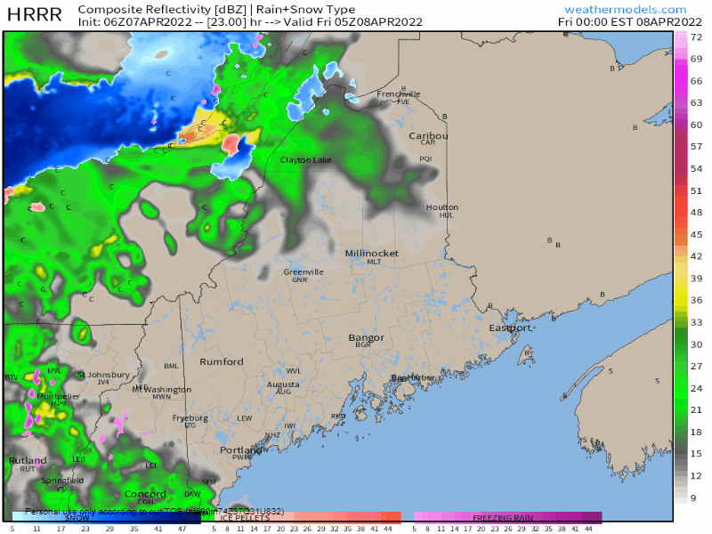 Friday Midnight to Noon - As the front and low approach, an increase in precipitation comes with it heading into Friday morning. Interior areas may be contending with a bit of snow, sleet and/ or freezing rain heading into daylight, primarily for the higher elevations. Given the tropical precipitation pump associated with the system, a few rumbles of thunder are possible. Steady rain tapers off over southwestern areas by around noon. 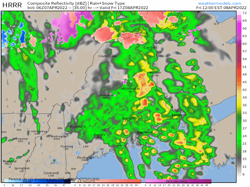 Friday Noon to Saturday Midnight - As the low tracks into New Brunswick, steady rain tapers to scattered showers before ending over the far north Friday night. The respite from precipitation is likely to be short lived as low pressure is expected to form along the New Jersey shore and track into New England Saturday morning, bringing more rain and perhaps some wet snow to the higher elevations Saturday morning through early Sunday. Rain / wind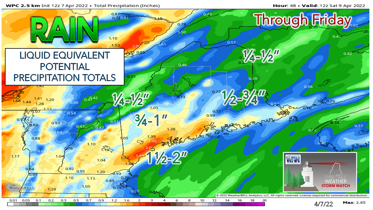 These sou'easter storms can be rather tricky for precipitation amounts pending on trajectory and track. This guidance from the Weather Prediction Center highlights the southwest coast and MidCoast areas as the likely jackpot region for the higher amounts. If thunderstorms develop, that is entirely possible with any localized heavy amounts. I do have concern for the western mountains that with the wind direction driving rain into the areas that 1-2" is possible in that area. For those in areas that still have snow, please keep in mind that the snowpack is ripe for rapid melting. That means flooding is possible. The National Weather Service may issue a flood watch pending on the development of the storm. For those that live near or travel around flood prone areas over the interior, stay on alert. 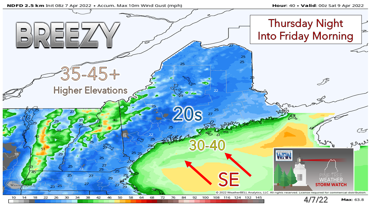 As of 5 AM Thursday, the National Weather Service is contemplating a wind advisory for northern Coos County in New Hampshire and possibly northern Oxford County in Maine. The strongest winds pass through that region between midnight and 6 AM Friday. Shoreline regions could see strong gusts off the water as well. Some power outages are possible. The gusty wind ends from west to east Friday morning through Friday afternoon. Outlook through TuesdayAnother round of low pressure brings showers to the region for Saturday. A strong ocean storm develops well offshore Saturday night and potential for an inverted trough keeps the risk of a shower in the forecast for Sunday. Monday appears fair. A warm front may bring another round of showers for southern areas on Tuesday. Temperatures are expected to warm up next week. 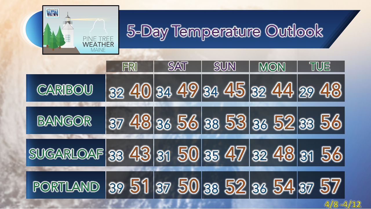 Be prepared to receive alerts and stay updated!
 For more information in between posts, please follow Pine Tree Weather on Facebook and Twitter. Thank you for supporting this community-based weather information source which operates by reader supported financial contributions. Thank you as always for your support! - Mike NOTE: The forecast information depicted on this platform is for general information purposes only for the public and is not designed or intended for commercial use. For those seeking pinpoint weather information for business operations should use a private sector source. For information about where to find commercial forecasters to assist your business, please message me and I will be happy to help you. |

Mike Haggett
|