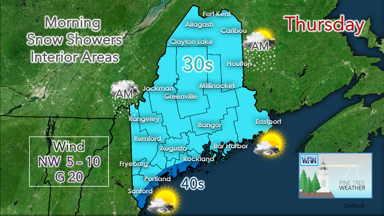
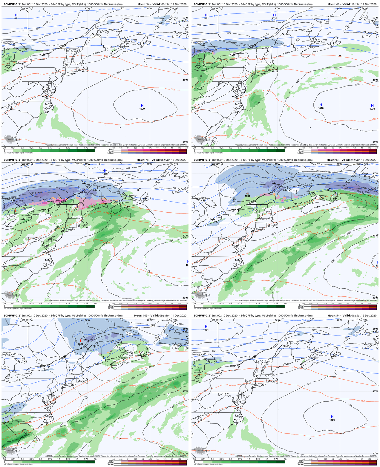
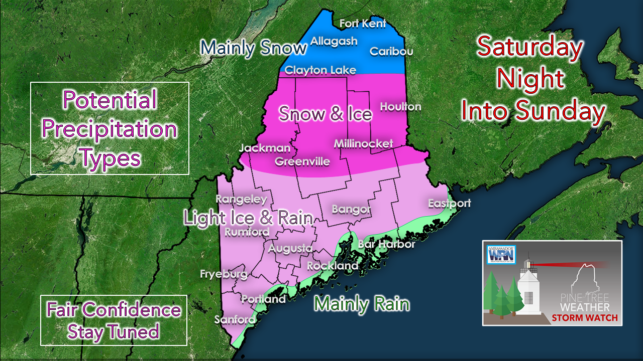
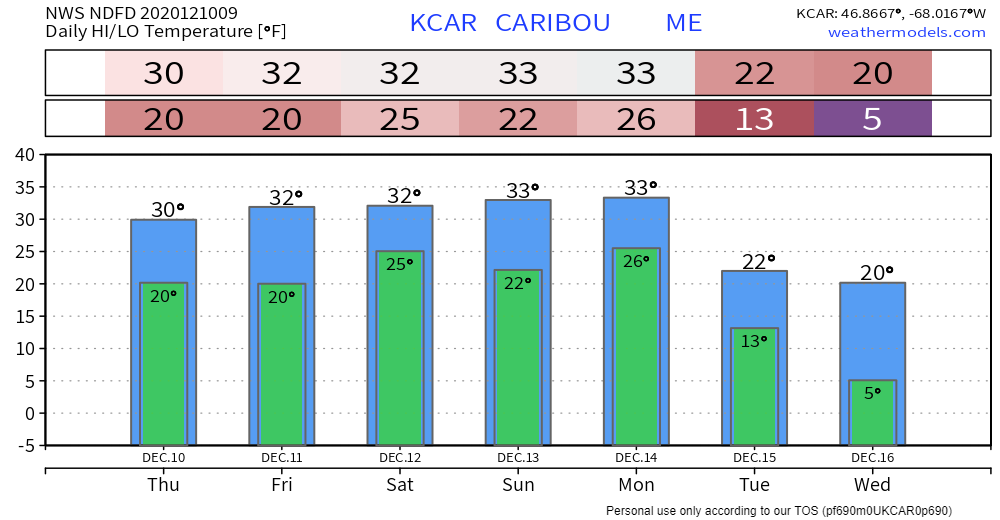
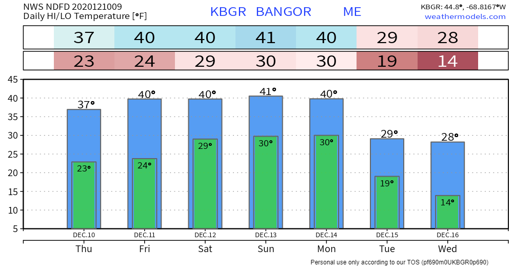
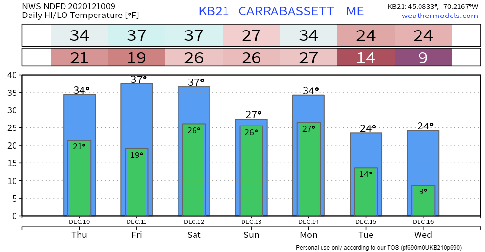
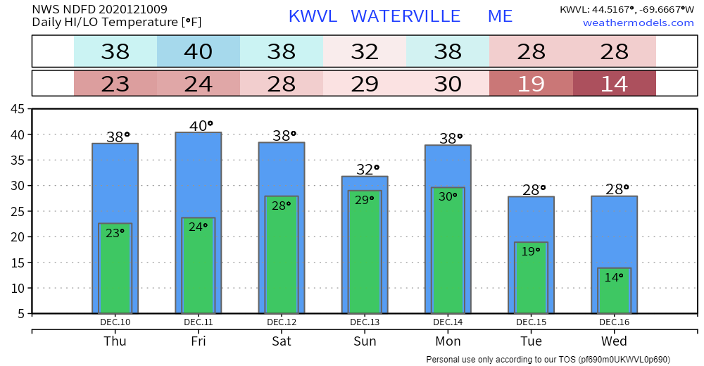
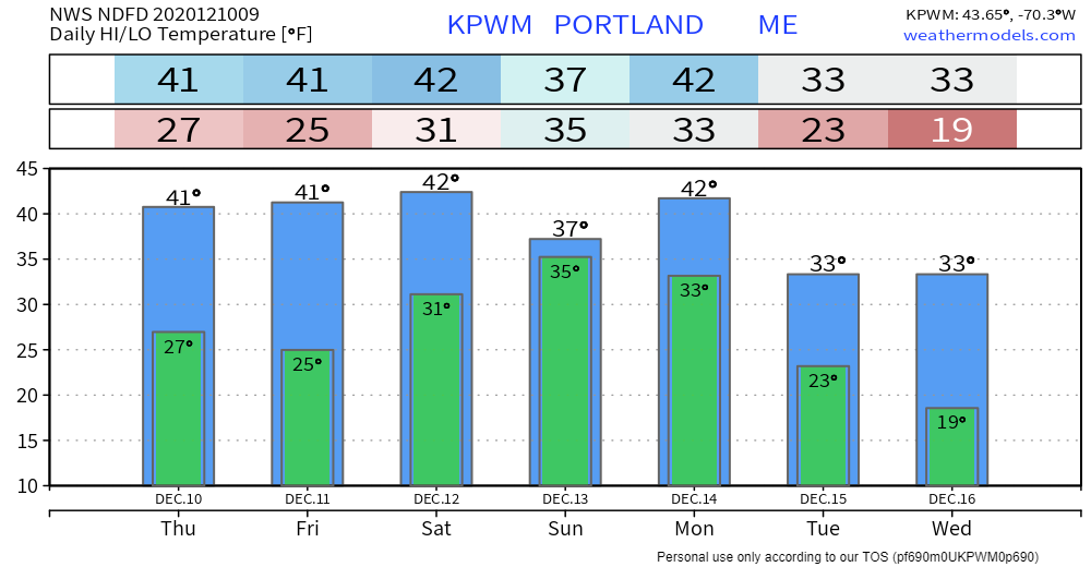
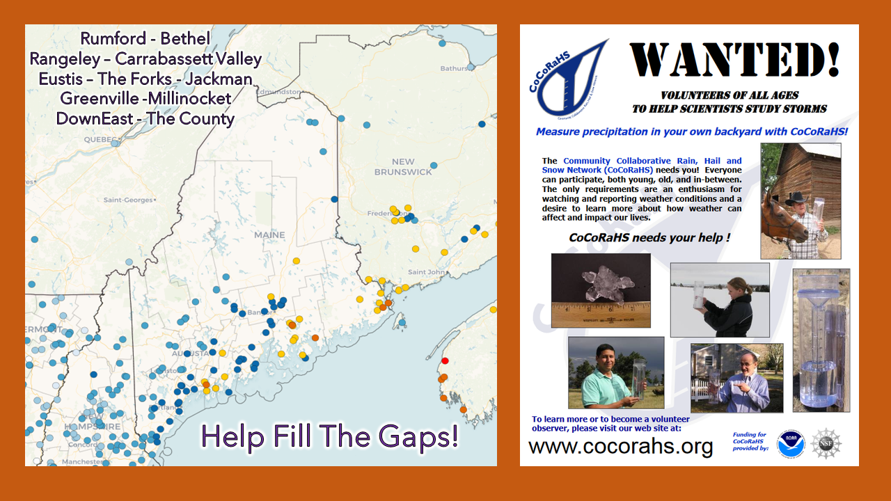
More sun than clouds for the coastNorthern and western areas deal with snow showers until around midday, and appear to be mostly cloudy in the afternoon. For eastern areas, a mix of sun and clouds. For southern areas, more clouds than sun. If the air column can clear out, it could be a mostly sunny afternoon. A northwest wind gusting to 20 mph will add a snap to the air, with wind chill indices in the upper teens to around 20 for the interior, and upper 20s to low 30s for the coastal plain. For Thursday night, there will be clouds around at times, with lows in the upper teens to upper 20s. Friday brings a chance for a snow shower in the far north. A mix of sun and clouds can be expected. Temperatures will be a bit warmer with 30s for the north and mountains and 40s south. The warm trend continues into Saturday, which will be helpful to get the ice and snow off the trees ahead of the next storm for Sunday. Cold air damming to dictate SundayAs I mentioned here Wednesday, high pressure near Labrador and the strength of it will dictate how much cold leaks into Maine and how long it hangs around for. The western mountains may pick up some snow showers Saturday afternoon as the warm front approaches. Southwest coastal areas may get a late afternoon rain shower. The bulk of the precipitation enters the region Saturday night into Sunday. With the warming from Friday and Saturday cleaning up the trees and not a whole lot of wind associated with this storm, I do not expect and concern for power outages for the southern half of the state. Time will tell for up north where the snow starts off fluffier and gets wetter as the front pushes north. My main concern for ice accumulation for now is for the Great North Woods. Stay tuned for updates on timing and amounts. Temperature outlook through WednesdayHelp fill the gaps!For folks in western, eastern, and northern areas, the Community Collaborative Rain, Hail and Snow Network could use your support! Verification of precipitation is very important to improve forecasts. All ages can participate. Reporting is easy, and it takes very little time to do. For more information, please check the CoCoRaHS Maine website. I would be more than happy to answer any questions you may have about the program! Be prepared to receive alerts and stay updated!
For more information, please follow Pine Tree Weather on Facebook and Twitter.
** FUNDING NEEDED FOR 2021 ** Thank you for supporting this community based weather information source that is funded by your financial contributions. Stay updated, stay on alert, and stay safe! - Mike |
Mike Haggett
|

