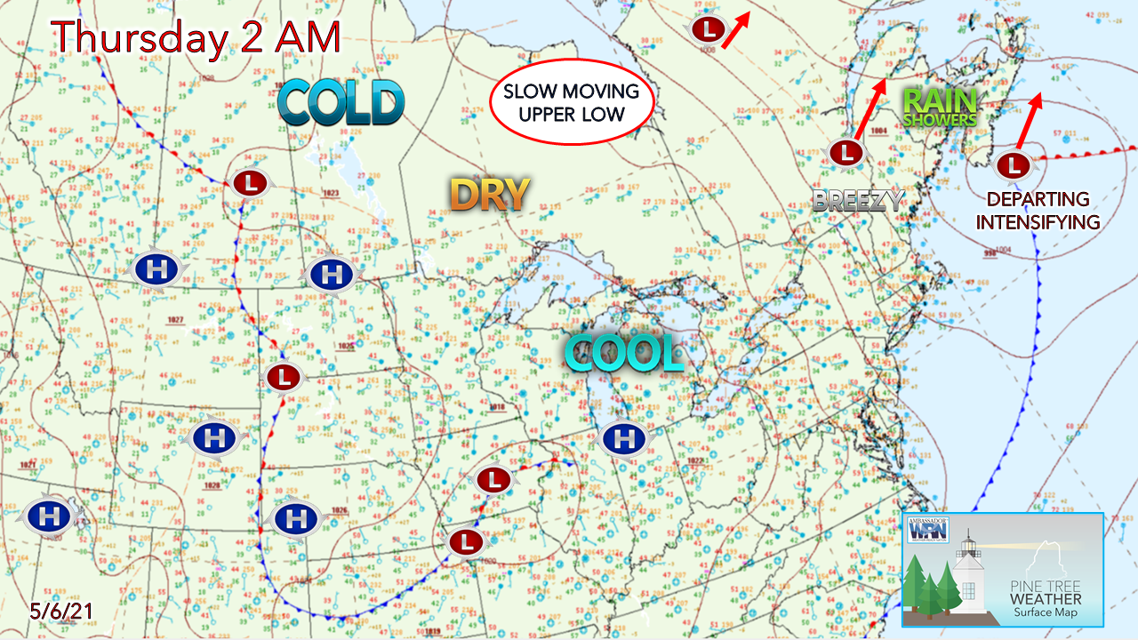
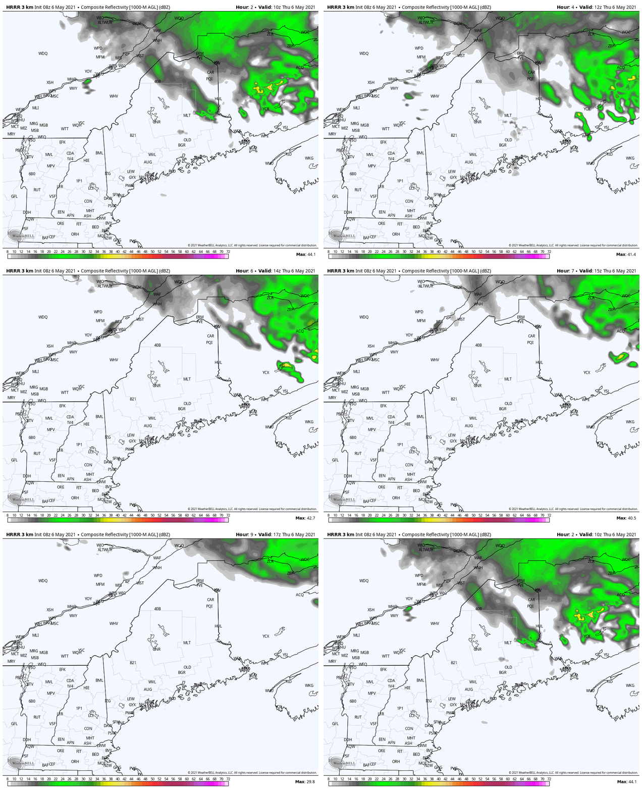
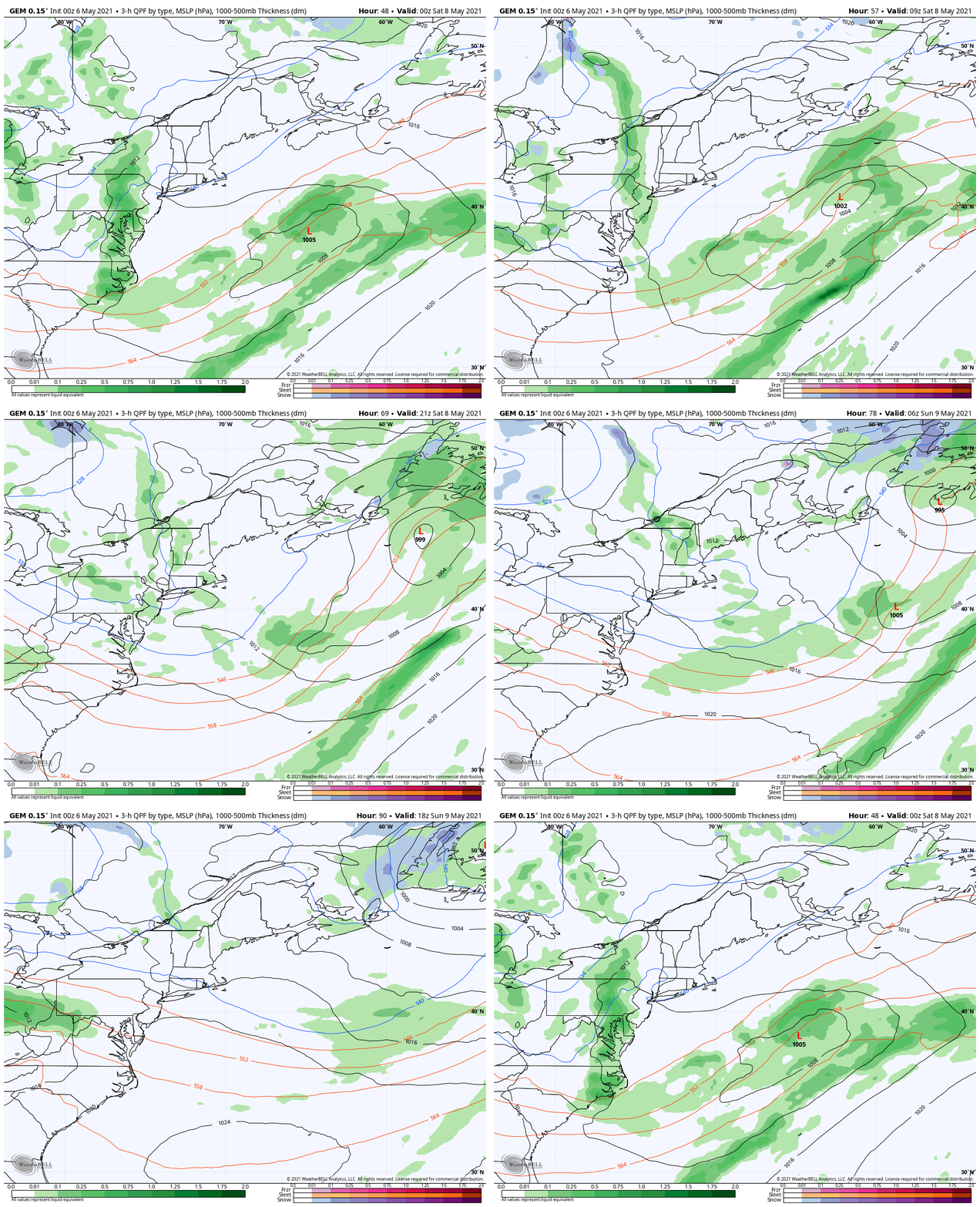
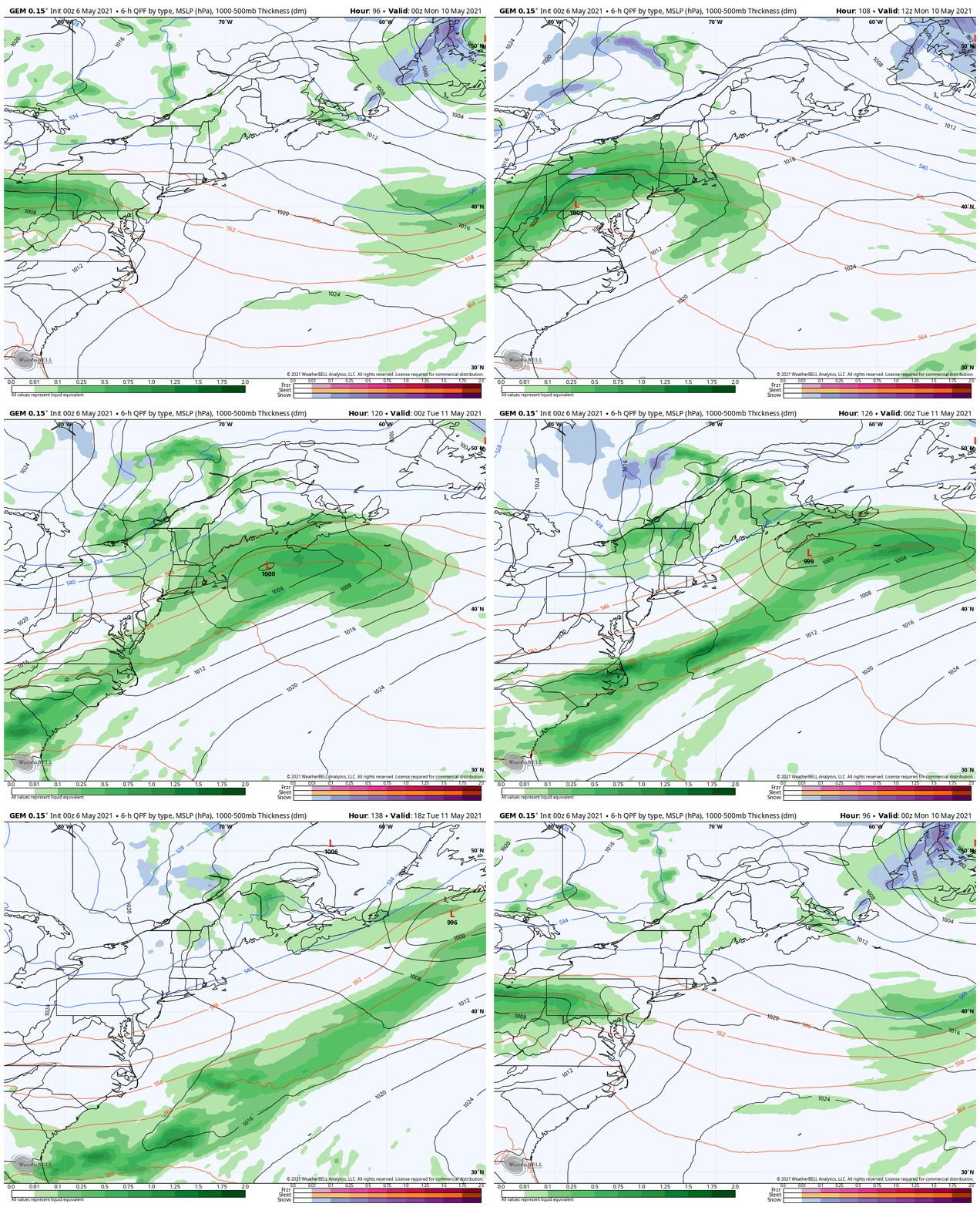
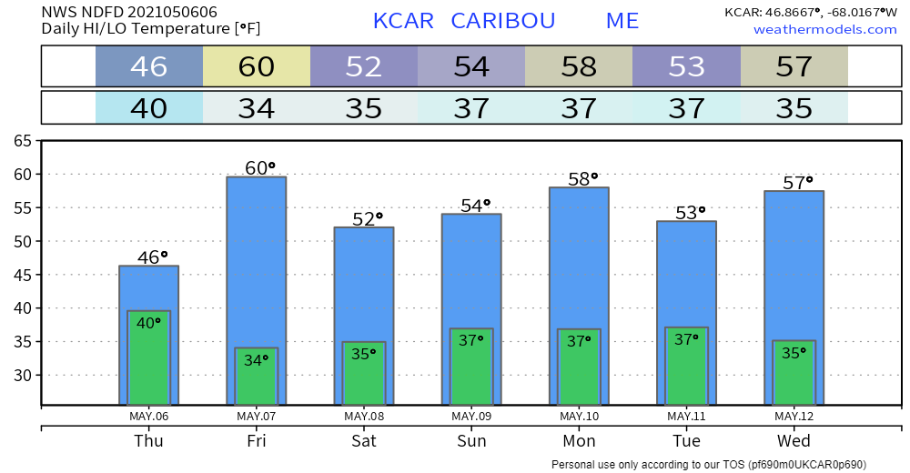
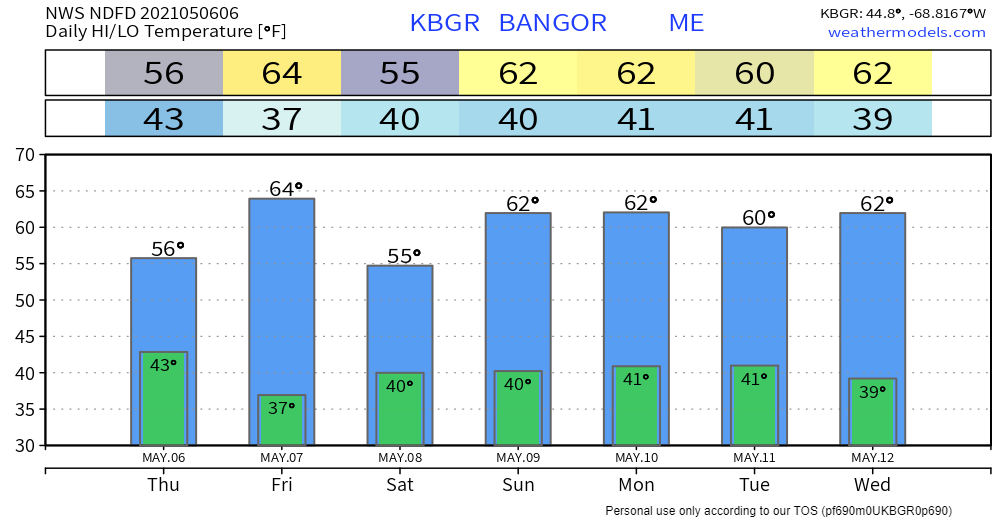
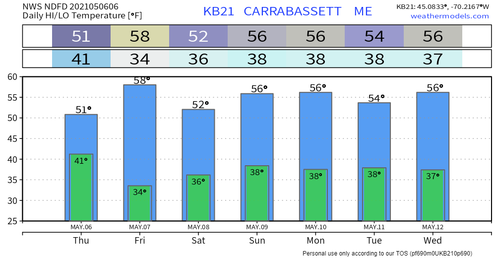
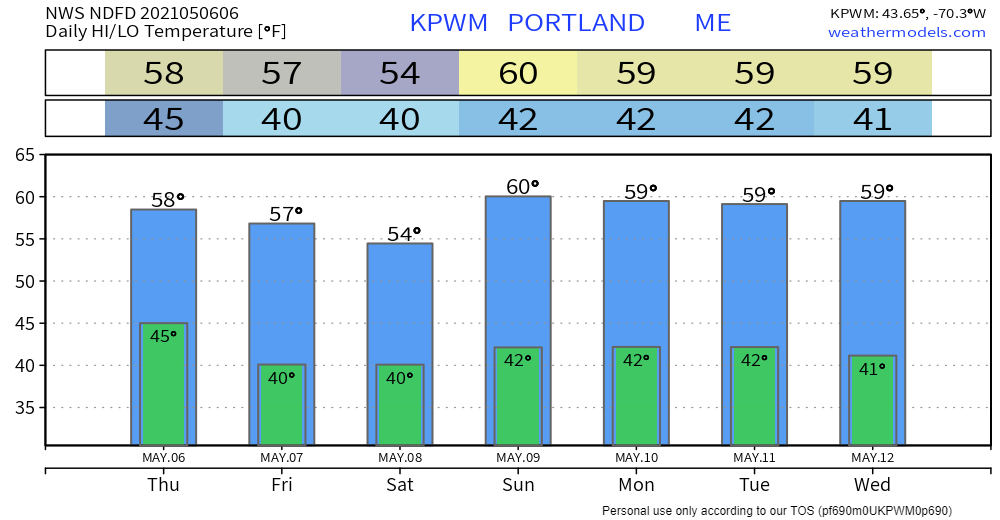
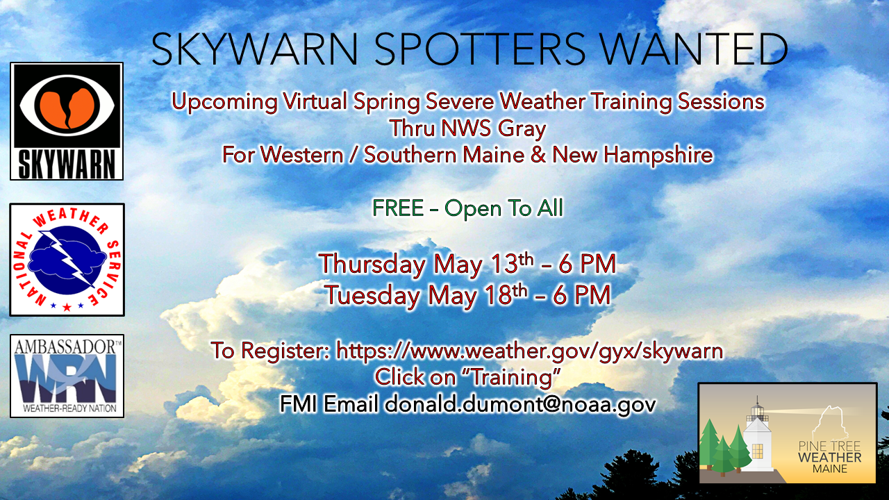
Skies improve across the region ThursdayShowers over northern and eastern areas track to the northeast Thursday morning, and clear out by early to mid-afternoon. Southern and western areas enjoy sunshine. As the storm intensifies on its way towards Newfoundland, a west-northwest breeze picks up, with gusts reaching 25-30 mph. Gusts will be stronger in the morning and subsides through the afternoon. With high pressure moving in, the breeze settles Thursday night. High temperatures for the day range from the mid-40s for The County, 50s west and east, and low 60s are possible for the southwest coast. Friday starts off chilly with a risk of frost for areas away from the shorelines. It appears to be decent day overall with fair weather clouds around. High temperatures reach the low 60s for most, a bit cooler for the western mountains and shoreline towns. Expect a sea breeze to develop along the coast. Unsettled pattern continuesAs the upper low over Hudson Bay slides to the southeast, expect clouds to be to dominant feature for Saturday. I can't rule out a sprinkle, but the day appears generally dry. As the upper low pinwheels disturbances around it, it does bring a chance for a light shower or sprinkle for southern and western areas for Sunday. Northern and eastern areas appear to stay dry through the weekend. A weak area of low pressure tracks through the region Monday and brings the chance for showers along with it. The storm intensifies as it heads towards Newfoundland and breezy conditions return for Tuesday. The pattern remains on the cool side into the foreseeable future, with no real warm up in sight for now. A time to celebrate graduation and Mother's Day. As I mentioned briefly in early April that I completed school. I was very fortunate to complete the final semester early, as my mother passed away exactly one month ago today, just four days after I finished. I knew that was imminent as she was placed in hospice care in early February. For me, the race was on to get my assignments completed ahead of time, knowing full well she could pass at any time. I am eternally grateful that my professor was able to work with me through the whole situation and I was able to finish two weeks ahead of schedule. The last 16 months have been a challenge for my time and faith. Add the pandemic into the mix and the effects of that on my day job and personal life, I can say where there were numerous occasions where I wondered if I would get through a semester, let alone complete all four of them. Fortunately, my family and I stayed healthy through it all. The weather pattern behaved better than I anticipated, which allowed me to focus on studying. The addition of interns Alex Hatfield and Kaitlyn Lardeo last summer was tremendous as that gave me time to do some intense coursework. In the end, it all worked out. It may not have been the way I envisioned it, but the mission was accomplished. Now I am a certified weather forecaster through The Pennsylvania State University, fulfilling a dream that I had as a young child in the 1970s. I have many folks to thank. The most important of all is you, my daily readers. There are about a thousand of you who read my posts every time I publish one. Of that group, there are those who financially support what I do, either monthly or yearly. It's because of you that I pursued further education. Your encouragement and backing have gotten me to where I am today. You stood by me through some rough life periods in the last 9½ years. I am sincerely grateful for your loyalty and belief in me to provide weather information not found elsewhere. I am going to pause for the weekend to spend time with my family, who have been my staunchest supporters. Updates will continue Monday. Seven-day temperature outlook through WednesdayJoin the weather community as a storm spotter!Here's a wonderful way to become active in the weather community and help the US National Weather Service Gray ME, broadcast media and forecasters like myself with storm reports. This information is vital during and after an event for forecasting and alerting purposes. I can't tell you how many times I have seen the importance of these reports in the past 9+ years I have been involved. Pine Tree Weather followers have stepped up in the past and participated, and with the readership base continuing to grow, I know there are more out there. This is the spring/summer session which discusses severe weather, what to look for, and how to report it. These sessions run for about 90 minutes. They are fact filled, educational and interesting. You can get the whole family involved from the comfort and safety of home. Once completed, you will get your spotter ID, and will be ready for the season ahead. For those who trained for the winter session, this will complete your full year training. It's important to have both sessions done. The link to register is here ► https://www.weather.gov/gyx/skywarn#fragment-2a If you need more information, please contact Donald Dumont, the Warning Coordinating Meteorologist at NWS Gray via email [email protected] or message me directly. Be prepared to receive alerts and stay updated!
For more information in between posts, please follow Pine Tree Weather on Facebook and Twitter.
Thank you for supporting this community-based weather information source which operates by reader supported financial contributions. Stay updated, stay on alert, and stay safe! Thank you as always for your support! - Mike |
Mike Haggett
|

