|
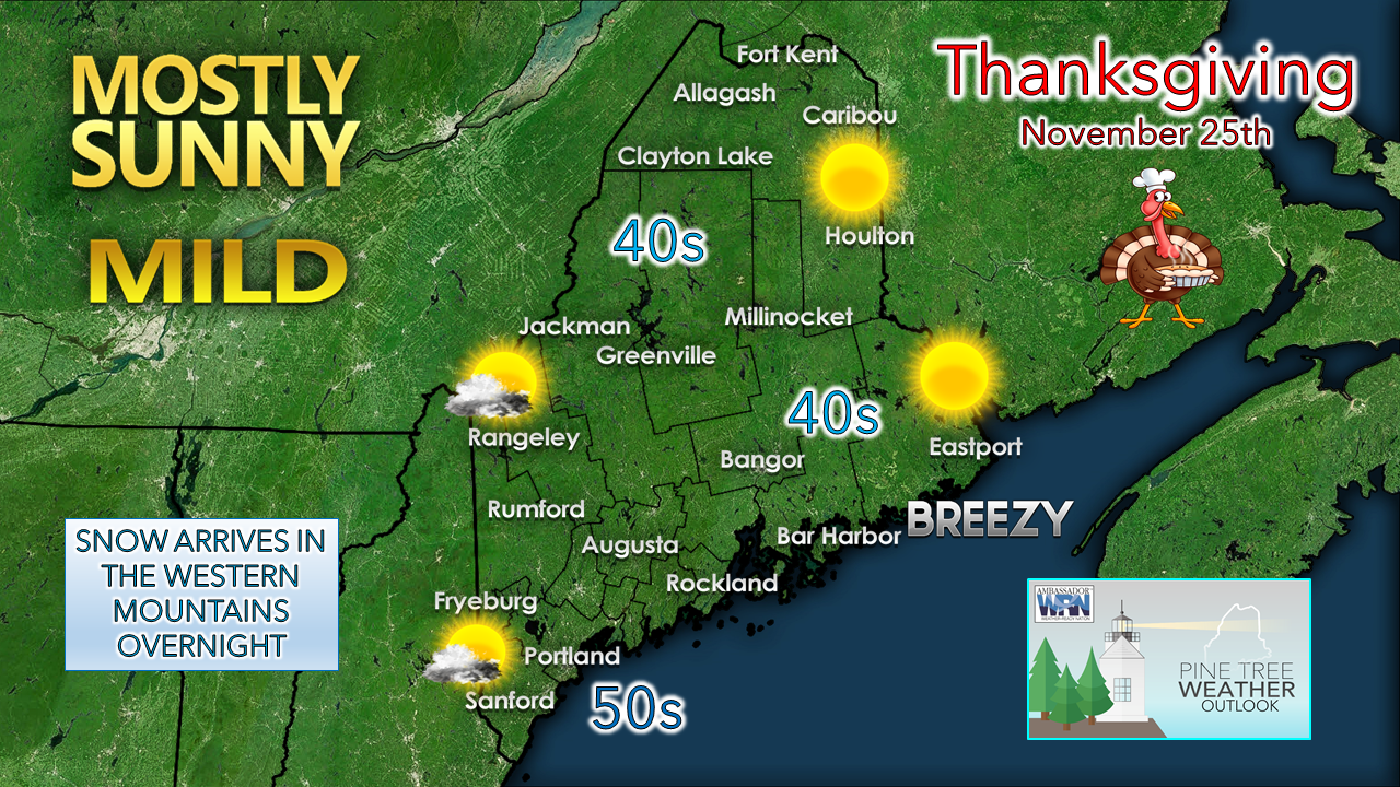
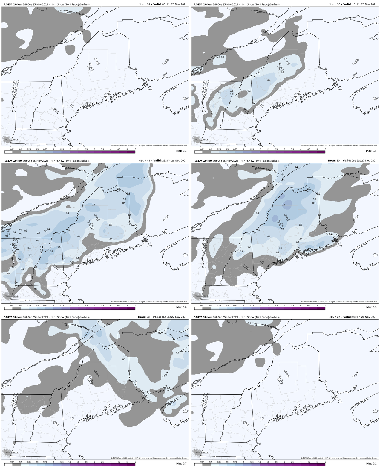
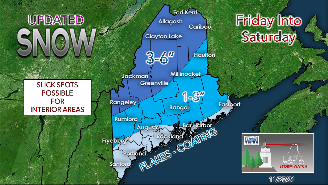
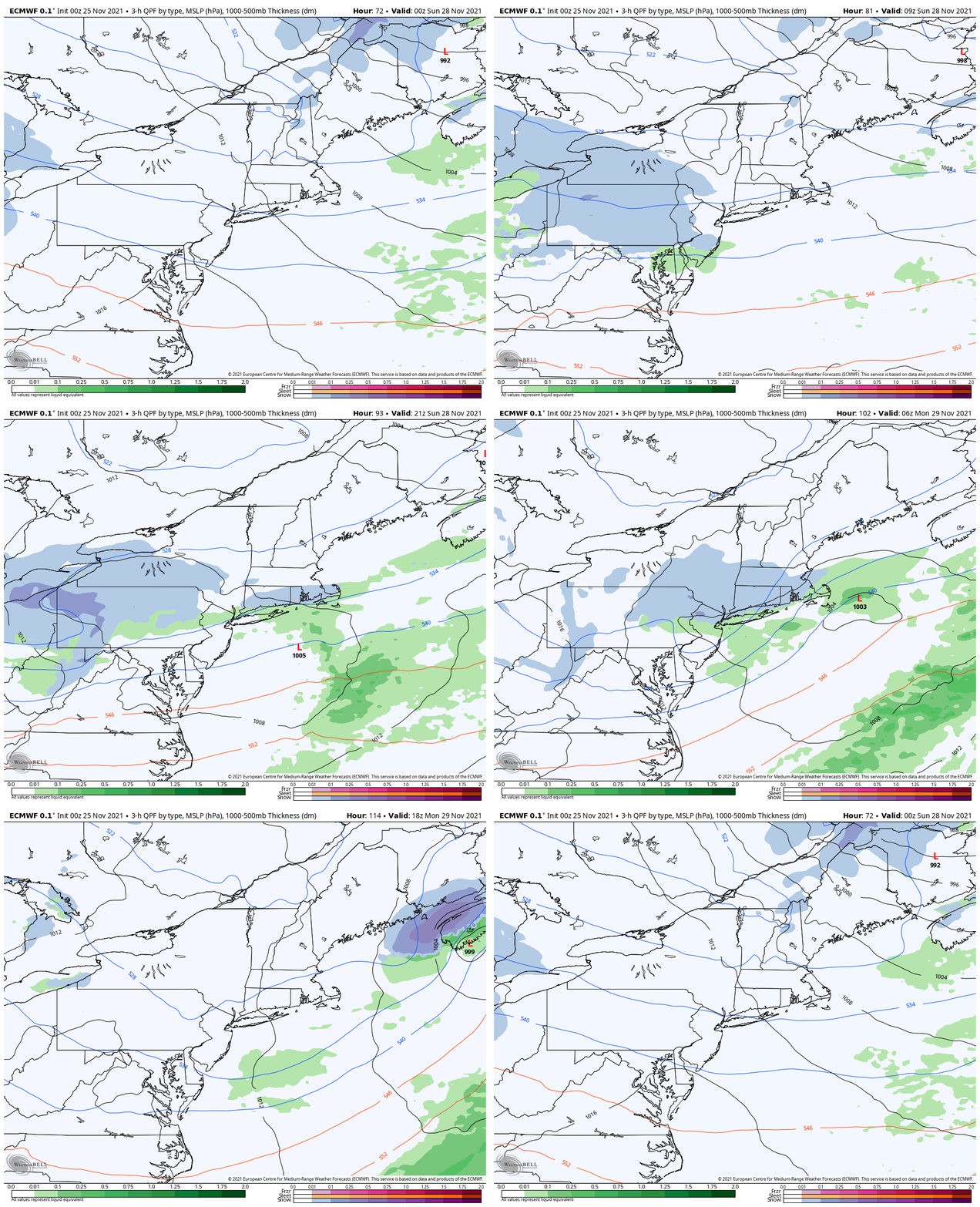
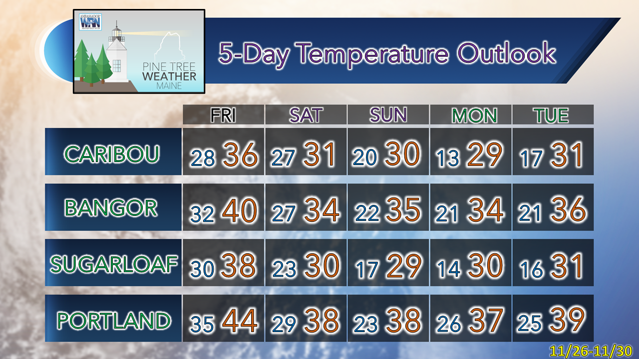
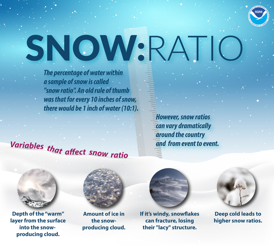
Before I get into the forecast, I wish you a Happy Thanksgiving. Holidays can come with joy, and also with mixed emotions. It has been an emotional roller-coaster ride for me this November, thinking of family members lost, and my recent 30-year anniversary in recovery from alcoholism and addiction. Sadness and joy. One thing I have learned over the years is that gratitude is love in action. What I do here helps me through the grieving process of my father, whom I lost in March of 2006, and to give back to a world that has been good to me. I am grateful that you are a part of this journey with me over the past 10 years, and in some cases much longer than that. It makes it worth it to get out of bed at 3 AM on a holiday to formulate a forecast, build graphics and write it out. I pray that each of you have a good holiday and enjoy the blessings of the day. A terrific turkey dayOutside of a breeze for DownEast areas associated with a slowly departing storm that has hammered Atlantic Canada for two days, it appears to be a generally quiet day. Clouds begin to filter the sun over western as southern areas in the afternoon, a precursor to the storm on the way for Black Friday. A tricky storm for FridayFriday 1 AM to Saturday 7 PM - This loop here looks at a model idea for 1-hour snowfall rates. It's important to note a couple of things here, rain is also a factor, as is snow to water ratios. Along with that, I don't think models have completely figured this out yet as they are flip-flopping worse than a politician. The issue is timing on development of a secondary low over the Gulf of Maine. This plays a huge role on the injection of cold and how much snow falls. The models are hinting that cold air could play more of an outcome in the final result, which makes sense given the dynamics. NWS Gray has issued a winter storm watch for Coos County New Hampshire. NWS Caribou has a winter storm watch for northeast and northwest Aroostook, northern Somerset and northern Piscataquis counties. This is shaping up to be a two-day event for the mountains, as upslope snow showers continue well into Saturday as a northwesterly wind cranks on the backside of this. I can see the idea 6-10" of snow for the Rangeley-Carrabassett-Eustis-Jackman region if this comes together in time. Snow to water ratios make forecasting snowfall amounts more difficult south and east of the mountains. The closer to the coast, the wetter the snow gets. Once the storm moves east, drier air cuts off the moisture, which would allow flakes to accumulate better. For more on snow to water ratios, I have a graphic further down in this post that helps explain it. As mentioned here in the previous update, my hunch for added snowfall over eastern areas appears to have a chance to happen, and thus I increased my idea there. Tracking a potential coastal storm MondaySaturday 7 PM to Monday 7 PM - This loop shows two things. High pressure works in for Sunday and shuts the wind down after a breezy Saturday. Another trough works southeast and tucks itself under the trough that impacts the region over the weekend and spins up low pressure over the MidAtlantic and moves northeastward. This could bring snow to coastal areas of Maine to start Monday. Ensemble ideas are relatively flat on intensity at this point, but there is time for that to change. Stay tuned for updates on that over the weekend. More about snow ratiosBe prepared to receive alerts and stay updated!
For more information in between posts, please follow Pine Tree Weather on Facebook and Twitter.
Thank you for supporting this community-based weather information source which operates by reader supported financial contributions. - Mike |
Mike Haggett
|

