 Much to discuss with this complicated event. It's important to stay updated beyond my report here. Stay in touch with the National Weather Service for bulletins from them, and local media of choice. In these types of events, the situation can change quickly. A dusting of snow possible Monday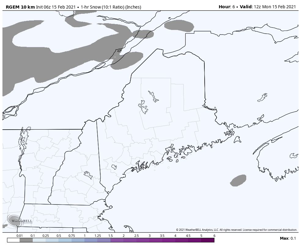 A weak shortwave passes through the region Monday, which may bring snow showers or flurries in areas through early evening. There may be enough snow to dust up the roads and may cause a surprise slick spot or two on the roads less traveled, and that may be it. The one thing this system appears to do is cement the cold in place for the mess on the way Tuesday A day to avoid travel Tuesday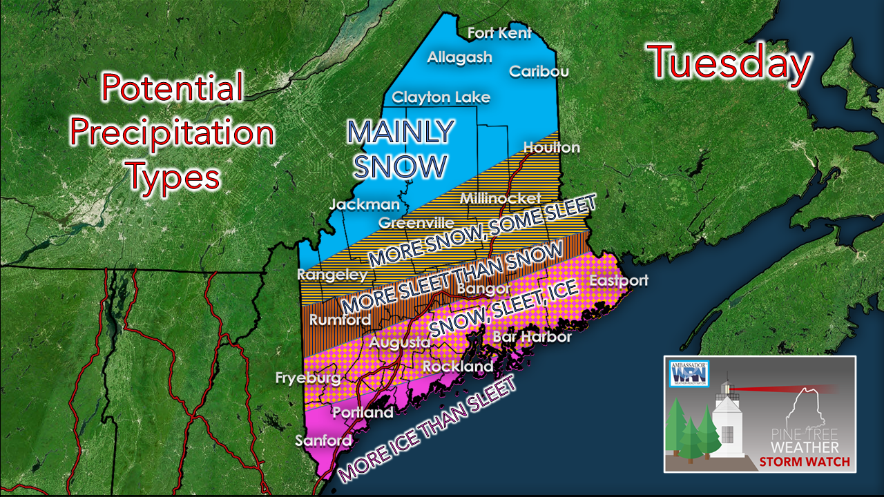 So this map which looks like a screen shot out of The Beatles' movie "Yellow Submarine" should give you the impression that this is complicated system. When we have complicated systems, there is a risk for bust potential. Sleet is a snow accumulation killer, so keep that in mind. 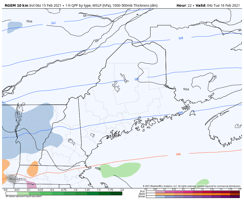 The coastal hugger solution appears to be the general idea as of Monday morning. It's a quick hitter, somewhat flat in nature as it is a developing system that cranks up as it departs. Southern and western areas see the first of the precipitation around midnight Tuesday. All areas appear to have travel impacts by the morning commute. As the system moves into the Gulf of Maine, precipitation tapers off over southern areas by late afternoon, eastern areas by early evening. Snow showers continue in western and northern areas into early Wednesday. 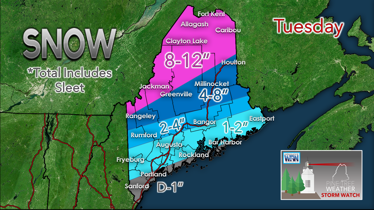 The further inland, the more snow. Closer to the coast, the more sleet and ice. If the storm moves closer to the coast, expect the numbers to shift northward on the map. Interior areas where the snow does fly could see a thump of 1-2"/hour snowfall rates which could make visibility difficult and roads treacherous Tuesday morning. 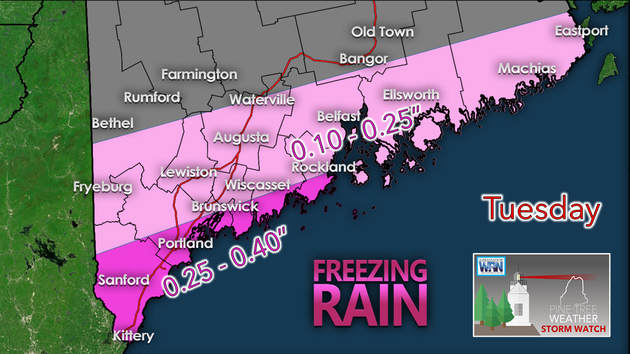 Cold air damming is shaping up to cause an icy affair for the coast. The islands and peninsulas could be spared of the ice and see above 32° rain, but for areas just inside the shorelines, this could be an ice event. Coastal interior areas that get a bit of snow and/or sleet appear to get a glaze of ice on top of that. Keep this in mind as you strategize how to treat your driveways and business clients. 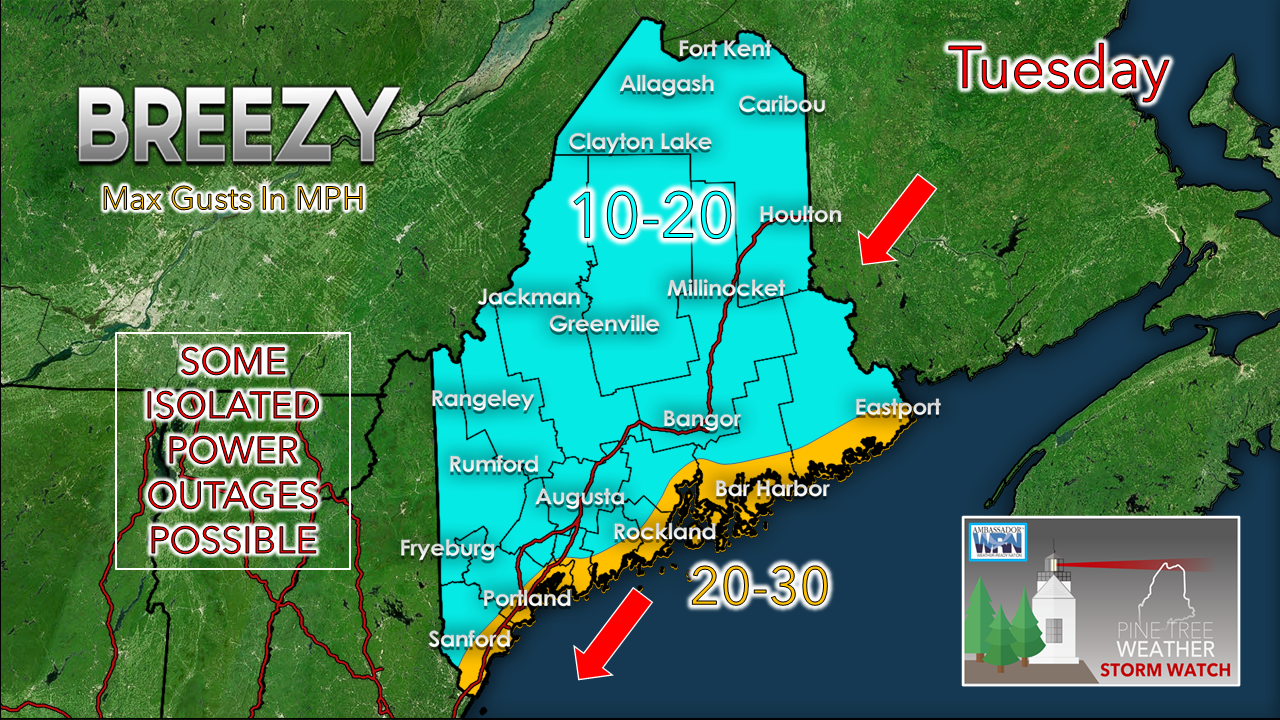 Since the the system is coming in rather flat, the wind does not appear to be a big deal. I am more concerned for isolated or spotty outages for the coast where ice accretes. Keep in mind with the storm increasing with intensity as it heads into the Canadian Maritimes, the wind shifts to the northwest. Tuesday night into Wednesday may see higher gusts in the wake of the storm, rather than during it. Another similar set up Thursday into Friday At this point, I should state that this idea is for entertainment purposes only as it will likely change as far as precipitation type and timing. Southern and western areas may see some Thursday evening commute issues, and Friday morning appears to be a mess everywhere. We'll get through Tuesday first, and then think about this one.  mPINGers needed for this storm! Check out mPING (Meteorological Phenomena Identification Near the Ground) project. Weird name, cool app! You can report the type of precipitation you see where you are. No need to measure! Use the free mobile app to send reports anonymously. Reports are automatically recorded into a database, which improves weather computer models. The information is even used by road maintenance operations and the aviation industry to diagnose areas of icing. mping.nssl.noaa.gov 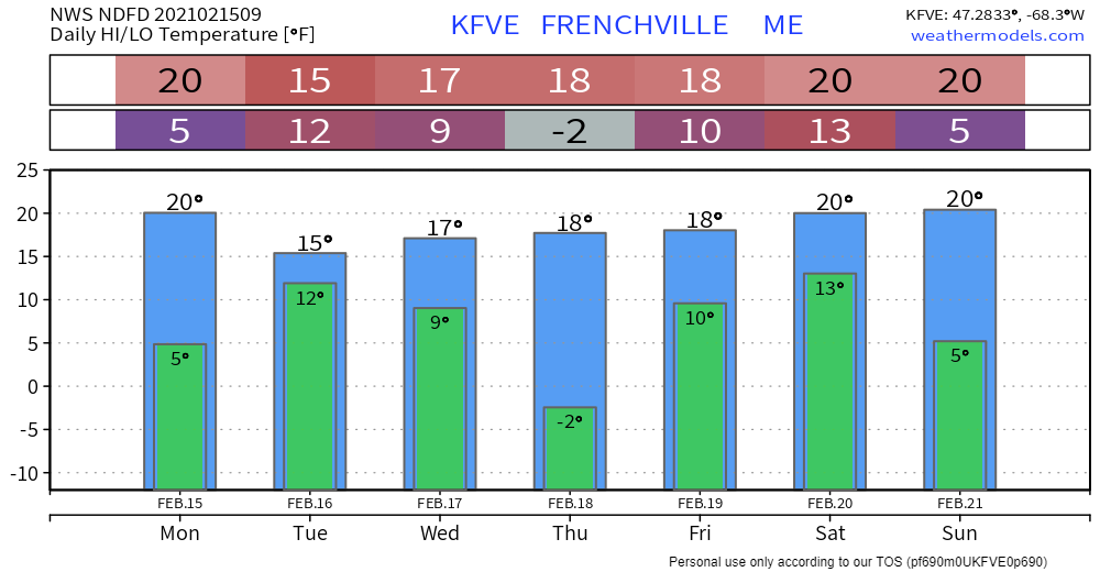 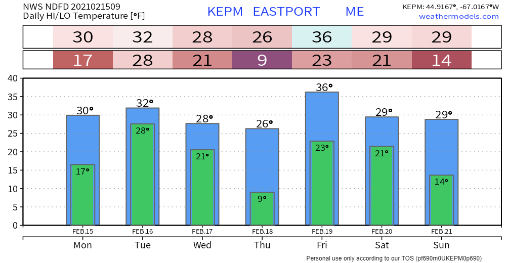 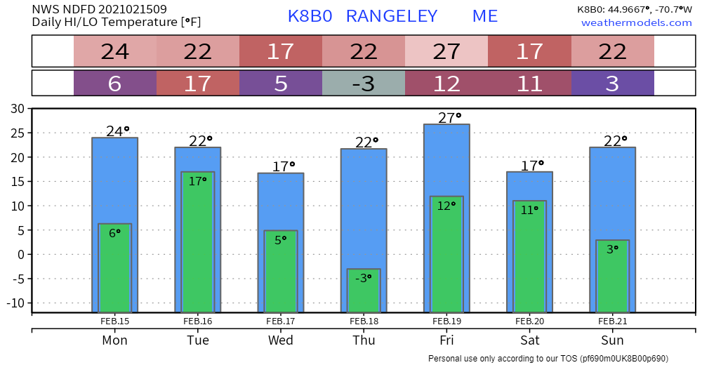 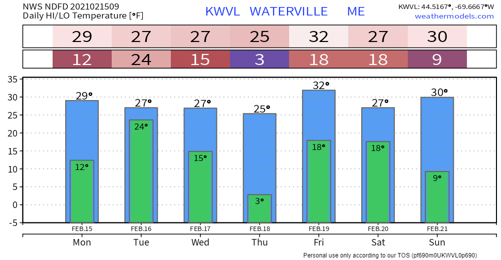 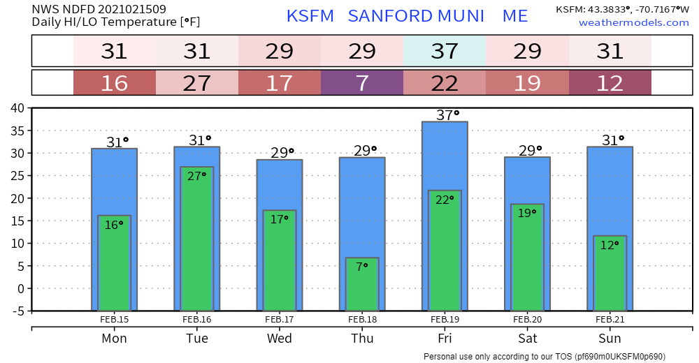 Be prepared to receive alerts and stay updated!
For more information in between posts, please follow Pine Tree Weather on Facebook and Twitter.
Thank you for supporting this community based weather information source which operates by reader supported financial contributions. Stay updated, stay on alert, and stay safe! Thank you as always for your support! - Mike |

Mike Haggett
|