Air with a bite to start the week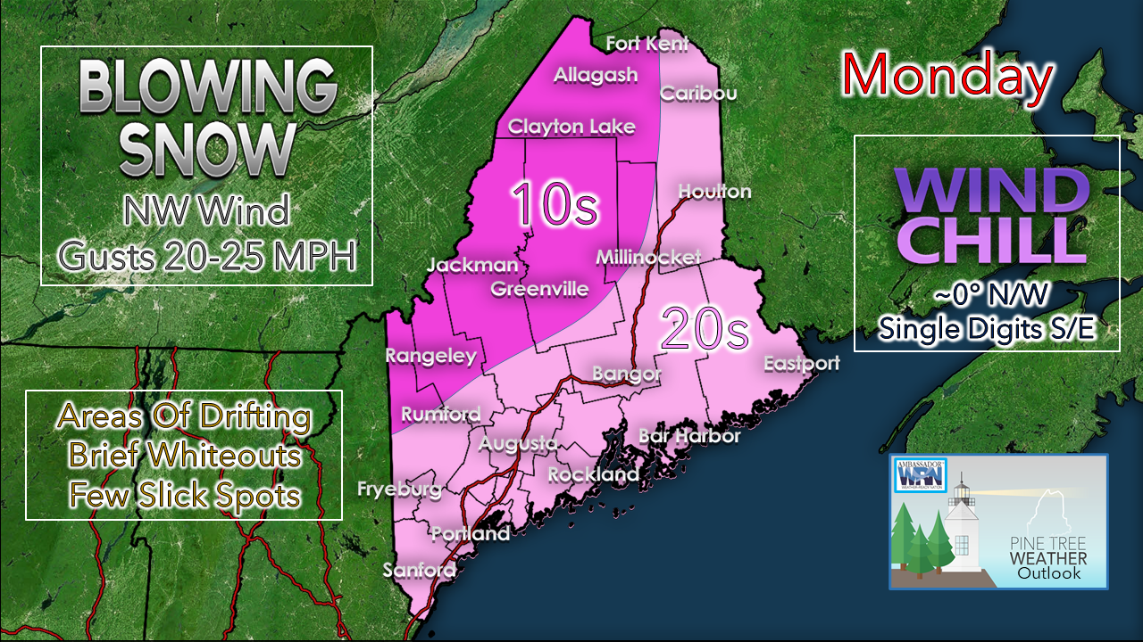 Snow wraps up over eastern areas Monday morning. The sky begins to clear and a gusty northwest wind ensues through the day. Bundle up as the wind chill will certainly be noticeable. The north and the mountains struggle to get above 0° with the apparent temperature, as the coastal plain may have difficulty to reach 10° at times. With the wind comes blowing snow, which may cause some drifting, slick spots in wide open areas, as well as brief whiteout conditions. The wind settles down Monday night. With clear skies to the north, overnight lows appear to fall below zero, and potentially double digits below for the Allagash region. Clouds move in over southern areas which keeps temps in the single digits above to around 10° for the immediate shorelines. Light snow moves into southern areas Tuesday What was once looking like a solid statewide event has slowly diminished with intensity. My only concern for this is for southern areas. Snow holds off for the morning commute, but could cause some slick spots beginning midday through the evening commute. 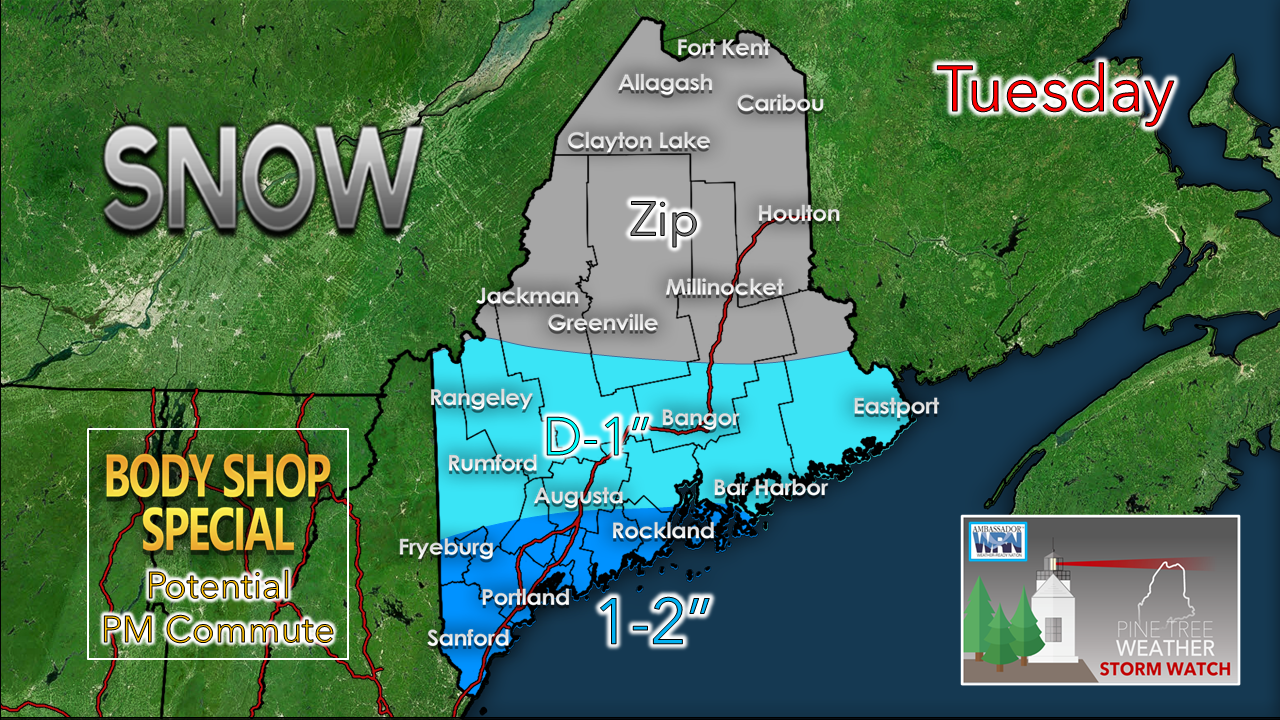 Important to note here that the trend is less and less for snowfall amounts. That said, it could still be enough to cover the roads and may contribute to accidents with careless or distracted driving, hence the potential for a Body Shop Special. Use caution, take your time, everyone gets home safe and without calling for a wrecker. Friday system a non-factor, for now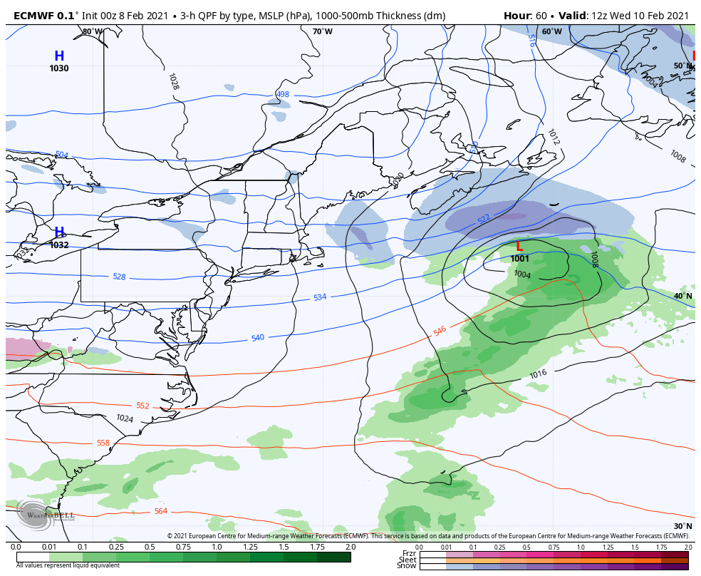 The Tuesday disturbance tracks east and blows up on its way south of Newfoundland Wednesday. High pressure holds the cold air in, and keeps the stormy wave train to the south. Here is another case where an impactful event was showing for Friday, and for now that idea has fizzled out, outside of a chance for snow showers. Time will tell if it stays that way. There are a few ensemble ideas that have not given up on a potential storm. With that in mind, it will need to be monitored.  Temperature outlook through Sunday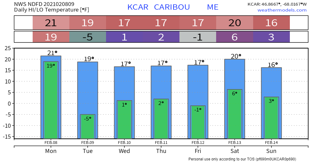 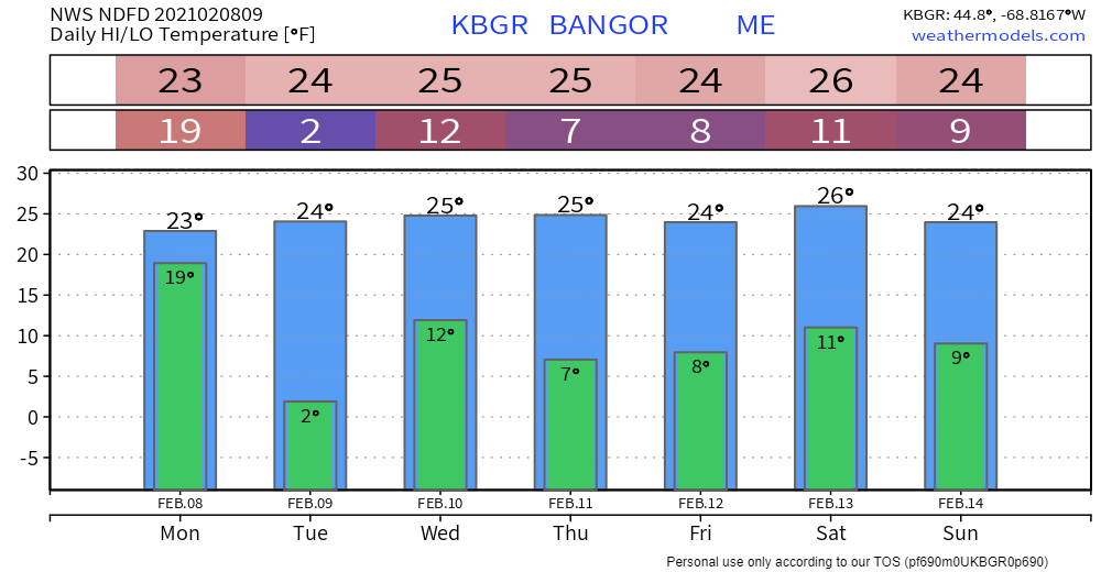 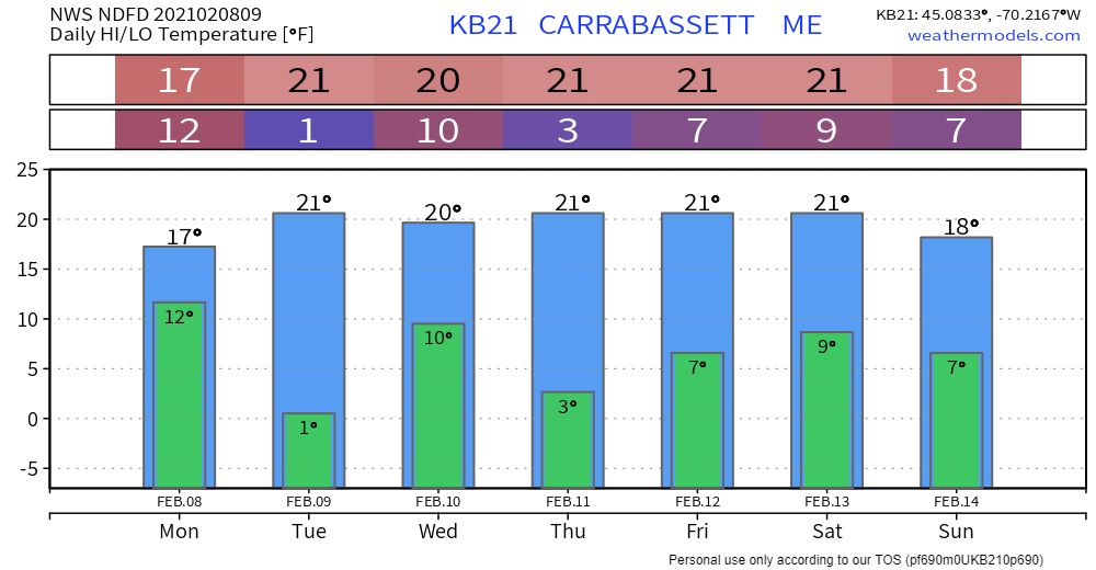 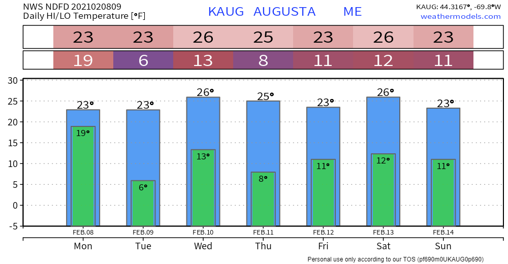 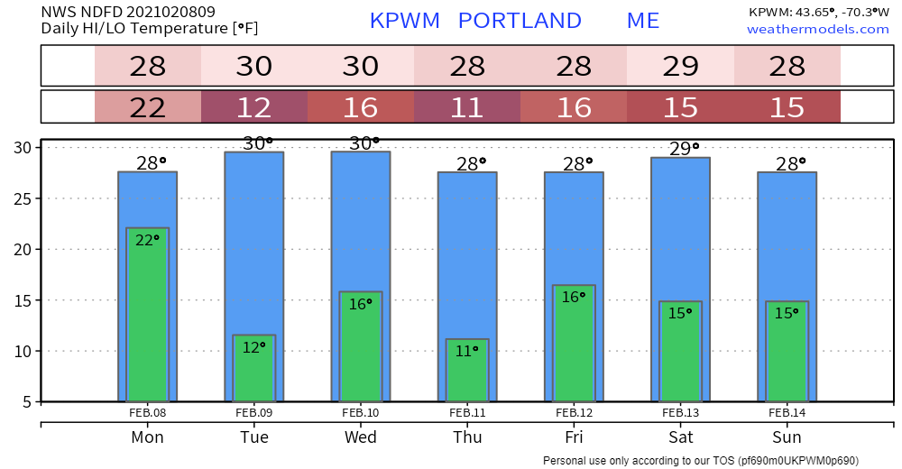 Science of snowflakes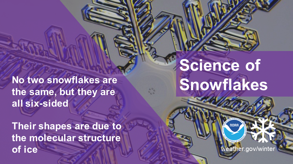 Did you know that while no two snowflakes are exactly the same, they are all six-sided? Snowflakes’ hexagonal shapes are due to the molecular structure of ice. Learn more about the science behind snowflakes: noaa.gov/stories/how-do-snowflakes-form-science-behind-snow Be prepared to receive alerts and stay updated!
For more information in between posts, please follow Pine Tree Weather on Facebook and Twitter. Thank you for supporting this community based weather information source which operates by reader supported financial contributions. Stay updated, stay on alert, and stay safe! Thank you as always for your support! - Mike |

Mike Haggett
|