|
Before I get into the forecast, I need to mention the fact that I am having a minor medical treatment Tuesday afternoon. Pending on how I feel Wednesday morning will dictate whether I will update or not. This discussion should have you prepared for what is coming... or not. Funding drive for 2022 is coming close to completion. I am down to $240 remaining needed to keep this operation going. Please click on the DONATE page or on the banner below at the end of the forecast on how you can contribute. Thank you so much for your support, and for having my back. A chilly Tuesday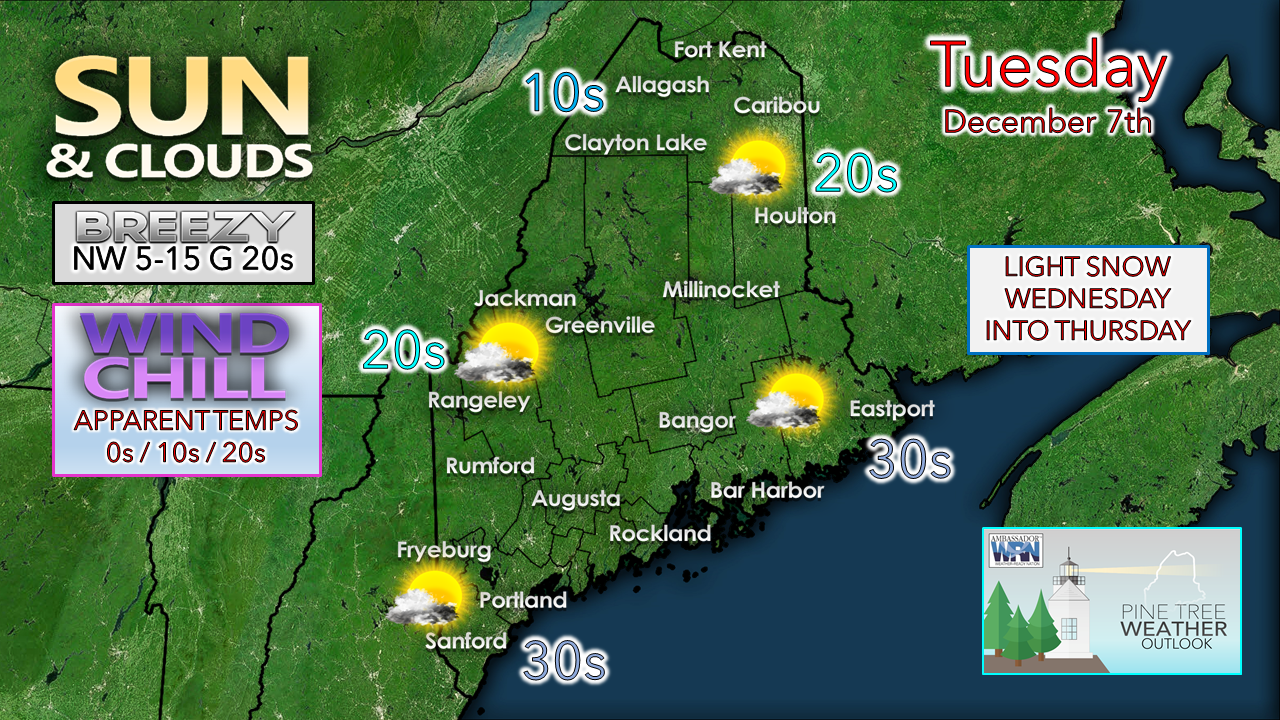 The cold front which passed through overnight and brought wind gusts in the 40-60 mph range is offshore. A chilly Canadian high is moving into the region. Temperatures gradually fall over the region as cold air works in. Bundle up as you head out as that extra layer may be needed. High clouds milk the sky to the north in the morning with the departing system, and to the south in the afternoon with the approaching system. Inverted trough to bring snow to parts of the region Wednesday into early Thursday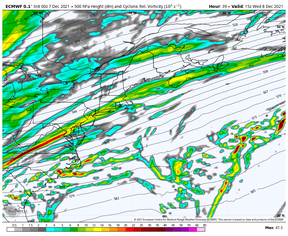 Wednesday 10 AM to Thursday 10 AM - Following this closely over the past week has been interesting. At one point this was a model tiger that ensembles were on board with for a solid dump of snow. Now, it is a nail biter on snowfall amounts with high bust potential. The ballgame here rests upon the interaction between upper-level energy aloft (above) with an area of low pressure forming offshore (below) and when it comes together. The closer the surface low is to the region, the greater the chance for accumulation. 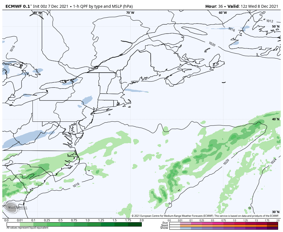 Wednesday 7 AM to Thursday 10 AM - This scenario sets up the potential of an inverted trough set up where moisture from the developing low is pulled to the northwest into the region. Outflow energy ahead of the low could bring snow showers the coast Wednesday, but the main event appears to be Wednesday overnight into early Thursday. 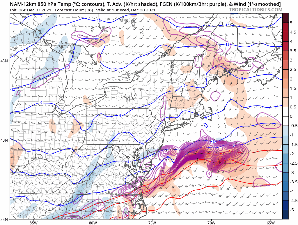 Wednesday 1 PM to Thursday 1 PM - The inverted trough set up causes lifting of warm air (orange) into cold air (blue) and causes what is known as frontogenesis (purple). With upper-level energy enhancing the surface low and thus drawing warmth off the ocean and drawing it northwestward, a front forms along it and in some cases can enhance precipitation amounts. This idea from the NAM model articulates that potential well. The question at this point is will it happen? These types of set-ups have made many a forecaster looking foolish, where accumulations are either flurries or blows up into a foot, and that idea can occur within a matter of a handful of miles as it has been demonstrated over the years. 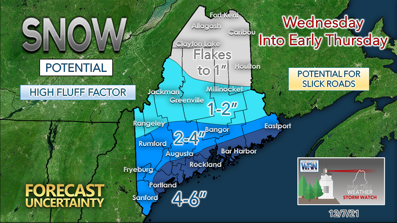 The bottom line at this point is the coastal plain is likely to see the most snow. With cold air in place, fluff factor will be high with water content is very low. The surprise potential is there for more and for less. Shoveling and plowing with this storm is optional. A storm on the way for the weekend is likely to wash it away. Warm up on the way for the weekend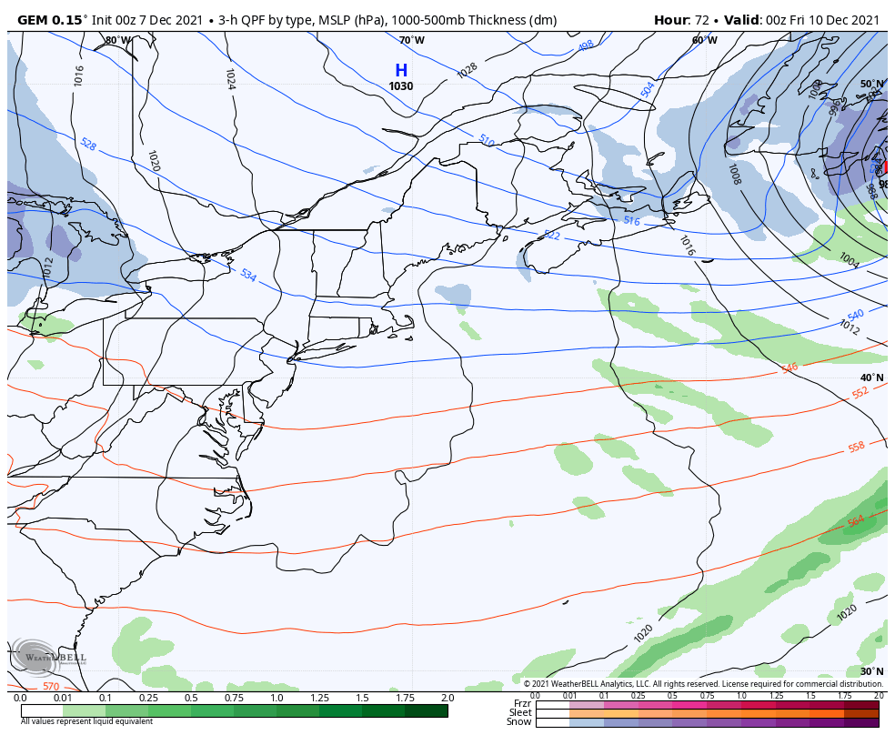 Thursday 7 PM to Sunday 7 PM - High pressure moves to the east Thursday night. A warm front enters the region for Friday which may bring light snow or rain showers. An inside runner appears on tap for Saturday. Cold air damming and ice potential is something to keep in mind for the southwest interior. Cooler conditions return for Sunday. 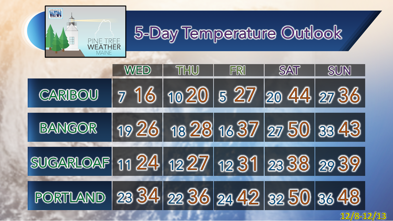  Black Ice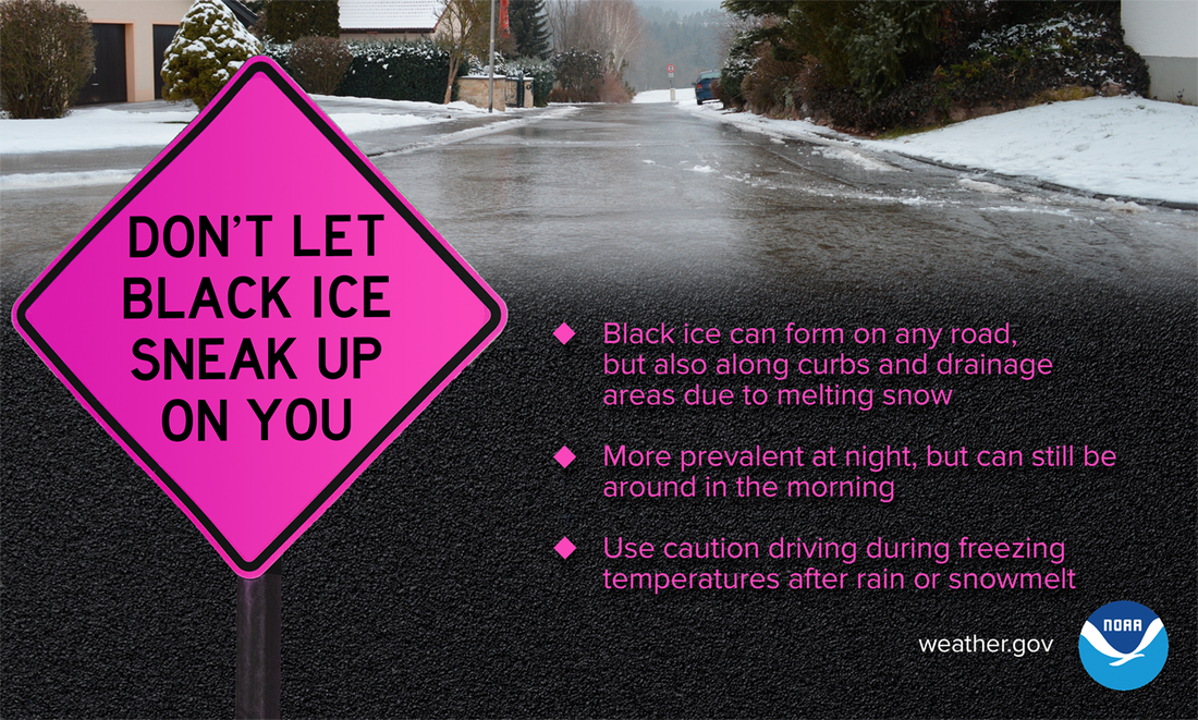 When recent rain or snowmelt comes into contact with freezing temperatures, black ice can form — and you might not even see it. And while black ice is more prevalent at night, it can often stick around for the morning commute. Use extreme caution when driving...don’t let black ice sneak up on you. weather.gov/safety/winter Be prepared to receive alerts and stay updated!
 For more information in between posts, please follow Pine Tree Weather on Facebook and Twitter.
Thank you for supporting this community-based weather information source which operates by reader supported financial contributions. - Mike |

Mike Haggett
|